close
-
Layers w
- Weather Layers
- Pro
- Pro
- Pro
- Pro
- Pro
- Pro
- More Layers
- Pro
- Pro
- Pro
- Pro
-
Upgrade to

3D
Trail Conditions
- Unknown
- Snow Groomed
- Snow Packed
- Snow Covered
- Snow Cover Partial
- Freeze/thaw Cycle
- Icy
- Prevalent Mud
- Wet
- Variable
- Ideal
- Dry
- Very Dry
Trail Flow (Ridden Direction)
Trailforks scans users ridelogs to determine the most popular direction each trail is ridden. A good flowing trail network will have most trails flowing in a single direction according to their intension.
The colour categories are based on what percentage of riders are riding a trail in its intended direction.
The colour categories are based on what percentage of riders are riding a trail in its intended direction.
- > 96%
- > 90%
- > 80%
- > 70%
- > 50%
- < 50%
- bi-directional trail
- no data
Trail Last Ridden
Trailforks scans ridelogs to determine the last time a trail was ridden.
- < 2 days
- < 1 week
- < 2 weeks
- < 1 month
- < 6 months
- > 6 months
Trail Ridden Direction
The intended direction a trail should be ridden.
- Downhill Only
- Downhill Primary
- Both Directions
- Uphill Primary
- Uphill Only
- One Direction
Contribute Details
Colors indicate trail is missing specified detail.
- Description
- Photos
- Description & Photos
- Videos
Trail Popularity ?
Trailforks scans ridelogs to determine which trails are ridden the most in the last 9 months.
Trails are compared with nearby trails in the same city region with a possible 25 colour shades.
Think of this as a heatmap, more rides = more kinetic energy = warmer colors.
- most popular
- popular
- less popular
- not popular
ATV/ORV/OHV Filter
Max Vehicle Width
inches
US Cell Coverage
Legend

Radar Time
Activity Recordings
Trailforks uses anonymized public activity data.
?
Activity Recordings
Trailforks uses anonymized public activity data.
?
Personal Heatmap
▶
Activity Types
all
/
none
▶
Options
2
Date range
month
–
Winter Trails
Warning
A routing network for winter maps does not exist. Selecting trails using the winter trails layer has been disabled.
Missing Trails
Most Popular
Least Popular
Trails are colored based on popularity. The more popular a trail is, the more red. Less popular trails trend towards green.
Jump Magnitude Heatmap
Heatmap of where riders jump on trails. Zoom in to see individual jumps, click circles to view jump details.
BC Backroad Status
![map legend]()
Service Road Atlas is a free to use, community-driven service for viewing and creating reports on the numerous back-country service roads around B.C. and Alberta.

Slope Aspect
Direction the slope faces
Trails Deemphasized
Trails are shown in grey.
Only show trails with no bike usage.
Suggested Layers
Based on selected activity type
Save the current map location and zoom level as your default home location whenever this page is loaded.
SaveThis region is Unsanctioned, Ride at your own Risk!
The Žilina Region (Slovak: Žilinský kraj; Polish: Kraj żyliński) is one of the eight Slovak administrative regions and consists of 11 districts (okresy) and 315 municipalities, from which 18 have a town status. The region was established in 1923, however, in its present borders exists from 1996. It is a more industrial region with several large towns. Žilina is the region administrative center and there is a strong cultural environment in Martin.
It is located in northern Slovakia and has an area of 6,804 km² and a population of 688,851 (2011). The whole area is mountainous, belonging to the Western Carpathians. Some of the mountain ranges in the region include Javorníky, the Lesser Fatra and the Greater Fatra in the west, Oravská Magura, Chočské vrchy, Low Tatras and Western Tatras in the east.
It is located in northern Slovakia and has an area of 6,804 km² and a population of 688,851 (2011). The whole area is mountainous, belonging to the Western Carpathians. Some of the mountain ranges in the region include Javorníky, the Lesser Fatra and the Greater Fatra in the west, Oravská Magura, Chočské vrchy, Low Tatras and Western Tatras in the east.
source: Žilina Region
AKA: Žilina
Region Details
- 279
- 5
- 129
- 209
- 114
- 29
- 3
Stats
- Avg Trail Rating
- Trails (view details)
- 1,011
- Trails Mountain Bike
- 823
- Trails E-Bike
- 352
- Trails Gravel Bike
- 8
- Trails Adaptive Bike
- 5
- Trails Winter Fat Bike
- 5
- Trails Horse
- 31
- Trails Hike
- 818
- Trails Trail Running
- 825
- Trails Dirtbike/Moto
- 10
- Trails ATV/ORV/OHV
- 14
- Trails Snowmobile
- 1
- Trails Snowshoe
- 58
- Trails Downhill Ski
- 19
- Trails Backcountry Ski
- 153
- Trails Nordic Ski
- 33
- Total Distance
- 1,211 miles
- Total Descent
- 431,220 ft
- Total Vertical
- 6,528 ft
- Highest Trailhead
- 7,300 ft
- Reports
- 18,307
- Photos
- 2,226
- Ridden Counter
- 69,360
Popular Trail Networks
view all areas »Sub Regions
- Chočské Vrchy (5)
- Javorníky (64)
- Kysucká Vrchovina (47)
- Kysucké Nové Mesto (14)
- Dubeň (7)
- Stranik (14)
- Veľký Vreteň (12)
- Kysucké Nové Mesto (14)
- Kysucké Beskydy (20)
- Cadca (24)
- Malá Fatra (280)
- Chata pod Chlebom (11)
- Chata Pod Kľačianskou Magurou (11)
- Chata pod Suchým (20)
- Cyklotrasy Paseky - Vrátna (3)
- Kunerad (67)
- Martinské Hole (56)
- Minčol (50)
- Polom (20)
- Rozsutce (3)
- Zázrivá (1)
- Nizke Tatry (40)
- Demänovské Vrchy (3)
- Liptovská Lúžna (17)
- Oravská Magura (34)
- Bike Park Kubínska (5)
- Horná Orava (18)
- Oravská Vrchovina (2)
- Oravské Beskydy (24)
- Skorušinské vrchy (4)
- Súľovské Vrchy (146)
- Lietavský hrad (15)
- Slnečné Skaly (26)
- Žibrid (10)
- ŽILINA OKӨ TRAILS (29)
- Veľká Fatra (61)
- Bike Park Jasenska (31)
- Malinô Brdo (18)
- Západné Beskydy (2)
- Západné Tatry (15)
- Trstená (2)
- Trstená (2)
- Bytča (28)
- Dolný Kubín (16)
- Liptovský Mikuláš (88)
- Bike World Jasná (4)
- Hradská Hora Trails (28)
- Važec (26)
- Martin (117)
- Žabokreky (1)
- Namestovo (46)
- Ružomberok (63)
- Šípska Fatra (7)
- Turčianske Teplice (13)
- Zniev (9)
- Tvrdosin (4)
- Žilina (398)
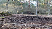
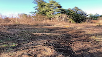
Popular Žilinský kraj Mountain Biking Trails
• 100 ★ 4.6 • 2 miles • 31 ft • 557 •
Highly rated popular blue difficulty singletrack. This mountain bike primary trail can be used downhill only. It features drop and rock face. On average it takes 7 minutes to complete this trail.
• 95 ★ 4.5 • 1,306 ft • 0 ft • 479 •
Highly rated popular blue difficulty doubletrack. This mountain bike primary trail can be used downhill only and has a moderate overall physical rating. It features berm and jump. On average it takes 1 minutes to complete this trail.
• 30 ★ 4.4 • 2 miles • 2 ft • 385 •
Highly rated less popular blue difficulty mixed. This mountain bike primary trail can be used downhill only. It features bridge and rock face. On average it takes 10 minutes to complete this trail.
• 80 ★ 5.0 • 764 ft • 0 ft • 368 •
Popular black diamond difficulty singletrack. This mountain bike primary trail can be used downhill only. It features bridge, drop and rock face. On average it takes 1 minutes to complete this trail.
• 60 ★ 4.5 • 2,548 ft • 0 ft • 357 •
Highly rated moderately popular black diamond difficulty singletrack. This mountain bike primary trail can be used downhill only. It features drop. On average it takes 3 minutes to complete this trail.
• 90 ★ 4.7 • 1,336 ft • 2 ft • 353 •
Highly rated popular black diamond difficulty singletrack. This mountain bike primary trail can be used downhill only. On average it takes 1 minutes to complete this trail.
• 65 ★ 4.5 • 2,978 ft • 16 ft • 308 •
Highly rated moderately popular double black diamond difficulty singletrack. This mountain bike primary trail can be used downhill only and has a hard overall physical rating. It features drop, jump and rock face. On average it takes 6 minutes to complete this trail.
Žilinský kraj Mountain Bike Routes
★ 5.0 • 24 miles • 4,592 ft • 5 • Loop •
Cyklookruh Hrebenom Velkej Fatry so zakoncenim na trailoch okolo Sidorova.
★ 5.0 • 13 miles • 3,130 ft • 8 • Point to Point •
AM/EN route from Turie to Strecno.
★ 4.0 • 21 miles • 5,015 ft • 0 • Out & Back •
Vtáčnik (1 345,8 m n. m.[1]) je výrazný bralnatý vrchol na hlavnom hrebeni rovnomenného pohoria....
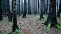
Photos of Žilinský kraj Mountain Bike
Videos of Žilinský kraj Mountain Bike
trail: Super Natural
3:22 |
8 |
May 13, 2026
trail: V.V. MTB
0:07 |
15 |
Mar 18, 2026

trail: Rázsošná
0:24 |
87 |
Oct 10, 2022
trail: Ozembuch - spodok
0:08 |
|
Apr 26, 2021
trail: Ozembuch - spodok
0:25 |
|
Apr 26, 2021
trail: Paragan
0:14 |
|
Apr 3, 2021
trail: V3S
0:08 |
|
Apr 3, 2021
trail: Hviezda
0:38 |
139 |
Jan 5, 2021
Current Trail Warnings
| status | trail | date | condition | user | info |
|---|---|---|---|---|---|
| Duky Trail Martinské Hole | Jun 10, 2026 @ 10:42am (Europe/Bratislava) Jun 10, 2026 | Unknown | Tomasz91kwdp | Tazba na koncu traila. Treba isc prez... | |
| Teacher Kunerad | Jun 2, 2026 @ 10:14am (Europe/Bratislava) Jun 2, 2026 | Ideal | jurosik | trail neprejazdný, zapadaný, neudržiavaný |
Recent Trail Reports
Activity Feed
| username | action | type | title | date |
|---|---|---|---|---|
| katko | add | report | activity #97404730 | Jun 20, 2026 @ 9:30am 11 hours |
| katko | add | report | activity #97404726 and 1 more | Jun 20, 2026 @ 9:30am 11 hours |
| katko | add | report | activity #97404725 and 1 more | Jun 20, 2026 @ 9:30am 11 hours |
| tomtoylc | add | report | activity #97391305 and 2 more | Jun 20, 2026 @ 7:09am 13 hours |
| DamianlauV6W | ridden | trail | activity #97370110 | Jun 20, 2026 @ 12:27am 20 hours |
Recent Comments
| username | type | title | comment | date |
|---|---|---|---|---|
| trail | Pozor! Pred koncom su dva spilene stromy... | May 10, 2026 @ 11:06am May 10, 2026 | ||
| trail | Kde presne boli popadané? Lebo pred... | Apr 26, 2026 @ 10:55am Apr 26, 2026 | ||
| trail | Dnes som bol pozrieť na peši. Sú tam... | Apr 26, 2026 @ 10:50am Apr 26, 2026 | ||
| report | Dnes som bol pozrieť na peši. Sú tam... | Apr 26, 2026 @ 6:44am Apr 26, 2026 | ||
| trail | Potvrdzujem trail niekto označil modrou... | Apr 23, 2026 @ 12:43pm Apr 23, 2026 |
Local Badges
-

MF Blue1 awarded -

10 Green Trails21 awarded -

Completionist2 awarded -
Completionist4 awarded -

Top 10 Trails0 awarded -

10 Blue Trails2 awarded
Bike & Skill Parks
| name | type | city | rating |
|---|---|---|---|
| ŽILINA OKӨ TRAILS | bike park | Žilina | |
| Malinô Brdo | bike park | Ružomberok | |
| Bike World Jasná | bike park | Liptovský Mikuláš | |
| Bike Park Jasenska | bike park | Martin | |
| Bike Park Grúniky | bike park | Namestovo |
Activity Type Stats
| activitytype | trails | distance | descent | descent distance | total vertical | rating | global rank | state rank | photos | reports | routes | ridelogs |
|---|---|---|---|---|---|---|---|---|---|---|---|---|
| Mountain Bike | 822 | 914 miles | 278,169 ft | 443 miles | 5,472 ft | 2,216 | 18,234 | 41 | 80,855 | |||
| E-Bike | 352 | 333 miles | 65,912 ft | 137 miles | 4,111 ft | 3 | 16,528 | 9 | 8,810 | |||
| Gravel Bike | 8 | 18 | 505 | |||||||||
| Adaptive Bike | 5 | 5 | ||||||||||
| Winter Fat Bike | 5 | 9 | ||||||||||
| Horse | 31 | 32 miles | 2,690 ft | 9 miles | 2,844 ft | 1,288 | ||||||
| Hike | 818 | 1,066 miles | 360,010 ft | 513 miles | 6,237 ft | 5 | 17,650 | 15,843 | ||||
| Trail Running | 825 | 1,085 miles | 359,232 ft | 519 miles | 6,237 ft | 17,624 | 1 | 7,224 | ||||
| Dirtbike/Moto | 10 | 8 miles | 751 ft | 1 mile | 1,962 ft | 1,298 | 3 | |||||
| ATV/ORV/OHV | 14 | 13 miles | 2,047 ft | 4 miles | 2,198 ft | 1,276 | 8 | |||||
| Snowmobile | 1 | 1 mile | 410 ft | 45 | ||||||||
| Snowshoe | 58 | 71 miles | 29,265 ft | 33 miles | 5,823 ft | 54 | 30 | |||||
| Downhill Ski | 19 | 9 miles | 13,494 ft | 9 miles | 2,972 ft | 50 | 5,095 | |||||
| Backcountry Ski | 153 | 161 miles | 85,495 ft | 87 miles | 6,529 ft | 2 | 176 | 5,382 | ||||
| Nordic Ski | 33 | 46 miles | 8,615 ft | 16 miles | 3,684 ft | 74 | 1,536 |
Activities
- Žilinský kraj Mountain Biking Trails
- Žilinský kraj E-Biking Trails
- Žilinský kraj Gravel Biking Trails
- Žilinský kraj Adaptive Biking Trails
- Žilinský kraj Winter Fat Biking Trails
- Žilinský kraj Horseback Trails
- Žilinský kraj Hiking Trails
- Žilinský kraj Trail Running Trails
- Žilinský kraj Dirtbiking Trails
- Žilinský kraj ATVing/Offroading Trails
- Žilinský kraj Snowshoeing Trails
- Žilinský kraj Skiing Trails
- Žilinský kraj Backcountry Skiing Trails
- Žilinský kraj Nordic Skiing Trails
Trails
Points of Interest
- Rozhľadňa Pri Hviezdoslavovej horárni Viewpoint
- PANORAMA VIEW Viewpoint
- RESTAURANT Jasenská dolina Other
- RESTAURANT Kaška Other
- LYSEC VIEW Viewpoint
- Konec trailu Information
- Infotabula Information
- Rázcestník KST Information
- Kamenná Chata Cabin
- Information TTF
- Terianska veža (7,490 ft)
- Nefcerská veža (7,477 ft)
- Taternicka Świnica (7,372 ft)
- By brenthillier
 NSMBA TRAILFORKS & contributors
 - Admins: jxxw
- #10071 - 13,920 views
- Žilinský kraj activity log | embed map of Žilinský kraj mountain bike trails | Žilinský kraj mountain biking points of interest polygons
Downloading of trail gps tracks in kml & gpx formats is enabled for Žilinský kraj.
You must login to download files.