close
-
Layers w
- Weather Layers
- Pro
- Pro
- Pro
- Pro
- Pro
- Pro
- More Layers
- Pro
- Pro
- Pro
- Pro
-
Upgrade to

3D
Trail Conditions
- Unknown
- Snow Groomed
- Snow Packed
- Snow Covered
- Snow Cover Partial
- Freeze/thaw Cycle
- Icy
- Prevalent Mud
- Wet
- Variable
- Ideal
- Dry
- Very Dry
Trail Flow (Ridden Direction)
Trailforks scans users ridelogs to determine the most popular direction each trail is ridden. A good flowing trail network will have most trails flowing in a single direction according to their intension.
The colour categories are based on what percentage of riders are riding a trail in its intended direction.
The colour categories are based on what percentage of riders are riding a trail in its intended direction.
- > 96%
- > 90%
- > 80%
- > 70%
- > 50%
- < 50%
- bi-directional trail
- no data
Trail Last Ridden
Trailforks scans ridelogs to determine the last time a trail was ridden.
- < 2 days
- < 1 week
- < 2 weeks
- < 1 month
- < 6 months
- > 6 months
Trail Ridden Direction
The intended direction a trail should be ridden.
- Downhill Only
- Downhill Primary
- Both Directions
- Uphill Primary
- Uphill Only
- One Direction
Contribute Details
Colors indicate trail is missing specified detail.
- Description
- Photos
- Description & Photos
- Videos
Trail Popularity ?
Trailforks scans ridelogs to determine which trails are ridden the most in the last 9 months.
Trails are compared with nearby trails in the same city region with a possible 25 colour shades.
Think of this as a heatmap, more rides = more kinetic energy = warmer colors.
- most popular
- popular
- less popular
- not popular
ATV/ORV/OHV Filter
Max Vehicle Width
inches
US Cell Coverage
Legend

Radar Time
Activity Recordings
Trailforks uses anonymized public activity data.
?
Activity Recordings
Trailforks uses anonymized public activity data.
?
Personal Heatmap
▶
Activity Types
all
/
none
▶
Options
2
Date range
month
–
Winter Trails
Warning
A routing network for winter maps does not exist. Selecting trails using the winter trails layer has been disabled.
Missing Trails
Most Popular
Least Popular
Trails are colored based on popularity. The more popular a trail is, the more red. Less popular trails trend towards green.
Jump Magnitude Heatmap
Heatmap of where riders jump on trails. Zoom in to see individual jumps, click circles to view jump details.
BC Backroad Status
![map legend]()
Service Road Atlas is a free to use, community-driven service for viewing and creating reports on the numerous back-country service roads around B.C. and Alberta.

Slope Aspect
Direction the slope faces
Trails Deemphasized
Trails are shown in grey.
Only show trails with no bike usage.
Suggested Layers
Based on selected activity type
Save the current map location and zoom level as your default home location whenever this page is loaded.
Save
No description for Imola has been added yet!
Login or register to submit one.
This region uses the Uk/Euro style trail grading system.
Activities Click to view
- Mountain Bike
71 trails
- E-Bike
55 trails
- Adaptive Bike
0 trails
- Winter Fat Bike
0 trails
- Hike
58 trails
- Trail Running
58 trails
Region Details
- 14
- 1
- 15
- 28
Region Status
Open as of Jun 7, 2026Stats
- Avg Trail Rating
- Trails (view details)
- 71
- Trails Mountain Bike
- 71
- Trails E-Bike
- 55
- Trails Horse
- 1
- Trails Hike
- 58
- Trails Trail Running
- 58
- Total Distance
- 82 miles
- Total Descent Distance
- 47 miles
- Total Descent
- 35,387 ft
- Total Vertical
- 3,035 ft
- Highest Trailhead
- 3,217 ft
- Reports
- 342
- Photos
- 21
- Ridden Counter
- 2,074
Sub Regions
-
Castel del Rio
- 4
- 8
-
Monte Battaglia
- 1
- 9
- 19
Popular Imola Mountain Biking Trails
• 75 ★ 4.0 • 2 miles • 9 ft • 72 •
Popular red difficulty singletrack. This mountain bike primary trail can be used downhill primary and has a hard overall physical rating. It features drop, jump and rock garden. Trail visibility is always easy to follow. On average it takes 21 minutes to complete this trail.
• 100 ★ 5.0 • 961 ft • 0 ft • 65 •
Popular blue difficulty singletrack. This mountain bike primary trail can be used downhill only. It features drop, rock garden and skinny. Trail visibility is always easy to follow. On average it takes 1 minutes to complete this trail.
• 65 ★ 3.0 • 4,150 ft • 0 ft • 64 •
Breve pistino con alcuni salti di cui alcuni non banali e curve paraboliche Nel finale passaggio su roccia con un doppio salto non proprio banale anche questo, direi che se la difficoltà è almeno piuttosto elevata. Attenzione che la...
• 95 ★ 0.0 • 600 ft • 78 ft • 53 •
Popular green difficulty singletrack. This mountain bike primary trail can be used both directions and has a moderate overall physical rating with a 78 ft blue climb. It features skinny. Trail visibility is always easy to follow. On average it takes 1 minutes to complete this trail.
• 90 ★ 0.0 • 610 ft • 78 ft • 48 •
Popular green difficulty singletrack. This mountain bike primary trail can be used both directions and has a moderate overall physical rating with a 78 ft blue climb. It features skinny. Trail visibility is always easy to follow. On average it takes 2 minutes to complete this trail.
• 90 ★ 4.5 • 1 mile • 30 ft • 48 •
Popular blue difficulty singletrack. This mountain bike primary trail can be used downhill primary and has a moderate overall physical rating. Trail visibility is always easy to follow. On average it takes 9 minutes to complete this trail.
• 95 ★ 3.0 • 1,463 ft • 0 ft • 45 •
Short but very fun single track in the wood. Berms and tight turns on top, steep sections at the bottom. Mostly smooth and flowy but with some tricky features toward the bottom (small drops, prominent roots on steep bits)
• 100 ★ 0.0 • 591 ft • 51 ft • 42 •
Popular green difficulty singletrack. This mountain bike primary trail can be used both directions and has a easy overall physical rating with a 51 ft green climb. Trail visibility is always easy to follow. On average it takes minutes to complete this trail.
Imola Mountain Bike Routes
14 miles • 3,223 ft • 13 • Loop •
Si parte da Passo del Prugno e si sale verso Mt. Battaglia, prima discesa: 1944 Trail, poi fino ad...
16 miles • 1,740 ft • 0 • Loop • Race •
Percorso del Mondiale di Ciclismo da strada di Imola 2020 ( senza la parte dell'autodromo )
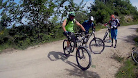
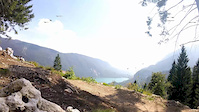
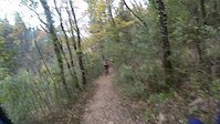
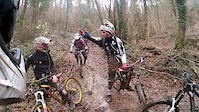
Photos of Imola Mountain Bike
Videos of Imola Mountain Bike
trail: Paventa FR
8:45 |
35 |
Apr 7, 2023
trail: Zardò
5:17 |
94 |
Sep 16, 2019
trail: The End
4:58 |
42 |
Feb 3, 2019
trail: Vecchia DH
6:59 |
86 |
Apr 14, 2018
trail: Vecchia DH
5:10 |
110 |
Dec 10, 2015
trail: Zardò
8:02 |
195 |
Dec 30, 2014
trail: The End
4:05 |
16671 |
Oct 6, 2011
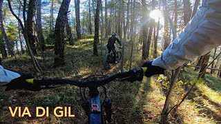
trail: Via di Gil
5:11 |
181 |
Dec 20, 2023 , Imola
Recent Trail Reports
Activity Feed
| username | action | type | title | date |
|---|---|---|---|---|
| gion86 | add | report | activity #96457682 and 5 more | Jun 7, 2026 @ 7:16am Jun 7, 2026 |
| NikoRnR | add | report | activity #95617808 and 3 more | May 27, 2026 @ 12:30am May 27, 2026 |
| gion86 | add | report | activity #95407465 | May 24, 2026 @ 7:26am May 24, 2026 |
| b1anc | add | report | activity #93953189 | May 3, 2026 @ 8:59am May 3, 2026 |
| b1anc | add | report | activity #93953109 and 3 more | May 3, 2026 @ 8:58am May 3, 2026 |
Recent Comments
| username | type | title | comment | date |
|---|---|---|---|---|
| trail | Chiuso per troppi rami | Mar 24, 2024 @ 7:55am Mar 24, 2024 | ||
| trail | Percorso non curato, troppi solchi di moto e... | Mar 17, 2023 @ 8:57am Mar 17, 2023 | ||
| trail | At the top watch the GPS to find the start, no... | Sep 5, 2021 @ 3:04pm Sep 5, 2021 | ||
| trail | So the "trialistica" is not an exaggeration in... | Sep 5, 2021 @ 2:57pm Sep 5, 2021 | ||
| report | Alcuni tratti scavati | Jul 19, 2020 @ 9:08am Jul 19, 2020 |
Local Badges
-

Completionist0 awarded -
Completionist0 awarded -

10 Blue Trails22 awarded -

Epic Mountain Bike Climb 2k66 awarded -

Climbing 10k Badge20 awarded -

Mountain Biking 100k Badge0 awarded
Activity Type Stats
| activitytype | trails | distance | descent | descent distance | total vertical | rating | global rank | state rank | photos | reports | routes | ridelogs |
|---|---|---|---|---|---|---|---|---|---|---|---|---|
| Mountain Bike | 71 | 82 miles | 35,387 ft | 47 miles | 3,035 ft | #2,106 | #92 | 19 | 342 | 2 | 1,296 | |
| E-Bike | 55 | 65 miles | 23,980 ft | 34 miles | 2,667 ft | #574 | #62 | 2 | 329 | 2 | 722 | |
| Horse | 1 | 1 mile | 764 ft | 1 mile | 764 ft | |||||||
| Hike | 58 | 69 miles | 28,570 ft | 39 miles | 2,667 ft | #3,801 | #135 | 338 | 87 | |||
| Trail Running | 58 | 69 miles | 28,661 ft | 39 miles | 2,667 ft | #3,234 | #114 | 338 | 8 |
Frequently Asked Questions About Imola
▼
What are the best places to ride in Imola?
Imola has 2 areas to explore for mountain biking. The top rated areas are:
▼
What are the highest rated mountain biking trails in Imola?
The highest rated mountain biking trails in Imola are:
- Inizio Cecilia (4.2/5)
- Sentiero delle Ossa (4.2/5)
- Camaggiore FR (4.2/5)
- Via di Gil (4.1/5)
- Ciclovia del Santerno (Fontanelice - Castel del Rio) (4.1/5)
▼
What is the best time of the year to ride in Imola?
Based on ride log data, the most popular months to ride in Imola are:
- June (19 activities)
- August (15 activities)
- July (12 activities)
▼
Where can I park to ride in Imola?
There are 2 parking locations listed in Imola. The most popular parking spots are:
Activities
Trails
Points of Interest
- By Blackmouse78 & contributors
- Admins: apply
- #31843 - 2,252 views
- imola activity log | embed map of Imola mountain bike trails | imola mountain biking points of interest
Downloading of trail gps tracks in kml & gpx formats is enabled for Imola.
You must login to download files.