close
-
Layers w
- Weather Layers
- Pro
- Pro
- Pro
- Pro
- Pro
- Pro
- More Layers
- Pro
- Pro
- Pro
- Pro
-
Upgrade to

3D
Trail Conditions
- Unknown
- Snow Groomed
- Snow Packed
- Snow Covered
- Snow Cover Partial
- Freeze/thaw Cycle
- Icy
- Prevalent Mud
- Wet
- Variable
- Ideal
- Dry
- Very Dry
Trail Flow (Ridden Direction)
Trailforks scans users ridelogs to determine the most popular direction each trail is ridden. A good flowing trail network will have most trails flowing in a single direction according to their intension.
The colour categories are based on what percentage of riders are riding a trail in its intended direction.
The colour categories are based on what percentage of riders are riding a trail in its intended direction.
- > 96%
- > 90%
- > 80%
- > 70%
- > 50%
- < 50%
- bi-directional trail
- no data
Trail Last Ridden
Trailforks scans ridelogs to determine the last time a trail was ridden.
- < 2 days
- < 1 week
- < 2 weeks
- < 1 month
- < 6 months
- > 6 months
Trail Ridden Direction
The intended direction a trail should be ridden.
- Downhill Only
- Downhill Primary
- Both Directions
- Uphill Primary
- Uphill Only
- One Direction
Contribute Details
Colors indicate trail is missing specified detail.
- Description
- Photos
- Description & Photos
- Videos
Trail Popularity ?
Trailforks scans ridelogs to determine which trails are ridden the most in the last 9 months.
Trails are compared with nearby trails in the same city region with a possible 25 colour shades.
Think of this as a heatmap, more rides = more kinetic energy = warmer colors.
- most popular
- popular
- less popular
- not popular
ATV/ORV/OHV Filter
Max Vehicle Width
inches
US Cell Coverage
Legend

Radar Time
Activity Recordings
Trailforks uses anonymized public activity data.
?
Activity Recordings
Trailforks uses anonymized public activity data.
?
Personal Heatmap
▶
Activity Types
all
/
none
▶
Options
2
Date range
month
–
Winter Trails
Warning
A routing network for winter maps does not exist. Selecting trails using the winter trails layer has been disabled.
Missing Trails
Most Popular
Least Popular
Trails are colored based on popularity. The more popular a trail is, the more red. Less popular trails trend towards green.
Jump Magnitude Heatmap
Heatmap of where riders jump on trails. Zoom in to see individual jumps, click circles to view jump details.
BC Backroad Status
![map legend]()
Service Road Atlas is a free to use, community-driven service for viewing and creating reports on the numerous back-country service roads around B.C. and Alberta.

Slope Aspect
Direction the slope faces
Trails Deemphasized
Trails are shown in grey.
Only show trails with no bike usage.
Suggested Layers
Based on selected activity type
Save the current map location and zoom level as your default home location whenever this page is loaded.
SaveUplift information here: https://www.adrenalinuplift.co.uk/
Innerleithen is an official trail centre ("Innerleithen Bike Park") with XC and downhill trails, part of the 7 Stanes.
Most mountain bikers referring to "Innerleithen" mean these trails. There are a couple of other areas including the "Golfie" all within a few minutes pedal. You can pedal between here and Glentress on a disused railway line in about 20 minutes. There are lots of unofficial enduro trails and marked DH trails.
The XC route is clearly marked, red only, though the final descent is black. Ignore most of those trails, use the climbs to get you to the good stuff, maybe ride Caddon Bank now and again. Things have moved on and everyone loves Angry Sheep!
There are no facilities in the car park, but there is an excellent bike shop (I-Cycles), public toilets, a Co-Op supermarket and a couple of great cafe's a couple of minutes from the trails. There's a free-standing GreaseMonkeyCycles.com bike stand outside the Co-Op, which is just across the road from I-Cycles. If you can't fix it outside the Co-op, standard price for quick and simple repairs at I-Cycles seems to be £10 and they have a coffee machine and a friendly dog!
Adrenalin Uplift who run the uplifts is a bit of a side project for an ATOL company who run ski holidays. They have holiday package deals, guides, accomadation etc. They have a tie in with I-Cycles so if you break your bike on an uplift day you get priority in the workshop.
Innerleithen is home to Findra Clothing, there are also some great pubs, an award winning Indian restaurant and plenty of great places to stay.
Primary Trail Type: All-Mountain & Downhill
AKA: Inners
Land Status: National Forest
 google parking directions
 Disclaimer:
All trails currently closed to cycling except fire roads.
This region uses the Uk/Euro style trail grading system.
Region Supporters & Maintainers
![]()
Adrenalin UpliftMaintainer
Activities Click to view
- Mountain Bike
117 trails
- E-Bike
117 trails
- Horse
6 trails
- Hike
32 trails
- Trail Running
31 trails
Bike Park Details
- 32
- 1
- 4
- 25
- 45
- 9
Region Status
Caution as of 2 days- Day Ticket
- £32 GBP
- Uplift Type
- Shuttle
Stats
- Avg Trail Rating
- Trails (view details)
- 116
- Trails Mountain Bike
- 117
- Trails E-Bike
- 117
- Trails Horse
- 6
- Trails Hike
- 32
- Trails Trail Running
- 31
- Total Distance
- 58 miles
- Total Descent Distance
- 36 miles
- Total Descent
- 21,036 ft
- Total Vertical
- 1,377 ft
- Highest Trailhead
- 1,850 ft
- Reports
- 1,685
- Photos
- 612
- Ridden Counter
- 74,227
Popular Traquair Trails Mountain Biking Trails
• 95 ★ 4.4 • 5,161 ft • 85 ft • 2,294 •
Highly rated popular red difficulty singletrack. This mountain bike primary trail and has a moderate overall physical rating. It features drop and jump. Trail visibility is always easy to follow. On average it takes 6 minutes to complete this trail.
• 100 ★ 4.9 • 1,942 ft • 0 ft • 2,275 •
Hand made, natural flowy trail without too many steep or overly techy sections. Easily one of the most fun trails in the Tweed Valley. For some reason riders have been trying to put s in, straightening out the amazing flowy corners -...
• 95 ★ 3.0 • 3,967 ft • 232 ft • 1,363 •
Very exposed in bad weather. Lots of bumpy rocks and little technical bits.
• 85 ★ 3.9 • 1 mile • 12 ft • 1,358 •
Fast and smooth trail with a few jumps and rock gardens (all rollable) and berms. Top part of this trail is marker on Strava as "Minch Moor Section 2. Lower part is marked as Section 3 and "No Trees No More". Last section is pretty much...
• 85 ★ 4.9 • 2,021 ft • 0 ft • 1,327 •
Highly rated popular red difficulty singletrack. This mountain bike primary trail can be used one direction and has a moderate overall physical rating with a 0 ft blue climb. On average it takes 6 minutes to complete this trail.
• 90 ★ 3.8 • 3,061 ft • 0 ft • 1,324 •
From the top, just after the shelter, across the first fire road to the second fire road.
• 95 ★ 3.6 • 322 ft • 0 ft • 1,260 •
is the like from the road gap jump to IXS, Make or break and the .
• 80 ★ 3.0 • 2 miles • 491 ft • 1,242 •
Popular red difficulty singletrack. This mountain bike primary trail can be used uphill only and has a moderate overall physical rating with a 491 ft blue climb. Trail visibility is always easy to follow. On average it takes 26 minutes to complete this trail.
Traquair Trails Mountain Bike Routes
★ 4.5 • 11 miles • 2,150 ft • 12 • Loop •
Starting at the Innerleithen trails car park, This route takes in the complete Red XC route.
★ 2.8 • 23 miles • 3,448 ft • 18 • Loop •
Out through Innerleithen via Minch Moor, over the Southern Upland way to the Three Brethren. This is all...
★ 1.0 • 4,203 ft • 1 •
Test track for CounterSycle Tuned Mass Damper - Pinkbike Review
★ 1.0 • 12 miles • 2,434 ft • 12 • Loop •
Classic XC route with few changes after storm damage
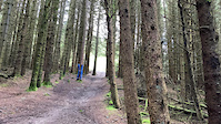
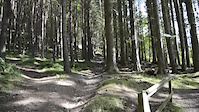
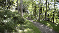
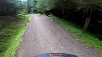
Photos of Traquair Trails Mountain Bike
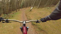
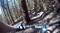
Videos of Traquair Trails Mountain Bike

trail: Make or Brake
5:59 |
133 |
Jun 23, 2021

trail: Make or Brake
6:17 |
125 |
Jun 17, 2021
trail: IXS
0:08 |
114 |
Jan 12, 2021
trail: Matador
0:11 |
509 |
Jan 12, 2021
trail: Matador
0:06 |
268 |
Jan 12, 2021
trail: Cresta Run
0:15 |
255 |
Nov 10, 2020
trail: Make or Brake
0:42 |
393 |
Aug 1, 2020
trail: Gold Run
4:09 |
576 |
Apr 15, 2020
Current Trail Warnings
| status | trail | date | condition | user | info |
|---|---|---|---|---|---|
| Forest Road | May 27, 2026 @ 5:56pm (Europe/London) May 27, 2026 | Unknown | steveo3po | no access along road due to tree felling.... | |
| Gold Run | May 25, 2026 @ 10:56am (Europe/London) May 25, 2026 | Dry | marccr0wley FLS | Closed weekdays, during harvesting | |
| Gold Run (upper) | May 25, 2026 @ 10:53am (Europe/London) May 25, 2026 | Variable | marccr0wley FLS | Closed weekdays during harvesting |
Recent Trail Reports
| status | trail | date | condition | info | user |
|---|---|---|---|---|---|
| Green Wing | Jun 20, 2026 @ 9:25am (Europe/Isle_of_Man) 2 days | Variable | RadBikeBro NCTC | ||
| 39 steps (Lower) | Jun 20, 2026 @ 9:25am (Europe/Isle_of_Man) 2 days | Variable | RadBikeBro NCTC | ||
| Spit Roast | Jun 20, 2026 @ 9:25am (Europe/Isle_of_Man) 2 days | Variable | RadBikeBro NCTC | ||
| Medium Kahunas | Jun 20, 2026 @ 9:25am (Europe/Isle_of_Man) 2 days | Variable | RadBikeBro NCTC | ||
| Angry Sheep | Jun 20, 2026 @ 9:25am (Europe/Isle_of_Man) 2 days | Ideal | RadBikeBro NCTC | ||
| Pushup | Jun 20, 2026 @ 9:25am (Europe/Isle_of_Man) 2 days | Variable | RadBikeBro NCTC | ||
| Past Blast | Jun 20, 2026 @ 9:25am (Europe/Isle_of_Man) 2 days | Variable | RadBikeBro NCTC | ||
| IXS | Jun 20, 2026 @ 9:25am (Europe/Isle_of_Man) 2 days | Variable | RadBikeBro NCTC | ||
| The Tunnel (Section Open) | Jun 20, 2026 @ 9:25am (Europe/Isle_of_Man) 2 days | Variable | RadBikeBro NCTC | ||
| Darkness (AKA Bye Driver) | Jun 20, 2026 @ 9:25am (Europe/Isle_of_Man) 2 days | Variable | RadBikeBro NCTC |
Activity Feed
| username | action | type | title | date |
|---|---|---|---|---|
| RadBikeBro | add | report | activity #97436100 and 16 more | Jun 20, 2026 @ 3:04pm 24 hours |
| Neilpaterson1969 | ridden | trail | activity #97411212 and 4 more | Jun 20, 2026 @ 10:32am 1 day |
| vince782963 | ridden | trail | activity #96886579 and 1 more | Jun 13, 2026 @ 9:21am Jun 13, 2026 |
| marccr0wley | update | polygon | activity #96800502 | Jun 12, 2026 @ 6:52am Jun 12, 2026 |
| marccr0wley | update | trail | activity #96725766 | Jun 11, 2026 @ 3:06am Jun 11, 2026 |
Recent Comments
| username | type | title | comment | date |
|---|---|---|---|---|
| trail | A little bit of debris but running nicely. Dry! | Aug 7, 2025 @ 6:22am Aug 7, 2025 | ||
| trail | Running primo 👌 | Jun 22, 2025 @ 7:35am Jun 22, 2025 | ||
| trail | It's running prime | Jun 22, 2025 @ 7:35am Jun 22, 2025 | ||
| trail | Started to follow this but lots of fallen... | May 30, 2025 @ 11:18am May 30, 2025 | ||
| report | The orange fence is there because it is closed... | Feb 15, 2025 @ 11:51am Feb 15, 2025 |
Nearby Areas
| name | distance | ||||
|---|---|---|---|---|---|
| Dod Hill | 2.6 km | ||||
| Caberston | 3 | 3 | 2.7 km | ||
| Elibank | 2 | 2.8 km | |||
| Cardrona | 1 | 2 | 3.5 km | ||
| Thornielee | 9 | 3.8 km |
Local Badges
-

Completionist0 awarded
Activity Type Stats
| activitytype | trails | distance | descent | descent distance | total vertical | rating | global rank | state rank | photos | reports | routes | ridelogs |
|---|---|---|---|---|---|---|---|---|---|---|---|---|
| Mountain Bike | 117 | 58 miles | 21,037 ft | 36 miles | 1,378 ft | #174 | #9 | 611 | 1,685 | 9 | 21,476 | |
| E-Bike | 117 | 58 miles | 21,037 ft | 36 miles | 1,378 ft | #601 | #42 | 1,542 | 3 | 2,475 | ||
| Horse | 6 | 14 miles | 1,703 ft | 7 miles | 922 ft | #208 | #16 | 485 | ||||
| Hike | 32 | 28 miles | 4,475 ft | 13 miles | 1,355 ft | #3,239 | #51 | 1,322 | 179 | |||
| Trail Running | 31 | 28 miles | 4,475 ft | 13 miles | 1,355 ft | #2,532 | #46 | 1,322 | 561 |
Frequently Asked Questions About Traquair Trails
▼
What are the highest rated mountain biking trails in Traquair Trails?
The highest rated mountain biking trails in Traquair Trails are:
- Angry Sheep (4.7/5)
- Green Wing (4.5/5)
- ProSpacker (4.5/5)
- Cresta Run (4.5/5)
- 39 steps (4.5/5)
▼
What is the best time of the year to ride in Traquair Trails?
Based on ride log data, the most popular months to ride in Traquair Trails are:
- July (76 activities)
- May (71 activities)
- September (67 activities)
▼
Where can I park to ride in Traquair Trails?
There are 2 parking locations listed in Traquair Trails. The most popular parking spots are:
▼
What is the longest trail in Traquair Trails?
The longest trail in Traquair Trails is Minch Moor Climb at 2.7 km. View all trails sorted by distance.
Activities
Trails
- By 20twenty-p
 TVTA & contributors
 - Admins: TVTA
- #5982 - 51,140 views
- traquair trails activity log | embed map of Traquair Trails mountain bike trails | traquair trails mountain biking points of interest polygons
Downloading of trail gps tracks in kml & gpx formats is enabled for Traquair Trails.
You must login to download files.