close
-
Layers w
- Weather Layers
- Pro
- Pro
- Pro
- Pro
- Pro
- Pro
- More Layers
- Pro
- Pro
- Pro
- Pro
-
Upgrade to

3D
Trail Conditions
- Unknown
- Snow Groomed
- Snow Packed
- Snow Covered
- Snow Cover Partial
- Freeze/thaw Cycle
- Icy
- Prevalent Mud
- Wet
- Variable
- Ideal
- Dry
- Very Dry
Trail Flow (Ridden Direction)
Trailforks scans users ridelogs to determine the most popular direction each trail is ridden. A good flowing trail network will have most trails flowing in a single direction according to their intension.
The colour categories are based on what percentage of riders are riding a trail in its intended direction.
The colour categories are based on what percentage of riders are riding a trail in its intended direction.
- > 96%
- > 90%
- > 80%
- > 70%
- > 50%
- < 50%
- bi-directional trail
- no data
Trail Last Ridden
Trailforks scans ridelogs to determine the last time a trail was ridden.
- < 2 days
- < 1 week
- < 2 weeks
- < 1 month
- < 6 months
- > 6 months
Trail Ridden Direction
The intended direction a trail should be ridden.
- Downhill Only
- Downhill Primary
- Both Directions
- Uphill Primary
- Uphill Only
- One Direction
Contribute Details
Colors indicate trail is missing specified detail.
- Description
- Photos
- Description & Photos
- Videos
Trail Popularity ?
Trailforks scans ridelogs to determine which trails are ridden the most in the last 9 months.
Trails are compared with nearby trails in the same city region with a possible 25 colour shades.
Think of this as a heatmap, more rides = more kinetic energy = warmer colors.
- most popular
- popular
- less popular
- not popular
ATV/ORV/OHV Filter
Max Vehicle Width
inches
US Cell Coverage
Legend

Radar Time
Activity Recordings
Trailforks uses anonymized public activity data.
?
Activity Recordings
Trailforks uses anonymized public activity data.
?
Personal Heatmap
▶
Activity Types
all
/
none
▶
Options
2
Date range
month
–
Winter Trails
Warning
A routing network for winter maps does not exist. Selecting trails using the winter trails layer has been disabled.
Missing Trails
Most Popular
Least Popular
Trails are colored based on popularity. The more popular a trail is, the more red. Less popular trails trend towards green.
Jump Magnitude Heatmap
Heatmap of where riders jump on trails. Zoom in to see individual jumps, click circles to view jump details.
BC Backroad Status
![map legend]()
Service Road Atlas is a free to use, community-driven service for viewing and creating reports on the numerous back-country service roads around B.C. and Alberta.

Slope Aspect
Direction the slope faces
Trails Deemphasized
Trails are shown in grey.
Only show trails with no bike usage.
Suggested Layers
Based on selected activity type
Save the current map location and zoom level as your default home location whenever this page is loaded.
SaveThe Southland Mountain Bike Club has two main riding areas, being Sandy Point and Bluff Hill.
Sandy Point trails consists of over 20km of single and forestry road tracks which are grade 2 and 3
Bluff Hill trails consist of 15km for grade 2-5 flow and technical trails.
Sandy Point trails consists of over 20km of single and forestry road tracks which are grade 2 and 3
Bluff Hill trails consist of 15km for grade 2-5 flow and technical trails.
Activities Click to view
- Mountain Bike
69 trails
- E-Bike
68 trails
- Gravel Bike
0 trails
- Adaptive Bike
0 trails
- Winter Fat Bike
0 trails
- Hike
53 trails
- Trail Running
63 trails
Region Details
- 10
- 1
- 6
- 27
- 1
- 1
Region Status
Open as of Jun 1, 2026Local Trail Association
Stats
- Avg Trail Rating
- Trails (view details)
- 46
- Trails Mountain Bike
- 69
- Trails E-Bike
- 68
- Trails Hike
- 60
- Trails Trail Running
- 63
- Total Distance
- 50 miles
- Total Descent
- 983 ft
- Total Vertical
- 692 ft
- Highest Trailhead
- 700 ft
- Reports
- 105
- Photos
- 8
- Ridden Counter
- 2,279
Sub Regions
-
Sandy Point
- 1
- 6
- 27
Popular Invercargill Mountain Biking Trails
• 90 ★ 4.0 • 4,318 ft • 24 ft • 136 •
Popular blue difficulty singletrack. This mountain bike primary trail can be used one direction and has a easy overall physical rating with a 24 ft blue climb. On average it takes 4 minutes to complete this trail.
• 85 ★ 4.0 • 1 mile • 31 ft • 134 •
Popular blue difficulty singletrack. This mountain bike primary trail can be used one direction and has a easy overall physical rating with a 31 ft green climb. Trail visibility is always easy to follow. On average it takes 6 minutes to complete this trail.
• 90 ★ 4.0 • 1 mile • 24 ft • 100 •
Popular blue difficulty singletrack. This mountain bike primary trail and has a moderate overall physical rating with a 24 ft blue climb. Trail visibility is always easy to follow. On average it takes 6 minutes to complete this trail.
• 95 ★ 4.0 • 5,072 ft • 21 ft • 99 •
Popular blue difficulty singletrack. This mountain bike primary trail can be used one direction. On average it takes 4 minutes to complete this trail.
• 80 ★ 4.0 • 1,427 ft • 19 ft • 96 •
Rebuilt in March 2023. This is the alternate entrance to the Sandy Point trails.
• 75 ★ 4.0 • 1 mile • 73 ft • 91 •
This trail was completely rebuilt late 2020 due to logging. Flowing one way trail making useof all availible hills. It has the biggest hill at Sandy Point (about 15m High) with lookout to view .
• 55 ★ 3.0 • 2,730 ft • 51 ft • 83 •
Moderately popular blue difficulty singletrack. This mountain bike primary trail. On average it takes 3 minutes to complete this trail.
• 80 ★ 0.0 • 17 miles • 102 ft • 82 •
Popular white difficulty paved path. This mountain bike primary trail can be used both directions. On average it takes 1 hour13 minutes to complete this trail.
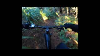
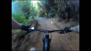
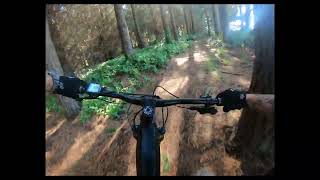
Photos of Invercargill Mountain Bike

Recent Trail Reports
| status | trail | date | condition | info | user |
|---|---|---|---|---|---|
| Central Trail | Jun 2, 2026 @ 1:03pm (Pacific/Auckland) Jun 1, 2026 | Unknown | Roydo | ||
| Waihopai left bank | Mar 14, 2026 @ 6:50pm (Pacific/Auckland) Mar 13, 2026 | Ideal | KiwiFrog | ||
| Oreti River Trail | Feb 1, 2026 @ 3:34pm (Pacific/Auckland) Jan 31, 2026 | Ideal | jhkoning | ||
| The Brettinator | Dec 12, 2025 @ 8:39am (Pacific/Auckland) Dec 11, 2025 | Unknown | Roydo | ||
| Waddick | Dec 12, 2025 @ 8:37am (Pacific/Auckland) Dec 11, 2025 | Unknown | Roydo | ||
| Morrison | Dec 12, 2025 @ 8:37am (Pacific/Auckland) Dec 11, 2025 | Unknown | Roydo | ||
| Will Feral | Dec 12, 2025 @ 8:37am (Pacific/Auckland) Dec 11, 2025 | Unknown | Roydo | ||
| Links Road | Dec 12, 2025 @ 8:37am (Pacific/Auckland) Dec 11, 2025 | Unknown | Roydo | ||
| Big Mac | Dec 12, 2025 @ 8:37am (Pacific/Auckland) Dec 11, 2025 | Unknown | Roydo | ||
| Pitt Road | Dec 12, 2025 @ 8:37am (Pacific/Auckland) Dec 11, 2025 | Unknown | Roydo |
Activity Feed
| username | action | type | title | date |
|---|---|---|---|---|
| Roydo | add | report | activity #96053954 | Jun 1, 2026 @ 6:03pm Jun 1, 2026 |
| ADHDMI | ridden | trail | activity #91941538 | Apr 4, 2026 @ 4:27pm Apr 4, 2026 |
| 1footloose | wishlist | trail | activity #91189863 | Mar 24, 2026 @ 1:32am Mar 24, 2026 |
| OneFtLs | wishlist | trail | activity #91189458 | Mar 24, 2026 @ 1:15am Mar 24, 2026 |
| KiwiFrog | add | report | activity #90532305 | Mar 14, 2026 @ 12:03am Mar 14, 2026 |
Recent Comments
| username | type | title | comment | date |
|---|---|---|---|---|
| trail | Excellent track with great up and down hills.... | Sep 21, 2025 @ 12:09am Sep 21, 2025 | ||
| trail | Track currently closed due to trees down. | Sep 18, 2025 @ 6:56pm Sep 18, 2025 | ||
| trail | Great track, did it on my new Giant Reign E+... | May 27, 2025 @ 6:18pm May 27, 2025 | ||
| trail | Possibly my favourite section of trail here | Dec 30, 2021 @ 7:56pm Dec 30, 2021 | ||
| trail | Just updated Waddick with new GPX file. | Jan 8, 2021 @ 5:38pm Jan 8, 2021 |
Local Badges
-

10 Blue Trails57 awarded -

Epic Ride Climb 2k3 awarded -

Climbing 10k Badge14 awarded -

Climbing 100k Badge2 awarded -

Epic Ride Descent 2k3 awarded -

Descent 10k Badge14 awarded
Bike & Skill Parks
| name | type | city | rating |
|---|---|---|---|
| Southland BMX Track | skill park | Invercargill | |
| Otatara Pump Track | skill park | Invercargill | |
| Myers Reserve Jumps | skill park | Invercargill |
Activity Type Stats
| activitytype | trails | distance | descent | descent distance | total vertical | rating | global rank | state rank | photos | reports | routes | ridelogs |
|---|---|---|---|---|---|---|---|---|---|---|---|---|
| Mountain Bike | 69 | 50 miles | 984 ft | 18 miles | 692 ft | #3,679 | #62 | 7 | 105 | 7,342 | ||
| E-Bike | 68 | 50 miles | 984 ft | 18 miles | 692 ft | #1,983 | #33 | 101 | 147 | |||
| Hike | 53 | 47 miles | 640 ft | 17 miles | 62 ft | #3,495 | #52 | 85 | 460 | |||
| Trail Running | 63 | 50 miles | 745 ft | 18 miles | 62 ft | #2,827 | #40 | 99 | 103 |
Frequently Asked Questions About Invercargill
▼
What are the best places to ride in Invercargill?
Invercargill has 1 areas to explore for mountain biking. The top rated areas are:
▼
What are the highest rated mountain biking trails in Invercargill?
The highest rated mountain biking trails in Invercargill are:
- access road (4.1/5)
- MITCH (4.1/5)
- JoJoe (4/5)
- Swoop (4/5)
- Big Mac (4/5)
▼
What is the best time of the year to ride in Invercargill?
Based on ride log data, the most popular months to ride in Invercargill are:
- July (39 activities)
- April (15 activities)
- October (13 activities)
▼
Where can I park to ride in Invercargill?
There are 1 parking locations listed in Invercargill. The most popular parking spots are:
Activities
- By brenthillier
 NSMBA TRAILFORKS & contributors
 - Admins: Alps2Ocean-Cycle-Trail
- #7883 - 10,562 views
- invercargill activity log | embed map of Invercargill mountain bike trails | invercargill mountain biking points of interest
Downloading of trail gps tracks in kml & gpx formats is enabled for Invercargill.
You must login to download files.