close
-
Layers w
- Weather Layers
- Pro
- Pro
- Pro
- Pro
- Pro
- Pro
- More Layers
- Pro
- Pro
- Pro
- Pro
-
Upgrade to

3D
Trail Conditions
- Unknown
- Snow Groomed
- Snow Packed
- Snow Covered
- Snow Cover Partial
- Freeze/thaw Cycle
- Icy
- Prevalent Mud
- Wet
- Variable
- Ideal
- Dry
- Very Dry
Trail Flow (Ridden Direction)
Trailforks scans users ridelogs to determine the most popular direction each trail is ridden. A good flowing trail network will have most trails flowing in a single direction according to their intension.
The colour categories are based on what percentage of riders are riding a trail in its intended direction.
The colour categories are based on what percentage of riders are riding a trail in its intended direction.
- > 96%
- > 90%
- > 80%
- > 70%
- > 50%
- < 50%
- bi-directional trail
- no data
Trail Last Ridden
Trailforks scans ridelogs to determine the last time a trail was ridden.
- < 2 days
- < 1 week
- < 2 weeks
- < 1 month
- < 6 months
- > 6 months
Trail Ridden Direction
The intended direction a trail should be ridden.
- Downhill Only
- Downhill Primary
- Both Directions
- Uphill Primary
- Uphill Only
- One Direction
Contribute Details
Colors indicate trail is missing specified detail.
- Description
- Photos
- Description & Photos
- Videos
Trail Popularity ?
Trailforks scans ridelogs to determine which trails are ridden the most in the last 9 months.
Trails are compared with nearby trails in the same city region with a possible 25 colour shades.
Think of this as a heatmap, more rides = more kinetic energy = warmer colors.
- most popular
- popular
- less popular
- not popular
ATV/ORV/OHV Filter
Max Vehicle Width
inches
US Cell Coverage
Legend

Radar Time
Activity Recordings
Trailforks uses anonymized public activity data.
?
Activity Recordings
Trailforks uses anonymized public activity data.
?
Personal Heatmap
▶
Activity Types
all
/
none
▶
Options
2
Date range
month
–
Winter Trails
Warning
A routing network for winter maps does not exist. Selecting trails using the winter trails layer has been disabled.
Missing Trails
Most Popular
Least Popular
Trails are colored based on popularity. The more popular a trail is, the more red. Less popular trails trend towards green.
Jump Magnitude Heatmap
Heatmap of where riders jump on trails. Zoom in to see individual jumps, click circles to view jump details.
BC Backroad Status
![map legend]()
Service Road Atlas is a free to use, community-driven service for viewing and creating reports on the numerous back-country service roads around B.C. and Alberta.

Slope Aspect
Direction the slope faces
Trails Deemphasized
Trails are shown in grey.
Only show trails with no bike usage.
Suggested Layers
Based on selected activity type
Save the current map location and zoom level as your default home location whenever this page is loaded.
SaveEUS: Ioar mendiaren magalean orotariko xenda ugari aurkituko dituzu basoan barna ibiltzeko. Uxerri bidea edo Los Lobos klasikoetatik hasi, eta Desobeierti edo Melanie jaitsiera beltza bezalako jaitsiera berrietara. Flowa nagusi bertakoek mimo handiz zaindutako eremu honetan.
CAS: Las faldas del monte Ioar esconden una buena cantidad de sendas de todo tipo que recorren sus bosques. Desde las clásicas La Dormida o Los Lobos, hasta las nuevas Desobeierti o negras como Melanie . Mucho flow en esta zona que los locales cuidan con mucho mimo.
CAS: Las faldas del monte Ioar esconden una buena cantidad de sendas de todo tipo que recorren sus bosques. Desde las clásicas La Dormida o Los Lobos, hasta las nuevas Desobeierti o negras como Melanie . Mucho flow en esta zona que los locales cuidan con mucho mimo.
Primary Trail Type: All-Mountain & Downhill
eBikes Allowed:
Yes
 google parking directions
This region uses the Uk/Euro style trail grading system.
Activities Click to view
- Mountain Bike
105 trails
- E-Bike
105 trails
- Horse
5 trails
- Hike
104 trails
- Trail Running
104 trails
Region Details
- 37
- 1
- 9
- 33
- 13
- 4
Region Status
Open as of Jun 13, 2026Stats
- Avg Trail Rating
- Trails (view details)
- 98
- Trails Mountain Bike
- 105
- Trails E-Bike
- 105
- Trails Gravel Bike
- 1
- Trails Horse
- 5
- Trails Hike
- 104
- Trails Trail Running
- 104
- Trails Dirtbike/Moto
- 1
- Total Distance
- 83 miles
- Total Descent Distance
- 45 miles
- Total Descent
- 24,255 ft
- Total Vertical
- 2,935 ft
- Highest Trailhead
- 4,643 ft
- Reports
- 685
- Photos
- 156
- Ridden Counter
- 2,143
Popular Ioar Mountain Biking Trails
• 95 ★ 4.8 • 1 mile • 20 ft • 152 •
Single track por una senda con mucho flow. Se alcanzan grandes velocidades. Hay que tener cuidado con los senderistas que suben y bajan.
• 100 ★ 4.4 • 2,999 ft • 0 ft • 123 •
Sendero sencillo que funciona en ambas direcciones paralelo a la pista. Ninguna complicación para subir y mucho flow para bajar. Cuidado con los paseantes.
• 100 ★ 4.4 • 2,907 ft • 0 ft • 108 •
Senda fácil y divertida de pequeños badenes y curvas con algún pequeño peralte natural en el que apoyarse.
• 100 ★ 4.2 • 2,552 ft • 0 ft • 99 •
Highly rated popular red difficulty singletrack. This multi-use trail can be used downhill primary and has a easy overall physical rating with a 0 ft blue climb. Trail visibility is always easy to follow. On average it takes 3 minutes to complete this trail.
• 100 ★ 4.7 • 3,284 ft • 0 ft • 96 •
Jaitsiera dibertigarria, hainbat mozturekin eta salto eta peralteekin. Adi ibili lehendabiziko aldietan, moztuetara iritsi eta min hartzeko arriskua dagoelako. Moztu eta salto guztiek daukate saihesbidea. Handienak moztuan bertan...
• 100 ★ 4.7 • 1,781 ft • 0 ft • 95 •
Mongiflow bakarrik igotzeko erabiltzeko zabaldu dugun jaitsiera. Tubo moduko bat da eta saltoak ditu eskuin-ezker. Nahi izanez gero egin daitezke, baina ez da beharrezkoa. Bajada abierta para dejar Mongiflow solo de subida. Es una...
• 95 ★ 4.3 • 2,175 ft • 0 ft • 92 •
Divertida senda que en la parte de arriba discurre por un sendero muy sinuoso con peraltes y con algún salto preparado.
Ioar Mountain Bike Routes
69 miles • 10,858 ft • 44 • Loop •
Recorrido oficial Eusko Bike 2025
6 miles • 905 ft • 1 •
Euskal Herriko Mendi Duatloi Zirkuitua 2025. 2. sektorea txirrinda / 2º sector bici
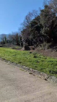
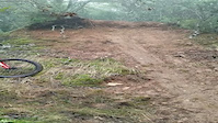
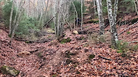
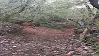
Photos of Ioar Mountain Bike
Videos of Ioar Mountain Bike
trail: Kanpezu Jump Line
0:11 |
18 |
Mar 21, 2026
trail: Oihua (El Grito)
0:03 |
191 |
Jan 16, 2023
trail: Oihua (El Grito)
0:19 |
119 |
Jan 16, 2023
trail: Oihua (El Grito)
0:16 |
122 |
Jan 16, 2023
trail: Oihua (El Grito)
0:27 |
111 |
Jan 16, 2023
trail: Desobeierti
0:11 |
120 |
Dec 17, 2022
trail: Desobeierti
0:06 |
76 |
Dec 17, 2022
trail: Desobeierti
0:12 |
66 |
Dec 17, 2022
Recent Trail Reports
| status | trail | date | condition | info | user |
|---|---|---|---|---|---|
| Dulcinea | Jun 13, 2026 @ 11:35pm (Europe/Madrid) Jun 13, 2026 | Ideal | stifmanenc | ||
| Ipurbeltz | Jun 13, 2026 @ 11:34pm (Europe/Madrid) Jun 13, 2026 | Ideal | stifmanenc | ||
| El jefe / Buruzagi | Jun 13, 2026 @ 11:34pm (Europe/Madrid) Jun 13, 2026 | Ideal | stifmanenc | ||
| Turbobeltz | Jun 13, 2026 @ 11:33pm (Europe/Madrid) Jun 13, 2026 | Ideal | stifmanenc | ||
| Oihua (El Grito) | Jun 13, 2026 @ 11:32pm (Europe/Madrid) Jun 13, 2026 | Ideal | stifmanenc | ||
| Txarriboda | Jun 13, 2026 @ 11:32pm (Europe/Madrid) Jun 13, 2026 | Dry | stifmanenc | ||
| Psiflowcybe | Jun 13, 2026 @ 11:31pm (Europe/Madrid) Jun 13, 2026 | Ideal | stifmanenc | ||
| Hamaiketokira! | Jun 9, 2026 @ 7:01pm (Europe/Madrid) Jun 9, 2026 | Ideal | jonjo | ||
| San Pedro | Apr 13, 2026 @ 2:16am (Europe/Madrid) Apr 12, 2026 | Ideal | GarridopwwVJA | ||
| Desobeierti | Mar 30, 2026 @ 4:12pm (Europe/Madrid) Mar 30, 2026 | Ideal | Ibai |
Activity Feed
| username | action | type | title | date |
|---|---|---|---|---|
| stifmanenc | add | report | activity #96917007 and 6 more | Jun 13, 2026 @ 2:31pm Jun 13, 2026 |
| jonjo | add | report | activity #96613191 | Jun 9, 2026 @ 10:01am Jun 9, 2026 |
| jonjo | vote | trail | activity #96613171 | Jun 9, 2026 @ 10:00am Jun 9, 2026 |
| aitormat | ridden | trail | activity #94140479 | May 6, 2026 @ 12:08am May 6, 2026 |
| PatriEH | vote | trail | activity #93654867 and 5 more | Apr 29, 2026 @ 9:53am Apr 29, 2026 |
Recent Comments
| username | type | title | comment | date |
|---|---|---|---|---|
| trail | A mí tb me ha parecido negra .. y nada... | Mar 22, 2026 @ 10:45am Mar 22, 2026 | ||
| trail | Se han añadido saltos y toboganes! | Sep 7, 2025 @ 8:04am Sep 7, 2025 | ||
| trail | El tramo de la alambrada es algo difícil de... | Aug 22, 2025 @ 7:00am Aug 22, 2025 | ||
| report | Sigue caido | Jun 20, 2025 @ 4:52am Jun 20, 2025 | ||
| trail | Pista Jodida... Pesada y pedregosa hasta el fin.. | Sep 10, 2024 @ 6:49am Sep 10, 2024 |
Nearby Areas
| name | distance | ||||
|---|---|---|---|---|---|
| Acedo Camping | 5 | 55 | 5.4 km | ||
| Izki-Arabako Mendialdea | 18 | 43 | 6 km | ||
| Lapoblacion | 5 | 24 | 6.1 km | ||
| Viana | 35 | 8.4 km | |||
| Los Arcos | 38 | 9 km |
Local Badges
-

Completionist0 awarded
Activity Type Stats
| activitytype | trails | distance | descent | descent distance | total vertical | rating | global rank | state rank | photos | reports | routes | ridelogs |
|---|---|---|---|---|---|---|---|---|---|---|---|---|
| Mountain Bike | 105 | 82 miles | 23,937 ft | 45 miles | 2,936 ft | #2,307 | #185 | 133 | 685 | 2 | 392 | |
| E-Bike | 105 | 82 miles | 23,937 ft | 45 miles | 2,936 ft | #188 | #91 | 16 | 655 | 1 | 330 | |
| Gravel Bike | 1 | 18 | ||||||||||
| Horse | 5 | 2,402 ft | 203 ft | 1,690 ft | 656 ft | #3,017 | #280 | 24 | ||||
| Hike | 104 | 82 miles | 23,117 ft | 44 miles | 2,936 ft | #2,358 | #269 | 3 | 666 | 75 | ||
| Trail Running | 104 | 82 miles | 23,117 ft | 44 miles | 2,936 ft | #1,759 | #244 | 666 | 2 | 38 | ||
| Dirtbike/Moto | 1 | 712 ft | 33 ft | 24 |
Frequently Asked Questions About Ioar
▼
What are the highest rated mountain biking trails in Ioar?
The highest rated mountain biking trails in Ioar are:
- Uxerri bidea - Senda La Dormida (4.4/5)
- Melanie Amatxo (4.4/5)
- Oihua (El Grito) (4.3/5)
- Txarriboda (4.3/5)
- Psiflowcybe (4.2/5)
▼
Where can I park to ride in Ioar?
There are 1 parking locations listed in Ioar. The most popular parking spots are:
▼
What is the longest trail in Ioar?
The longest trail in Ioar is V.V. Ferrocarril Vasco Navarro - Santa Cruz-Laminoria at 12.0 miles. View all trails sorted by distance.
▼
What are the best & highest rated hiking trails in Ioar?
The best hiking trails in Ioar are: View all hiking trails sorted by popularity score.
Activities
Trails
Points of Interest
- ioar activity log | embed map of Ioar mountain bike trails | ioar mountain biking points of interest
Downloading of trail gps tracks in kml & gpx formats is enabled for Ioar.
You must login to download files.