close
-
Layers w
- Weather Layers
- Pro
- Pro
- Pro
- Pro
- Pro
- Pro
- More Layers
- Pro
- Pro
- Pro
- Pro
-
Upgrade to

3D
Trail Conditions
- Unknown
- Snow Groomed
- Snow Packed
- Snow Covered
- Snow Cover Partial
- Freeze/thaw Cycle
- Icy
- Prevalent Mud
- Wet
- Variable
- Ideal
- Dry
- Very Dry
Trail Flow (Ridden Direction)
Trailforks scans users ridelogs to determine the most popular direction each trail is ridden. A good flowing trail network will have most trails flowing in a single direction according to their intension.
The colour categories are based on what percentage of riders are riding a trail in its intended direction.
The colour categories are based on what percentage of riders are riding a trail in its intended direction.
- > 96%
- > 90%
- > 80%
- > 70%
- > 50%
- < 50%
- bi-directional trail
- no data
Trail Last Ridden
Trailforks scans ridelogs to determine the last time a trail was ridden.
- < 2 days
- < 1 week
- < 2 weeks
- < 1 month
- < 6 months
- > 6 months
Trail Ridden Direction
The intended direction a trail should be ridden.
- Downhill Only
- Downhill Primary
- Both Directions
- Uphill Primary
- Uphill Only
- One Direction
Contribute Details
Colors indicate trail is missing specified detail.
- Description
- Photos
- Description & Photos
- Videos
Trail Popularity ?
Trailforks scans ridelogs to determine which trails are ridden the most in the last 9 months.
Trails are compared with nearby trails in the same city region with a possible 25 colour shades.
Think of this as a heatmap, more rides = more kinetic energy = warmer colors.
- most popular
- popular
- less popular
- not popular
ATV/ORV/OHV Filter
Max Vehicle Width
inches
US Cell Coverage
Legend

Radar Time
Activity Recordings
Trailforks uses anonymized public activity data.
?
Activity Recordings
Trailforks uses anonymized public activity data.
?
Personal Heatmap
▶
Activity Types
all
/
none
▶
Options
2
Date range
month
–
Winter Trails
Warning
A routing network for winter maps does not exist. Selecting trails using the winter trails layer has been disabled.
Missing Trails
Most Popular
Least Popular
Trails are colored based on popularity. The more popular a trail is, the more red. Less popular trails trend towards green.
Jump Magnitude Heatmap
Heatmap of where riders jump on trails. Zoom in to see individual jumps, click circles to view jump details.
BC Backroad Status
![map legend]()
Service Road Atlas is a free to use, community-driven service for viewing and creating reports on the numerous back-country service roads around B.C. and Alberta.

Slope Aspect
Direction the slope faces
Trails Deemphasized
Trails are shown in grey.
Only show trails with no bike usage.
Suggested Layers
Based on selected activity type
Save the current map location and zoom level as your default home location whenever this page is loaded.
Save
No description for Ionia County has been added yet!
Login or register to submit one.
Region Supporters & Maintainers
![]()
Central District CyclerySponsor![]()
Grand Rapids Bicycle CompanySponsor![]()
Perrin Brewing CompanySponsor![Merrell]()
MerrellSponsor![Wynalda Packaging]()
Wynalda PackagingSponsor
Activities Click to view
- Mountain Bike
21 trails
- E-Bike
14 trails
- Horse
30 trails
- Hike
57 trails
- Trail Running
57 trails
- Dirtbike/Moto
0 trails
- ATV/ORV/OHV
0 trails
- Snowmobile
0 trails
- Snowshoe
33 trails
- Downhill Ski
0 trails
- Backcountry Ski
0 trails
- Nordic Ski
33 trails
Region Details
- 4
- 3
- 8
- 6
Stats
- Avg Trail Rating
- Trails (view details)
- 55
- Trails Mountain Bike
- 24
- Trails E-Bike
- 14
- Trails Horse
- 32
- Trails Hike
- 57
- Trails Trail Running
- 57
- Trails Snowshoe
- 33
- Trails Nordic Ski
- 33
- Total Distance
- 58 miles
- Total Descent
- 2,474 ft
- Total Vertical
- 217 ft
- Highest Trailhead
- 821 ft
- Reports
- 299
- Photos
- 83
- Ridden Counter
- 819
Popular Ionia County Mountain Biking Trails
• 65 ★ 4.0 • 5 miles • 148 ft • 162 •
Moderately popular blue difficulty singletrack. This mountain bike primary trail can be used both directions. On average it takes 27 minutes to complete this trail.
• 100 ★ 0.0 • 2,310 ft • 24 ft • 109 •
Popular blue difficulty singletrack. This mountain bike primary trail can be used both directions. Trail visibility is always easy to follow. On average it takes 3 minutes to complete this trail.
• 80 ★ 0.0 • 2 miles • 3 ft • 69 •
Popular white difficulty family friendly gravel path. This multi-use trail can be used both directions. Trail visibility is always easy to follow. On average it takes 10 minutes to complete this trail.
• 75 ★ 4.0 • 2 miles • 140 ft • 65 •
Popular blue difficulty singletrack. This mountain bike primary trail can be used both directions. On average it takes 13 minutes to complete this trail.
• 95 ★ 0.0 • 3 miles • 9 ft • 61 •
Popular white difficulty family friendly paved path. This multi-use trail can be used both directions. Trail visibility is always easy to follow. On average it takes 18 minutes to complete this trail.
• 100 ★ 0.0 • 5 miles • 26 ft • 49 •
Popular white difficulty family friendly gravel path. This multi-use trail can be used both directions and has a easy overall physical rating. Trail visibility is always easy to follow. On average it takes 20 minutes to complete this trail.
• 70 ★ 4.0 • 5 miles • 132 ft • 31 •
Ride clockwise. There are no signs and the trailhead is kind of secluded, but it is behind the pit toilet in the NE corner of the . Very tight singletrack, meanders through the lush woods of the park. A few very small dirt mounds make...
• 85 ★ 4.0 • 3,002 ft • 21 ft • 19 •
Popular blue difficulty singletrack. This mountain bike primary trail can be used one direction. Trail visibility is always easy to follow. On average it takes 3 minutes to complete this trail.
Ionia County Mountain Bike Routes
7 miles • 232 ft • 2 • Loop •
This is the Ionia mountain bike trail's "yellow" clockwise direction loop used on Tuesdays Thursdays and...
7 miles • 234 ft • 0 • Loop •
This is the Ionia mountain bike trail's counter-clockwise direction loop used on Sundays Mondays...
34 miles • 569 ft • 0 • Race •
20 miles • 437 ft • 0 • Race •
63 miles • 913 ft • 0 • Race •
Photos of Ionia County Mountain Bike
Videos of Ionia County Mountain Bike

trail: Parking Lot
0:29 |
136 |
Oct 30, 2016
trail: Bogue Flats
62 |
Jun 8, 2025 , Portland
youtuber
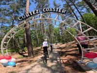
![Ionia State Recreation Area Mountain Bike...]()

trail: Ionia East Loop
8:33 |
567 |
Jul 8, 2020 , Ionia
Recent Trail Reports
| status | trail | date | condition | info | user |
|---|---|---|---|---|---|
| Ionia West Loop Ionia State Recreation Area | Jun 20, 2026 @ 1:59pm (America/Detroit) 12 hours | Ideal | MTB-Cowgirl | ||
| West Loop to Steven's Point Ionia State Recreation Area | May 26, 2026 @ 5:29pm (America/Detroit) May 26, 2026 | Ideal | chisel2025 | ||
| Bogue Flats Chime In Portland | May 4, 2025 @ 12:14pm May 4, 2025 | Ideal | garbagefan MMMBA | ||
| Ionia East Loop Ionia State Recreation Area | Feb 9, 2025 @ 6:17am Feb 9, 2025 | Unknown | jsimpson336 WMMBA | ||
| Blue Trail Portland | Sep 29, 2024 @ 3:01pm Sep 29, 2024 | Ideal | garbagefan MMMBA | ||
| Black And Blue Trail Start Portland | Sep 29, 2024 @ 3:00pm Sep 29, 2024 | Ideal | garbagefan MMMBA | ||
| Black Trail Connector Portland | Sep 29, 2024 @ 2:58pm Sep 29, 2024 | Ideal | garbagefan MMMBA | ||
| East Most Rail Trail Connector Ionia State Recreation Area | Sep 29, 2024 @ 2:53pm Sep 29, 2024 | Ideal | garbagefan MMMBA | ||
| River Access Dirt Road Ionia State Recreation Area | Sep 29, 2024 @ 2:52pm Sep 29, 2024 | Ideal | garbagefan MMMBA | ||
| West Short Cut1 Ionia State Recreation Area | Sep 29, 2024 @ 2:49pm Sep 29, 2024 | Ideal | garbagefan MMMBA |
Activity Feed
| username | action | type | title | date |
|---|---|---|---|---|
| MTB-Cowgirl | add | report | activity #97423960 | Jun 20, 2026 @ 12:40pm 10 hours |
| EthanYwvHde | ridden | trail | activity #97071204 | Jun 15, 2026 @ 4:03pm Jun 15, 2026 |
| EthanYwvHde | ridden | trail | activity #97071172 | Jun 15, 2026 @ 4:03pm Jun 15, 2026 |
| chisel2025 | add | report | activity #95607781 | May 26, 2026 @ 7:10pm May 26, 2026 |
| flyinghighk9s | wishlist | region | activity #95370935 | May 23, 2026 @ 6:11pm May 23, 2026 |
Recent Comments
| username | type | title | comment | date |
|---|---|---|---|---|
| trail | No jumps. | Jun 30, 2022 @ 3:50am Jun 30, 2022 | ||
| report | Trees were cleared 3/20/20 | Mar 20, 2020 @ 11:01pm Mar 20, 2020 | ||
| report | Lots of branches over the trail and a few... | Jul 26, 2019 @ 9:41am Jul 26, 2019 | ||
| report | East loop is holding water everywhere. Avoid... | May 3, 2019 @ 2:22pm May 3, 2019 |
Local Badges
-

Epic Ride 50k203 awarded -

Climbing 10k Badge0 awarded -

Epic Mountain Bike Climb 2k0 awarded -

Mountain Biking 100k Badge0 awarded -

Big Ride 30k386 awarded -

Descent 100k Badge0 awarded
Activity Type Stats
| activitytype | trails | distance | descent | descent distance | total vertical | rating | global rank | state rank | photos | reports | routes | ridelogs |
|---|---|---|---|---|---|---|---|---|---|---|---|---|
| Mountain Bike | 21 | 40 miles | 1,030 ft | 9 miles | 203 ft | 73 | 311 | 5 | 3,231 | |||
| E-Bike | 14 | 28 miles | 459 ft | 5 miles | 164 ft | 198 | 9 | |||||
| Horse | 30 | 15 miles | 1,191 ft | 6 miles | 167 ft | 9 | 222 | 249 | ||||
| Hike | 57 | 58 miles | 2,448 ft | 17 miles | 217 ft | 1 | 315 | 136 | ||||
| Trail Running | 57 | 58 miles | 2,448 ft | 17 miles | 217 ft | 312 | 107 | |||||
| Snowshoe | 33 | 24 miles | 1,194 ft | 8 miles | 187 ft | 58 | 6 | |||||
| Nordic Ski | 33 | 24 miles | 1,194 ft | 8 miles | 187 ft | 58 | 119 |
Frequently Asked Questions About Ionia County
▼
What are the best places to ride in Ionia County?
Ionia County has 2 areas to explore for mountain biking. The top rated areas are:
▼
What are the highest rated mountain biking trails in Ionia County?
The highest rated mountain biking trails in Ionia County are:
- Ionia West Loop (4/5)
- Ionia East Loop (4/5)
- Black Trail (4/5)
- Bogue Flats (4/5)
- Portland River Trail Past Hs (4/5)
▼
What is the best time of the year to ride in Ionia County?
Based on ride log data, the most popular months to ride in Ionia County are:
- May (20 activities)
- July (19 activities)
- April (17 activities)
▼
What is the longest trail in Ionia County?
The longest trail in Ionia County is Lightning Bend Loop at 5.3 miles. View all trails sorted by distance.
Activities
Trails
- By WillieJacobsz
 Trailforks SBP SWW & contributors
 - Admins: M MOTO, truebleve, garbagefan
- #49869 - 1,420 views
- ionia county activity log | embed map of Ionia County mountain bike trails | ionia county mountain biking points of interest
Downloading of trail gps tracks in kml & gpx formats is enabled for Ionia County.
You must login to download files.