close
-
Layers w
- Weather Layers
- Pro
- Pro
- Pro
- Pro
- Pro
- Pro
- More Layers
- Pro
- Pro
- Pro
- Pro
-
Upgrade to

3D
Trail Conditions
- Unknown
- Snow Groomed
- Snow Packed
- Snow Covered
- Snow Cover Partial
- Freeze/thaw Cycle
- Icy
- Prevalent Mud
- Wet
- Variable
- Ideal
- Dry
- Very Dry
Trail Flow (Ridden Direction)
Trailforks scans users ridelogs to determine the most popular direction each trail is ridden. A good flowing trail network will have most trails flowing in a single direction according to their intension.
The colour categories are based on what percentage of riders are riding a trail in its intended direction.
The colour categories are based on what percentage of riders are riding a trail in its intended direction.
- > 96%
- > 90%
- > 80%
- > 70%
- > 50%
- < 50%
- bi-directional trail
- no data
Trail Last Ridden
Trailforks scans ridelogs to determine the last time a trail was ridden.
- < 2 days
- < 1 week
- < 2 weeks
- < 1 month
- < 6 months
- > 6 months
Trail Ridden Direction
The intended direction a trail should be ridden.
- Downhill Only
- Downhill Primary
- Both Directions
- Uphill Primary
- Uphill Only
- One Direction
Contribute Details
Colors indicate trail is missing specified detail.
- Description
- Photos
- Description & Photos
- Videos
Trail Popularity ?
Trailforks scans ridelogs to determine which trails are ridden the most in the last 9 months.
Trails are compared with nearby trails in the same city region with a possible 25 colour shades.
Think of this as a heatmap, more rides = more kinetic energy = warmer colors.
- most popular
- popular
- less popular
- not popular
ATV/ORV/OHV Filter
Max Vehicle Width
inches
US Cell Coverage
Legend

Radar Time
Activity Recordings
Trailforks uses anonymized public activity data.
?
Activity Recordings
Trailforks uses anonymized public activity data.
?
Personal Heatmap
▶
Activity Types
all
/
none
▶
Options
2
Date range
month
–
Winter Trails
Warning
A routing network for winter maps does not exist. Selecting trails using the winter trails layer has been disabled.
Missing Trails
Most Popular
Least Popular
Trails are colored based on popularity. The more popular a trail is, the more red. Less popular trails trend towards green.
Jump Magnitude Heatmap
Heatmap of where riders jump on trails. Zoom in to see individual jumps, click circles to view jump details.
BC Backroad Status
![map legend]()
Service Road Atlas is a free to use, community-driven service for viewing and creating reports on the numerous back-country service roads around B.C. and Alberta.

Slope Aspect
Direction the slope faces
Trails Deemphasized
Trails are shown in grey.
Only show trails with no bike usage.
Suggested Layers
Based on selected activity type
Save the current map location and zoom level as your default home location whenever this page is loaded.
Save
No description for Iowa County has been added yet!
Login or register to submit one.
Activities Click to view
- Mountain Bike
41 trails
- E-Bike
6 trails
- Hike
66 trails
- Trail Running
65 trails
- Snowshoe
15 trails
- Downhill Ski
24 trails
- Nordic Ski
11 trails
Region Details
- 4
- 1
- 16
- 13
- 5
Stats
- Avg Trail Rating
- Trails (view details)
- 113
- Trails Mountain Bike
- 41
- Trails E-Bike
- 6
- Trails Gravel Bike
- 3
- Trails Adaptive Bike
- 3
- Trails Winter Fat Bike
- 6
- Trails Horse
- 2
- Trails Hike
- 66
- Trails Trail Running
- 65
- Trails Snowmobile
- 1
- Trails Snowshoe
- 15
- Trails Downhill Ski
- 24
- Trails Nordic Ski
- 11
- Total Distance
- 103 miles
- Total Descent
- 12,635 ft
- Total Vertical
- 909 ft
- Highest Trailhead
- 1,714 ft
- Reports
- 517
- Photos
- 301
- Ridden Counter
- 4,463
Sub Regions
- Blue Mounds (9)
- Dodgeville (31)
- Mineral Point (0)
Popular Iowa County Mountain Biking Trails
• 50 ★ 3.7 • 4 miles • 725 ft • 300 •
Begin by crossing the road at the first gravel crossing on & Smooth. From there, take a left and fly down the ski trail until you see a fork to the left. Stay right, but slow down because the singletrack starts just after the fork, on...
• 85 ★ 4.3 • 3,343 ft • 32 ft • 276 •
is a fairly rooty and rocky trail that gets a little easier past the halfway point, where a section of the trail was rebuilt, with plans to rebuilt the rest. The trail winds down the mound and then back up, with one ski/hiking trail...
• 45 ★ 5.0 • 1,654 ft • 103 ft • 263 •
Moderately popular black diamond difficulty singletrack. This multi-use trail can be used downhill primary. On average it takes 3 minutes to complete this trail.
• 70 ★ 4.1 • 4 miles • 536 ft • 237 •
What's in a name? You'll find out. The first part is fairly fast but often technical. The far northwest corner is the bottom of a long descent, and you start to realize you're going to pay for that potential energy you just blew...
• 95 ★ 5.0 • 2 miles • 295 ft • 183 •
Popular blue difficulty singletrack. This multi-use trail can be used one direction and has a moderate overall physical rating with a 295 ft blue climb. It features berm, drop, jump, log ride, rock face, rock garden and roller coaster. Trail visibility is always easy to follow. On average it takes 16 minutes to complete this trail.
• 35 ★ 0.0 • 2,021 ft • 77 ft • 77 •
Probably the flowiest trail at the park, this loop is especially nice to ride as a warmup or as a bit of relief after riding .
• 20 ★ 4.0 • 2 miles • 149 ft • 61 •
The trail begins after crossing the road from the first gravel path on & Smooth. Take a right at the fork, fly down the hill, take another right and cross the road again. The entrance is on the right just down from the road. Every few...
Iowa County Mountain Bike Routes
2 miles • 125 ft • 5 • Loop •
Loop from Forest Village cabins without going down into . Easy loop to get started.
4 miles • 456 ft • 10 • Loop •
Complete mtb loop of Horizons trails - get ready to climb
Photos of Iowa County Mountain Bike
Videos of Iowa County Mountain Bike
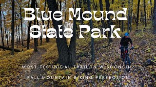
trail: Gneiss Loop
10:37 |
94 |
Nov 6, 2024 , Blue Mounds

trail: Holy Schist
10:37 |
196 |
Nov 6, 2024 , Blue Mounds

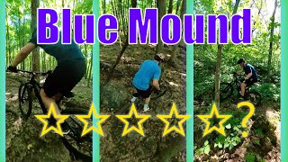
trail: Gneiss
25:50 |
436 |
Jul 24, 2022 , Blue Mounds
trail: Holy Schist
25:50 |
461 |
Jul 24, 2022 , Blue Mounds
Current Trail Warnings
| status | trail | date | condition | user | info |
|---|---|---|---|---|---|
| Nutty Squirrel Dodgeville Trail Cluster | Jun 15, 2026 @ 10:58am (America/Chicago) Jun 15, 2026 | Dry | PaulgwbVub FOH | Large tree down across trail, blocking trail |
Recent Trail Reports
Activity Feed
| username | action | type | title | date |
|---|---|---|---|---|
| PaulgwbVub | add | report | activity #97044924 | Jun 15, 2026 @ 8:58am Jun 15, 2026 |
| adman2345 | wishlist | region | activity #96693448 | Jun 10, 2026 @ 1:31pm Jun 10, 2026 |
| adman2345 | wishlist | region | activity #96693429 | Jun 10, 2026 @ 1:30pm Jun 10, 2026 |
| chrisjlind | add | report | activity #96471185 | Jun 7, 2026 @ 9:37am Jun 7, 2026 |
| pppielage | wishlist | region | activity #96356291 | Jun 6, 2026 @ 4:33am Jun 6, 2026 |
Recent Comments
| username | type | title | comment | date |
|---|---|---|---|---|
| trail | A short section of the whole Thistle Hill... | Sep 28, 2025 @ 3:16pm Sep 28, 2025 | ||
| report | Tree across trail before first big berm;... | Jun 12, 2024 @ 7:54am Jun 12, 2024 | ||
| report | Tree down south of cabins | May 7, 2024 @ 1:44pm May 7, 2024 | ||
| report | Is there Dddttt | Sep 3, 2023 @ 10:40am Sep 3, 2023 | ||
| report | No | Sep 3, 2023 @ 10:38am Sep 3, 2023 |
Local Badges
-

Descent 10k Badge0 awarded -

Climbing 10k Badge0 awarded -

Mountain Biking 100k Badge0 awarded -

Epic Ride Descent 2k0 awarded -

Big Ride 30k5 awarded -

Epic Ride 50k2 awarded
Activity Type Stats
| activitytype | trails | distance | descent | descent distance | total vertical | rating | global rank | state rank | photos | reports | routes | ridelogs |
|---|---|---|---|---|---|---|---|---|---|---|---|---|
| Mountain Bike | 41 | 54 miles | 5,548 ft | 21 miles | 722 ft | 227 | 498 | 3 | 3,890 | |||
| E-Bike | 6 | 4 miles | 541 ft | 2 miles | 279 ft | 241 | 84 | |||||
| Gravel Bike | 3 | 8 miles | 1,604 ft | 3 miles | 341 ft | 25 | 50 | |||||
| Adaptive Bike | 3 | 8 miles | 1,604 ft | 3 miles | 341 ft | 68 | ||||||
| Winter Fat Bike | 6 | 7 miles | 883 ft | 2 miles | 554 ft | 5 | 15 | 48 | ||||
| Horse | 2 | 16 miles | 1,604 ft | 7 miles | 331 ft | 42 | 1 | |||||
| Hike | 66 | 88 miles | 9,610 ft | 35 miles | 909 ft | 68 | 445 | 10 | 499 | |||
| Trail Running | 65 | 88 miles | 9,567 ft | 35 miles | 909 ft | 445 | 1 | 56 | ||||
| Snowmobile | 1 | 19 miles | 276 ft | 7 miles | 174 ft | 1 | ||||||
| Snowshoe | 15 | 36 miles | 2,877 ft | 14 miles | 909 ft | 10 | 34 | |||||
| Downhill Ski | 24 | 3 miles | 1,325 ft | 2 miles | 246 ft | 1 | 104 | |||||
| Nordic Ski | 11 | 8 miles | 666 ft | 3 miles | 407 ft | 1 | 2 | 53 |
Frequently Asked Questions About Iowa County
▼
What are the best places to ride in Iowa County?
Iowa County has 8 areas to explore for mountain biking. The top rated areas are:
▼
What are the highest rated mountain biking trails in Iowa County?
The highest rated mountain biking trails in Iowa County are:
- Twisted Birch (4.2/5)
- Gneiss (4.1/5)
- Bumpy Bunny (4.1/5)
- Connector Trail to Twisted Birch (4.1/5)
- Coulee Climb (4.1/5)
▼
What is the best time of the year to ride in Iowa County?
Based on ride log data, the most popular months to ride in Iowa County are:
- July (37 activities)
- August (29 activities)
- February (28 activities)
▼
What is the longest trail in Iowa County?
The longest trail in Iowa County is Military Ridge State Trail (Iowa County Section) at 18.5 miles. View all trails sorted by distance.
Activities
Trails
- By brenthillier
 NSMBA TRAILFORKS & contributors
 - Admins: MW HIKING, feardabeast
- #10963 - 2,681 views
- iowa county activity log | embed map of Iowa County mountain bike trails | iowa county mountain biking points of interest polygons
Downloading of trail gps tracks in kml & gpx formats is enabled for Iowa County.
You must login to download files.