close
-
Layers w
- Weather Layers
- Pro
- Pro
- Pro
- Pro
- Pro
- Pro
- More Layers
- Pro
- Pro
- Pro
- Pro
-
Upgrade to

3D
Trail Conditions
- Unknown
- Snow Groomed
- Snow Packed
- Snow Covered
- Snow Cover Partial
- Freeze/thaw Cycle
- Icy
- Prevalent Mud
- Wet
- Variable
- Ideal
- Dry
- Very Dry
Trail Flow (Ridden Direction)
Trailforks scans users ridelogs to determine the most popular direction each trail is ridden. A good flowing trail network will have most trails flowing in a single direction according to their intension.
The colour categories are based on what percentage of riders are riding a trail in its intended direction.
The colour categories are based on what percentage of riders are riding a trail in its intended direction.
- > 96%
- > 90%
- > 80%
- > 70%
- > 50%
- < 50%
- bi-directional trail
- no data
Trail Last Ridden
Trailforks scans ridelogs to determine the last time a trail was ridden.
- < 2 days
- < 1 week
- < 2 weeks
- < 1 month
- < 6 months
- > 6 months
Trail Ridden Direction
The intended direction a trail should be ridden.
- Downhill Only
- Downhill Primary
- Both Directions
- Uphill Primary
- Uphill Only
- One Direction
Contribute Details
Colors indicate trail is missing specified detail.
- Description
- Photos
- Description & Photos
- Videos
Trail Popularity ?
Trailforks scans ridelogs to determine which trails are ridden the most in the last 9 months.
Trails are compared with nearby trails in the same city region with a possible 25 colour shades.
Think of this as a heatmap, more rides = more kinetic energy = warmer colors.
- most popular
- popular
- less popular
- not popular
ATV/ORV/OHV Filter
Max Vehicle Width
inches
US Cell Coverage
Legend

Radar Time
Activity Recordings
Trailforks uses anonymized public activity data.
?
Activity Recordings
Trailforks uses anonymized public activity data.
?
Personal Heatmap
▶
Activity Types
all
/
none
▶
Options
2
Date range
month
–
Winter Trails
Warning
A routing network for winter maps does not exist. Selecting trails using the winter trails layer has been disabled.
Missing Trails
Most Popular
Least Popular
Trails are colored based on popularity. The more popular a trail is, the more red. Less popular trails trend towards green.
Jump Magnitude Heatmap
Heatmap of where riders jump on trails. Zoom in to see individual jumps, click circles to view jump details.
BC Backroad Status
![map legend]()
Service Road Atlas is a free to use, community-driven service for viewing and creating reports on the numerous back-country service roads around B.C. and Alberta.

Slope Aspect
Direction the slope faces
Trails Deemphasized
Trails are shown in grey.
Only show trails with no bike usage.
Suggested Layers
Based on selected activity type
Save the current map location and zoom level as your default home location whenever this page is loaded.
SavePopular Trail Networks
view all areas »
No description for Ireland has been added yet!
Login or register to submit one.
eBikes Allowed:
Yes
AKA: Republic Of Ireland, Éire
This region uses the Uk/Euro style trail grading system.
Stats
- Avg Trail Rating
- Trails (view details)
- 1,436
- Trails Mountain Bike
- 1,229
- Trails E-Bike
- 715
- Trails Gravel Bike
- 75
- Trails Adaptive Bike
- 149
- Trails Winter Fat Bike
- 43
- Trails Horse
- 38
- Trails Hike
- 986
- Trails Trail Running
- 987
- Trails Dirtbike/Moto
- 5
- Trails Observed Trials
- 4
- Trails ATV/ORV/OHV
- 2
- Total Distance
- 848 miles
- Total Descent
- 215,636 ft
- Total Vertical
- 3,014 ft
- Highest Trailhead
- 3,025 ft
- Reports
- 8,931
- Photos
- 1,146
- Ridden Counter
- 119,945
Articles

Kevin Randall Dominates Ireland’s U16 Downhill Series
Nov 6, 2025 from pinkbike.com
The rookie phenom sets fastest times across multiple rounds, claiming the Co-Labb Race Prize and a sponsorship package.

Video: The History of Irish Downhill Mountain Biking in 'Emerald Storm'
Aug 21, 2025 from pinkbike.com
How small beginnings have led to the rise of some of the fastest and most exciting riders in the world.
Video: Dan Wolfe Unleashes on Dublin’s Newest Trail in New Raw Edit
Mar 26, 2025 from pinkbike.com
Pinkbike's very own social media correspondent isn't just a wizard on the gram; he is also quite handy on the bike.
Video: Behind the Scenes of Building Greg Callaghan's Dream Trail
Mar 19, 2025 from pinkbike.com
Part 1 of a 3-part series documenting the whole process, from designing, building, and testing all the way up to opening the trail.
Sub Regions
- Border Region (52)
- Dublin Region (367)
- Dún Laoghaire–Rathdown (277)
- Fingal (13)
- South Dublin (74)
- Dublin (322)
- Dún Laoghaire–Rathdown (277)
- Mid-East Region (460)
- County Louth (47)
- County Wicklow (363)
- Arklow (30)
- Blessington (23)
- Bray (28)
- Co. Wicklow (62)
- Glendalough (26)
- Kildare (13)
- Kildare (27)
- Monasterevin (20)
- Drogheda (0)
- Glenealy (51)
- Wicklow (133)
- County Louth (47)
- Mid-West Region (134)
- Clare (2)
- Clare (16)
- County Limerick (77)
- Limerick (77)
- County Tipperary (41)
- Cahir (20)
- Clare (2)
- Midlands Region (138)
- Offaly (117)
- Tullamore (26)
- Westmeath (26)
- Ballymanus (23)
- Offaly (117)
- South-East Region (161)
- South-West Region (71)
- West Region (21)
- County Galway (9)
- Clarinbridge (1)
- Galway (7)
- Letterfrack (0)
- Mayo (12)
- County Galway (9)
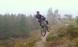
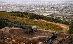
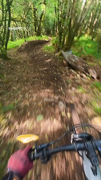
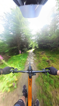
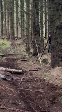
Popular Ireland Mountain Biking Trails
• 100 ★ 4.4 • 1,119 ft • 0 ft • 902 •
The best well known and flowy trail around. Transformed some couple years ago from a tech trail with the adage of big berms and smooth flowing lines and extended all the way down to the Biking.ie hut. The surface is firm and...
• 100 ★ 5.0 • 577 ft • 0 ft • 767 •
Highly rated popular red difficulty singletrack. This mountain bike primary trail can be used downhill primary and has a moderate overall physical rating. It features rock face. On average it takes minutes to complete this trail.
• 100 ★ 4.3 • 1 mile • 243 ft • 757 •
Part of the Ticknock trail center oficial trail is broadly used by most of riders to start their ride in the area. It connects to several natural trails. The descent section is fast and fun with some small rockgardens and features.
• 100 ★ 4.5 • 1,312 ft • 0 ft • 702 •
last section of Ticknock MTB trail that leaves you right next to the cafe and bike wash area
• 90 ★ 4.4 • 883 ft • 0 ft • 677 •
Popular blue difficulty singletrack. This mountain bike primary trail can be used downhill only. It features jump, pump track and roller coaster. Trail visibility is always easy to follow. On average it takes 2 minutes to complete this trail.
• 65 ★ 4.9 • 4,406 ft • 3 ft • 662 •
One of the blue trail in the Gap perfect for novice riders and kids. If you go fast there are several small doubles and tricky berms.
• 95 ★ 4.4 • 4,948 ft • 201 ft • 660 •
Second section of the official trail center trail. Climb only trail with no major obstacles or difficulties. Is not a shared trail but you may find hikers on it, be respectful even if you have priority.
• 90 ★ 4.5 • 4,452 ft • 45 ft • 647 •
Bike only trail part of the official trail center marked trails in Ticknock. Recently revamped is fun and fast. No big obstacles, good trail for novice-mid level riders. Can be done on gravel bike and if you are a masochist, also on CX
Ireland Mountain Bike Routes
★ 5.0 • 29 miles • 3,396 ft • 1 • Loop •
Castlepook Loop - Red Loop This is the ultimate loop of the Ballyhoura trails, being the longest and most...
★ 4.5 • 17 miles • 2,293 ft • 2 • Loop •
Purple loop, called "Tech Trails" by locals. 27km of fun that includes the Tech Loop 1 and and some other...
★ 4.0 • 21 miles • 2,475 ft • 1 • Loop •
The Garrane Loop ventures westwards from Waypoint 3 taking in some long and fast singletrack descents as...
★ 5.0 • 79 miles • 13,649 ft • 9 • Point to Point •
The entire Wicklow Way is a moderate to strenuous 4 to 10 day (130 km) long distance walking and hiking...
★ 5.0 • 10 miles • 938 ft • 5 • Loop •
Derroura Mountain Bike Trail Network, is over 16 km in length and lies at the gateway to Connemara. The...
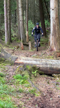
Photos of Ireland Mountain Bike
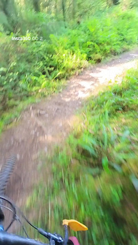
Videos of Ireland Mountain Bike
trail: Zero
0:11 |
9 |
Feb 27, 2026
trail: Bannana
2:42 |
30 |
Jul 12, 2025
trail: Bambi
2:17 |
44 |
Jul 12, 2025
trail: Coffin Trail
0:06 |
|
May 11, 2025
trail: Expressway
0:16 |
76 |
Jul 26, 2024
trail: Silliest Simon
0:10 |
95 |
Jul 19, 2024
trail: Silliest Simon
0:08 |
67 |
Jul 12, 2024
trail: Silliest Simon
0:08 |
71 |
Jun 21, 2024
Recent Comments
| username | type | title | comment | date |
|---|---|---|---|---|
| trail | Found the second half after it crosses the... | Jun 12, 2026 @ 10:06am Jun 12, 2026 | ||
| trail | Don’t think this trail exists anymore 🥲 | Jun 12, 2026 @ 9:36am Jun 12, 2026 | ||
| trail | Well maintained, with a couple steep turns and... | Jun 10, 2026 @ 11:44am Jun 10, 2026 | ||
| trail | Upper half has big wash outs (up to 50 cm).... | Jun 10, 2026 @ 3:10am Jun 10, 2026 | ||
| report | yup pretty sure they are gone quite a while. | Jun 2, 2026 @ 3:30pm Jun 2, 2026 |
Bike & Skill Parks
| name | type | city | rating |
|---|---|---|---|
| Bike Park Ireland | bike park | ||
| The GAP | bike park | Dublin | |
| Bike Park Ireland Pumptrack | skill park | ||
| Ratoath BMX Track | skill park | ||
| Pumptrack Shannon | skill park |
Activity Type Stats
| activitytype | trails | distance | descent | descent distance | total vertical | rating | global rank | state rank | photos | reports | routes | ridelogs |
|---|---|---|---|---|---|---|---|---|---|---|---|---|
| Mountain Bike | 1,229 | 697 miles | 188,501 ft | 377 miles | 3,009 ft | #33 | 1,119 | 8,928 | 93 | 166,668 | ||
| E-Bike | 715 | 414 miles | 105,056 ft | 217 miles | 3,009 ft | #37 | 4 | 7,874 | 58 | 15,577 | ||
| Gravel Bike | 75 | 69 miles | 11,542 ft | 27 miles | 2,648 ft | #27 | 2 | 537 | 12 | 823 | ||
| Adaptive Bike | 149 | 132 miles | 14,281 ft | 40 miles | 2,539 ft | #24 | 904 | 2 | 1 | |||
| Winter Fat Bike | 43 | 42 miles | 5,617 ft | 14 miles | 1,713 ft | #30 | 391 | 1 | ||||
| Horse | 38 | 35 miles | 3,356 ft | 12 miles | 1,224 ft | #45 | 858 | |||||
| Hike | 986 | 662 miles | 132,766 ft | 303 miles | 3,015 ft | #35 | 17 | 8,354 | 13 | 11,261 | ||
| Trail Running | 987 | 662 miles | 133,173 ft | 304 miles | 3,015 ft | #40 | 8,366 | 15 | 2,759 | |||
| Dirtbike/Moto | 5 | 3 miles | 180 ft | 3,543 ft | 748 ft | #52 | 725 | 12 | ||||
| Observed Trials | 4 | 1 mile | 10 ft | 1,742 ft | 66 ft | #37 | 10 | 6 | ||||
| ATV/ORV/OHV | 2 | 3,665 ft | 171 ft | 2,110 ft | 157 ft | #44 | 726 | 9 |
Activities
Trails
- By canadaka
 Trailforks & contributors
 - Admins: elyari
- #3141 - 73,716 views
- ireland activity log | embed map of Ireland mountain bike trails | ireland mountain biking points of interest
Downloading of trail gps tracks in kml & gpx formats is enabled for Ireland.
You must login to download files.