close
-
Layers w
- Weather Layers
- Pro
- Pro
- Pro
- Pro
- Pro
- Pro
- More Layers
- Pro
- Pro
- Pro
- Pro
-
Upgrade to

3D
Trail Conditions
- Unknown
- Snow Groomed
- Snow Packed
- Snow Covered
- Snow Cover Partial
- Freeze/thaw Cycle
- Icy
- Prevalent Mud
- Wet
- Variable
- Ideal
- Dry
- Very Dry
Trail Flow (Ridden Direction)
Trailforks scans users ridelogs to determine the most popular direction each trail is ridden. A good flowing trail network will have most trails flowing in a single direction according to their intension.
The colour categories are based on what percentage of riders are riding a trail in its intended direction.
The colour categories are based on what percentage of riders are riding a trail in its intended direction.
- > 96%
- > 90%
- > 80%
- > 70%
- > 50%
- < 50%
- bi-directional trail
- no data
Trail Last Ridden
Trailforks scans ridelogs to determine the last time a trail was ridden.
- < 2 days
- < 1 week
- < 2 weeks
- < 1 month
- < 6 months
- > 6 months
Trail Ridden Direction
The intended direction a trail should be ridden.
- Downhill Only
- Downhill Primary
- Both Directions
- Uphill Primary
- Uphill Only
- One Direction
Contribute Details
Colors indicate trail is missing specified detail.
- Description
- Photos
- Description & Photos
- Videos
Trail Popularity ?
Trailforks scans ridelogs to determine which trails are ridden the most in the last 9 months.
Trails are compared with nearby trails in the same city region with a possible 25 colour shades.
Think of this as a heatmap, more rides = more kinetic energy = warmer colors.
- most popular
- popular
- less popular
- not popular
ATV/ORV/OHV Filter
Max Vehicle Width
inches
US Cell Coverage
Legend

Radar Time
Activity Recordings
Trailforks uses anonymized public activity data.
?
Activity Recordings
Trailforks uses anonymized public activity data.
?
Personal Heatmap
▶
Activity Types
all
/
none
▶
Options
2
Date range
month
–
Winter Trails
Warning
A routing network for winter maps does not exist. Selecting trails using the winter trails layer has been disabled.
Missing Trails
Most Popular
Least Popular
Trails are colored based on popularity. The more popular a trail is, the more red. Less popular trails trend towards green.
Jump Magnitude Heatmap
Heatmap of where riders jump on trails. Zoom in to see individual jumps, click circles to view jump details.
BC Backroad Status
![map legend]()
Service Road Atlas is a free to use, community-driven service for viewing and creating reports on the numerous back-country service roads around B.C. and Alberta.

Slope Aspect
Direction the slope faces
Trails Deemphasized
Trails are shown in grey.
Only show trails with no bike usage.
Suggested Layers
Based on selected activity type
Save the current map location and zoom level as your default home location whenever this page is loaded.
SavePopular Trail Networks
view all areas »
No description for Isere has been added yet!
Login or register to submit one.
This region uses the Uk/Euro style trail grading system.
Activities Click to view
- Mountain Bike
1,779 trails
- E-Bike
1,718 trails
- Horse
91 trails
- Hike
1,227 trails
- Trail Running
1,226 trails
- Dirtbike/Moto
23 trails
- Observed Trials
11 trails
- ATV/ORV/OHV
13 trails
- Snowmobile
0 trails
- Snowshoe
16 trails
- Downhill Ski
650 trails
- Backcountry Ski
5 trails
- Nordic Ski
12 trails
Stats
- Avg Trail Rating
- Trails (view details)
- 2,442
- Trails Mountain Bike
- 1,779
- Trails E-Bike
- 1,718
- Trails Gravel Bike
- 144
- Trails Adaptive Bike
- 193
- Trails Winter Fat Bike
- 28
- Trails Horse
- 91
- Trails Hike
- 1,227
- Trails Trail Running
- 1,226
- Trails Dirtbike/Moto
- 23
- Trails Observed Trials
- 11
- Trails ATV/ORV/OHV
- 13
- Trails Snowshoe
- 16
- Trails Downhill Ski
- 650
- Trails Backcountry Ski
- 5
- Trails Nordic Ski
- 12
- Total Distance
- 1,607 miles
- Total Descent
- 931,880 ft
- Total Vertical
- 11,018 ft
- Highest Trailhead
- 11,608 ft
- Reports
- 6,399
- Photos
- 1,313
- Ridden Counter
- 89,395
Articles

Results: Coulanges and Nicole Win French Cup DH #2 - Les 2 Alpes
Aug 16, 2020 from pinkbike.com
Home riders came out on top despite a field stacked with international World Cup talent.
Video: Danny Hart & Thibaut Daprela's Course Previews from the Les 2 Alpes French Cup
Aug 14, 2020 from pinkbike.com
This will be race to follow this weekend with Madison Saracen, Atherton Racing and the Syndicate all joining a host of fast Frenchies at their...
Final Results: French National Championships Downhill 2019
Jul 20, 2019 from pinkbike.com
The results are in from the French National Championships with some tight racing in the Elite Men's field.
Photo Epic: Qualification & Finals - Megavalanche 2019
Jul 15, 2019 from pinkbike.com
Catch up with all the racing from the 2019 Megavalanche.
Sub Regions
- Allemond (23)
- Allevard (9)
- Alpe d'Huez (98)
- Autrans (57)
- Barraux (2)
- Bernin (21)
- Besse (27)
- Biviers (16)
- Bourgoin-Jallieu (3)
- Brié-et-Angonnes (10)
- Champagnier (2)
- Chamrousse (31)
- Chapareillan (8)
- Château-Bernard (4)
- Chatel-en-Trièves (1)
- Chichilianne (5)
- Chozeau (10)
- Clelles (3)
- Corenc (7)
- Cornillon-en-Trièves (13)
- Corps (12)
- Correncon En Vercors (8)
- Crémieu (44)
- Crêts En Belledonne (12)
- Crolles (4)
- Domene (2)
- Fontanil-Cornillon (12)
- Grenoble (138)
- Les 4 Seigneurs (54)
- Mont Rachais (24)
- Rocher de Comboire (28)
- Gresse-en-Vercors (48)
- Herbeys (6)
- Jarrie (55)
- Frange Verte (37)
- La Combe-de-Lancey (4)
- La Morte (52)
- Alpe du Grand-Serre (20)
- Taillefer (8)
- La Motte-d'Aveillans (29)
- La Mure (15)
- La Tronche (4)
- Laffrey (16)
- Lans-en-Vercors (94)
- Lavars (7)
- Le Bourg d'Oisans (17)
- Le Gua (26)
- Le Sappey en Chartreuse (25)
- Le Touvet (15)
- Les Deux Alpes (53)
- Livet-et-Gavet (4)
- Mayres-Savel (4)
- Meaudre (5)
- Mens (21)
- Merlas (16)
- Meylan (11)
- Miribel-les-Echelles (9)
- Monestier De Clermont (21)
- Montaud (2)
- Montchaboud (24)
- Nantes-en-Rattier (25)
- Notre-Dame-de-Mésage (8)
- Noyarey (9)
- Ornon (4)
- Oules (2)
- Oulles (4)
- Oyeu (8)
- Oz (11)
- Passins (2)
- Plateau-des-Petites-Roches (12)
- Prapoutel (27)
- Les 7 Laux (22)
- Prunières (21)
- Revel (8)
- Rochefort-en-Valdaine (1)
- Roissard (7)
- Saint Agnan En Vercors (16)
- Saint Aupre (12)
- Saint Martin d'Uriage (47)
- Les Seiglières (36)
- Saint Nizier du Moucherotte (34)
- Saint Savin (11)
- Saint-Georges-de-Commiers (26)
- Saint-Ismier (42)
- Saint-Jean-le-Vieux (8)
- Saint-Martin-le-Vinoux (19)
- Serlin Trail (4)
- Saint-Michel-les-Portes (3)
- Saint-Nazaire-les-Eymes (37)
- Saint-Pierre-d'Entremont (4)
- Sainte-Marie-du-Mont (5)
- Seyssinet-Pariset (57)
- Vouillants (46)
- St Hilaire du Touvet (2)
- Susville (24)
- Theys (15)
- Treffort (30)
- Vaujany (19)
- Vaulnaveys-le-Bas (7)
- Venon (4)
- Veyssilieu (4)
- Vif (8)
- Villages Du Lac De Paladru (6)
- Villard Saint Christophe (31)
- Villard-de-Lans (66)
- Vizille (18)
- Voreppe (17)
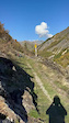
Popular Isere Mountain Biking Trails
• 95 ★ 5.0 • 1 mile • 90 ft • 935 • • hike
Highly rated popular blue difficulty singletrack. This hike primary trail and has a moderate overall physical rating. On average it takes 7 minutes to complete this trail.
• 100 ★ 4.3 • 2 miles • 9 ft • 597 •
Top part of the megavalanche qualifier. Rocky from top to bottom. Intimidating during the first run, but real fun if you can find the flow of the track
• 65 ★ 4.2 • 2 miles • 0 ft • 524 •
Highly rated moderately popular blue difficulty singletrack. This mountain bike primary trail can be used downhill only and has a moderate overall physical rating. On average it takes 8 minutes to complete this trail.
• 90 ★ 4.2 • 1,444 ft • 0 ft • 523 •
Highly rated popular blue difficulty singletrack. This mountain bike primary trail can be used one direction and has a moderate overall physical rating. It features berm and jump. Trail visibility is always easy to follow. On average it takes 1 minutes to complete this trail.
• 85 ★ 4.8 • 2 miles • 43 ft • 479 •
A true rollercoaster for mountain bike! Berm, jump, repeat! full gas and enjoy!
Isere Mountain Bike Routes
★ 4.0 • 10 miles • 3,361 ft • 3 • Loop •
Very nice tour ! The climb is long but easy on the road and next on a gravel road ! And the downhill is a...
14 miles • 4,640 ft • 6 • Loop •
Petit parking dans la vallée, on attaque à monter par une route régulière puis une belle piste 4x4 qui...
★ 4.0 • 15 miles • 5,829 ft • 6 • Loop •
Le taillefer Summit : Start on the road "Route du poursollet part 1", easy one not to steep, perfect to...
10 miles • 2,534 ft • 4 • Loop •
tour de vtt, le montée se fait par le golf, avec des descentes faciles.
22 miles • 5,188 ft • 3 •
Nice tour from Seyssinet, up to St Nizier. Way down by Ferme Durand and Vouilland best trails.
★ 2.5 • 6 miles • 235 ft • 8 • Point to Point •
Part 2 of the new version of megavalanche.
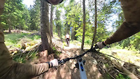
Photos of Isere Mountain Bike
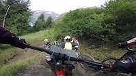
Videos of Isere Mountain Bike
trail: Fond Du Ferrand
0:45 |
10 |
Oct 15, 2025
trail: Sentier Du Freney d'Oisans
0:25 |
9 |
Oct 15, 2025
trail: Wild Berries
0:51 |
53 |
Aug 10, 2023
trail: LE TAILLEFER SOMMET
3:08 |
26 |
Feb 14, 2023
trail: Venosc
0:14 |
77 |
Jan 22, 2022
trail: Plan des cavales
2:49 |
473 |
Aug 17, 2021

trail: Full Serlin
2:15 |
147 |
Jul 2, 2021
trail: Diable Upper
6:08 |
10 |
Aug 4, 2020
Current Trail Warnings
| status | trail | date | condition | user | info |
|---|---|---|---|---|---|
| Singletrack Theys Lower Theys | Jun 15, 2026 @ 2:23pm (Europe/Paris) Jun 15, 2026 | Unknown | Mickey38 | Fermé temporairement pour cause de... | |
| La Bleue Lans-en-Vercors | Jun 15, 2026 @ 9:04am (Europe/Paris) Jun 15, 2026 | Ideal | freerider48 TRAILFORKS | Fermé cause "pâturage", pas de date de... | |
| Bois Sigu Lans-en-Vercors | Jun 15, 2026 @ 9:04am (Europe/Paris) Jun 15, 2026 | Ideal | freerider48 TRAILFORKS | Fermé cause "pâturage", pas de date de... |
Recent Trail Reports
National Scenic Trails & Official Routes
-
Grande Traversée VTT des Préalpes - Les Chemins du Soleil
- Mountain Bike
- E-Bike
-
Le Grand Tour du Vercors
- Mountain Bike
- E-Bike
Activity Feed
| username | action | type | title | date |
|---|---|---|---|---|
| StanislasVrKgrf | wishlist | trail | activity #97256768 and 1 more | Jun 18, 2026 @ 9:14am 6 hours |
| FlorianptcBnv | wishlist | trail | activity #97174717 and 2 more | Jun 17, 2026 @ 4:56am 1 day |
| Psph | ridden | trail | activity #97105621 | Jun 16, 2026 @ 6:37am 2 days |
| Psph | vote | trail | activity #97105619 | Jun 16, 2026 @ 6:37am 2 days |
| Psph | ridden | trail | activity #97096706 | Jun 16, 2026 @ 3:13am 2 days |
Recent Comments
| username | type | title | comment | date |
|---|---|---|---|---|
| trail | Très cassant, assez exigeant | Jun 15, 2026 @ 9:08am Jun 15, 2026 | ||
| trail | Fermé cause "pâturage", pas de date de... | Jun 14, 2026 @ 2:19am Jun 14, 2026 | ||
| trail | Fermé cause "pâturage", pas de date de... | Jun 14, 2026 @ 2:18am Jun 14, 2026 | ||
| report | Ouh ca fait du slow tech la | Jun 11, 2026 @ 12:09pm Jun 11, 2026 | ||
| trail | Hiking trail, watch out for hikers !! | Jun 11, 2026 @ 10:43am Jun 11, 2026 |
Local Badges
-

Epic Ride Descent 2k2 awarded -

Descent 10k Badge0 awarded -
Epic Ride Descent 2k0 awarded -
Descent 10k Badge0 awarded -
Epic Ride Descent 2k0 awarded -
Epic Ride Descent 2k0 awarded
Bike & Skill Parks
| name | type | city | rating |
|---|---|---|---|
| Alpe d'Huez Bike Park | bike park | Alpe d'Huez | |
| Les 2 Alpes Bike Park | bike park | Les Deux Alpes | |
| Les 7 Laux | bike park | Prapoutel | |
| Villard de Lans Bike Park | bike park | Villard-de-Lans | |
| Bike Park Bourg d'Oisans | skill park | Le Bourg d'Oisans |
Upcoming Local Events
Activity Type Stats
| activitytype | trails | distance | descent | descent distance | total vertical | rating | global rank | state rank | photos | reports | routes | ridelogs |
|---|---|---|---|---|---|---|---|---|---|---|---|---|
| Mountain Bike | 1,779 | 1,252 miles | 608,104 ft | 743 miles | 10,240 ft | 1,296 | 6,400 | 25 | 56,355 | |||
| E-Bike | 1,718 | 1,191 miles | 569,780 ft | 698 miles | 10,240 ft | 6,065 | 11 | 7,867 | ||||
| Gravel Bike | 144 | 149 miles | 13,904 ft | 37 miles | 6,450 ft | 52 | 1 | 133 | ||||
| Adaptive Bike | 193 | 234 miles | 18,809 ft | 58 miles | 6,860 ft | 421 | ||||||
| Winter Fat Bike | 28 | 51 miles | 5,709 ft | 18 miles | 6,860 ft | 11 | 1 | |||||
| Horse | 91 | 78 miles | 7,385 ft | 21 miles | 4,518 ft | 840 | ||||||
| Hike | 1,227 | 983 miles | 380,889 ft | 502 miles | 10,240 ft | 5,687 | 2 | 4,446 | ||||
| Trail Running | 1,226 | 982 miles | 379,262 ft | 500 miles | 10,240 ft | 1 | 5,686 | 2 | 3,430 | |||
| Dirtbike/Moto | 23 | 19 miles | 2,375 ft | 5 miles | 4,544 ft | 831 | 8 | |||||
| Observed Trials | 11 | 14 miles | 1,673 ft | 4 miles | 4,800 ft | 11 | 1 | |||||
| ATV/ORV/OHV | 13 | 16 miles | 1,594 ft | 4 miles | 4,534 ft | 831 | 1 | |||||
| Snowshoe | 16 | 17 miles | 5,650 ft | 11 miles | 2,703 ft | 3 | 1 | 89 | ||||
| Downhill Ski | 650 | 348 miles | 320,538 ft | 334 miles | 8,622 ft | 2 | 4 | 5,365 | ||||
| Backcountry Ski | 5 | 9 miles | 3,852 ft | 7 miles | 2,680 ft | 2 | 1 | 2,433 | ||||
| Nordic Ski | 12 | 8 miles | 1,106 ft | 4 miles | 663 ft | 2 | 1,651 |
Frequently Asked Questions About Isere
▼
What are the best places to ride in Isere?
Isere has 34 areas to explore for mountain biking. The top rated areas are:
▼
What are the highest rated mountain biking trails in Isere?
The highest rated mountain biking trails in Isere are:
- Venosc (4.6/5)
- Petit Faon Upper (4.6/5)
- La Cote (4.5/5)
- Sappey'Rénise (4.5/5)
- Cortillets (4.5/5)
▼
What is the best time of the year to ride in Isere?
Based on ride log data, the most popular months to ride in Isere are:
- July (186 activities)
- June (117 activities)
- October (113 activities)
▼
What is the longest trail in Isere?
The longest trail in Isere is Plan des cavales at 6.5 miles. View all trails sorted by distance.
Activities
- Isere Mountain Biking Trails
- Isere E-Biking Trails
- Isere Horseback Trails
- Isere Hiking Trails
- Isere Trail Running Trails
- Isere Dirtbiking Trails
- Isere Observed Trials Trails
- Isere ATVing/Offroading Trails
- Isere Snowshoeing Trails
- Isere Skiing Trails
- Isere Backcountry Skiing Trails
- Isere Nordic Skiing Trails
Trails
Points of Interest
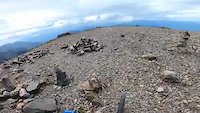
- Pravouta Summit
- Refuge Du Crêt Du Poulet Cabin
- Crêt Du Poulet Summit
- Zone Bivouac Camping
- Croix De Gouret Sight
- Chateau Du Touvet Sight
- Dent De Crolles Summit
- Col Des Ayes Summit
- Col Du Coq Summit
- Col De Pravouta Summit
- Dôme de Neige des Écrins (12,992 ft)
- Jumeaux des Écrins (12,116 ft)
- Clocher des Écrins (12,116 ft)
- By hpman83
 TRAILFORKS TFFRANCE & contributors
 - Admins: TFFRANCE, elyari, freerider48, provencemb, B MTB Co, JordiBN, Whipperman
- #7123 - 8,162 views
- isere activity log | embed map of Isere mountain bike trails | isere mountain biking points of interest polygons
Downloading of trail gps tracks in kml & gpx formats is enabled for Isere.
You must login to download files.