close
-
Layers w
- Weather Layers
- Pro
- Pro
- Pro
- Pro
- Pro
- Pro
- More Layers
- Pro
- Pro
- Pro
- Pro
-
Upgrade to

3D
Trail Conditions
- Unknown
- Snow Groomed
- Snow Packed
- Snow Covered
- Snow Cover Partial
- Freeze/thaw Cycle
- Icy
- Prevalent Mud
- Wet
- Variable
- Ideal
- Dry
- Very Dry
Trail Flow (Ridden Direction)
Trailforks scans users ridelogs to determine the most popular direction each trail is ridden. A good flowing trail network will have most trails flowing in a single direction according to their intension.
The colour categories are based on what percentage of riders are riding a trail in its intended direction.
The colour categories are based on what percentage of riders are riding a trail in its intended direction.
- > 96%
- > 90%
- > 80%
- > 70%
- > 50%
- < 50%
- bi-directional trail
- no data
Trail Last Ridden
Trailforks scans ridelogs to determine the last time a trail was ridden.
- < 2 days
- < 1 week
- < 2 weeks
- < 1 month
- < 6 months
- > 6 months
Trail Ridden Direction
The intended direction a trail should be ridden.
- Downhill Only
- Downhill Primary
- Both Directions
- Uphill Primary
- Uphill Only
- One Direction
Contribute Details
Colors indicate trail is missing specified detail.
- Description
- Photos
- Description & Photos
- Videos
Trail Popularity ?
Trailforks scans ridelogs to determine which trails are ridden the most in the last 9 months.
Trails are compared with nearby trails in the same city region with a possible 25 colour shades.
Think of this as a heatmap, more rides = more kinetic energy = warmer colors.
- most popular
- popular
- less popular
- not popular
ATV/ORV/OHV Filter
Max Vehicle Width
inches
US Cell Coverage
Legend

Radar Time
Activity Recordings
Trailforks uses anonymized public activity data.
?
Activity Recordings
Trailforks uses anonymized public activity data.
?
Personal Heatmap
▶
Activity Types
all
/
none
▶
Options
2
Date range
month
–
Winter Trails
Warning
A routing network for winter maps does not exist. Selecting trails using the winter trails layer has been disabled.
Missing Trails
Most Popular
Least Popular
Trails are colored based on popularity. The more popular a trail is, the more red. Less popular trails trend towards green.
Jump Magnitude Heatmap
Heatmap of where riders jump on trails. Zoom in to see individual jumps, click circles to view jump details.
BC Backroad Status
![map legend]()
Service Road Atlas is a free to use, community-driven service for viewing and creating reports on the numerous back-country service roads around B.C. and Alberta.

Slope Aspect
Direction the slope faces
Trails Deemphasized
Trails are shown in grey.
Only show trails with no bike usage.
Suggested Layers
Based on selected activity type
Save the current map location and zoom level as your default home location whenever this page is loaded.
SaveLas Islas Baleares (en catalán y oficialmente, Illes Balears) son una comunidad autónoma uniprovincial española, compuesta por las islas del archipiélago balear. Se encuentran situadas en el mar Mediterráneo, frente a la costa oriental de la Península Ibérica. Su capital es Palma de Mallorca.
El archipiélago está formado por dos grupos de islas y numerosos islotes: las Gimnesias (Mallorca, Menorca, Cabrera y algunos islotes cercanos como Dragonera, Conejera o la Isla del Aire) y las Pitiusas (Ibiza –en catalán y oficialmente Eivissa– y Formentera, junto con los distintos islotes que las rodean, como Espalmador y Espardell).
El archipiélago está formado por dos grupos de islas y numerosos islotes: las Gimnesias (Mallorca, Menorca, Cabrera y algunos islotes cercanos como Dragonera, Conejera o la Isla del Aire) y las Pitiusas (Ibiza –en catalán y oficialmente Eivissa– y Formentera, junto con los distintos islotes que las rodean, como Espalmador y Espardell).
This region uses the Uk/Euro style trail grading system.
Region Details
- 275
- 21
- 62
- 239
- 154
- 42
Stats
- Avg Trail Rating
- Trails (view details)
- 823
- Trails Mountain Bike
- 794
- Trails E-Bike
- 752
- Trails Horse
- 19
- Trails Hike
- 823
- Trails Trail Running
- 822
- Total Distance
- 1,051 miles
- Total Descent
- 245,921 ft
- Total Vertical
- 4,405 ft
- Highest Trailhead
- 4,406 ft
- Reports
- 1,613
- Photos
- 493
- Ridden Counter
- 27,164
Popular Trail Networks
view all areas »Sub Regions
- Ibiza (76)
- Eivissa (63)
- Sant Antoni de Portmany (13)
- Sant Joan de Labritja (0)
- Mallorca (701)
- Alaro (9)
- Alcudia (26)
- Algaida (0)
- Randa (0)
- Andratx (52)
- Andratx (52)
- Arta (44)
- Llevant (43)
- Bunyola (37)
- Comuna de Bunyola (37)
- Calvia (35)
- Calvia (35)
- Capdepera (4)
- Escorca (50)
- Escorca (48)
- Esporles (73)
- Esporles (73)
- Estellencs (2)
- Felanitx (17)
- Inca (3)
- Lloseta (2)
- Manacor (42)
- Punta de n'Amer (32)
- Palma de Mallorca (150)
- Na Burguesa (61)
- Peguera (22)
- Trailpark Paguera (22)
- Pollenca (14)
- Santañi (1)
- Sóller (70)
- Tramuntana Central (17)
- Valldemossa (39)
- Valldemossa (38)
- Randa (7)
- Santuari Sant Salvador (5)
- Alaro (9)
- Menorca (26)
- Ciudadela (2)
- Cala Galdana (2)
- Ciudadela (2)
Popular Islas Baleares Mountain Biking Trails
• 100 ★ 2.5 • 3 miles • 786 ft • 1,203 • • hike
Old walking path used to get to the lighthouse. Views are astonishing from several points but current status is pretty bad. Rocky and with several hike-a-bike sections.
• 100 ★ 4.0 • 1 mile • 27 ft • 583 •
Carril bici que recorre el paseo marítimo frente a la Catedral de Mallorca y Playa de Can Pere Antoni. Muy frecuentado, patines, patinetes, turistas, un poco de todo, ir con cuidado.
• 100 ★ 4.0 • 5,039 ft • 14 ft • 543 •
Popular white difficulty family friendly paved path. This multi-use trail can be used both directions and has a easy overall physical rating with a 14 ft green climb. Adaptive MTB rating: amtb green. Trail visibility is always easy to follow. On average it takes 4 minutes to complete this trail.
• 100 ★ 4.0 • 1 mile • 14 ft • 527 •
Popular white difficulty family friendly paved path. This multi-use trail can be used both directions and has a easy overall physical rating with a 14 ft green climb. Adaptive MTB rating: amtb green. Trail visibility is always easy to follow. On average it takes 8 minutes to complete this trail.
• 100 ★ 4.0 • 4,633 ft • 38 ft • 520 •
Popular white difficulty family friendly paved path. This multi-use trail can be used both directions and has a easy overall physical rating with a 38 ft green climb. Adaptive MTB rating: amtb green. Trail visibility is always easy to follow. On average it takes 4 minutes to complete this trail.
• 100 ★ 4.0 • 1 mile • 19 ft • 279 •
Popular white difficulty family friendly paved path. This multi-use trail can be used both directions and has a easy overall physical rating with a 19 ft green climb. Adaptive MTB rating: amtb green. Trail visibility is always easy to follow. On average it takes 5 minutes to complete this trail.
• 100 ★ 4.0 • 3 miles • 20 ft • 268 •
Popular white difficulty family friendly paved path. This multi-use trail can be used both directions and has a easy overall physical rating with a 20 ft green climb. Adaptive MTB rating: amtb green. Trail visibility is always easy to follow. On average it takes 22 minutes to complete this trail.
• 95 ★ 0.0 • 2 miles • 46 ft • 214 •
Atención al cruce con semáforos al final (o principio segíun se mire) donde hay tráfico por la salida de camiones del Moll Vell.
Islas Baleares Mountain Bike Routes
★ 5.0 • 31 miles • 5,454 ft • 1 • Point to Point •
Part of the TransTramuntana route that traverses all the Tramuntana Serra in Mallorca island. There are...
★ 5.0 • 20 miles • 4,869 ft • 5 • Point to Point •
Part of the TransTramuntana route that traverses all the Tramuntana Serra in Mallorca island. There are...
★ 5.0 • 33 miles • 5,333 ft • 7 • Loop •
Ruta bastante dura física y técnicamente que hace algunas de los mejores bajadas de la región. En...
★ 5.0 • 110 miles • 27,191 ft • 46 • Point to Point •
The GR 221 Ruta de Pedra en Sec (Dry Stone Route) is a hiking trail in Majorca that proposes you to...
★ 5.0 • 33 miles • 6,605 ft • 7 • Loop •
Ruta espectacular donde las haya, pero dura de cojones también. Las vistas sobre el Mediterráneo...
★ 5.0 • 33 miles • 6,161 ft • 3 • Point to Point •
Part of the TransTramuntana route that traverses all the Tramuntana Serra in Mallorca island. There are...
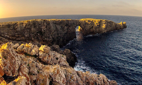
Photos of Islas Baleares Mountain Bike
Videos of Islas Baleares Mountain Bike
trail: La Enduro
0:40 |
127 |
Jul 12, 2023
trail: Costers De Na Dalmau
0:58 |
319 |
Oct 9, 2022
trail: Sa Creu
0:00 |
708 |
Jan 4, 2018
trail: Son Borras
5:40 |
383 |
Nov 27, 2014
trail: Oli Clar, Font Figuera
4:57 |
139 |
Aug 6, 2014
trail: Branson
6:58 |
330 |
Feb 9, 2013
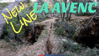
trail: Avenc
3:53 |
83 |
Oct 1, 2025 , Palma de Mallorca
youtuber
![Riding in Paguera Bike Park Was Insane Until I...]()
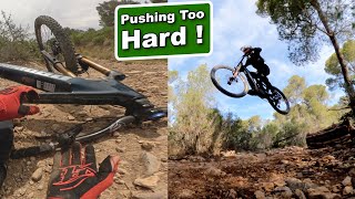
12:09 |
93 |
May 14, 2025
Current Trail Warnings
| status | trail | date | condition | user | info |
|---|---|---|---|---|---|
| Es Ratxo Esporles | Jun 18, 2026 @ 1:16pm (Europe/Madrid) Jun 18, 2026 | Unknown | MaciejjSnGpF | closed gates |
Recent Trail Reports
| status | trail | date | condition | info | user |
|---|---|---|---|---|---|
| Son Daviu a Can Capellers Palma de Mallorca | Jun 25, 2026 @ 6:34pm (Africa/Algiers) 2 days | Very Dry | alvarolopez | ||
| n'Amer Punta de n'Amer | Jun 25, 2026 @ 6:38am (Africa/Algiers) 2 days | Very Dry | GilesHeardman | ||
| Es Serral Calvia | Jun 18, 2026 @ 1:21pm (Europe/Madrid) Jun 18, 2026 | Dry | MaciejjSnGpF | ||
| Coll Des Carniceret Calvia | Jun 18, 2026 @ 1:19pm (Europe/Madrid) Jun 18, 2026 | Unknown | MaciejjSnGpF | ||
| La Pedrera Na Burguesa | May 9, 2026 @ 9:18am (Africa/Algiers) May 9, 2026 | Ideal | andrereve | ||
| 3K Comuna de Bunyola | May 3, 2026 @ 9:56pm (Europe/Madrid) May 3, 2026 | Dry | ErikPanjer | ||
| Dressera Alcudia | Apr 30, 2026 @ 11:35am (Europe/Andorra) Apr 30, 2026 | Dry | paulkleefman | ||
| Ermita | Apr 30, 2026 @ 11:35am (Europe/Andorra) Apr 30, 2026 | Dry | paulkleefman | ||
| Fontanelles Sobiranes | Apr 30, 2026 @ 11:35am (Europe/Andorra) Apr 30, 2026 | Dry | paulkleefman | ||
| Claper des gegants Alcudia | Apr 30, 2026 @ 11:35am (Europe/Andorra) Apr 30, 2026 | Dry | paulkleefman |
National Scenic Trails & Official Routes
-
GR 221 Cami de La Pedra en Sec
- Mountain Bike
- Hike
- Trail Running
-
GR 223 Cami des Cavalls
- Mountain Bike
- Hike
Activity Feed
| username | action | type | title | date |
|---|---|---|---|---|
| alvarolopez | add | report | activity #97790941 | Jun 25, 2026 @ 1:41pm 2 days |
| GilesHeardman | add | report | activity #97753764 | Jun 25, 2026 @ 1:15am 2 days |
| FernwehHcwww0 | wishlist | trail | activity #97490707 | Jun 21, 2026 @ 9:01am Jun 21, 2026 |
| FernwehHcwww0 | wishlist | trail | activity #97490478 and 1 more | Jun 21, 2026 @ 8:59am Jun 21, 2026 |
| FernwehHcwww0 | wishlist | trail | activity #97490173 and 1 more | Jun 21, 2026 @ 8:56am Jun 21, 2026 |
Recent Comments
| username | type | title | comment | date |
|---|---|---|---|---|
| trail | this track is closed because it's in reservar area | Jun 18, 2026 @ 4:15am Jun 18, 2026 | ||
| trail | I was on a 4h ride waiting for the 5 star... | May 24, 2026 @ 12:25pm May 24, 2026 | ||
| trail | Definitely not a biking trail. I did read the... | Apr 23, 2026 @ 6:22am Apr 23, 2026 | ||
| trail | Trail was very overgrown and at the end there... | Apr 9, 2026 @ 6:01am Apr 9, 2026 | ||
| trail | Road then farm track. Straightforward.... | Apr 8, 2026 @ 9:09am Apr 8, 2026 |
Local Badges
-

Big Ride 30k184 awarded -

Epic Ride 50k122 awarded -
Big Ride 30k1,269 awarded -
Big Ride 30k2,500 awarded -
Big Ride 30k792 awarded -
Big Ride 30k203 awarded
Bike & Skill Parks
| name | type | city | rating |
|---|---|---|---|
| Skatepark Sa Riera | skill park | Palma de Mallorca | |
| Palma supercross | skill park | Llucmajor | |
| Esporles Skillpark | skill park | Esporles | |
| Son Matamoros motocross | skill park | Manacor | |
| Supercross muligvis | skill park | Llucmajor |
Activity Type Stats
| activitytype | trails | distance | descent | descent distance | total vertical | rating | global rank | state rank | photos | reports | routes | ridelogs |
|---|---|---|---|---|---|---|---|---|---|---|---|---|
| Mountain Bike | 794 | 1,028 miles | 236,070 ft | 444 miles | 4,406 ft | 489 | 1,613 | 31 | 78,302 | |||
| E-Bike | 752 | 889 miles | 215,581 ft | 389 miles | 4,406 ft | 2 | 1,510 | 17 | 6,269 | |||
| Horse | 19 | 90 miles | 9,908 ft | 40 miles | 427 ft | 545 | ||||||
| Hike | 823 | 1,051 miles | 245,922 ft | 457 miles | 4,406 ft | 2 | 1,610 | 4 | 4,832 | |||
| Trail Running | 822 | 1,051 miles | 245,922 ft | 457 miles | 4,406 ft | 1,609 | 4 | 2,739 |
Activities
Trails
Points of Interest
- Pas de Estalo Viewpoint
- Restaurant Es Verger Information
- Pas de Estalo Viewpoint
- Sight Viewpoint
- La Trapa viewpoint
- Túnel camí de muntanya (sota vies de tren) Bridge
- Raixeta Viewpoint
- Torrent Bunyola, camí muntanya Bridge
- Pont del Torrent Gros Bridge
- Puig Major (1,433 m)
- Penyal des Migdia (1,375 m)
- Puig Major - espoló NE (1,368 m)
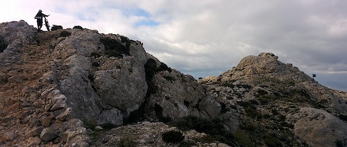
- By canadaka
 Trailforks & contributors
 - Admins: mul0w, elyari, AMG, juanx, Angelreing
- #3531 - 4,396 views
- islas baleares activity log | embed map of Islas Baleares mountain bike trails | islas baleares mountain biking points of interest
Downloading of trail gps tracks in kml & gpx formats is enabled for Islas Baleares.
You must login to download files.