close
-
Layers w
- Weather Layers
- Pro
- Pro
- Pro
- Pro
- Pro
- Pro
- More Layers
- Pro
- Pro
- Pro
- Pro
-
Upgrade to

3D
Trail Conditions
- Unknown
- Snow Groomed
- Snow Packed
- Snow Covered
- Snow Cover Partial
- Freeze/thaw Cycle
- Icy
- Prevalent Mud
- Wet
- Variable
- Ideal
- Dry
- Very Dry
Trail Flow (Ridden Direction)
Trailforks scans users ridelogs to determine the most popular direction each trail is ridden. A good flowing trail network will have most trails flowing in a single direction according to their intension.
The colour categories are based on what percentage of riders are riding a trail in its intended direction.
The colour categories are based on what percentage of riders are riding a trail in its intended direction.
- > 96%
- > 90%
- > 80%
- > 70%
- > 50%
- < 50%
- bi-directional trail
- no data
Trail Last Ridden
Trailforks scans ridelogs to determine the last time a trail was ridden.
- < 2 days
- < 1 week
- < 2 weeks
- < 1 month
- < 6 months
- > 6 months
Trail Ridden Direction
The intended direction a trail should be ridden.
- Downhill Only
- Downhill Primary
- Both Directions
- Uphill Primary
- Uphill Only
- One Direction
Contribute Details
Colors indicate trail is missing specified detail.
- Description
- Photos
- Description & Photos
- Videos
Trail Popularity ?
Trailforks scans ridelogs to determine which trails are ridden the most in the last 9 months.
Trails are compared with nearby trails in the same city region with a possible 25 colour shades.
Think of this as a heatmap, more rides = more kinetic energy = warmer colors.
- most popular
- popular
- less popular
- not popular
ATV/ORV/OHV Filter
Max Vehicle Width
inches
US Cell Coverage
Legend

Radar Time
Activity Recordings
Trailforks uses anonymized public activity data.
?
Activity Recordings
Trailforks uses anonymized public activity data.
?
Personal Heatmap
▶
Activity Types
all
/
none
▶
Options
2
Date range
month
–
Winter Trails
Warning
A routing network for winter maps does not exist. Selecting trails using the winter trails layer has been disabled.
Missing Trails
Most Popular
Least Popular
Trails are colored based on popularity. The more popular a trail is, the more red. Less popular trails trend towards green.
Jump Magnitude Heatmap
Heatmap of where riders jump on trails. Zoom in to see individual jumps, click circles to view jump details.
BC Backroad Status
![map legend]()
Service Road Atlas is a free to use, community-driven service for viewing and creating reports on the numerous back-country service roads around B.C. and Alberta.

Slope Aspect
Direction the slope faces
Trails Deemphasized
Trails are shown in grey.
Only show trails with no bike usage.
Suggested Layers
Based on selected activity type
Save the current map location and zoom level as your default home location whenever this page is loaded.
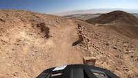
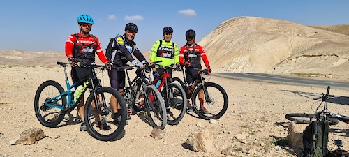
SaveIsrael has a few features that make it an awesome mountain biking area. It's geographically really small with a length of only 420km, making getting places pretty quick. The winter is super easy and without much rain, making it a great winter getaway from the elements in Europe. The culture is diverse, and so are the trails, from easy XC to woods to desert and enduro, there's a bit of everything - and it's Israel
AKA: ישראל
This region uses the Uk/Euro style trail grading system.
Region Details
- 155
- 3
- 321
- 422
- 137
- 24
Stats
- Avg Trail Rating
- Trails (view details)
- 1,122
- Trails Mountain Bike
- 1,074
- Trails E-Bike
- 914
- Trails Gravel Bike
- 6
- Trails Adaptive Bike
- 7
- Trails Horse
- 5
- Trails Hike
- 983
- Trails Trail Running
- 971
- Trails Dirtbike/Moto
- 5
- Trails ATV/ORV/OHV
- 6
- Total Distance
- 2,336 miles
- Total Descent
- 332,953 ft
- Total Vertical
- 3,843 ft
- Highest Trailhead
- 3,845 ft
- Reports
- 9,058
- Photos
- 971
- Ridden Counter
- 89,385
Articles

Video: Fabio Wibmer Turns Israel into His MTB Playground
Jan 15, 2020 from pinkbike.com
Fabio Wibmer visits Tel Aviv and the Utah-esque deserts of Israel in his first edit on Canyon.
Popular Trail Networks
view all areas »Sub Regions
- Arava - Northern (0)
- Carmel Mountain (152)
- Haifa (71)
- Ofer Forest (73)
- Shfeya (3)
- Center (178)
- Ariel (22)
- Founders Grove (0)
- WildLife (0)
- Ben Shemen (51)
- Canada Park (17)
- Horashim (36)
- Karmei Yosef (16)
- Neve Shalom (2)
- Tzur Yitzhak (14)
- Ariel (22)
- Eilat Mountains & Southern Arava (24)
- Eilat (10)
- Eilat (10)
- Golan Heights (4)
- Jerusalem Mountains (50)
- Jezreel Valley (6)
- Judea Desert (28)
- Arad (6)
- Northern Judea Desert (20)
- Arad (6)
- Judean Plains (25)
- Lachish (14)
- Srigim Li-on (4)
- Lower Galillee (200)
- Alon HaGalil (24)
- Kfar HaHoresh (25)
- Kiryat Ata Forest (8)
- Kiryat Tivon (66)
- Misgav (60)
- Negev - Central (32)
- Negev - Northern (23)
- Beer Sheva (20)
- Beer Sheva (20)
- Negev - West (25)
- Be'eri (7)
- Northern Shomron & Sharon (277)
- Zihron Ya'akov (29)
- Ramat Ha'anadiv (17)
- Horeshan (80)
- Kfar Glikson (19)
- Ma'anit (43)
- Mishmar HaEmek (72)
- Ramot Menashe (33)
- Zihron Ya'akov (29)
- Upper Galillee (16)
- Kiryat Shmona (6)
- Manara (5)
- Kiryat Shmona (6)
- Western Galilee (27)
- Ahihud Forest (5)
- Hanita (10)
Popular Israel Mountain Biking Trails
• 95 ★ 4.7 • 6 miles • 389 ft • 372 •
Highly rated popular blue difficulty singletrack. This mountain bike primary trail can be used downhill primary and has a moderate overall physical rating with a 389 ft green climb. On average it takes 52 minutes to complete this trail.
• 95 ★ 4.9 • 1 mile • 21 ft • 360 •
The trail (marked Black for orientation) features good gradient for both easy climbing and flowy descending, and takes great advantage of the natural, sometimes rocky terrain of the area. A good spot for riding and meeting riders, and...
• 100 ★ 4.7 • 3 miles • 531 ft • 360 •
Highly rated popular blue difficulty singletrack. This mountain bike primary trail can be used one direction. It features rock face and rock garden. On average it takes 33 minutes to complete this trail.
• 90 ★ 4.7 • 2 miles • 133 ft • 347 •
A technical and rocky trail, with good flow fun and speed
• 100 ★ 4.0 • 966 ft • 27 ft • 338 •
Popular blue difficulty singletrack. This mountain bike primary trail can be used downhill primary. On average it takes 2 minutes to complete this trail.
• 100 ★ 0.0 • 993 ft • 9 ft • 318 •
Popular green difficulty singletrack. This mountain bike primary trail can be used downhill primary and has a easy overall physical rating with a 9 ft green climb. On average it takes minutes to complete this trail.
• 100 ★ 3.5 • 1,006 ft • 1 ft • 315 •
Popular green difficulty singletrack. This mountain bike primary trail can be used both directions and has a easy overall physical rating. On average it takes 1 minutes to complete this trail.
• 85 ★ 4.8 • 4 miles • 736 ft • 301 •
This Long trail features good flow on the descent with few technical sections, good speed and small berms. The climb back is on a moderate gradient that suites any rider.
Israel Mountain Bike Routes
HaZore'a - Yellow loop Featured
★ 4.0 • 8 miles • 864 ft • 10 • Loop •
A beautiful loop in HaZore'a forest, good flow, well shaded. an excellent all year route (avoid on rainy days)
Mizpe Ramon - Khan Be'erot Featured
★ 5.0 • 24 miles • 1,090 ft • 4 • Point to Point •
Makhtesh Ramon is the largest of the four makhteshim in Israel (The three are Small Makhtesh, the Great...
★ 5.0 • 13 miles • 1,682 ft • 13 • Loop •
An offical KKL route, marked in Yellow, climbs are not steep, it has no technical features. Most of the...
11 miles • 1,196 ft • 4 •
=========== אימוני בוקר על המסלול לכל הקטגוריות ביום האירוע מ...
★ 4.0 • 6 miles • 579 ft • 7 • Loop •
The yellow Loop is a XC oriented Route, consisting of 25% single track. The route is very scenic and...
★ 4.0 • 9 miles • 1,011 ft • 20 • Loop •
The Misgav area has a network of unofficial singletrack, this specific trail is the only official MTB...
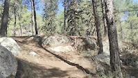
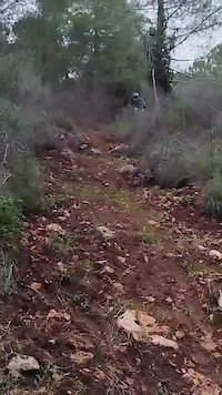
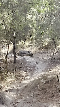
Photos of Israel Mountain Bike
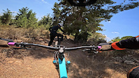
Videos of Israel Mountain Bike
trail: Val Di Sol
0:45 |
38 |
May 31, 2025
trail: daniboy
0:11 |
65 |
Dec 26, 2024
trail: Misgav KKL 04
0:11 |
|
Aug 30, 2024
trail: The Pirate
4:02 |
53 |
Aug 5, 2024
trail: Ketura Ascend
3:54 |
122 |
Dec 3, 2023
trail: Kapara
0:16 |
97 |
Sep 17, 2023
trail: IMBA - Part 1
0:23 |
18 |
Apr 10, 2023
trail: The Pirate
0:32 |
35 |
Apr 6, 2023
National Scenic Trails & Official Routes
-
Israel Bike Trail - IBT
- Mountain Bike
- E-Bike
Recent Comments
| username | type | title | comment | date |
|---|---|---|---|---|
| trail | סינגל הדרקון עכשיו נמצא... | Jun 16, 2026 @ 11:14pm Jun 16, 2026 | ||
| trail | Bicycle trail. And you can walk there also | Jun 15, 2026 @ 8:40pm Jun 15, 2026 | ||
| trail | Definitely more red trail than blue | Sep 30, 2025 @ 10:39am Sep 30, 2025 | ||
| trail | Nice! | Sep 6, 2025 @ 12:28am Sep 6, 2025 | ||
| report | Sand has overtaken parts of the trail | Jun 27, 2025 @ 5:08am Jun 27, 2025 |
Bike & Skill Parks
| name | type | city | rating |
|---|---|---|---|
| Manara | bike park | Kiryat Shmona | |
| Alon Park Karmiel Pump Track | skill park | Karmiel | |
| Modi'in Pump Track | skill park | Jerusalem | |
| Alon Hagalil Pump Track | skill park | ||
| Herzelia Pump Track | skill park | Herzliya |
Activity Type Stats
| activitytype | trails | distance | descent | descent distance | total vertical | rating | global rank | state rank | photos | reports | routes | ridelogs |
|---|---|---|---|---|---|---|---|---|---|---|---|---|
| Mountain Bike | 1,067 | 1,674 miles | 256,614 ft | 806 miles | 3,747 ft | #30 | 938 | 9,049 | 69 | 210,301 | ||
| E-Bike | 914 | 1,036 miles | 180,997 ft | 518 miles | 3,127 ft | #28 | 23 | 8,701 | 22 | 27,830 | ||
| Gravel Bike | 6 | #28 | 2 | 1 | 391 | |||||||
| Adaptive Bike | 7 | #26 | ||||||||||
| Horse | 5 | 27 miles | 3,517 ft | 14 miles | 1,532 ft | #37 | 1,629 | 1 | 11 | |||
| Hike | 983 | 2,168 miles | 300,436 ft | 1,001 miles | 3,842 ft | #25 | 2 | 9,089 | 6 | 5,718 | ||
| Trail Running | 971 | 2,150 miles | 296,371 ft | 990 miles | 3,842 ft | #25 | 8 | 9,089 | 6 | 2,179 | ||
| Dirtbike/Moto | 5 | 25 miles | 3,127 ft | 13 miles | 1,503 ft | #36 | 1,627 | 7 | ||||
| ATV/ORV/OHV | 6 | 35 miles | 3,215 ft | 15 miles | 2,657 ft | #29 | 1,626 | 31 |
Activities
Trails
- By canadaka
 Trailforks & contributors
 - Admins: ziv2102
- #3185 - 65,401 views
- israel activity log | embed map of Israel mountain bike trails | israel mountain biking points of interest
Downloading of trail gps tracks in kml & gpx formats is enabled for Israel.
You must login to download files.