close
-
Layers w
- Weather Layers
- Pro
- Pro
- Pro
- Pro
- Pro
- Pro
- More Layers
- Pro
- Pro
- Pro
- Pro
-
Upgrade to

3D
Trail Conditions
- Unknown
- Snow Groomed
- Snow Packed
- Snow Covered
- Snow Cover Partial
- Freeze/thaw Cycle
- Icy
- Prevalent Mud
- Wet
- Variable
- Ideal
- Dry
- Very Dry
Trail Flow (Ridden Direction)
Trailforks scans users ridelogs to determine the most popular direction each trail is ridden. A good flowing trail network will have most trails flowing in a single direction according to their intension.
The colour categories are based on what percentage of riders are riding a trail in its intended direction.
The colour categories are based on what percentage of riders are riding a trail in its intended direction.
- > 96%
- > 90%
- > 80%
- > 70%
- > 50%
- < 50%
- bi-directional trail
- no data
Trail Last Ridden
Trailforks scans ridelogs to determine the last time a trail was ridden.
- < 2 days
- < 1 week
- < 2 weeks
- < 1 month
- < 6 months
- > 6 months
Trail Ridden Direction
The intended direction a trail should be ridden.
- Downhill Only
- Downhill Primary
- Both Directions
- Uphill Primary
- Uphill Only
- One Direction
Contribute Details
Colors indicate trail is missing specified detail.
- Description
- Photos
- Description & Photos
- Videos
Trail Popularity ?
Trailforks scans ridelogs to determine which trails are ridden the most in the last 9 months.
Trails are compared with nearby trails in the same city region with a possible 25 colour shades.
Think of this as a heatmap, more rides = more kinetic energy = warmer colors.
- most popular
- popular
- less popular
- not popular
ATV/ORV/OHV Filter
Max Vehicle Width
inches
US Cell Coverage
Legend

Radar Time
Activity Recordings
Trailforks uses anonymized public activity data.
?
Activity Recordings
Trailforks uses anonymized public activity data.
?
Personal Heatmap
▶
Activity Types
all
/
none
▶
Options
2
Date range
month
–
Winter Trails
Warning
A routing network for winter maps does not exist. Selecting trails using the winter trails layer has been disabled.
Missing Trails
Most Popular
Least Popular
Trails are colored based on popularity. The more popular a trail is, the more red. Less popular trails trend towards green.
Jump Magnitude Heatmap
Heatmap of where riders jump on trails. Zoom in to see individual jumps, click circles to view jump details.
BC Backroad Status
![map legend]()
Service Road Atlas is a free to use, community-driven service for viewing and creating reports on the numerous back-country service roads around B.C. and Alberta.

Slope Aspect
Direction the slope faces
Trails Deemphasized
Trails are shown in grey.
Only show trails with no bike usage.
Suggested Layers
Based on selected activity type
Save the current map location and zoom level as your default home location whenever this page is loaded.
SaveIstria (/ˈɪstriə/; Croatian, Slovene: Istra; Istriot: Eîstria; German: Istrien), formerly Histria (Latin), is the largest peninsula in the Adriatic Sea. The peninsula is located at the head of the Adriatic between the Gulf of Trieste and the Kvarner Gulf. It is shared by three countries: Croatia, Slovenia, and Italy.[1][2]
AKA: Istria
This region uses the Uk/Euro style trail grading system.
Region Details
- 57
- 3
- 45
- 29
- 33
- 2
- 1
Stats
- Avg Trail Rating
- Trails (view details)
- 173
- Trails Mountain Bike
- 202
- Trails E-Bike
- 92
- Trails Horse
- 9
- Trails Hike
- 151
- Trails Trail Running
- 152
- Trails Dirtbike/Moto
- 13
- Trails Observed Trials
- 2
- Trails ATV/ORV/OHV
- 13
- Trails Snowshoe
- 1
- Total Distance
- 246 miles
- Total Descent
- 38,557 ft
- Total Vertical
- 3,290 ft
- Highest Trailhead
- 3,291 ft
- Reports
- 1,012
- Photos
- 420
- Ridden Counter
- 13,830
Articles

Video & Race Report: Enduro Grozni, SloEnduro Final
Oct 17, 2019 from pinkbike.com
The 2019 SloEnduro comes to a close in Grožnjan, Croatia.
Popular Trail Networks
view all areas »Sub Regions
- Buzet (11)
- Gradinje (2)
- Grožnjan (26)
- Kaštel (2)
- Labin (74)
- Bike Center Rabac (26)
- Labinski Poluotok (24)
- Pazin (8)
- Poreč (25)
- San Servolo trails (10)
- Pula (30)
- Kamenjak (10)
- Vintijan Bike Park (17)
- Ćićarija (16)
Popular Istarska Mountain Biking Trails
• 90 ★ 4.4 • 2 miles • 3 ft • 380 •
Difficulty: demanding Length: 3000 m Surface: natural terrain
• 100 ★ 4.3 • 1,483 ft • 88 ft • 338 •
Difficulty: easy Length: 420 m Surface: fine sand
• 100 ★ 4.6 • 5,217 ft • 3 ft • 324 •
Highly rated popular red difficulty singletrack. This mountain bike primary trail can be used downhill primary and has a moderate overall physical rating with a 3 ft blue climb. On average it takes 7 minutes to complete this trail.
• 100 ★ 4.6 • 4,192 ft • 12 ft • 307 •
Highly rated popular blue difficulty singletrack. This mountain bike primary trail can be used downhill primary and has a moderate overall physical rating with a 12 ft blue climb. On average it takes 11 minutes to complete this trail.
• 85 ★ 4.8 • 3,641 ft • 2 ft • 296 •
Forrest trail with hardpack soil. Technical, but at the same time approachable. Begins on the tarmac road leading to Groznjan and ends up near the gravel road leading to Groznjan. The track was part of SloEnduro race.
• 100 ★ 3.3 • 489 ft • 0 ft • 284 •
Difficulty: demanding Length: 170 m Surface: natural terrain
Istarska Mountain Bike Routes
★ 5.0 • 12 miles • 888 ft • 2 • Loop •
Official track of UCI MTB XC Marathon, held on April 8th 2018 on Kamenjak. One loop 20 km. Elite category...
★ 4.0 • 20 miles • 1,073 ft • 0 •
A very nice XC trail/course. Part of the course was used (until 2017) for the international MTB Parenazan...
★ 3.5 • 20 miles • 1,327 ft • 0 • Out & Back •
This is officially trail number 315/316 locally. There are many signs listing the trail number and...
★ 5.0 • 37 miles • 1,930 ft • 0 • Loop •
Nice and relaxing MTB/gravel bike route, starts in Poreč and takes insland to the small medieval town of...
★ 5.0 • 20 miles • 3,619 ft • 0 • Loop •
XC MTB Dausi Die Hard track, part of Dausijada group of rural sports events.
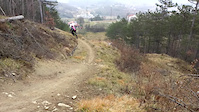
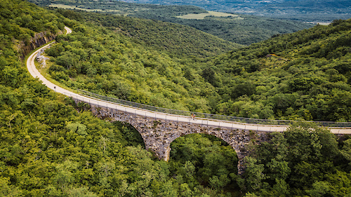
Photos of Istarska Mountain Bike
Videos of Istarska Mountain Bike
trail: Downhill Buzet
3:07 |
317 |
Jan 2, 2022

trail: Grožnjan
4:25 |
671 |
Oct 16, 2019
trail: Grožnjan - Sv. Juraj
0:37 |
196 |
Oct 16, 2018
trail: Get
2:08 |
1611 |
Nov 6, 2017
trail: Wild Ride
0:47 |
309 |
Aug 6, 2016
trail: Grožnjan
2:15 |
943 |
Dec 27, 2015

trail: Grožnjan
6:12 |
631 |
Oct 28, 2015

trail: Downhill Buzet
0:05 |
897 |
Apr 9, 2015
Recent Trail Reports
National Scenic Trails & Official Routes
-
Parenzana
- Mountain Bike
- E-Bike
Activity Feed
| username | action | type | title | date |
|---|---|---|---|---|
| odenwaelder | wishlist | route | activity #96585065 | Jun 8, 2026 @ 9:58pm Jun 8, 2026 |
| Gerhardco5aRt | ridden | trail | activity #96373923 | Jun 6, 2026 @ 8:29am Jun 6, 2026 |
| Gerhardco5aRt | ridden | trail | activity #96348717 | Jun 6, 2026 @ 1:56am Jun 6, 2026 |
| FrankoAkJ5nL | wishlist | region | activity #96038898 | Jun 1, 2026 @ 1:47pm Jun 1, 2026 |
| Endurocker | vote | trail | activity #95855904 and 1 more | May 30, 2026 @ 8:37am May 30, 2026 |
Recent Comments
| username | type | title | comment | date |
|---|---|---|---|---|
| trail | Less interesting than some of the other lines... | Oct 15, 2025 @ 2:29pm Oct 15, 2025 | ||
| trail | Could be rad if it got tuned up. As it sits,... | Oct 15, 2025 @ 2:26pm Oct 15, 2025 | ||
| trail | I think if this was as long as Kalcini it... | Oct 15, 2025 @ 2:24pm Oct 15, 2025 | ||
| trail | I think this is the best trail in Groznjan,... | Oct 15, 2025 @ 2:22pm Oct 15, 2025 | ||
| trail | Substantially less good than other trails in... | Oct 15, 2025 @ 2:20pm Oct 15, 2025 |
Local Badges
-

Epic Ride 50k174 awarded -

Mountain Biking 100k Badge0 awarded -

Climbing 10k Badge1 awarded -

Epic Mountain Bike Climb 2k7 awarded -

Epic Ride Descent 2k7 awarded -
Epic Ride 50k678 awarded
Bike & Skill Parks
| name | type | city | rating |
|---|---|---|---|
| Bike Skills Park | skill park | Labin | |
| Poreč Pumptrack | skill park | Poreč |
Activity Type Stats
| activitytype | trails | distance | descent | descent distance | total vertical | rating | global rank | state rank | photos | reports | routes | ridelogs |
|---|---|---|---|---|---|---|---|---|---|---|---|---|
| Mountain Bike | 197 | 246 miles | 38,556 ft | 115 miles | 3,291 ft | 373 | 1,047 | 27 | 19,047 | |||
| E-Bike | 92 | 69 miles | 10,600 ft | 29 miles | 3,291 ft | 15 | 854 | 17 | 2,847 | |||
| Horse | 9 | 18 miles | 1,949 ft | 8 miles | 3,022 ft | 87 | 1 | |||||
| Hike | 151 | 226 miles | 31,460 ft | 103 miles | 3,291 ft | 957 | 6 | 1,008 | ||||
| Trail Running | 152 | 226 miles | 31,991 ft | 103 miles | 3,291 ft | 959 | 8 | 206 | ||||
| Dirtbike/Moto | 13 | 15 miles | 1,401 ft | 6 miles | 630 ft | 88 | 1 | 5 | ||||
| Observed Trials | 2 | 14 miles | 1,401 ft | 6 miles | 630 ft | 6 | ||||||
| ATV/ORV/OHV | 13 | 16 miles | 1,657 ft | 7 miles | 879 ft | 86 | 1 | 4 | ||||
| Snowshoe | 1 |
Activities
Trails
- By VjekoslavKrsanac
 TRAILFORKS & contributors
 - Admins: VjekoslavKrsanac
- #6908 - 12,341 views
- istarska activity log | embed map of Istarska mountain bike trails | istarska mountain biking points of interest
Downloading of trail gps tracks in kml & gpx formats is enabled for Istarska.
You must login to download files.