close
-
Layers w
- Weather Layers
- Pro
- Pro
- Pro
- Pro
- Pro
- Pro
- More Layers
- Pro
- Pro
- Pro
- Pro
-
Upgrade to

3D
Trail Conditions
- Unknown
- Snow Groomed
- Snow Packed
- Snow Covered
- Snow Cover Partial
- Freeze/thaw Cycle
- Icy
- Prevalent Mud
- Wet
- Variable
- Ideal
- Dry
- Very Dry
Trail Flow (Ridden Direction)
Trailforks scans users ridelogs to determine the most popular direction each trail is ridden. A good flowing trail network will have most trails flowing in a single direction according to their intension.
The colour categories are based on what percentage of riders are riding a trail in its intended direction.
The colour categories are based on what percentage of riders are riding a trail in its intended direction.
- > 96%
- > 90%
- > 80%
- > 70%
- > 50%
- < 50%
- bi-directional trail
- no data
Trail Last Ridden
Trailforks scans ridelogs to determine the last time a trail was ridden.
- < 2 days
- < 1 week
- < 2 weeks
- < 1 month
- < 6 months
- > 6 months
Trail Ridden Direction
The intended direction a trail should be ridden.
- Downhill Only
- Downhill Primary
- Both Directions
- Uphill Primary
- Uphill Only
- One Direction
Contribute Details
Colors indicate trail is missing specified detail.
- Description
- Photos
- Description & Photos
- Videos
Trail Popularity ?
Trailforks scans ridelogs to determine which trails are ridden the most in the last 9 months.
Trails are compared with nearby trails in the same city region with a possible 25 colour shades.
Think of this as a heatmap, more rides = more kinetic energy = warmer colors.
- most popular
- popular
- less popular
- not popular
ATV/ORV/OHV Filter
Max Vehicle Width
inches
US Cell Coverage
Legend

Radar Time
Activity Recordings
Trailforks uses anonymized public activity data.
?
Activity Recordings
Trailforks uses anonymized public activity data.
?
Personal Heatmap
▶
Activity Types
all
/
none
▶
Options
2
Date range
month
–
Winter Trails
Warning
A routing network for winter maps does not exist. Selecting trails using the winter trails layer has been disabled.
Missing Trails
Most Popular
Least Popular
Trails are colored based on popularity. The more popular a trail is, the more red. Less popular trails trend towards green.
Jump Magnitude Heatmap
Heatmap of where riders jump on trails. Zoom in to see individual jumps, click circles to view jump details.
BC Backroad Status
![map legend]()
Service Road Atlas is a free to use, community-driven service for viewing and creating reports on the numerous back-country service roads around B.C. and Alberta.

Slope Aspect
Direction the slope faces
Trails Deemphasized
Trails are shown in grey.
Only show trails with no bike usage.
Suggested Layers
Based on selected activity type
Save the current map location and zoom level as your default home location whenever this page is loaded.
SaveL'Italia, ufficialmente Repubblica Italiana, è una repubblica parlamentare situata nell'Europa meridionale, con una popolazione di 60,7 milioni di abitanti. La sua capitale è Roma.
Delimitata dall'arco alpino confina a nord, da ovest a est, con Francia, Svizzera, Austria e Slovenia; il resto del territorio, circondato dai mari Ligure, Tirreno, Ionio e Adriatico, si protende nel mar Mediterraneo, occupando la penisola italiana e numerose isole (le maggiori sono Sicilia e Sardegna), per un totale di 301 340 km². Gli Stati della Città del Vaticano e di San Marino sono enclavi della Repubblica.
Delimitata dall'arco alpino confina a nord, da ovest a est, con Francia, Svizzera, Austria e Slovenia; il resto del territorio, circondato dai mari Ligure, Tirreno, Ionio e Adriatico, si protende nel mar Mediterraneo, occupando la penisola italiana e numerose isole (le maggiori sono Sicilia e Sardegna), per un totale di 301 340 km². Gli Stati della Città del Vaticano e di San Marino sono enclavi della Repubblica.
Links
- Gruppo Facebook Trailforks Italia
- Video-tutorial in italiano su YouTube by Trailforks Italia
- Le 6 regole del sentiero IMBA
- I 10 punti del mountain biking sostenibile IMBA
- 10 comportamenti da rispettare sui sentieri
This region uses the Uk/Euro style trail grading system.
Stats
- Avg Trail Rating
- Global Ranking
- #4
- Trails (view details)
- 35,780
- Trails Mountain Bike
- 32,948
- Trails E-Bike
- 26,925
- Trails Gravel Bike
- 2,034
- Trails Adaptive Bike
- 5,964
- Trails Winter Fat Bike
- 4,062
- Trails Horse
- 3,330
- Trails Hike
- 27,441
- Trails Trail Running
- 27,008
- Trails Dirtbike/Moto
- 1,429
- Trails Observed Trials
- 218
- Trails ATV/ORV/OHV
- 251
- Trails Snowmobile
- 32
- Trails Snowshoe
- 363
- Trails Downhill Ski
- 1,795
- Trails Backcountry Ski
- 336
- Trails Nordic Ski
- 133
- Total Distance
- 39,818 miles
- Total Descent
- 2,885 miles
- Total Vertical
- 12,108 ft
- Highest Trailhead
- 12,109 ft
- Reports
- 271,805
- Photos
- 53,985
- Ridden Counter
- 2,311,286
Articles
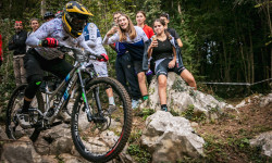
Tommaso Francardo & Nadine Ellecosta Win the Enduro Italian Championship 2025
Oct 1, 2025 from pinkbike.com
The competition took place in San Pietro al Natisone, featuring a diverse range of trails suitable for a high-level race.

Video: The Brothers Who Helped to Shape the European MTB Scene in 'No Matter the Age'
Sep 12, 2025 from pinkbike.com
Meet 73-year-old Peo Vernassa and his 67-year-old brother Roberto. For more than 25 years, these two have been building trails in the rugged hills...
Video: So Fast, So Close, So Cruel - Norco Race Division's 'Just Getting Started' EP6
Jul 22, 2025 from pinkbike.com
A look at the high-altitude, high-stress reality of racing two weekends in a row.
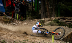
Video: This Gap Won The Race | Downhill Story Of The Race with Ben Cathro
Jul 7, 2025 from pinkbike.com
Ben Cathro recaps the Downhill World Cup racing in La Thuile.
Popular Trail Networks
view all areas »Sub Regions
- Abruzzo (180)
- Basilicata (19)
- Calabria (148)
- Campania (654)
- Emilia Romagna (3,091)
- Friuli-Venezia Giulia (1,359)
- Lazio (716)
- Liguria (3,230)
- Lombardia (6,634)
- Marche (1,477)
- Molise (167)
- Piemonte (4,193)
- Puglia (49)
- Sardegna (333)
- Sicilia (155)
- Toscana (5,537)
- Trentino-Alto Adige/Südtirol (1,752)
- Umbria (2,093)
- Valle d'Aosta (625)
- Veneto (1,238)
Popular Italy Mountain Biking Trails
• 100 ★ 4.5 • 4 miles • 95 ft • 7,751 •
Maybe the most iconic and known trail in Finale. Every rider that spends time in Finale must ride this. In its 7km length, you’ll find an experience packed with fun, speed, gnar, views for a great all-round experience. Used as stage 1...
• 100 ★ 4.6 • 1 mile • 0 ft • 6,629 •
The second trail from the left once we leave the Nato Base is . Maybe the easiest track of the four, has a very similar style to the other trails of the area. Features a lot of flowy lines, no jumps or mandatory gaps. It ends on a...
• 100 ★ 4.8 • 2 miles • 17 ft • 5,943 •
One of the most complete enduro stages ever built in Finale. Designed for the EWS in 2015, it is one of the fastest, most challenging stages to the date. Enjoyed by pro racers, enjoyable by a very wide variety of riders, in its 7 kms,...
• 95 ★ 4.7 • 2 miles • 0 ft • 5,071 •
One of the first trails built in the Nato Base area. The longest trail of the 4 that roll down straight from the Base itself, and one of the most fun. Fast lines, banks, tiny jumps and a lot of flow, definitely a must-ride of the area....
• 100 ★ 4.7 • 3,002 ft • 0 ft • 5,064 •
Cravarezza takes its name from the crossroad that the trails starts from: Colla Cravarezza. By many considered the first part of the Trail, it was indeed used as the stage in 2015. It is definitely a nice start of a beautiful fast and...
• 95 ★ 4.2 • 2 miles • 113 ft • 4,371 •
This first part of Crestino trail comprises of many different sections. Is the main access not only to the area of Vezzi and the east but also to the Mallare Area. After the first traverse that ends to Colla and 5 minutes of riding...
• 100 ★ 4.8 • 1 mile • 50 ft • 4,124 •
A little more than 1 km, it is the perfect end to an already great trail as Isallo Extasi is. It starts at the end of the tarmac road that leads to the Ferrata degli Artisti and features some gullies, exposed sections, roots and steep...
Italy Mountain Bike Routes
Anello Coazze Col Bione Featured
★ 5.0 • 12 miles • 2,777 ft • 9 •
Giro classico con arrivo al Colle Bione, Passando da Coazze - - Colle Bione - Pianiermo - Mattonera
Stramaiolo Trail Tour Featured
★ 5.0 • 13 miles • 4,148 ft • 6 • Loop •
Partenza da località Centrale di Bedollo, si sale attraverso strada asfaltata fino a . Da li parte il...
Tra Storia e Malghe Featured
★ 3.5 • 14 miles • 3,093 ft • 3 • Loop •
Paesaggi fantastici sentieri puliti e qualche malga dove fermarsi ad assaggiare prodotti locali (solo da...
Laste / San Daniele Featured
★ 5.0 • 10 miles • 2,587 ft • 10 • Loop •
Giro adatto a bici all mountain / enduro, ma anche a chi ci sa fare con le xc! Si consiglia di partire dal...
★ 3.0 • 55 miles • 682 ft • 22 • Point to Point •
La traccia completa del Canale Villoresi che collega le dighe del Panperduto a Somma Lombardo con la...
Abbadia - Parco Valentino - Enduro Featured
14 miles • 4,300 ft • 6 • Loop •
From Abbadia to Piani dei Resinelli throught Campelli. It is a very steep climb a with cemented surface....
Photos of Italy Mountain Bike
Videos of Italy Mountain Bike
featured
![Frontignano Bike Park]()
trail: Pino Torto Reloaded
3:47 |
80 |
May 16, 2021
featured
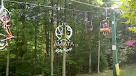
![Amiata Freeride Bike Resort]()
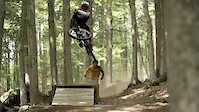
trail: 8volante High
2:12 |
248 |
Feb 18, 2019
4:04 |
2 |
Jun 1, 2026
0:11 |
3 |
May 26, 2026
trail: Serpentone basso
0:45 |
8 |
Apr 22, 2026
trail: Base Nato
11:41 |
16 |
Apr 12, 2026
trail: Frasnadello
0:27 |
9 |
Apr 8, 2026
National Scenic Trails & Official Routes
-
Trans-Altarezia Bike #32
- Mountain Bike
- E-Bike

Recent Comments
| username | type | title | comment | date |
|---|---|---|---|---|
| trail | What a gem! Very natural terrain. Great loam. | Jun 18, 2026 @ 1:18am 6 hours | ||
| trail | Not a real trail. Starting at the farm it is a... | Jun 17, 2026 @ 11:13pm 8 hours | ||
| trail | Ok trail, nothing special. | Jun 17, 2026 @ 8:49am 22 hours | ||
| trail | Long middle part which is not rideable. First... | Jun 17, 2026 @ 8:48am 22 hours | ||
| trail | Only short single trail sections. Overall it's... | Jun 17, 2026 @ 4:59am 1 day |
Bike & Skill Parks
| name | type | city | rating |
|---|---|---|---|
| Val di Sole Bike Land | bike park | Commezzadura | |
| Fassa Bike District | bike park | Canazei | |
| Dolomiti Paganella Bike | bike park | Andalo | |
| Bike Park Alta Langa | bike park | Rocchetta Belbo | |
| Pila Bikeland | bike park | Pila |
Upcoming Local Events
Activity Type Stats
| activitytype | trails | distance | descent | descent distance | total vertical | rating | global rank | state rank | photos | reports | routes | ridelogs |
|---|---|---|---|---|---|---|---|---|---|---|---|---|
| Mountain Bike | 32,947 | 37,118 miles | 2,575 miles | 20,184 miles | 11,171 ft | #4 | 49,708 | 270,126 | 2,158 | 2,340,107 | ||
| E-Bike | 26,925 | 30,643 miles | 2,048 miles | 16,395 miles | 11,171 ft | #3 | 3,116 | 250,076 | 1,139 | 460,421 | ||
| Gravel Bike | 2,034 | 3,215 miles | 485,728 ft | 1,055 miles | 10,906 ft | #5 | 92 | 18,776 | 188 | 30,080 | ||
| Adaptive Bike | 5,964 | 9,507 miles | 1,188,031 ft | 3,240 miles | 9,954 ft | #4 | 2 | 48,755 | 48 | 18 | ||
| Winter Fat Bike | 4,062 | 5,301 miles | 1,216,319 ft | 2,365 miles | 9,954 ft | #3 | 3 | 29,003 | 13 | 19 | ||
| Horse | 3,330 | 4,571 miles | 946,739 ft | 2,017 miles | 9,948 ft | #4 | 3 | 15,877 | 52 | 86 | ||
| Hike | 27,441 | 32,149 miles | 2,136 miles | 16,830 miles | 11,280 ft | #4 | 510 | 251,852 | 257 | 158,907 | ||
| Trail Running | 27,008 | 31,849 miles | 2,090 miles | 16,615 miles | 11,280 ft | #4 | 203 | 251,463 | 247 | 69,602 | ||
| Dirtbike/Moto | 1,429 | 1,803 miles | 357,264 ft | 805 miles | 9,826 ft | #5 | 10 | 13,735 | 15 | 199 | ||
| Observed Trials | 218 | 259 miles | 55,026 ft | 117 miles | 8,051 ft | #9 | 2 | 1,411 | 56 | |||
| ATV/ORV/OHV | 251 | 434 miles | 74,104 ft | 173 miles | 9,826 ft | #9 | 13,423 | 80 | ||||
| Snowmobile | 32 | 38 miles | 7,877 ft | 17 miles | 7,815 ft | #10 | 270 | 18 | ||||
| Snowshoe | 363 | 539 miles | 163,812 ft | 238 miles | 8,773 ft | #4 | 785 | 7 | 1,525 | |||
| Downhill Ski | 1,795 | 1,177 miles | 1,079,085 ft | 1,092 miles | 11,093 ft | #4 | 10 | 1,586 | 50,054 | |||
| Backcountry Ski | 336 | 545 miles | 191,542 ft | 248 miles | 11,926 ft | #3 | 560 | 4 | 22,107 | |||
| Nordic Ski | 133 | 224 miles | 46,299 ft | 98 miles | 8,740 ft | #4 | 426 | 2 | 10,226 |
Activities
- Italy Mountain Biking Trails
- Italy E-Biking Trails
- Italy Gravel Biking Trails
- Italy Adaptive Biking Trails
- Italy Winter Fat Biking Trails
- Italy Horseback Trails
- Italy Hiking Trails
- Italy Trail Running Trails
- Italy Dirtbiking Trails
- Italy Observed Trials Trails
- Italy ATVing/Offroading Trails
- Italy Snowmobiling Trails
- Italy Snowshoeing Trails
- Italy Skiing Trails
- Italy Backcountry Skiing Trails
- Italy Nordic Skiing Trails
Trails
Points of Interest
- By canadaka
 Trailforks & contributors
 - Admins: denitopia, marcoangeletti, cemoorelife
- #3223 - 283,650 views
- italy activity log | embed map of Italy mountain bike trails | italy mountain biking points of interest polygons
Downloading of trail gps tracks in kml & gpx formats is enabled for Italy.
You must login to download files.