close
-
Layers w
- Weather Layers
- Pro
- Pro
- Pro
- Pro
- Pro
- Pro
- More Layers
- Pro
- Pro
- Pro
- Pro
-
Upgrade to

3D
Trail Conditions
- Unknown
- Snow Groomed
- Snow Packed
- Snow Covered
- Snow Cover Partial
- Freeze/thaw Cycle
- Icy
- Prevalent Mud
- Wet
- Variable
- Ideal
- Dry
- Very Dry
Trail Flow (Ridden Direction)
Trailforks scans users ridelogs to determine the most popular direction each trail is ridden. A good flowing trail network will have most trails flowing in a single direction according to their intension.
The colour categories are based on what percentage of riders are riding a trail in its intended direction.
The colour categories are based on what percentage of riders are riding a trail in its intended direction.
- > 96%
- > 90%
- > 80%
- > 70%
- > 50%
- < 50%
- bi-directional trail
- no data
Trail Last Ridden
Trailforks scans ridelogs to determine the last time a trail was ridden.
- < 2 days
- < 1 week
- < 2 weeks
- < 1 month
- < 6 months
- > 6 months
Trail Ridden Direction
The intended direction a trail should be ridden.
- Downhill Only
- Downhill Primary
- Both Directions
- Uphill Primary
- Uphill Only
- One Direction
Contribute Details
Colors indicate trail is missing specified detail.
- Description
- Photos
- Description & Photos
- Videos
Trail Popularity ?
Trailforks scans ridelogs to determine which trails are ridden the most in the last 9 months.
Trails are compared with nearby trails in the same city region with a possible 25 colour shades.
Think of this as a heatmap, more rides = more kinetic energy = warmer colors.
- most popular
- popular
- less popular
- not popular
ATV/ORV/OHV Filter
Max Vehicle Width
inches
US Cell Coverage
Legend

Radar Time
Activity Recordings
Trailforks uses anonymized public activity data.
?
Activity Recordings
Trailforks uses anonymized public activity data.
?
Personal Heatmap
▶
Activity Types
all
/
none
▶
Options
2
Date range
month
–
Winter Trails
Warning
A routing network for winter maps does not exist. Selecting trails using the winter trails layer has been disabled.
Missing Trails
Most Popular
Least Popular
Trails are colored based on popularity. The more popular a trail is, the more red. Less popular trails trend towards green.
Jump Magnitude Heatmap
Heatmap of where riders jump on trails. Zoom in to see individual jumps, click circles to view jump details.
BC Backroad Status
![map legend]()
Service Road Atlas is a free to use, community-driven service for viewing and creating reports on the numerous back-country service roads around B.C. and Alberta.

Slope Aspect
Direction the slope faces
Trails Deemphasized
Trails are shown in grey.
Only show trails with no bike usage.
Suggested Layers
Based on selected activity type
Save the current map location and zoom level as your default home location whenever this page is loaded.
Save  |
Tenemos todo tipo de senderos, pero princiapalmente es zona de estratos, con lo que tenemos mucha piedra, bloque, hay pocos caminos tradicionales, pues hace años se talaron todos los arboles para pasto y se repobló, con lo que desaparecieron casi todos.
De reciente creacion el centro BTT Jaca Pirineos Bikeland está aún en fase de conclusión, de 12 rutas hay abiertas 8 y otras 4 en espera de actuaciones menores.
This region uses the Uk/Euro style trail grading system.
Activities Click to view
- Mountain Bike
1,064 trails
- E-Bike
1,151 trails
- Adaptive Bike
194 trails
- Winter Fat Bike
464 trails
- Horse
44 trails
- Hike
1,271 trails
- Trail Running
1,270 trails
- Dirtbike/Moto
8 trails
- Snowshoe
25 trails
- Downhill Ski
82 trails
- Backcountry Ski
61 trails
- Nordic Ski
6 trails
Region Details
- 431
- 38
- 398
- 164
- 29
Region Status
Open as of 2 daysStats
- Avg Trail Rating
- Trails (view details)
- 1,359
- Trails Mountain Bike
- 1,064
- Trails E-Bike
- 1,151
- Trails Gravel Bike
- 392
- Trails Adaptive Bike
- 194
- Trails Winter Fat Bike
- 464
- Trails Horse
- 44
- Trails Hike
- 1,271
- Trails Trail Running
- 1,270
- Trails Dirtbike/Moto
- 8
- Trails Snowshoe
- 25
- Trails Downhill Ski
- 82
- Trails Backcountry Ski
- 61
- Trails Nordic Ski
- 6
- Total Distance
- 1,620 miles
- Total Descent Distance
- 754 miles
- Total Descent
- 438,077 ft
- Total Vertical
- 7,744 ft
- Highest Trailhead
- 9,375 ft
- Reports
- 5,646
- Photos
- 1,699
- Ridden Counter
- 26,713
Sub Regions
-
Alto Aragón
- 2
- 30
- 20
- 9
-
Astún
- 1
-
Boalar
- 11
- 4
- 1
-
Caminos de Collarada
- 4
- 32
- 31
- 2
-
Candanchú
-
FiulleFlow
- 1
- 41
- 32
- 4
-
Jaca Pirineos Bikeland.- Centro MTB
- 8
- 47
- 15
-
Lizara
- 3
-
Monte Sesún
- 15
- 9
-
Rapitán
- 1
- 16
- 3
- 1
-
San Juan de la Peña
- 3
- 21
- 8
-
Santa Cilia de Jaca
- 3
- 49
- 14
-
Sierra de Santa Isabel
- 11
- 5
-
Valle de Aisa Trails
- 27
- 4
- 4
-
VallesOnBike
- 3
- 42
- 7
- 7
Popular Jaca Mountain Biking Trails
• 100 ★ 4.0 • 2,369 ft • 251 ft • 118 •
Sendero con un par de escalones rocosos con fuerte pendiente, se requiere cierta técnica para subir entero montado, acceso a varias sendas
• 95 ★ 4.6 • 2 miles • 8 ft • 112 •
Inicio de la bajada con fuerte pendiente que puede echar para atrás algunos, una vez hace el giro la pendiente se suaviza y empiza el flow variado con muchas curvas cerradas y un final más trabajado con algunos peraltes y saltos,...
• 100 ★ 4.0 • 436 ft • 32 ft • 110 •
Senda de subida por bosque de boj, hay que gestionar postura y fuerza en el pedaleo, con el paso entre arboles.
• 100 ★ 4.9 • 3,852 ft • 0 ft • 107 •
Buena bajada rápida de flow con algún salto y apoyos, drops naturales muy divertidos que discurre tramo medio y bajo por barranquera entre bojs. Una clásica. Estaría en el limite de Azul con Roja por varios pasos.
• 95 ★ 4.9 • 4,987 ft • 4 ft • 106 •
senda bastante rápida y buena con buen flow y varios pasos técnico de piedras y curvas cerradas. Cabe resaltar la llegada a la , con un drop natural de roca y paso técnico.
• 95 ★ 4.5 • 1,693 ft • 0 ft • 98 •
Popular red difficulty singletrack. This multi-use trail can be used downhill primary and has a hard overall physical rating with a 0 ft blue climb. It features drop, rock face, rock garden and wallride. Trail visibility is always easy to follow. On average it takes 3 minutes to complete this trail.
• 100 ★ 3.9 • 3,586 ft • 250 ft • 98 •
Doubletrack casi perdido, poco usado por vehículos, convertido en sendero
• 100 ★ 4.0 • 988 ft • 66 ft • 95 •
Senda de subida por bosque de boj, hay que gestionar postura y fuerza en el pedaleo, con el paso entre arboles.
Jaca Mountain Bike Routes
★ 5.0 • 13 miles • 3,891 ft • 5 •
350m d+ porteo, 150m d+ empujar. Ruta en la que subes por pista hasta el refugio de la Estapa y tras eso...
★ 5.0 • 9 miles • 2,202 ft • 8 • Loop •
REJECTED 15.2 km Distance 673 m Climb -675 m Descent 1.6 km High Point TIEMPO: 1H30MIN ASCENSO: 1H...
★ 5.0 • 20 miles • 3,383 ft • 11 • Loop •
Ruta circular de BTT que sale desde Jaca y recorre los valles del Lubierre y del Aragón, llevándonos...
★ 5.0 • 19 miles • 3,989 ft • 13 • Loop •
Ruta de BTT circular desde Jaca que discurre por el norte de Jaca y las dos vertientes del río Aragón,...
★ 4.4 • 11 miles • 2,993 ft • 13 • Loop •
Ruta circular que sale del pueblo de Barós, a unos 3km de Jaca, por lo que podrás realizarla también...
★ 3.5 • 15 miles • 2,408 ft • 11 • Loop •
Ruta de BTT circular desde Jaca que recorre el monte Rapitán y posteriormente nos lleva hasta el pueblo...
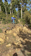
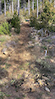
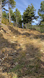
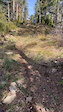
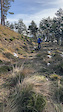
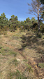
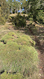
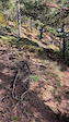
Photos of Jaca Mountain Bike
Videos of Jaca Mountain Bike
trail: La Contienda Inferior
0:56 |
9 |
Jan 19, 2025
trail: La Contienda Inferior
0:17 |
1 |
Jan 19, 2025
trail: La Contienda Inferior
0:20 |
1 |
Jan 19, 2025
trail: La Contienda Inferior
0:28 |
3 |
Jan 19, 2025
trail: La Contienda Inferior
0:08 |
1 |
Jan 19, 2025
trail: La Contienda Superior
0:33 |
11 |
Jan 19, 2025
trail: La Contienda Superior
0:29 |
7 |
Jan 19, 2025
trail: La Contienda Superior
0:18 |
4 |
Jan 19, 2025
Current Trail Warnings
| status | trail | date | condition | user | info |
|---|---|---|---|---|---|
| Barranco de Ena-Peiró | Jun 16, 2026 @ 5:09pm (Europe/Madrid) 2 days | Unknown | Crisjaca | Pista muy perdida, se desconoce... | |
| Barranco de Organiso | Jun 16, 2026 @ 5:07pm (Europe/Madrid) 2 days | Very Dry | Crisjaca | Sin trazada clara, muy perdido, solo Hike | |
| Barranco de Ordaniso | Jun 16, 2026 @ 5:06pm (Europe/Madrid) 2 days | Very Dry | Crisjaca | Sin trazada clara, solo para hike, en... |
Recent Trail Reports
| status | trail | date | condition | info | user |
|---|---|---|---|---|---|
| Alternativa Barranco Triste | Jun 16, 2026 @ 8:38pm (Europe/Madrid) 2 days | Very Dry | Crisjaca | ||
| Organiso | Jun 16, 2026 @ 5:08pm (Europe/Madrid) 2 days | Very Dry | Crisjaca | ||
| El Charrampan | Jun 16, 2026 @ 5:04pm (Europe/Madrid) 2 days | Very Dry | Crisjaca | ||
| Barranco Triste | Jun 16, 2026 @ 4:39pm (Europe/Madrid) 2 days | Very Dry | Crisjaca | ||
| Paloto Integral Inferior | Jun 15, 2026 @ 9:17am (Europe/Andorra) Jun 15, 2026 | Very Dry | PatriEH | ||
| Paloto Integral Intermedia | Jun 15, 2026 @ 9:17am (Europe/Andorra) Jun 15, 2026 | Very Dry | PatriEH | ||
| Garacha del Olmo Superior | Jun 15, 2026 @ 9:17am (Europe/Andorra) Jun 15, 2026 | Very Dry | PatriEH | ||
| Garacha del Olmo Inferior | Jun 15, 2026 @ 9:17am (Europe/Andorra) Jun 15, 2026 | Very Dry | PatriEH | ||
| Las Labratas | Jun 15, 2026 @ 9:17am (Europe/Andorra) Jun 15, 2026 | Very Dry | PatriEH | ||
| Fuente Baros | Jun 15, 2026 @ 9:17am (Europe/Andorra) Jun 15, 2026 | Very Dry | PatriEH |
National Scenic Trails & Official Routes
-
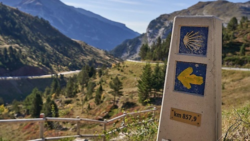
GR 65.3 Camino Francés por Aragón
- Mountain Bike
- E-Bike
- Horse
- Hike
- Trail Running
Activity Feed
| username | action | type | title | date |
|---|---|---|---|---|
| Gonzajaca | comment | report | activity #97195998 | Jun 17, 2026 @ 10:53am 17 hours |
| Crisjaca | vote | trail | activity #97165599 | Jun 16, 2026 @ 11:49pm 1 day |
| Crisjaca | ridden | trail | activity #97165597 | Jun 16, 2026 @ 11:49pm 1 day |
| Crisjaca | add | photo | activity #97165565 and 9 more | Jun 16, 2026 @ 11:48pm 1 day |
| Crisjaca | add | trail | activity #97164078 and 1 more | Jun 16, 2026 @ 10:54pm 1 day |
Recent Comments
| username | type | title | comment | date |
|---|---|---|---|---|
| report | hola , la han arreglado? | Jun 17, 2026 @ 10:53am 17 hours | ||
| trail | La subida hasta el primer desvío, con... | Jun 15, 2026 @ 3:07am Jun 15, 2026 | ||
| trail | se está complicando mucho este sendero, el... | Jun 15, 2026 @ 2:12am Jun 15, 2026 | ||
| trail | En las fotos se ve llanito y fácil, pero de... | Jun 15, 2026 @ 2:02am Jun 15, 2026 | ||
| trail | Uffff. te piensas que empiezas y que es todo... | Jun 12, 2026 @ 9:41am Jun 12, 2026 |
Local Badges
-

Completionist0 awarded -
Completionist0 awarded -
Completionist0 awarded -
Completionist0 awarded -
Completionist0 awarded -
Completionist0 awarded
Bike & Skill Parks
| name | type | city | rating |
|---|---|---|---|
| Pump Track Villanúa | skill park | Jaca | |
| Skatepark Jaca | skill park | Jaca | |
| Circuito BTT Jaca | skill park | Jaca |
Local Products
Activity Type Stats
| activitytype | trails | distance | descent | descent distance | total vertical | rating | global rank | state rank | photos | reports | routes | ridelogs |
|---|---|---|---|---|---|---|---|---|---|---|---|---|
| Mountain Bike | 1,064 | 1,239 miles | 316,348 ft | 618 miles | 6,073 ft | #75 | #11 | 1,566 | 5,632 | 48 | 6,517 | |
| E-Bike | 1,151 | 1,389 miles | 345,876 ft | 658 miles | 7,733 ft | #10 | #11 | 50 | 5,566 | 47 | 1,676 | |
| Gravel Bike | 392 | 642 miles | 76,460 ft | 241 miles | 7,290 ft | #1,058 | #14 | 123 | 30 | |||
| Adaptive Bike | 194 | 387 miles | 44,938 ft | 157 miles | 5,607 ft | #97 | #90 | 809 | ||||
| Winter Fat Bike | 464 | 559 miles | 129,964 ft | 283 miles | 5,515 ft | #83 | #13 | 83 | 1 | |||
| Horse | 44 | 49 miles | 13,307 ft | 25 miles | 3,553 ft | #234 | #18 | 307 | 1 | |||
| Hike | 1,271 | 1,535 miles | 391,991 ft | 711 miles | 7,733 ft | #5 | #5 | 68 | 5,608 | 31 | 1,419 | |
| Trail Running | 1,270 | 1,535 miles | 391,991 ft | 711 miles | 7,733 ft | #5 | #5 | 5,621 | 30 | 2,119 | ||
| Dirtbike/Moto | 8 | 12 miles | 1,490 ft | 6 miles | 1,631 ft | #251 | #8 | 272 | 1 | |||
| Snowshoe | 25 | 29 miles | 9,820 ft | 11 miles | 4,364 ft | #112 | #2 | 35 | 1 | 13 | ||
| Downhill Ski | 82 | 44 miles | 35,397 ft | 31 miles | 3,757 ft | #105 | #2 | 11 | 1 | 872 | ||
| Backcountry Ski | 61 | 94 miles | 34,144 ft | 36 miles | 6,168 ft | #22 | #1 | 10 | 5 | 901 | ||
| Nordic Ski | 6 | 8 miles | 2,329 ft | 4 miles | 1,988 ft | #242 | #4 | 21 | 1 | 56 |
Frequently Asked Questions About Jaca
▼
What are the best places to ride in Jaca?
Jaca has 16 areas to explore for mountain biking. The top rated areas are:
▼
What are the highest rated mountain biking trails in Jaca?
The highest rated mountain biking trails in Jaca are:
- Integral Boalar Superior (4.5/5)
- Torre del Moro (4.5/5)
- El Fabar (4.4/5)
- La Raca (4.4/5)
- Bacún-Punta La Selva Inferior (4.4/5)
▼
What is the best time of the year to ride in Jaca?
Based on ride log data, the most popular months to ride in Jaca are:
- August (63 activities)
- July (60 activities)
- October (41 activities)
▼
Where can I park to ride in Jaca?
There are 26 parking locations listed in Jaca. The most popular parking spots are: View all parking and trailhead locations on the map to plan your visit.
Activities
Trails
Points of Interest
- Refugio de Gabardito Lodge
- Refugio Utilizable Cabin
- Refugio de las Foyas - Acherito Cabin
- Refugio Borda las Bacias Cabin
- [ref. ng] de la Cueva Lizara Cabin
- Refugio de Oldecua Cabin
- Refugio de Vernera Cabin
- Refugio de Fetás Cabin
- Refugio del Foraton Cabin
- [ref. ng} de Plan d\'Aniz (Dios te salve) Cabin
- Pala de Ip (2,735 m)
- Collaradeta (2,716 m)
- El Fraile (2,678 m)
- By ToniMTB
 & contributors
 - Admins: juanx, Kalamarrrrrdo
- #31787 - 15,084 views
- jaca activity log | embed map of Jaca mountain bike trails | jaca mountain biking points of interest polygons
Downloading of trail gps tracks in kml & gpx formats is enabled for Jaca.
You must login to download files.