close
-
Layers w
- Weather Layers
- Pro
- Pro
- Pro
- Pro
- Pro
- Pro
- More Layers
- Pro
- Pro
- Pro
- Pro
-
Upgrade to

3D
Trail Conditions
- Unknown
- Snow Groomed
- Snow Packed
- Snow Covered
- Snow Cover Partial
- Freeze/thaw Cycle
- Icy
- Prevalent Mud
- Wet
- Variable
- Ideal
- Dry
- Very Dry
Trail Flow (Ridden Direction)
Trailforks scans users ridelogs to determine the most popular direction each trail is ridden. A good flowing trail network will have most trails flowing in a single direction according to their intension.
The colour categories are based on what percentage of riders are riding a trail in its intended direction.
The colour categories are based on what percentage of riders are riding a trail in its intended direction.
- > 96%
- > 90%
- > 80%
- > 70%
- > 50%
- < 50%
- bi-directional trail
- no data
Trail Last Ridden
Trailforks scans ridelogs to determine the last time a trail was ridden.
- < 2 days
- < 1 week
- < 2 weeks
- < 1 month
- < 6 months
- > 6 months
Trail Ridden Direction
The intended direction a trail should be ridden.
- Downhill Only
- Downhill Primary
- Both Directions
- Uphill Primary
- Uphill Only
- One Direction
Contribute Details
Colors indicate trail is missing specified detail.
- Description
- Photos
- Description & Photos
- Videos
Trail Popularity ?
Trailforks scans ridelogs to determine which trails are ridden the most in the last 9 months.
Trails are compared with nearby trails in the same city region with a possible 25 colour shades.
Think of this as a heatmap, more rides = more kinetic energy = warmer colors.
- most popular
- popular
- less popular
- not popular
ATV/ORV/OHV Filter
Max Vehicle Width
inches
US Cell Coverage
Legend

Radar Time
Activity Recordings
Trailforks uses anonymized public activity data.
?
Activity Recordings
Trailforks uses anonymized public activity data.
?
Personal Heatmap
▶
Activity Types
all
/
none
▶
Options
2
Date range
month
–
Winter Trails
Warning
A routing network for winter maps does not exist. Selecting trails using the winter trails layer has been disabled.
Missing Trails
Most Popular
Least Popular
Trails are colored based on popularity. The more popular a trail is, the more red. Less popular trails trend towards green.
Jump Magnitude Heatmap
Heatmap of where riders jump on trails. Zoom in to see individual jumps, click circles to view jump details.
BC Backroad Status
![map legend]()
Service Road Atlas is a free to use, community-driven service for viewing and creating reports on the numerous back-country service roads around B.C. and Alberta.

Slope Aspect
Direction the slope faces
Trails Deemphasized
Trails are shown in grey.
Only show trails with no bike usage.
Suggested Layers
Based on selected activity type
Save the current map location and zoom level as your default home location whenever this page is loaded.
Save
No description for Jackson has been added yet!
Login or register to submit one.

IMBA Ride Center
Teton Region
Activities Click to view
- Mountain Bike
106 trails
- E-Bike
22 trails
- Gravel Bike
12 trails
- Adaptive Bike
3 trails
- Horse
108 trails
- Hike
161 trails
- Trail Running
159 trails
- Dirtbike/Moto
8 trails
- Snowshoe
18 trails
- Downhill Ski
45 trails
- Nordic Ski
21 trails
Region Details
- 20
- 12
- 50
- 23
- 1
Region Status
Open as of 9 hoursStats
- Avg Trail Rating
- Trails (view details)
- 226
- Trails Mountain Bike
- 106
- Trails E-Bike
- 22
- Trails Gravel Bike
- 12
- Trails Adaptive Bike
- 3
- Trails Horse
- 108
- Trails Hike
- 161
- Trails Trail Running
- 159
- Trails Dirtbike/Moto
- 8
- Trails Snowshoe
- 18
- Trails Downhill Ski
- 45
- Trails Nordic Ski
- 21
- Total Distance
- 466 miles
- Total Descent
- 74,854 ft
- Total Vertical
- 5,433 ft
- Highest Trailhead
- 11,219 ft
- Reports
- 310
- Photos
- 163
- Ridden Counter
- 19,924
Articles
The 12 Most Stunning Trails in the U.S.
May 29, 2025 from outsideonline.com
In celebration of National Trails Day, discover some of the best hikes in the U.S.—from slot canyons to grasslands, waterfalls, and secluded...
Sub Regions
-
High School Butte
-
Hoback
- 8
- 18
-
Munger Mountain
- 1
- 7
- 1
-
Snow King Mountain
- 10
- 27
- 5
Popular Jackson Mountain Biking Trails
• 95 ★ 4.2 • 3 miles • 936 ft • 616 •
The trail follows the north side of the Cache Creek drainage from the Nelson Dr. trailhead to the end of the trail. It is a rolling singletrack that is often linked with the trail for a fun loop. It can be accessed from the Nelson Dr....
• 100 ★ 3.5 • 1 mile • 363 ft • 582 •
The Trail follows several benches on the north side of and mirrors the Trail on the south side of the creek. The 2 trails for a great cross country loop. The trail begins at the Nelson Dr. Trailhead and climbs past 4 connector trails...
• 90 ★ 3.8 • 2 miles • 64 ft • 562 •
The Trail above the old trailhead at the Gauging Station become a doubletrack and fades to singletrack. The section from the Gauging Station to is easy and becomes slightly harder above that as you approach the Wilderness boundary. It...
• 80 ★ 3.4 • 3 miles • 312 ft • 432 •
West climbs from up over the saddle to the junction with the Trail. It has become more popular since bridges were built over all the creek crossings in 2013, but still has a wild remote feel to it.
• 100 ★ 3.0 • 753 ft • 30 ft • 337 •
This trail connects the Trail to the Road and the . It can be used to avoid the stairs located between Bridge 2 and 3 on the Trail.
Jackson Mountain Bike Routes
★ 4.0 • 15 miles • 2,344 ft • 6 • Loop •
Great loop, plenty of fun and flowy descents. Climbing can be long (approx 30 minutes or less) but worth it.
16 miles • 2,102 ft • 2 • Loop •
A loop starting from Wheel Wranglers, summiting near Snow King, and then a long flow back before finishing...
20 miles • 3,141 ft • 4 • Point to Point •
An off the radar, backcountry route in the shadow of the Tetons. Ride begins with a road climb to Ditch...
6 miles • 865 ft • 4 • Race •
This is the new (2026) www.trailforks.com/trails/cache-creek-trail/]Cache Creek[/L] Race, short course.
16 miles • 2,669 ft • 4 • Race •
This is the 2026 www.trailforks.com/trails/cache-creek-trail/]Cache Creek[/L] Race Long Course, sponsored...
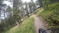
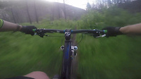
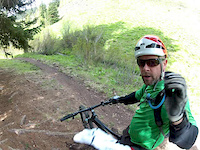
Photos of Jackson Mountain Bike
Videos of Jackson Mountain Bike
trail: Sink or Swim
4:16 |
420 |
Sep 7, 2015
trail: Wilson Canyon
2:46 |
857 |
Sep 7, 2015
trail: Game Creek Trail
4:10 |
131 |
Jun 12, 2015
Recent Trail Reports
| status | trail | date | condition | info | user |
|---|---|---|---|---|---|
| Ferrins | Jun 28, 2026 @ 6:38pm (America/Denver) 9 hours | Ideal | Rwilich MRR | ||
| West Game Creek | May 19, 2026 @ 8:18am (America/Denver) May 19, 2026 | Ideal | Rwilich MRR | ||
| Wilson Canyon | May 14, 2026 @ 7:43am (America/Denver) May 14, 2026 | Unknown | brookscurran | ||
| Skyline | May 14, 2026 @ 6:55am (America/Denver) May 14, 2026 | Variable | Rwilich MRR | ||
| Hagen | May 4, 2026 @ 11:57am (America/Vancouver) May 4, 2026 | Prevalent Mud | mtbrider24 | ||
| Putt Putt | Apr 18, 2026 @ 5:23pm (America/Denver) Apr 18, 2026 | Variable | 4hMhyG4a | ||
| Beaver Ponds Loop | Apr 13, 2026 @ 11:16am (America/Denver) Apr 13, 2026 | Variable | awaite | ||
| Game Creek | Apr 13, 2026 @ 11:14am (America/Denver) Apr 13, 2026 | Variable | awaite | ||
| Game Creek Trail | Apr 12, 2026 @ 11:45am (America/Boise) Apr 12, 2026 | Variable | awaite | ||
| Game Creek Road | Apr 12, 2026 @ 11:45am (America/Boise) Apr 12, 2026 | Ideal | awaite |
Activity Feed
| username | action | type | title | date |
|---|---|---|---|---|
| Rwilich | add | report | activity #98036645 | Jun 28, 2026 @ 5:38pm 9 hours |
| sonjaco | wishlist | route | activity #97534818 | Jun 21, 2026 @ 5:54pm Jun 21, 2026 |
| xlnRAw | ridden | trail | activity #97316822 | Jun 19, 2026 @ 7:43am Jun 19, 2026 |
| HalBwxQz | add | route | activity #97102117 and 1 more | Jun 16, 2026 @ 5:28am Jun 16, 2026 |
| MTbucket | ridden | trail | activity #97068677 | Jun 15, 2026 @ 3:22pm Jun 15, 2026 |
Recent Comments
| username | type | title | comment | date |
|---|---|---|---|---|
| trail | Rode up the south way from fall creek... | Aug 11, 2025 @ 8:55pm Aug 11, 2025 | ||
| trail | Some parts a bit overgrown near the top. Wear... | Jul 13, 2025 @ 9:14pm Jul 13, 2025 | ||
| trail | Broken bridge early in the descent in rock... | Jul 3, 2025 @ 8:13pm Jul 3, 2025 | ||
| report | Bridge is broken on lower rock cr. | Jun 29, 2025 @ 5:11pm Jun 29, 2025 | ||
| report | Bridge on lower rock cr is broken | Jun 29, 2025 @ 5:09pm Jun 29, 2025 |
Local Badges
-

10 Black Trails22 awarded -

Epic Ride 50k898 awarded -

Top 10 Trails0 awarded -

Completionist0 awarded -

Big Ride 30k2,234 awarded -
Completionist0 awarded
Bike & Skill Parks
| name | type | city | rating |
|---|---|---|---|
| Blair Dr. Kids Pump Park | skill park | Jackson |
Upcoming Local Events
Local Mountain Biking Directory
-
Teton FreeRiders
![Teton FreeRiders]()
-
Friends of Pathways
![Friends of Pathways]()
-
The Hub Bicycles - Jackson
![The Hub Bicycles - Jackson]()
-
Hoback Sports
![Hoback Sports]() Bike Shop
Bike Shop
-
Fitzgerald's Bicycles - Jackson
![Fitzgerald's Bicycles - Jackson]() Bike Shop
Bike Shop
-
Hoff's Bikesmith
![Hoff's Bikesmith]() Bike Shop
Bike Shop
Local Products
Local Mountain Biking Directory
-
Teton FreeRiders
![Teton FreeRiders]()
-
Friends of Pathways
![Friends of Pathways]()
-
The Hub Bicycles - Jackson
![The Hub Bicycles - Jackson]()
-
Hoback SportsBike Shop
![Hoback Sports]()
-
Fitzgerald's Bicycles - JacksonBike Shop
![Fitzgerald's Bicycles - Jackson]()
-
Hoff's BikesmithBike Shop
![Hoff's Bikesmith]()
Local Products
Activity Type Stats
| activitytype | trails | distance | descent | descent distance | total vertical | rating | global rank | state rank | photos | reports | routes | ridelogs |
|---|---|---|---|---|---|---|---|---|---|---|---|---|
| Mountain Bike | 106 | 258 miles | 40,217 ft | 99 miles | 4,216 ft | #872 | #345 | 141 | 308 | 7 | 16,925 | |
| E-Bike | 22 | 51 miles | 6,765 ft | 24 miles | 2,425 ft | #2,965 | #1,110 | 239 | 1 | 319 | ||
| Gravel Bike | 12 | 40 miles | 1,204 ft | 17 miles | 1,955 ft | #336 | #929 | 22 | 95 | |||
| Adaptive Bike | 3 | 2 miles | 36 ft | 3,077 ft | 1,850 ft | #458 | #1,764 | 1 | 1 | |||
| Horse | 108 | 372 miles | 54,409 ft | 130 miles | 5,433 ft | #38 | #329 | 108 | 8 | |||
| Hike | 161 | 441 miles | 63,497 ft | 155 miles | 5,433 ft | #221 | #113 | 20 | 308 | 3,866 | ||
| Trail Running | 159 | 440 miles | 63,497 ft | 155 miles | 5,433 ft | #228 | #97 | 308 | 2,664 | |||
| Dirtbike/Moto | 8 | 19 miles | 4,528 ft | 9 miles | 2,037 ft | #852 | #310 | 4 | 47 | 1 | 20 | |
| Snowshoe | 18 | 13 miles | 1,266 ft | 4 miles | 955 ft | #842 | #393 | 6 | 6 | |||
| Downhill Ski | 45 | 12 miles | 10,082 ft | 11 miles | 1,594 ft | #355 | #138 | 468 | ||||
| Nordic Ski | 21 | 14 miles | 1,273 ft | 4 miles | 1,188 ft | #677 | #239 | 8 | 627 |
Frequently Asked Questions About Jackson
▼
What are the best places to ride in Jackson?
Jackson has 8 areas to explore for mountain biking. The top rated areas are:
▼
What are the highest rated mountain biking trails in Jackson?
The highest rated mountain biking trails in Jackson are:
- Josie's Ridge (4.1/5)
- Ferrins (4.1/5)
- Putt Putt (4.1/5)
- Game Creek (4/5)
- Wally World (3.9/5)
▼
What is the best time of the year to ride in Jackson?
Based on ride log data, the most popular months to ride in Jackson are:
- July (407 activities)
- June (258 activities)
- August (223 activities)
▼
Where can I park to ride in Jackson?
There are 26 parking locations listed in Jackson. The most popular parking spots are: View all parking and trailhead locations on the map to plan your visit.
Activities
Trails
- By todd
 Trailforks & contributors
 - Admins: MBT, MBT, TFR
- #7148 - 15,793 views
- jackson activity log | embed map of Jackson mountain bike trails | jackson mountain biking points of interest polygons
Downloading of trail gps tracks in kml & gpx formats is enabled for Jackson.
You must login to download files.