close
-
Layers w
- Weather Layers
- Pro
- Pro
- Pro
- Pro
- Pro
- Pro
- More Layers
- Pro
- Pro
- Pro
- Pro
-
Upgrade to

3D
Trail Conditions
- Unknown
- Snow Groomed
- Snow Packed
- Snow Covered
- Snow Cover Partial
- Freeze/thaw Cycle
- Icy
- Prevalent Mud
- Wet
- Variable
- Ideal
- Dry
- Very Dry
Trail Flow (Ridden Direction)
Trailforks scans users ridelogs to determine the most popular direction each trail is ridden. A good flowing trail network will have most trails flowing in a single direction according to their intension.
The colour categories are based on what percentage of riders are riding a trail in its intended direction.
The colour categories are based on what percentage of riders are riding a trail in its intended direction.
- > 96%
- > 90%
- > 80%
- > 70%
- > 50%
- < 50%
- bi-directional trail
- no data
Trail Last Ridden
Trailforks scans ridelogs to determine the last time a trail was ridden.
- < 2 days
- < 1 week
- < 2 weeks
- < 1 month
- < 6 months
- > 6 months
Trail Ridden Direction
The intended direction a trail should be ridden.
- Downhill Only
- Downhill Primary
- Both Directions
- Uphill Primary
- Uphill Only
- One Direction
Contribute Details
Colors indicate trail is missing specified detail.
- Description
- Photos
- Description & Photos
- Videos
Trail Popularity ?
Trailforks scans ridelogs to determine which trails are ridden the most in the last 9 months.
Trails are compared with nearby trails in the same city region with a possible 25 colour shades.
Think of this as a heatmap, more rides = more kinetic energy = warmer colors.
- most popular
- popular
- less popular
- not popular
ATV/ORV/OHV Filter
Max Vehicle Width
inches
US Cell Coverage
Legend

Radar Time
Activity Recordings
Trailforks uses anonymized public activity data.
?
Activity Recordings
Trailforks uses anonymized public activity data.
?
Personal Heatmap
▶
Activity Types
all
/
none
▶
Options
2
Date range
month
–
Winter Trails
Warning
A routing network for winter maps does not exist. Selecting trails using the winter trails layer has been disabled.
Missing Trails
Most Popular
Least Popular
Trails are colored based on popularity. The more popular a trail is, the more red. Less popular trails trend towards green.
Jump Magnitude Heatmap
Heatmap of where riders jump on trails. Zoom in to see individual jumps, click circles to view jump details.
BC Backroad Status
![map legend]()
Service Road Atlas is a free to use, community-driven service for viewing and creating reports on the numerous back-country service roads around B.C. and Alberta.

Slope Aspect
Direction the slope faces
Trails Deemphasized
Trails are shown in grey.
Only show trails with no bike usage.
Suggested Layers
Based on selected activity type
Save the current map location and zoom level as your default home location whenever this page is loaded.
SavePopular Trail Networks
view all areas »
No description for Jacksonville has been added yet!
Login or register to submit one.
Activities Click to view
- Mountain Bike
89 trails
- E-Bike
36 trails
- Gravel Bike
6 trails
- Adaptive Bike
2 trails
- Winter Fat Bike
24 trails
- Horse
9 trails
- Hike
141 trails
- Trail Running
141 trails
Region Details
- 11
- 1
- 35
- 32
- 8
- 2
Region Status
Open as of 16 hoursStats
- Avg Trail Rating
- Trails (view details)
- 157
- Trails Mountain Bike
- 89
- Trails E-Bike
- 36
- Trails Gravel Bike
- 6
- Trails Adaptive Bike
- 2
- Trails Winter Fat Bike
- 24
- Trails Horse
- 9
- Trails Hike
- 141
- Trails Trail Running
- 141
- Total Distance
- 127 miles
- Total Descent
- 2,383 ft
- Total Vertical
- 115 ft
- Highest Trailhead
- 115 ft
- Reports
- 845
- Photos
- 137
- Ridden Counter
- 14,434
Sub Regions
-
Beach & Peach Urban Bike Park
- 1
-
Big Talbot Island State Park
- 3
-
Bulls Bay Preserve
- 4
-
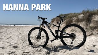
Hanna Park
- 1
- 3
- 2
- 4
-
Jennings State Forest
-
Julington-Durbin Creek Preserve
- 4
-
Little Talbot Island State Park
-
Losco Regional Park
- 6
-
RiverTown Trails
- 2
-
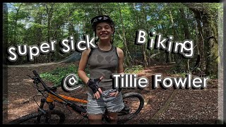
Tillie Fowler Regional Park
- 7
- 9
- 2
-
Trek Trails at Aterro Park
- 9
- 14
- 2
- 2
Popular Jacksonville Mountain Biking Trails
• 95 ★ 3.8 • 4 miles • 5 ft • 555 •
This trail is a fairly mellow, slightly technical singletrack trail. It is directional and thus riding direction changes from clockwise to counterclockwise depending on the day of the week. There are some roots and bridges to negotiate...
• 80 ★ 3.2 • 3 miles • 2 ft • 458 •
is for those who love to test their slow speed balance and technical skills. As the hardest route in Hanna Park, you'll have the book thrown at you. Tight, twisty sections of singletrack mixed in with quick, punch climbs and...
• 80 ★ 1.0 • 1,683 ft • 0 ft • 419 •
Popular green difficulty singletrack. This multi-use trail can be used both directions and has a easy overall physical rating with a 0 ft green climb. On average it takes 2 minutes to complete this trail.
• 80 ★ 0.0 • 2,106 ft • 17 ft • 414 •
Popular green difficulty singletrack. This multi-use trail can be used both directions and has a easy overall physical rating with a 17 ft green climb. On average it takes 1 minutes to complete this trail.
• 90 ★ 1.0 • 1,053 ft • 0 ft • 395 •
Popular green difficulty singletrack. This mountain bike primary trail can be used both directions and has a easy overall physical rating with a 0 ft green climb. On average it takes minutes to complete this trail.
• 65 ★ 3.7 • 3 miles • 5 ft • 378 •
Some fun, fast and flowy sections. Definitely prefer this and the trail to the Z trail, which has very few fast sections to let it rip. This is a singletrack trail that has a few bridges and lots of roots for a rider to negotiate. The...
• 70 ★ 3.4 • 1 mile • 10 ft • 317 •
Great park to go ride with close access to town. This trail is the main loop that navigates the park and takes you to other little loops that increase in difficulty. This trail is mostly flat and pretty smooth and winds tightly through...
• 65 ★ 3.2 • 1,558 ft • 2 ft • 316 •
This is the best trail in the park. It gets a bit more difficult on the trail, but their are woodwork features that make this really fun. Some steep drops that you can easily OTB if not careful. This is a dirt, singletrack trail that is...
Jacksonville Mountain Bike Routes
549 miles • 6,437 ft • 2 • Point to Point •
A 550-mile journey across Northern Florida from the Atlantic Coast to the Alabama state line, mostly...
Test Route Featured
3 miles • 243 ft • 15 • Loop • Race •
• 18 miles • 28 ft • 8 •
• 4 miles • 7 ft • 7 •
• 17 miles • 10 ft • 9 •
• 4 miles • 10 ft • 18 •
Photos of Jacksonville Mountain Bike
Videos of Jacksonville Mountain Bike
trail: Z Trail
0:05 |
1132 |
Feb 1, 2021
7:16 |
78 |
May 4, 2025
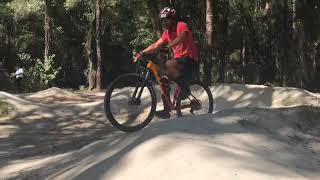
trail: Progressive Jump Line
7:19 |
332 |
Jul 14, 2024 , Jacksonville
2:38 |
247 |
Nov 28, 2021
2:09 |
311 |
Nov 28, 2021
trail: WKC Trail
7:34 |
610 |
Mar 7, 2020 , Jacksonville
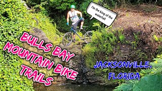
trail: Waterfall Loop
13:50 |
1804 |
Nov 21, 2019 , Jacksonville

trail: Hoosker Doo
8:07 |
2629 |
Feb 13, 2018 , Jacksonville
Current Trail Warnings
| status | trail | date | condition | user | info |
|---|---|---|---|---|---|
| E-Line Loop | Jun 21, 2026 @ 10:47am (America/Nassau) 16 hours | Variable | reddiver27 | E-Bike LARGE TREE DOWN A roughly 6ft by 2ft... |
Recent Trail Reports
| status | trail | date | condition | info | user |
|---|---|---|---|---|---|
| Westside Regional Park Road | Jun 10, 2026 @ 9:32am (America/New_York) Jun 10, 2026 | Ideal | vlisiecki | ||
| Nipsy Daiser | Jun 10, 2026 @ 9:32am (America/New_York) Jun 10, 2026 | Ideal | vlisiecki | ||
| Skills Area | Jun 10, 2026 @ 9:32am (America/New_York) Jun 10, 2026 | Ideal | vlisiecki | ||
| WKC Trail | Jun 10, 2026 @ 9:32am (America/New_York) Jun 10, 2026 | Ideal | vlisiecki | ||
| Access Road | May 22, 2026 @ 3:08pm (America/New_York) May 22, 2026 | Ideal | WillieJacobsz Trailforks | ||
| Xanadu | May 22, 2026 @ 2:55pm (America/New_York) May 22, 2026 | Ideal | WillieJacobsz Trailforks | ||
| Up Chuck | May 22, 2026 @ 2:55pm (America/New_York) May 22, 2026 | Ideal | WillieJacobsz Trailforks | ||
| Trek Trails Entrance | May 22, 2026 @ 2:55pm (America/New_York) May 22, 2026 | Ideal | WillieJacobsz Trailforks | ||
| Top Gun | May 22, 2026 @ 2:55pm (America/New_York) May 22, 2026 | Ideal | WillieJacobsz Trailforks | ||
| The Transition | May 22, 2026 @ 2:55pm (America/New_York) May 22, 2026 | Ideal | WillieJacobsz Trailforks |
Activity Feed
| username | action | type | title | date |
|---|---|---|---|---|
| reddiver27 | add | report | activity #97521143 | Jun 21, 2026 @ 2:29pm 9 hours |
| bikinbabylon | wishlist | region | activity #97189701 | Jun 17, 2026 @ 9:28am Jun 17, 2026 |
| bikinbabylon | wishlist | region | activity #97189328 | Jun 17, 2026 @ 9:22am Jun 17, 2026 |
| vlisiecki | add | report | activity #96696489 and 3 more | Jun 10, 2026 @ 2:33pm Jun 10, 2026 |
| sandymacjr | update | region | activity #96176684 | Jun 3, 2026 @ 1:12pm Jun 3, 2026 |
Recent Comments
| username | type | title | comment | date |
|---|---|---|---|---|
| report | It’s in the plan to take care of this, until... | Apr 15, 2026 @ 6:26pm Apr 15, 2026 | ||
| trail | any idea the parking fee? | Jan 2, 2026 @ 10:45am Jan 2, 2026 | ||
| trail | Big flow ..nice jumps ..roll | Apr 1, 2025 @ 4:27am Apr 1, 2025 | ||
| trail | Nice trail with a good flow you can get a lot... | Apr 1, 2025 @ 4:27am Apr 1, 2025 | ||
| trail | Rode yesterday with my daughter. Lots of... | Dec 28, 2024 @ 4:19am Dec 28, 2024 |
Local Badges
-

10 Green Trails196 awarded -

Epic Ride Climb 2k0 awarded -

Climbing 10k Badge17 awarded -

Climbing 100k Badge0 awarded -

Epic Ride Descent 2k0 awarded -

Descent 10k Badge18 awarded
Bike & Skill Parks
| name | type | city | rating |
|---|---|---|---|
| The Beach N Peach Urban Bike Park | skill park | Jacksonville | |
| WW Ranch | skill park | Jacksonville |
Local Mountain Biking Directory
-
SORBA Jax
![SORBA Jax]()
-
Velofix Jacksonville
-
ZenCog
![ZenCog]()
-
Champion CyclingBike Shop
-
Bicycles Etc - Phillips HwyBike Shop
-
Bicycles Etc - Beach BlvdBike Shop
Activity Type Stats
| activitytype | trails | distance | descent | descent distance | total vertical | rating | global rank | state rank | photos | reports | routes | ridelogs |
|---|---|---|---|---|---|---|---|---|---|---|---|---|
| Mountain Bike | 89 | 67 miles | 1,037 ft | 13 miles | 92 ft | #954 | #377 | 132 | 845 | 2 | 27,515 | |
| E-Bike | 36 | 20 miles | 699 ft | 5 miles | 92 ft | #3,249 | #1,168 | 744 | 849 | |||
| Gravel Bike | 6 | 24 miles | 105 ft | 6 miles | 82 ft | #383 | #972 | 3 | 110 | |||
| Adaptive Bike | 2 | 4,245 ft | 33 ft | 705 ft | 43 ft | #462 | #1,792 | 33 | ||||
| Winter Fat Bike | 24 | 18 miles | 148 ft | 1 mile | 89 ft | #246 | #1,025 | 411 | ||||
| Horse | 9 | 4 miles | 7 ft | 945 ft | 7 ft | #2,199 | #1,218 | 39 | ||||
| Hike | 141 | 121 miles | 1,916 ft | 24 miles | 115 ft | #1,299 | #596 | 5 | 828 | 2 | 510 | |
| Trail Running | 141 | 121 miles | 1,916 ft | 24 miles | 115 ft | #1,296 | #471 | 828 | 2 | 366 |
Frequently Asked Questions About Jacksonville
▼
What are the best places to ride in Jacksonville?
Jacksonville has 16 areas to explore for mountain biking. The top rated areas are:
▼
What are the highest rated mountain biking trails in Jacksonville?
The highest rated mountain biking trails in Jacksonville are:
- Do It Again (4.2/5)
- Broken Path (4.1/5)
- Boulder Bay (4.1/5)
- Desert Highway (4.1/5)
- Chain Reaction (4.1/5)
▼
What is the best time of the year to ride in Jacksonville?
Based on ride log data, the most popular months to ride in Jacksonville are:
- July (239 activities)
- February (198 activities)
- April (188 activities)
▼
Where can I park to ride in Jacksonville?
There are 23 parking locations listed in Jacksonville. The most popular parking spots are: View all parking and trailhead locations on the map to plan your visit.
Activities
Trails
- By brenthillier
 NSMBA TRAILFORKS & contributors
 - Admins: SORBAJAX, SORBAJax-TB
- #3679 - 13,862 views
- jacksonville activity log | embed map of Jacksonville mountain bike trails | jacksonville mountain biking points of interest
Downloading of trail gps tracks in kml & gpx formats is enabled for Jacksonville.
You must login to download files.