close
-
Layers w
- Weather Layers
- Pro
- Pro
- Pro
- Pro
- Pro
- Pro
- More Layers
- Pro
- Pro
- Pro
- Pro
-
Upgrade to

3D
Trail Conditions
- Unknown
- Snow Groomed
- Snow Packed
- Snow Covered
- Snow Cover Partial
- Freeze/thaw Cycle
- Icy
- Prevalent Mud
- Wet
- Variable
- Ideal
- Dry
- Very Dry
Trail Flow (Ridden Direction)
Trailforks scans users ridelogs to determine the most popular direction each trail is ridden. A good flowing trail network will have most trails flowing in a single direction according to their intension.
The colour categories are based on what percentage of riders are riding a trail in its intended direction.
The colour categories are based on what percentage of riders are riding a trail in its intended direction.
- > 96%
- > 90%
- > 80%
- > 70%
- > 50%
- < 50%
- bi-directional trail
- no data
Trail Last Ridden
Trailforks scans ridelogs to determine the last time a trail was ridden.
- < 2 days
- < 1 week
- < 2 weeks
- < 1 month
- < 6 months
- > 6 months
Trail Ridden Direction
The intended direction a trail should be ridden.
- Downhill Only
- Downhill Primary
- Both Directions
- Uphill Primary
- Uphill Only
- One Direction
Contribute Details
Colors indicate trail is missing specified detail.
- Description
- Photos
- Description & Photos
- Videos
Trail Popularity ?
Trailforks scans ridelogs to determine which trails are ridden the most in the last 9 months.
Trails are compared with nearby trails in the same city region with a possible 25 colour shades.
Think of this as a heatmap, more rides = more kinetic energy = warmer colors.
- most popular
- popular
- less popular
- not popular
ATV/ORV/OHV Filter
Max Vehicle Width
inches
US Cell Coverage
Legend

Radar Time
Activity Recordings
Trailforks uses anonymized public activity data.
?
Activity Recordings
Trailforks uses anonymized public activity data.
?
Personal Heatmap
▶
Activity Types
all
/
none
▶
Options
2
Date range
month
–
Winter Trails
Warning
A routing network for winter maps does not exist. Selecting trails using the winter trails layer has been disabled.
Missing Trails
Most Popular
Least Popular
Trails are colored based on popularity. The more popular a trail is, the more red. Less popular trails trend towards green.
Jump Magnitude Heatmap
Heatmap of where riders jump on trails. Zoom in to see individual jumps, click circles to view jump details.
BC Backroad Status
![map legend]()
Service Road Atlas is a free to use, community-driven service for viewing and creating reports on the numerous back-country service roads around B.C. and Alberta.

Slope Aspect
Direction the slope faces
Trails Deemphasized
Trails are shown in grey.
Only show trails with no bike usage.
Suggested Layers
Based on selected activity type
Save the current map location and zoom level as your default home location whenever this page is loaded.
SaveJalisco, officially the Free and Sovereign State of Jalisco, is one of the 31 states which, along with Mexico City, comprise the 32 Federal Entities of Mexico. It is located in western Mexico and is bordered by six states, Nayarit, Zacatecas, Aguascalientes, Guanajuato, Michoacán, and Colima. Jalisco is divided into 125 municipalities, and its capital and largest city is Guadalajara.
Jalisco is one of the most economically and culturally important states in Mexico, owing to its natural resources as well as its long history and culture. Many of the characteristic traits of Mexican culture are originally from Jalisco, such as mariachi, tequila, ranchera, birria, and jaripeo—hence the state's motto: Jalisco es México ('Jalisco is Mexico'). Economically, it is ranked third among the Mexican states, with industries centered in the Guadalajara metropolitan area, the third largest metropolitan area in Mexico. The state is home to two significant indigenous populations, the Huichols and the Nahuas. There is also a significant foreign population, mostly from the United States and Canada, living in the Lake Chapala and Puerto Vallarta areas.
Jalisco is one of the most economically and culturally important states in Mexico, owing to its natural resources as well as its long history and culture. Many of the characteristic traits of Mexican culture are originally from Jalisco, such as mariachi, tequila, ranchera, birria, and jaripeo—hence the state's motto: Jalisco es México ('Jalisco is Mexico'). Economically, it is ranked third among the Mexican states, with industries centered in the Guadalajara metropolitan area, the third largest metropolitan area in Mexico. The state is home to two significant indigenous populations, the Huichols and the Nahuas. There is also a significant foreign population, mostly from the United States and Canada, living in the Lake Chapala and Puerto Vallarta areas.
source: Jalisco - Wikipedia
Links
Region Details
- 99
- 38
- 78
- 55
- 9
- 2
Stats
- Avg Trail Rating
- Trails (view details)
- 295
- Trails Mountain Bike
- 281
- Trails E-Bike
- 227
- Trails Horse
- 45
- Trails Hike
- 269
- Trails Trail Running
- 270
- Trails Dirtbike/Moto
- 26
- Trails Observed Trials
- 5
- Trails ATV/ORV/OHV
- 26
- Trails Snowmobile
- 1
- Trails Snowshoe
- 1
- Trails Downhill Ski
- 1
- Trails Backcountry Ski
- 1
- Trails Nordic Ski
- 1
- Total Distance
- 528 miles
- Total Descent
- 141,282 ft
- Total Vertical
- 13,903 ft
- Highest Trailhead
- 13,911 ft
- Reports
- 1,576
- Photos
- 688
- Ridden Counter
- 9,023
Popular Trail Networks
view all areas »Sub Regions
- Chapala (Municipality) (24)
- Ajijic (24)
- Ajijic Trail Network (16)
- Las Minas (8)
- Chapala (8)
- Ajijic (24)
- Guadalajara (Municipality) (5)
- Guadalajara (5)
- Mascota (Municipality) (50)
- Mascota (6)
- Mascota Trails (6)
- Yerbabuena (44)
- Mascota (6)
- Mazamitla (Municipality) (34)
- Mazamitla (34)
- Puerto Vallarta (Municipality) (18)
- San Sebastian del Oeste (Municipal District) (6)
- Tlajomulco De Zúñiga (Municipality) (26)
- Tomatlan (Municipality) (17)
- Tomatlán (17)
- Xala Trail Network (16)
- Tomatlán (17)
- Villa Hidalgo (Municipality) (0)
- Zapopan (Municipality) (109)
- Zapopan (108)
- Colomos (1)
- Mezcala (1)
- Tepatitlán De Morelos (1)
- La Huizachela MTB (5)
Popular Jalisco (State) Mountain Biking Trails
• 100 ★ 5.0 • 1 mile • 8 ft • 299 •
Una vereda que accedes terminando el descenso de o Pinos y conecta con el camino ancho, vereda abierta toda la Temporada ya que no produce charcos. ATENCION: los días Miércoles por la tarde y los Sábados por la mañana, los ciclistas...
• 100 ★ 4.7 • 1 mile • 0 ft • 286 •
Highly rated popular black diamond difficulty singletrack. This mountain bike primary trail and has a moderate overall physical rating with a 0 ft blue climb. It features berm, bridge, drop, jump and rock garden. On average it takes 7 minutes to complete this trail.
• 100 ★ 4.5 • 3,789 ft • 3 ft • 276 •
Extensión del del Diablo que se conecta con la Vaca Muerta
• 95 ★ 4.7 • 2 miles • 0 ft • 263 •
Popular blue difficulty singletrack. This mountain bike primary trail and has a moderate overall physical rating with a 0 ft blue climb. It features a-frame, bridge, drop, gap jump and rock garden. Trail visibility is always easy to follow. On average it takes 18 minutes to complete this trail.
• 100 ★ 4.4 • 1 mile • 300 ft • 255 •
Acceso a extensión del . Normalmente usada para subir. Para bajar, extension del que va en la dirección de los y la
• 95 ★ 3.5 • 3,960 ft • 35 ft • 229 •
Popular green difficulty singletrack. This mountain bike primary trail can be used both directions and has a easy overall physical rating with a 35 ft green climb. On average it takes 5 minutes to complete this trail.
• 85 ★ 4.5 • 3 miles • 486 ft • 172 •
Una de las primeras y mas famosas veredas del Bosque la Primavera. fue nombra así gracias a que el Dr. Oskar A.K.A se atrevió a descubrir la vereda en los inicios del ciclismo de montaña, hace mas de 30 años. Vereda con una subidas...
Jalisco (State) Mountain Bike Routes
23 miles • 3,581 ft • 4 • Loop •
Ruta para intermedios MTB, Cross-Country o Trail
★ 5.0 • 4 miles • 517 ft • 0 • Loop •
Circuito compuesto por , Represa, Asadores y Turbolandia Conecta con la salida de
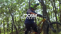
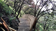
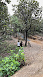
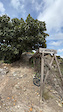
Photos of Jalisco (State) Mountain Bike
Videos of Jalisco (State) Mountain Bike
trail: Baby Merchant
0:06 |
18 |
Feb 11, 2025
trail: Baby Merchant
0:10 |
17 |
Jan 16, 2025
trail: Brujas
0:07 |
17 |
Jan 10, 2025
trail: Brujas
0:48 |
7 |
Jan 10, 2025
trail: S-LINE
2:05 |
25 |
Jan 10, 2025
trail: S-LINE
0:13 |
16 |
Jan 10, 2025
trail: DH Bugambilias
0:11 |
79 |
Sep 19, 2022
trail: DH Bugambilias
0:09 |
102 |
Sep 19, 2022
Recent Trail Reports
Activity Feed
| username | action | type | title | date |
|---|---|---|---|---|
| bleaksun | wishlist | trail | activity #98072235 | Jun 29, 2026 @ 10:15am 1 hours |
| gerajacobor | wishlist | region | activity #97176894 | Jun 17, 2026 @ 5:48am Jun 17, 2026 |
| ChecoTurbina | add | report | activity #97061023 and 5 more | Jun 15, 2026 @ 12:59pm Jun 15, 2026 |
| JustinQiiamy | ridden | trail | activity #97010538 and 1 more | Jun 14, 2026 @ 3:56pm Jun 14, 2026 |
| Hugodh24 | add | photo | activity #96519261 | Jun 7, 2026 @ 9:01pm Jun 7, 2026 |
Recent Comments
| username | type | title | comment | date |
|---|---|---|---|---|
| trail | Mi trail favorito, tiene de todo. | Jan 6, 2026 @ 4:54pm Jan 6, 2026 | ||
| report | Siempre está rodable. Sólo en tiempo de... | Nov 29, 2025 @ 12:12pm Nov 29, 2025 | ||
| report | Qué tal está la pista? | Nov 28, 2025 @ 8:55pm Nov 28, 2025 | ||
| trail | Actualmente el trail está en funcionamiento.... | Jul 10, 2025 @ 10:18am Jul 10, 2025 | ||
| trail | Muy descuidada | Jun 8, 2025 @ 10:27pm Jun 8, 2025 |
Local Badges
-

Epic Ride Descent 2k0 awarded -
Epic Ride Descent 2k0 awarded -
Epic Ride Descent 2k0 awarded -
Epic Ride Descent 2k2 awarded -
Epic Ride Descent 2k0 awarded -
Epic Ride Descent 2k0 awarded
Bike & Skill Parks
| name | type | city | rating |
|---|---|---|---|
| Las Minas Jumps | skill park | Ajijic |
Local Trail Supporters
- Ecoridemex
![]()
- mictlan
![]()
Activity Type Stats
| activitytype | trails | distance | descent | descent distance | total vertical | rating | global rank | state rank | photos | reports | routes | ridelogs |
|---|---|---|---|---|---|---|---|---|---|---|---|---|
| Mountain Bike | 281 | 516 miles | 132,943 ft | 275 miles | 9,659 ft | 651 | 1,576 | 25 | 32,163 | |||
| E-Bike | 227 | 413 miles | 93,753 ft | 216 miles | 9,659 ft | 3 | 1,492 | 6 | 3,980 | |||
| Horse | 45 | 135 miles | 20,735 ft | 65 miles | 5,256 ft | 99 | ||||||
| Hike | 269 | 483 miles | 125,768 ft | 251 miles | 13,904 ft | 10 | 1,546 | 3 | 2,022 | |||
| Trail Running | 270 | 485 miles | 124,521 ft | 253 miles | 13,904 ft | 20 | 1,546 | 2 | 1,006 | |||
| Dirtbike/Moto | 26 | 80 miles | 9,085 ft | 33 miles | 5,256 ft | 4 | 98 | 26 | ||||
| Observed Trials | 5 | 3 miles | 1,660 ft | 2 miles | 2,500 ft | 3 | ||||||
| ATV/ORV/OHV | 26 | 71 miles | 7,920 ft | 29 miles | 5,256 ft | 98 | 5 | |||||
| Snowmobile | 1 | 1 mile | 1,339 ft | 1 mile | 1,302 ft | |||||||
| Snowshoe | 1 | 1 mile | 1,339 ft | 1 mile | 1,302 ft | 1 | ||||||
| Downhill Ski | 1 | 1 mile | 1,339 ft | 1 mile | 1,302 ft | 2 | ||||||
| Backcountry Ski | 1 | 1 mile | 1,339 ft | 1 mile | 1,302 ft | 2 | ||||||
| Nordic Ski | 1 | 1 mile | 1,339 ft | 1 mile | 1,302 ft | 3 |
Activities
Trails
Points of Interest
- Jackson TTF
- Punto Wifi MBM - Torre 3 Information
- Punto de conexión Wifi MBM - Huevona Information
- Punto Wifi MBM - Toboganes Information
- Mirador Caracol Viewpoint
- El Fayuque Restaurant Other
- Drop De Brujitas TTF
- Últimos saltos-mesas Garrison TTF
- Tobo Drop TTF
- Casa Abandonada Viewpoint
- Nevado de Colima (4,226 m)
- Volcán de Colima (3,811 m)
- Cerro Viejo (2,945 m)
- By primaveramtb & contributors
- Admins: MAG, JSAG
- #9002 - 9,434 views
- jalisco (state) activity log | embed map of Jalisco (State) mountain bike trails | jalisco (state) mountain biking points of interest
Downloading of trail gps tracks in kml & gpx formats is enabled for Jalisco (State).
You must login to download files.