close
-
Layers w
- Weather Layers
- Pro
- Pro
- Pro
- Pro
- Pro
- Pro
- More Layers
- Pro
- Pro
- Pro
- Pro
-
Upgrade to

3D
Trail Conditions
- Unknown
- Snow Groomed
- Snow Packed
- Snow Covered
- Snow Cover Partial
- Freeze/thaw Cycle
- Icy
- Prevalent Mud
- Wet
- Variable
- Ideal
- Dry
- Very Dry
Trail Flow (Ridden Direction)
Trailforks scans users ridelogs to determine the most popular direction each trail is ridden. A good flowing trail network will have most trails flowing in a single direction according to their intension.
The colour categories are based on what percentage of riders are riding a trail in its intended direction.
The colour categories are based on what percentage of riders are riding a trail in its intended direction.
- > 96%
- > 90%
- > 80%
- > 70%
- > 50%
- < 50%
- bi-directional trail
- no data
Trail Last Ridden
Trailforks scans ridelogs to determine the last time a trail was ridden.
- < 2 days
- < 1 week
- < 2 weeks
- < 1 month
- < 6 months
- > 6 months
Trail Ridden Direction
The intended direction a trail should be ridden.
- Downhill Only
- Downhill Primary
- Both Directions
- Uphill Primary
- Uphill Only
- One Direction
Contribute Details
Colors indicate trail is missing specified detail.
- Description
- Photos
- Description & Photos
- Videos
Trail Popularity ?
Trailforks scans ridelogs to determine which trails are ridden the most in the last 9 months.
Trails are compared with nearby trails in the same city region with a possible 25 colour shades.
Think of this as a heatmap, more rides = more kinetic energy = warmer colors.
- most popular
- popular
- less popular
- not popular
ATV/ORV/OHV Filter
Max Vehicle Width
inches
US Cell Coverage
Legend

Radar Time
Activity Recordings
Trailforks uses anonymized public activity data.
?
Activity Recordings
Trailforks uses anonymized public activity data.
?
Personal Heatmap
▶
Activity Types
all
/
none
▶
Options
2
Date range
month
–
Winter Trails
Warning
A routing network for winter maps does not exist. Selecting trails using the winter trails layer has been disabled.
Missing Trails
Most Popular
Least Popular
Trails are colored based on popularity. The more popular a trail is, the more red. Less popular trails trend towards green.
Jump Magnitude Heatmap
Heatmap of where riders jump on trails. Zoom in to see individual jumps, click circles to view jump details.
BC Backroad Status
![map legend]()
Service Road Atlas is a free to use, community-driven service for viewing and creating reports on the numerous back-country service roads around B.C. and Alberta.

Slope Aspect
Direction the slope faces
Trails Deemphasized
Trails are shown in grey.
Only show trails with no bike usage.
Suggested Layers
Based on selected activity type
Save the current map location and zoom level as your default home location whenever this page is loaded.
Save
No description for Jamaica has been added yet!
Login or register to submit one.
Region Details
- 2
- 4
- 4
- 5
Stats
- Avg Trail Rating
- Trails (view details)
- 15
- Trails Mountain Bike
- 17
- Trails E-Bike
- 7
- Trails Horse
- 3
- Trails Hike
- 14
- Trails Trail Running
- 14
- Trails Dirtbike/Moto
- 1
- Trails Observed Trials
- 2
- Trails ATV/ORV/OHV
- 2
- Total Distance
- 16 miles
- Total Descent
- 2,290 ft
- Total Vertical
- 638 ft
- Highest Trailhead
- 650 ft
- Reports
- 11
- Photos
- 125
- Ridden Counter
- 30
Sub Regions
- Westmoreland Hills (6)
- Jamaica Ville (1)
- Blue Mountains (2)
- Negril (9)
Popular Jamaica Mountain Biking Trails
• 5 ★ 4.5 • 2 miles • 31 ft • 1 •
This is one of many trails in the ZMBA bike park in the Westmoreland Hills overlooking Negril. This technical ride features ridge line like bench cuts and berms in Good Hope's jungle setting.
• 5 ★ 5.0 • 2,766 ft • 11 ft • 1 •
starting at the Whitehall Greenhouse this is my oldest trail. It's filled with berms followed by slight ups and downs and off camber sections. A quick four minutes of Jamaican fun. A shuttlable trail.
• 90 ★ 5.0 • 5,013 ft • 6 ft • 1 •
This DH can be difficult when wet as the blue moss turns green and it becomes as slick as glassine sections. At the bottom before the second DH road to the highway there is a small blue house=Chef Snow's bake shop, no sign.
• 100 ★ 5.0 • 6 miles • 731 ft • 1 •
This is one ancient trail/mule cart road used for farming Sugar Cane, Bamboo, etc. The uphill is rarely used an old road that is now a destroyed single track that opens up to a 4' sometimes old pavement under a canopy of bamboo. The DH...
• 100 ★ 0.0 • 2 miles • 27 ft • 1 •
Popular green difficulty singletrack. This mountain bike primary trail can be used both directions.
• ★ 0.0 • 5 miles • 213 ft • 1 •
• 5 ★ 5.0 • 2 miles • 25 ft •
A desolate century old trail rarely used in it's entirety except for Zion Mountain Bike Adventures. Located on the Jackson property that has thousands of acres from the south coast to Moreland Mountain near the north coast. The trail...
• 5 ★ 5.0 • 2 miles • 280 ft •
This is the first trail I built as a DH intermediate and now its my premier local climbing trail. After you get to the top there is a nice rewarding short DH rock garden. Most of the trails merge near the end of the Jangalee Graveyard....
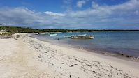
Photos of Jamaica Mountain Bike
Videos of Jamaica Mountain Bike

trail: Flamstead
0:09 |
4 |
Mar 31, 2026
trail: Greenwich
0:09 |
7 |
Mar 31, 2026
trail: Blue Mountain peak
0:03 |
12 |
Aug 29, 2025
trail: Mount Airy DH
3:18 |
170 |
Mar 9, 2021
trail: The Burning Goat XC Trail
45:47 |
210 |
Jan 12, 2021

trail: Jangalee Graveyard Trail
52:34 |
99 |
Jan 6, 2021
trail: Janky Jimmy Jackson Enduro
39:05 |
196 |
Jan 4, 2021

trail: Janky Jimmy Jackson Enduro
4:07 |
723 |
Apr 27, 2020
Recent Comments
| username | type | title | comment | date |
|---|---|---|---|---|
| report | pic is from little Bay Caves a 1/4 mile from... | Feb 28, 2020 @ 8:48am Feb 28, 2020 | ||
| trail | Rode the new builds and this trail is off the... | Jan 6, 2020 @ 6:19am Jan 6, 2020 | ||
| report | ancient natural trails rarely used. | Jun 16, 2019 @ 10:35am Jun 16, 2019 | ||
| trail | Built by the 40 Leggier Bush Doctor Crew | May 10, 2019 @ 8:06pm May 10, 2019 |
Activity Type Stats
| activitytype | trails | distance | descent | descent distance | total vertical | rating | global rank | state rank | photos | reports | routes | ridelogs |
|---|---|---|---|---|---|---|---|---|---|---|---|---|
| Mountain Bike | 17 | 16 miles | 2,290 ft | 8 miles | 640 ft | #103 | 125 | 11 | 1,398 | |||
| E-Bike | 7 | #118 | 1 | 37 | ||||||||
| Horse | 3 | 10 miles | 1,286 ft | 5 miles | 640 ft | #75 | 5 | 5 | ||||
| Hike | 14 | 14 miles | 1,677 ft | 6 miles | 640 ft | #111 | 8 | 171 | ||||
| Trail Running | 14 | 14 miles | 1,677 ft | 6 miles | 640 ft | #109 | 8 | 2 | ||||
| Dirtbike/Moto | 1 | 6 miles | 732 ft | 3 miles | 518 ft | #76 | 3 | 1 | ||||
| Observed Trials | 2 | 4 miles | 686 ft | 2 miles | 364 ft | #53 | 2 | |||||
| ATV/ORV/OHV | 2 | 4 miles | 686 ft | 2 miles | 364 ft | #60 | 2 |
Activities
Trails
Points of Interest
- By brenthillier
 NSMBA TRAILFORKS & contributors
 - Admins: apply
- #6144 - 11,212 views
- jamaica activity log | embed map of Jamaica mountain bike trails |
Downloading of trail gps tracks in kml & gpx formats is enabled for Jamaica.
You must login to download files.