close
-
Layers w
- Weather Layers
- Pro
- Pro
- Pro
- Pro
- Pro
- Pro
- More Layers
- Pro
- Pro
- Pro
- Pro
-
Upgrade to

3D
Trail Conditions
- Unknown
- Snow Groomed
- Snow Packed
- Snow Covered
- Snow Cover Partial
- Freeze/thaw Cycle
- Icy
- Prevalent Mud
- Wet
- Variable
- Ideal
- Dry
- Very Dry
Trail Flow (Ridden Direction)
Trailforks scans users ridelogs to determine the most popular direction each trail is ridden. A good flowing trail network will have most trails flowing in a single direction according to their intension.
The colour categories are based on what percentage of riders are riding a trail in its intended direction.
The colour categories are based on what percentage of riders are riding a trail in its intended direction.
- > 96%
- > 90%
- > 80%
- > 70%
- > 50%
- < 50%
- bi-directional trail
- no data
Trail Last Ridden
Trailforks scans ridelogs to determine the last time a trail was ridden.
- < 2 days
- < 1 week
- < 2 weeks
- < 1 month
- < 6 months
- > 6 months
Trail Ridden Direction
The intended direction a trail should be ridden.
- Downhill Only
- Downhill Primary
- Both Directions
- Uphill Primary
- Uphill Only
- One Direction
Contribute Details
Colors indicate trail is missing specified detail.
- Description
- Photos
- Description & Photos
- Videos
Trail Popularity ?
Trailforks scans ridelogs to determine which trails are ridden the most in the last 9 months.
Trails are compared with nearby trails in the same city region with a possible 25 colour shades.
Think of this as a heatmap, more rides = more kinetic energy = warmer colors.
- most popular
- popular
- less popular
- not popular
ATV/ORV/OHV Filter
Max Vehicle Width
inches
US Cell Coverage
Legend

Radar Time
Activity Recordings
Trailforks uses anonymized public activity data.
?
Activity Recordings
Trailforks uses anonymized public activity data.
?
Personal Heatmap
▶
Activity Types
all
/
none
▶
Options
2
Date range
month
–
Winter Trails
Warning
A routing network for winter maps does not exist. Selecting trails using the winter trails layer has been disabled.
Missing Trails
Most Popular
Least Popular
Trails are colored based on popularity. The more popular a trail is, the more red. Less popular trails trend towards green.
Jump Magnitude Heatmap
Heatmap of where riders jump on trails. Zoom in to see individual jumps, click circles to view jump details.
BC Backroad Status
![map legend]()
Service Road Atlas is a free to use, community-driven service for viewing and creating reports on the numerous back-country service roads around B.C. and Alberta.

Slope Aspect
Direction the slope faces
Trails Deemphasized
Trails are shown in grey.
Only show trails with no bike usage.
Suggested Layers
Based on selected activity type
Save the current map location and zoom level as your default home location whenever this page is loaded.
Save
No description for Jamul has been added yet!
Login or register to submit one.
AKA: Crestridge
Activities Click to view
- Mountain Bike
16 trails
- Gravel Bike
0 trails
- Adaptive Bike
0 trails
- Hike
17 trails
- Trail Running
17 trails
Region Details
- 4
- 4
- 6
- 1
Region Status
Caution as of Jan 2, 2026Local Trail Association
Stats
- Avg Trail Rating
- Trails (view details)
- 15
- Trails Mountain Bike
- 16
- Trails E-Bike
- 3
- Trails Horse
- 2
- Trails Hike
- 17
- Trails Trail Running
- 17
- Trails Dirtbike/Moto
- 1
- Trails ATV/ORV/OHV
- 1
- Total Distance
- 33 miles
- Total Descent
- 3,051 ft
- Total Vertical
- 2,430 ft
- Highest Trailhead
- 2,986 ft
- Reports
- 53
- Photos
- 50
- Ridden Counter
- 1,139
Sub Regions
-
Hollenbeck Canyon
- 2
- 4
Popular Jamul Mountain Biking Trails
• 60 ★ 3.5 • 2 miles • 369 ft • 119 •
Combo of double and single track through the lower wooded section of and onto the hill side single track of the upper canyon. Access to other trails from this main trail. Trail use has been modified to allow bikes only on the southern...
• 35 ★ 0.0 • 1 mile • 46 ft • 60 •
This trail is a narrow, sporty singletrack in the Hollenbeck Canyon recreation area. It can be ridden in either direction and may be the preferred route for ascending the upper regions of the canyon area, but it's great going down. Some...
• 45 ★ 4.0 • 1 mile • 6 ft • 59 •
Tight fast downhill coming back down from the Daily Ranch Trail fire road. Good rock sections with ruts. Can be difficult to spot obstacles in the spring as there can be a lot of natural weed overgrowth from the rains.
• 30 ★ 3.0 • 3 miles • 715 ft • 43 •
Off the bend in the , You can jump on the Honey Springs truck trail. It starts off with a fast, steep, rocky decent. You get the Hollenbeck trail if you want or continue down across the creek then back uphill on a moderate singletrack...
• 20 ★ 3.5 • 2,592 ft • 0 ft • 31 •
This trail in the Hollenbeck Canyon recreation area is a shortcut to the upper canyon regions or a quick way down back to the canyon base. It is a hard, packed dirt road that is cut by deep erosion scars and ruts that criss-cross this...
• 70 ★ 0.0 • 5 miles • 754 ft • 15 •
Barber Mountain Road is a forest road in Eastern San Diego County. There are some steep short climbs and some beat up and rocky sections. Some parts of this road are in poor condition. It gets very hot in summer. This road can be used...
• 40 ★ 3.0 • 2 miles • 1,267 ft • 9 • • hike
is a steep and challenging trail, and signage is limited. Please stay on the widest trail most traveled. At the parking lot the trail is wide, flat and hard packed. As it ascends it becomes narrow. then erosion ruts begin to appear and...
Jamul Mountain Bike Routes
14 miles • 2,021 ft • 5 • Loop •
This route is a way to get a feel for what and the adjacent area has to over.
1,909 ft • 31 ft • 0 • Point to Point •
A short connector to provide access to Lyons Valley Road from
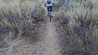
Photos of Jamul Mountain Bike
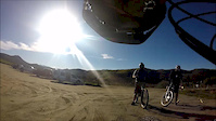
Videos of Jamul Mountain Bike
trail: Daley Ranch Truck Trail
0:10 |
191 |
Oct 4, 2020
trail: Hollenbeck Canyon Trail
6:25 |
238 |
Jan 4, 2016
Recent Trail Reports
| status | trail | date | condition | info | user |
|---|---|---|---|---|---|
| El Camino Verde | Jan 2, 2026 @ 12:16pm (America/Los_Angeles) Jan 2, 2026 | Variable | drinkofishboy | ||
| Honey Springs Ranch Truck Trail | Aug 14, 2025 @ 8:45am Aug 14, 2025 | Very Dry | BenLow2019 | ||
| Daley Ranch Truck Trail Access | Aug 14, 2025 @ 8:45am Aug 14, 2025 | Very Dry | BenLow2019 | ||
| Daley Ranch Truck Trail | Aug 14, 2025 @ 8:45am Aug 14, 2025 | Very Dry | BenLow2019 | ||
| Hollenbeck Hill Trail | Aug 14, 2025 @ 8:45am Aug 14, 2025 | Very Dry | BenLow2019 | ||
| Proctor Bypass | Aug 8, 2025 @ 6:27pm Aug 8, 2025 | Dry | trailforks Trailforks | ||
| Hollenbeck Canyon Trail | Aug 2, 2025 @ 10:22am Aug 2, 2025 | Dry | BenLow2019 | ||
| McGinty Mountain | Dec 29, 2024 @ 9:04am Dec 29, 2024 | Very Dry | aweesan | ||
| Single track DH | Sep 30, 2023 @ 11:07am Sep 30, 2023 | Ideal | MMac44 | ||
| Jamul Spring | Feb 4, 2023 @ 12:55pm Feb 4, 2023 | Variable | BenLow2019 |
Activity Feed
| username | action | type | title | date |
|---|---|---|---|---|
| zsENNr | wishlist | trail | activity #89825214 | Mar 1, 2026 @ 10:26pm Mar 1, 2026 |
| zsENNr | ridden | trail | activity #89825206 | Mar 1, 2026 @ 10:26pm Mar 1, 2026 |
| zsENNr | add | photo | activity #89825199 | Mar 1, 2026 @ 10:25pm Mar 1, 2026 |
| zsENNr | add | photo | activity #89741075 | Feb 28, 2026 @ 5:12pm Feb 28, 2026 |
| zsENNr | comment | trail | activity #89741019 | Feb 28, 2026 @ 5:11pm Feb 28, 2026 |
Recent Comments
| username | type | title | comment | date |
|---|---|---|---|---|
| trail | Good route. As described. | Feb 28, 2026 @ 5:11pm Feb 28, 2026 | ||
| trail | Updated trail information, added POI | Aug 15, 2025 @ 5:48am Aug 15, 2025 | ||
| trail | Upper trail has signage indicates foot traffic... | Nov 20, 2024 @ 12:37pm Nov 20, 2024 | ||
| trail | This trail is open? Wow. It has been fenced... | Mar 1, 2023 @ 9:54am Mar 1, 2023 | ||
| trail | This pedally XC route has potential for being... | Sep 25, 2022 @ 4:52pm Sep 25, 2022 |
Local Badges
-

Epic Mountain Bike Climb 2k1 awarded -

Climbing 10k Badge0 awarded -

Mountain Biking 100k Badge0 awarded -

Epic Ride Descent 2k1 awarded -

Descent 10k Badge0 awarded -

Descent 100k Badge0 awarded
Activity Type Stats
| activitytype | trails | distance | descent | descent distance | total vertical | rating | global rank | state rank | photos | reports | routes | ridelogs |
|---|---|---|---|---|---|---|---|---|---|---|---|---|
| Mountain Bike | 16 | 33 miles | 3,051 ft | 10 miles | 2,431 ft | #6,005 | #2,039 | 40 | 53 | 2 | 4,196 | |
| E-Bike | 3 | 5 miles | 164 ft | 1 mile | 1,017 ft | 3 | 28 | 241 | ||||
| Horse | 2 | 8 miles | 197 ft | 1 mile | 2,264 ft | 5 | ||||||
| Hike | 17 | 33 miles | 3,051 ft | 10 miles | 2,431 ft | #3,591 | #1,263 | 13 | 53 | 1 | 319 | |
| Trail Running | 17 | 33 miles | 3,051 ft | 10 miles | 2,431 ft | #6,180 | #1,990 | 53 | 1 | 67 | ||
| Dirtbike/Moto | 1 | 5 miles | 164 ft | 1 mile | 1,017 ft | 3 | ||||||
| ATV/ORV/OHV | 1 | 5 miles | 164 ft | 1 mile | 1,017 ft | 3 |
Frequently Asked Questions About Jamul
▼
What are the best places to ride in Jamul?
Jamul has 1 areas to explore for mountain biking. The top rated areas are:
▼
What are the highest rated mountain biking trails in Jamul?
The highest rated mountain biking trails in Jamul are:
- Jamul Spring (4/5)
- Hollenbeck Hill Trail (4/5)
- Hollenbeck Canyon Trail (3.9/5)
- McGinty Mountain (3.8/5)
- Honey Springs Ranch Truck Trail (3.8/5)
▼
What is the best time of the year to ride in Jamul?
Based on ride log data, the most popular months to ride in Jamul are:
- July (58 activities)
- June (50 activities)
- October (47 activities)
▼
Where can I park to ride in Jamul?
There are 3 parking locations listed in Jamul. The most popular parking spots are: View all parking and trailhead locations on the map to plan your visit.
Trails
Points of Interest
- By stoker1223 & contributors
- Admins: SDMBA
- #14494 - 4,813 views
- jamul activity log | embed map of Jamul mountain bike trails | jamul mountain biking points of interest polygons
Downloading of trail gps tracks in kml & gpx formats is enabled for Jamul.
You must login to download files.