close
-
Layers w
- Weather Layers
- Pro
- Pro
- Pro
- Pro
- Pro
- Pro
- More Layers
- Pro
- Pro
- Pro
- Pro
-
Upgrade to

3D
Trail Conditions
- Unknown
- Snow Groomed
- Snow Packed
- Snow Covered
- Snow Cover Partial
- Freeze/thaw Cycle
- Icy
- Prevalent Mud
- Wet
- Variable
- Ideal
- Dry
- Very Dry
Trail Flow (Ridden Direction)
Trailforks scans users ridelogs to determine the most popular direction each trail is ridden. A good flowing trail network will have most trails flowing in a single direction according to their intension.
The colour categories are based on what percentage of riders are riding a trail in its intended direction.
The colour categories are based on what percentage of riders are riding a trail in its intended direction.
- > 96%
- > 90%
- > 80%
- > 70%
- > 50%
- < 50%
- bi-directional trail
- no data
Trail Last Ridden
Trailforks scans ridelogs to determine the last time a trail was ridden.
- < 2 days
- < 1 week
- < 2 weeks
- < 1 month
- < 6 months
- > 6 months
Trail Ridden Direction
The intended direction a trail should be ridden.
- Downhill Only
- Downhill Primary
- Both Directions
- Uphill Primary
- Uphill Only
- One Direction
Contribute Details
Colors indicate trail is missing specified detail.
- Description
- Photos
- Description & Photos
- Videos
Trail Popularity ?
Trailforks scans ridelogs to determine which trails are ridden the most in the last 9 months.
Trails are compared with nearby trails in the same city region with a possible 25 colour shades.
Think of this as a heatmap, more rides = more kinetic energy = warmer colors.
- most popular
- popular
- less popular
- not popular
ATV/ORV/OHV Filter
Max Vehicle Width
inches
US Cell Coverage
Legend

Radar Time
Activity Recordings
Trailforks uses anonymized public activity data.
?
Activity Recordings
Trailforks uses anonymized public activity data.
?
Personal Heatmap
▶
Activity Types
all
/
none
▶
Options
2
Date range
month
–
Winter Trails
Warning
A routing network for winter maps does not exist. Selecting trails using the winter trails layer has been disabled.
Missing Trails
Most Popular
Least Popular
Trails are colored based on popularity. The more popular a trail is, the more red. Less popular trails trend towards green.
Jump Magnitude Heatmap
Heatmap of where riders jump on trails. Zoom in to see individual jumps, click circles to view jump details.
BC Backroad Status
![map legend]()
Service Road Atlas is a free to use, community-driven service for viewing and creating reports on the numerous back-country service roads around B.C. and Alberta.

Slope Aspect
Direction the slope faces
Trails Deemphasized
Trails are shown in grey.
Only show trails with no bike usage.
Suggested Layers
Based on selected activity type
Save the current map location and zoom level as your default home location whenever this page is loaded.
Save
No description for Jedburgh has been added yet!
Login or register to submit one.
This region uses the Uk/Euro style trail grading system.
Activities Click to view
- Mountain Bike
29 trails
- E-Bike
2 trails
- Adaptive Bike
0 trails
- Winter Fat Bike
0 trails
- Hike
12 trails
- Trail Running
12 trails
Region Details
- 1
- 2
- 4
- 21
- 1
Region Status
Open as of Sep 28, 2022Stats
- Avg Trail Rating
- Trails (view details)
- 29
- Trails Mountain Bike
- 29
- Trails E-Bike
- 2
- Trails Hike
- 12
- Trails Trail Running
- 12
- Total Distance
- 18 miles
- Total Descent
- 2,648 ft
- Total Vertical
- 576 ft
- Highest Trailhead
- 757 ft
- Reports
- 30
- Photos
- 29
- Ridden Counter
- 305
Sub Regions
-
JedForest Trails
- 2
- 4
- 21
- 1
Popular Jedburgh Mountain Biking Trails
• 80 ★ 0.0 • 1,083 ft • 73 ft • 17 •
Popular red difficulty singletrack. This mountain bike primary trail can be used uphill primary. On average it takes 2 minutes to complete this trail.
• 85 ★ 0.0 • 2,809 ft • 181 ft • 14 •
Popular red difficulty mixed. This mountain bike primary trail can be used uphill primary. On average it takes 7 minutes to complete this trail.
• 75 ★ 4.0 • 1,857 ft • 61 ft • 14 •
Popular red difficulty singletrack. This mountain bike primary trail can be used downhill primary. On average it takes 3 minutes to complete this trail.
• 80 ★ 0.0 • 3,047 ft • 5 ft • 14 •
Popular red difficulty singletrack. This mountain bike primary trail can be used downhill primary. On average it takes 8 minutes to complete this trail.
• 90 ★ 0.0 • 2,471 ft • 0 ft • 13 •
Popular red difficulty singletrack. This mountain bike primary trail can be used downhill primary. On average it takes 2 minutes to complete this trail.
• 100 ★ 3.0 • 2,266 ft • 22 ft • 12 •
Popular blue difficulty singletrack. This mountain bike primary trail can be used uphill primary. On average it takes 3 minutes to complete this trail.
• 70 ★ 0.0 • 2 miles • 97 ft • 10 •
Popular blue difficulty gravel path. This mountain bike primary trail can be used both directions. On average it takes 7 minutes to complete this trail.
• 55 ★ 0.0 • 4,117 ft • 0 ft • 10 • • hike
Moderately popular red difficulty singletrack. This hike primary trail can be used downhill primary. On average it takes 3 minutes to complete this trail.
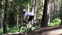
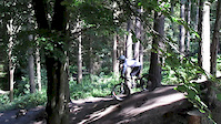
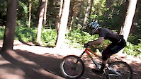
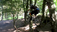
Photos of Jedburgh Mountain Bike
Videos of Jedburgh Mountain Bike
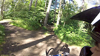
trail: Bombhole
0:02 |
81 |
Aug 7, 2015
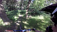
trail: Bombhole
0:26 |
44 |
Aug 7, 2015
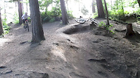
trail: Bombhole
0:11 |
48 |
Aug 6, 2015
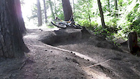
trail: Bombhole
0:12 |
40 |
Aug 6, 2015
trail: Bombhole
0:10 |
29 |
Aug 6, 2015
trail: Bombhole
0:05 |
17 |
Aug 6, 2015
trail: Bombhole
0:15 |
28 |
Aug 6, 2015
trail: Bombhole
0:15 |
44 |
Aug 6, 2015
Recent Trail Reports
| status | trail | date | condition | info | user |
|---|---|---|---|---|---|
| Ya Bitch Jump | Sep 28, 2022 @ 2:54pm Sep 28, 2022 | Variable | gav-s | ||
| Woodside | Sep 28, 2022 @ 2:54pm Sep 28, 2022 | Variable | gav-s | ||
| Water run | Sep 28, 2022 @ 2:54pm Sep 28, 2022 | Variable | gav-s | ||
| Viewpoint Climb | Sep 28, 2022 @ 2:54pm Sep 28, 2022 | Variable | gav-s | ||
| UppieDoonieAyeBeen | Sep 28, 2022 @ 2:54pm Sep 28, 2022 | Variable | gav-s | ||
| Track | Sep 28, 2022 @ 2:54pm Sep 28, 2022 | Variable | gav-s | ||
| Timpendean | Sep 28, 2022 @ 2:54pm Sep 28, 2022 | Variable | gav-s | ||
| The Tunnel | Sep 28, 2022 @ 2:54pm Sep 28, 2022 | Variable | gav-s | ||
| the full kaw | Sep 28, 2022 @ 2:54pm Sep 28, 2022 | Variable | gav-s | ||
| The Enduro Track | Sep 28, 2022 @ 2:54pm Sep 28, 2022 | Variable | gav-s |
Activity Feed
| username | action | type | title | date |
|---|---|---|---|---|
| trailforks | add | video | activity #95623744 | May 27, 2026 @ 4:00am May 27, 2026 |
| trailforks | add | video | activity #92616075 | Apr 14, 2026 @ 1:00pm Apr 14, 2026 |
| trailforks | add | video | activity #88819129 | Feb 13, 2026 @ 12:00am Feb 13, 2026 |
| trailforks | add | video | activity #83127417 | Oct 27, 2025 @ 1:00pm Oct 27, 2025 |
| trailforks | add | video | activity #82733974 | Oct 20, 2025 @ 4:00pm Oct 20, 2025 |
Recent Comments
| username | type | title | comment | date |
|---|---|---|---|---|
| trail | please note this trail was closed at request... | Sep 29, 2017 @ 1:39pm Sep 29, 2017 |
Local Badges
-

Epic Ride Climb 2k7 awarded -

Climbing 10k Badge10 awarded -

Climbing 100k Badge0 awarded -

Epic Ride Descent 2k7 awarded -

Descent 10k Badge10 awarded -

Descent 100k Badge0 awarded
Activity Type Stats
| activitytype | trails | distance | descent | descent distance | total vertical | rating | global rank | state rank | photos | reports | routes | ridelogs |
|---|---|---|---|---|---|---|---|---|---|---|---|---|
| Mountain Bike | 29 | 18 miles | 2,648 ft | 9 miles | 577 ft | #5,958 | #211 | 29 | 30 | 1,419 | ||
| E-Bike | 2 | 1 mile | 253 ft | 4,741 ft | 384 ft | #7,663 | #341 | 28 | 471 | |||
| Hike | 12 | 8 miles | 997 ft | 4 miles | 577 ft | #9,546 | #300 | 28 | 185 | |||
| Trail Running | 12 | 8 miles | 997 ft | 4 miles | 577 ft | #9,253 | #294 | 28 | 102 |
Frequently Asked Questions About Jedburgh
▼
What are the best places to ride in Jedburgh?
Jedburgh has 1 areas to explore for mountain biking. The top rated areas are:
▼
What are the highest rated mountain biking trails in Jedburgh?
The highest rated mountain biking trails in Jedburgh are:
- Cottage Pie (4/5)
- Cheggy Hunt (4/5)
- DELVY B-Line (4/5)
- Bombhole Climb (4/5)
- Timpendean (3.8/5)
▼
What is the best time of the year to ride in Jedburgh?
Based on ride log data, the most popular months to ride in Jedburgh are:
- April (4 activities)
- June (3 activities)
- August (2 activities)
▼
Where can I park to ride in Jedburgh?
Check the Jedburgh trail map for trailhead and parking information. Community members regularly update access and parking details for trails in the area.
- By gav-s
 & contributors
 - Admins: DMBinS, FLS, TVTA
- #20261 - 3,416 views
- jedburgh activity log | embed map of Jedburgh mountain bike trails |
Downloading of trail gps tracks in kml & gpx formats is enabled for Jedburgh.
You must login to download files.