close
-
Layers w
- Weather Layers
- Pro
- Pro
- Pro
- Pro
- Pro
- Pro
- More Layers
- Pro
- Pro
- Pro
- Pro
-
Upgrade to

3D
Trail Conditions
- Unknown
- Snow Groomed
- Snow Packed
- Snow Covered
- Snow Cover Partial
- Freeze/thaw Cycle
- Icy
- Prevalent Mud
- Wet
- Variable
- Ideal
- Dry
- Very Dry
Trail Flow (Ridden Direction)
Trailforks scans users ridelogs to determine the most popular direction each trail is ridden. A good flowing trail network will have most trails flowing in a single direction according to their intension.
The colour categories are based on what percentage of riders are riding a trail in its intended direction.
The colour categories are based on what percentage of riders are riding a trail in its intended direction.
- > 96%
- > 90%
- > 80%
- > 70%
- > 50%
- < 50%
- bi-directional trail
- no data
Trail Last Ridden
Trailforks scans ridelogs to determine the last time a trail was ridden.
- < 2 days
- < 1 week
- < 2 weeks
- < 1 month
- < 6 months
- > 6 months
Trail Ridden Direction
The intended direction a trail should be ridden.
- Downhill Only
- Downhill Primary
- Both Directions
- Uphill Primary
- Uphill Only
- One Direction
Contribute Details
Colors indicate trail is missing specified detail.
- Description
- Photos
- Description & Photos
- Videos
Trail Popularity ?
Trailforks scans ridelogs to determine which trails are ridden the most in the last 9 months.
Trails are compared with nearby trails in the same city region with a possible 25 colour shades.
Think of this as a heatmap, more rides = more kinetic energy = warmer colors.
- most popular
- popular
- less popular
- not popular
ATV/ORV/OHV Filter
Max Vehicle Width
inches
US Cell Coverage
Legend

Radar Time
Activity Recordings
Trailforks uses anonymized public activity data.
?
Activity Recordings
Trailforks uses anonymized public activity data.
?
Personal Heatmap
▶
Activity Types
all
/
none
▶
Options
2
Date range
month
–
Winter Trails
Warning
A routing network for winter maps does not exist. Selecting trails using the winter trails layer has been disabled.
Missing Trails
Most Popular
Least Popular
Trails are colored based on popularity. The more popular a trail is, the more red. Less popular trails trend towards green.
Jump Magnitude Heatmap
Heatmap of where riders jump on trails. Zoom in to see individual jumps, click circles to view jump details.
BC Backroad Status
![map legend]()
Service Road Atlas is a free to use, community-driven service for viewing and creating reports on the numerous back-country service roads around B.C. and Alberta.

Slope Aspect
Direction the slope faces
Trails Deemphasized
Trails are shown in grey.
Only show trails with no bike usage.
Suggested Layers
Based on selected activity type
Save the current map location and zoom level as your default home location whenever this page is loaded.
Save
No description for Jefferson has been added yet!
Login or register to submit one.
Activities Click to view
- Mountain Bike
103 trails
- Gravel Bike
0 trails
- Adaptive Bike
0 trails
- Horse
15 trails
- Hike
120 trails
- Trail Running
120 trails
Region Details
- 21
- 1
- 6
- 58
- 2
- 2
Region Status
Open as of Jun 11, 2026Local Trail Association
Stats
- Avg Trail Rating
- Trails (view details)
- 106
- Trails Mountain Bike
- 103
- Trails E-Bike
- 2
- Trails Horse
- 15
- Trails Hike
- 120
- Trails Trail Running
- 120
- Total Distance
- 71 miles
- Total Descent
- 7,395 ft
- Total Vertical
- 675 ft
- Highest Trailhead
- 1,383 ft
- Reports
- 473
- Photos
- 159
- Ridden Counter
- 10,143
Sub Regions
-
Mahlon Dickerson Reservation
- 16
- 30
- 3
- 2
-
Rockaway River Wildlife Management Area
- 13
Popular Jefferson Mountain Biking Trails
• 75 ★ 0.0 • 3,307 ft • 91 ft • 419 •
This section of the Loop continues with relatively smooth, wide singletrack and some gravel stretches.
• 85 ★ 3.5 • 1 mile • 88 ft • 302 •
Popular black diamond difficulty singletrack. This multi-use trail can be used downhill primary and has a moderate overall physical rating with a 88 ft black diamond climb. It features rock garden. Trail visibility is always easy to follow. On average it takes 18 minutes to complete this trail.
• 95 ★ 4.0 • 1 mile • 94 ft • 298 •
Popular green difficulty rail trail. This multi-use trail can be used both directions and has a easy overall physical rating with a 94 ft green climb. Trail visibility is always easy to follow. On average it takes 11 minutes to complete this trail.
• 90 ★ 4.0 • 2,648 ft • 102 ft • 281 •
Mostly doubletrack with one technical section near Pond.
• 85 ★ 4.0 • 1,312 ft • 0 ft • 275 •
Popular blue difficulty doubletrack. This multi-use trail can be used both directions and has a moderate overall physical rating with a 0 ft blue climb. Trail visibility is always easy to follow. On average it takes 2 minutes to complete this trail.
• 95 ★ 0.0 • 1,552 ft • 28 ft • 270 •
Part of the Loop that is co-aligned with the on old grade.
• 100 ★ 3.0 • 2 miles • 84 ft • 270 •
Jefferson Mountain Bike Routes
★ 2.0 • 13 miles • 1,408 ft • 2 • Loop •
This is a moderate route that covers many of the blazed trails on both sides of Weldon Road, with some...
★ 1.0 • 7 miles • 432 ft • 1 • Out & Back •
Route starts on the north side of Weldon Rd at the main on the green trail and covers the Weldon Brook WMA...
7 miles • 409 ft • 1 • Out & Back •
Route starts on the north side of Weldon Rd at the main on the green trail. There is 3 miles of ease to...
13 miles • 1,231 ft • 10 •
Practice plan for Sussex Shredders A Group 19 March 2026
10 miles • 1,120 ft • 3 • Loop •
A 10-mile mountain bike lap with some technical features and significant climbing.
8 miles • 431 ft • 3 • Loop •
Route starts with a warm-up around the then increases the technical difficulty on the Heron trail which is...
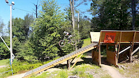
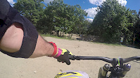
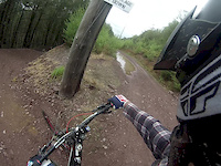
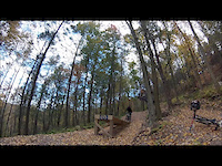
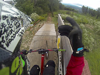
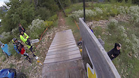
Photos of Jefferson Mountain Bike
Videos of Jefferson Mountain Bike


Recent Trail Reports
| status | trail | date | condition | info | user |
|---|---|---|---|---|---|
| Black Magic | Jun 10, 2026 @ 10:48am (America/New_York) Jun 10, 2026 | Unknown | ehardmeyer | ||
| Red | Jun 7, 2026 @ 10:30am (America/New_York) Jun 7, 2026 | Unknown | Deerpark20 | ||
| Red Extension | May 29, 2026 @ 5:28pm (America/New_York) May 29, 2026 | Ideal | jahranja | ||
| Purple | May 29, 2026 @ 5:28pm (America/New_York) May 29, 2026 | Ideal | jahranja | ||
| White (Pine Swamp) | May 29, 2026 @ 5:28pm (America/New_York) May 29, 2026 | Ideal | jahranja | ||
| Teal & White (Highlands & Pine Swamp) | May 29, 2026 @ 5:28pm (America/New_York) May 29, 2026 | Ideal | jahranja | ||
| Yellow (Stonegate) | May 5, 2026 @ 6:20pm (America/New_York) May 5, 2026 | Unknown | gofastcrashhard | ||
| WMA Loop | Apr 23, 2026 @ 10:13am (America/New_York) Apr 23, 2026 | Ideal | JohnoprEFs | ||
| Blue Crescent Moon | Apr 23, 2026 @ 10:13am (America/New_York) Apr 23, 2026 | Ideal | JohnoprEFs | ||
| Arapaho Trail | Apr 23, 2026 @ 10:13am (America/New_York) Apr 23, 2026 | Ideal | JohnoprEFs |
Activity Feed
| username | action | type | title | date |
|---|---|---|---|---|
| ehardmeyer | comment | report | activity #96672622 | Jun 10, 2026 @ 7:48am Jun 10, 2026 |
| ehardmeyer | add | report | activity #96672544 and 1 more | Jun 10, 2026 @ 7:47am Jun 10, 2026 |
| Deerpark20 | add | report | activity #96458827 | Jun 7, 2026 @ 7:30am Jun 7, 2026 |
| jahranja | add | report | activity #95851567 and 3 more | May 30, 2026 @ 7:50am May 30, 2026 |
| XRef | wishlist | route | activity #95017218 | May 18, 2026 @ 7:31pm May 18, 2026 |
Recent Comments
| username | type | title | comment | date |
|---|---|---|---|---|
| report | Tree across trail. Can go over | Jun 10, 2026 @ 7:48am Jun 10, 2026 | ||
| report | Clear | Apr 4, 2026 @ 7:42am Apr 4, 2026 | ||
| trail | Not a trail that is used often, if at all. It... | Dec 3, 2025 @ 8:05am Dec 3, 2025 | ||
| trail | pretty nice trail, includes a nice, big rock... | Nov 22, 2025 @ 1:37pm Nov 22, 2025 | ||
| report | Cleared. Thanks for report! | Jul 16, 2025 @ 6:51pm Jul 16, 2025 |
Local Badges
-

10 Blue Trails195 awarded -

Epic Ride Climb 2k3 awarded -

Climbing 10k Badge25 awarded -

Climbing 100k Badge0 awarded -

Completionist1 awarded -

Epic Ride Descent 2k3 awarded
Activity Type Stats
| activitytype | trails | distance | descent | descent distance | total vertical | rating | global rank | state rank | photos | reports | routes | ridelogs |
|---|---|---|---|---|---|---|---|---|---|---|---|---|
| Mountain Bike | 103 | 58 miles | 6,411 ft | 24 miles | 676 ft | #2,682 | #957 | 157 | 476 | 12 | 6,879 | |
| E-Bike | 2 | 253 ft | 3 ft | 275 | 410 | |||||||
| Horse | 15 | 7 miles | 1,027 ft | 3 miles | 433 ft | #2,639 | #1,463 | 109 | 1 | |||
| Hike | 120 | 71 miles | 7,395 ft | 28 miles | 676 ft | #3,051 | #1,101 | 8 | 471 | 4 | 546 | |
| Trail Running | 120 | 71 miles | 7,395 ft | 28 miles | 676 ft | #2,936 | #853 | 471 | 5 | 159 |
Frequently Asked Questions About Jefferson
▼
What are the best places to ride in Jefferson?
Jefferson has 2 areas to explore for mountain biking. The top rated areas are:
▼
What are the highest rated mountain biking trails in Jefferson?
The highest rated mountain biking trails in Jefferson are:
- Blue (Ghost) (4.1/5)
- Fry Pan (4.1/5)
- Brown Pow (4.1/5)
- Blue Crescent Moon (4.1/5)
- Purple (Cascade) (4.1/5)
▼
What is the best time of the year to ride in Jefferson?
Based on ride log data, the most popular months to ride in Jefferson are:
- July (131 activities)
- June (123 activities)
- May (101 activities)
▼
Where can I park to ride in Jefferson?
There are 5 parking locations listed in Jefferson. The most popular parking spots are:
- Saffin Pond Parking
- Parking - (Park n Ride Lot)
- Picnic Area Parking
- Rock Rill Parking
- Parking - Beaver Brook Trailhead
Activities
Trails
Points of Interest
- By brenthillier
 NSMBA TRAILFORKS & contributors
 - Admins: NYNJTC, josowski, Tkeyworth, Morris, alutsko
- #3631 - 2,951 views
- jefferson activity log | embed map of Jefferson mountain bike trails | jefferson mountain biking points of interest
Downloading of trail gps tracks in kml & gpx formats is enabled for Jefferson.
You must login to download files.