close
-
Layers w
- Weather Layers
- Pro
- Pro
- Pro
- Pro
- Pro
- Pro
- More Layers
- Pro
- Pro
- Pro
- Pro
-
Upgrade to

3D
Trail Conditions
- Unknown
- Snow Groomed
- Snow Packed
- Snow Covered
- Snow Cover Partial
- Freeze/thaw Cycle
- Icy
- Prevalent Mud
- Wet
- Variable
- Ideal
- Dry
- Very Dry
Trail Flow (Ridden Direction)
Trailforks scans users ridelogs to determine the most popular direction each trail is ridden. A good flowing trail network will have most trails flowing in a single direction according to their intension.
The colour categories are based on what percentage of riders are riding a trail in its intended direction.
The colour categories are based on what percentage of riders are riding a trail in its intended direction.
- > 96%
- > 90%
- > 80%
- > 70%
- > 50%
- < 50%
- bi-directional trail
- no data
Trail Last Ridden
Trailforks scans ridelogs to determine the last time a trail was ridden.
- < 2 days
- < 1 week
- < 2 weeks
- < 1 month
- < 6 months
- > 6 months
Trail Ridden Direction
The intended direction a trail should be ridden.
- Downhill Only
- Downhill Primary
- Both Directions
- Uphill Primary
- Uphill Only
- One Direction
Contribute Details
Colors indicate trail is missing specified detail.
- Description
- Photos
- Description & Photos
- Videos
Trail Popularity ?
Trailforks scans ridelogs to determine which trails are ridden the most in the last 9 months.
Trails are compared with nearby trails in the same city region with a possible 25 colour shades.
Think of this as a heatmap, more rides = more kinetic energy = warmer colors.
- most popular
- popular
- less popular
- not popular
ATV/ORV/OHV Filter
Max Vehicle Width
inches
US Cell Coverage
Legend

Radar Time
Activity Recordings
Trailforks uses anonymized public activity data.
?
Activity Recordings
Trailforks uses anonymized public activity data.
?
Personal Heatmap
▶
Activity Types
all
/
none
▶
Options
2
Date range
month
–
Winter Trails
Warning
A routing network for winter maps does not exist. Selecting trails using the winter trails layer has been disabled.
Missing Trails
Most Popular
Least Popular
Trails are colored based on popularity. The more popular a trail is, the more red. Less popular trails trend towards green.
Jump Magnitude Heatmap
Heatmap of where riders jump on trails. Zoom in to see individual jumps, click circles to view jump details.
BC Backroad Status
![map legend]()
Service Road Atlas is a free to use, community-driven service for viewing and creating reports on the numerous back-country service roads around B.C. and Alberta.

Slope Aspect
Direction the slope faces
Trails Deemphasized
Trails are shown in grey.
Only show trails with no bike usage.
Suggested Layers
Based on selected activity type
Save the current map location and zoom level as your default home location whenever this page is loaded.
Save
No description for Jefferson County has been added yet!
Login or register to submit one.
Activities Click to view
- Mountain Bike
12 trails
- Hike
16 trails
- Trail Running
15 trails
Region Details
- 8
- 3
- 1
Stats
- Avg Trail Rating
- Trails (view details)
- 16
- Trails Mountain Bike
- 12
- Trails E-Bike
- 1
- Trails Horse
- 1
- Trails Hike
- 16
- Trails Trail Running
- 15
- Trails Snowmobile
- 1
- Trails Nordic Ski
- 1
- Total Distance
- 44 miles
- Total Descent Distance
- 15 miles
- Total Descent
- 702 ft
- Total Vertical
- 146 ft
- Highest Trailhead
- 926 ft
- Reports
- 225
- Photos
- 5
- Ridden Counter
- 5,142
Sub Regions
- Jefferson (6)
- Lake Mills (2)
- Korth Park (0)
- Waterloo (12)
- Trek Trails (47)
Popular Jefferson County Mountain Biking Trails
• 95 ★ 5.0 • 23 miles • 215 ft • 37 •
Popular white difficulty gravel path. This multi-use trail can be used both directions and has a easy overall physical rating with a 215 ft green climb. On average it takes 1 hour17 minutes to complete this trail.
• 85 ★ 0.0 • 3 miles • 19 ft • 21 •
Popular white difficulty paved path. This multi-use trail can be used both directions and has a easy overall physical rating with a 19 ft green climb. On average it takes 26 minutes to complete this trail.
• ★ 0.0 • 4,252 ft • 0 ft • 12 •
White difficulty paved path. This multi-use trail can be used both directions. On average it takes 3 minutes to complete this trail.
• ★ 0.0 • 4,350 ft • 78 ft • 11 •
White difficulty paved path. This multi-use trail can be used both directions. On average it takes 9 minutes to complete this trail.
• 50 ★ 0.0 • 5 miles • 71 ft • 11 •
Moderately popular white difficulty paved path. This multi-use trail can be used both directions and has a easy overall physical rating with a 71 ft green climb. On average it takes 15 minutes to complete this trail.
• 100 ★ 4.0 • 1 mile • 70 ft • 11 •
Popular green difficulty singletrack. This multi-use trail can be used one direction. On average it takes 10 minutes to complete this trail.
• 35 ★ 0.0 • 2,208 ft • 7 ft • 9 •
Less popular green difficulty gravel path. This multi-use trail can be used both directions. On average it takes 2 minutes to complete this trail.
• 85 ★ 4.0 • 3,304 ft • 29 ft • 9 •
Popular blue difficulty singletrack. This multi-use trail can be used one direction. On average it takes 7 minutes to complete this trail.
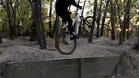
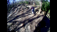
Videos of Jefferson County Mountain Bike
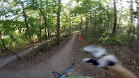
trail: Pump Track
0:52 |
77 |
Feb 3, 2015
trail: Pump Track
0:05 |
191 |
Nov 9, 2014
trail: Pump Track
0:59 |
243 |
Feb 8, 2014
trail: Pump Track
0:43 |
148 |
Jan 13, 2013
trail: Pump Track
2:35 |
586 |
Nov 18, 2012

trail: Funk
3:32 |
431 |
Jul 5, 2012
trail: Pump Track
0:25 |
125 |
Jan 17, 2011
Recent Trail Reports
| status | trail | date | condition | info | user |
|---|---|---|---|---|---|
| Glacial Drumlin State Trail (Cottage Grove) Jefferson County | Jul 23, 2025 @ 5:48pm Jul 23, 2025 | Variable | makers1963 | ||
| Glacial Drumlin State Trail Lake Mills | Jul 23, 2025 @ 5:48pm Jul 23, 2025 | Variable | makers1963 | ||
| Glacial River (Fort Atkinson) Jefferson County | Jun 23, 2024 @ 3:15am Jun 23, 2024 | Ideal | DaveCarnahan | ||
| Glacial River MTB Trail Glacial River Park | Aug 1, 2023 @ 1:08am Aug 1, 2023 | Variable | breuer29 | ||
| Glacial River MTB Trail Glacial River Park | Aug 1, 2023 @ 1:08am Aug 1, 2023 | Variable | breuer29 | ||
| Glacial River (Watertown) Jefferson County | May 11, 2023 @ 8:17am May 11, 2023 | Ideal | trailforks Trailforks | ||
| Glacial River (Johnson Creek) Jefferson | Jun 19, 2022 @ 9:29am Jun 19, 2022 | Ideal | trailforks Trailforks |
Activity Feed
| username | action | type | title | date |
|---|---|---|---|---|
| update | event | activity #94497067 | May 11, 2026 @ 8:40am May 11, 2026 | |
| Tony9704 | ridden | trail | activity #92570533 | Apr 13, 2026 @ 5:51pm Apr 13, 2026 |
| update | event | activity #91738807 and 1 more | Apr 1, 2026 @ 6:17pm Apr 1, 2026 | |
| fl0wstate | ridden | trail | activity #90741413 | Mar 17, 2026 @ 8:09am Mar 17, 2026 |
| update | event | activity #88699719 | Feb 10, 2026 @ 3:53pm Feb 10, 2026 |
Recent Comments
| username | type | title | comment | date |
|---|---|---|---|---|
| trail | These trails are not open to the public, even... | May 24, 2025 @ 2:06pm May 24, 2025 | ||
| trail | Very flat, enjoyed | Nov 9, 2020 @ 12:09pm Nov 9, 2020 |
Local Badges
-

Completionist0 awarded -

10 Blue Trails5 awarded -

Epic Mountain Bike Climb 2k0 awarded -

Climbing 10k Badge0 awarded -

Mountain Biking 100k Badge0 awarded -

Epic Ride Descent 2k0 awarded
Bike & Skill Parks
| name | type | city | rating |
|---|---|---|---|
| Aztalan Cycle Club | skill park |
Activity Type Stats
| activitytype | trails | distance | descent | descent distance | total vertical | rating | global rank | state rank | photos | reports | routes | ridelogs |
|---|---|---|---|---|---|---|---|---|---|---|---|---|
| Mountain Bike | 12 | 42 miles | 558 ft | 14 miles | 144 ft | 5 | 225 | 6,361 | ||||
| E-Bike | 1 | 23 miles | 154 ft | 6 miles | 105 ft | 224 | 540 | |||||
| Horse | 1 | 2,208 ft | 7 ft | 522 ft | 10 ft | 5 | ||||||
| Hike | 16 | 44 miles | 702 ft | 15 miles | 144 ft | 225 | 110 | |||||
| Trail Running | 15 | 43 miles | 696 ft | 15 miles | 144 ft | 225 | 95 | |||||
| Snowmobile | 1 | 23 miles | 154 ft | 6 miles | 105 ft | 1 | ||||||
| Nordic Ski | 1 | 23 miles | 154 ft | 6 miles | 105 ft | 1 | 15 |
Frequently Asked Questions About Jefferson County
▼
What are the best places to ride in Jefferson County?
Jefferson County has 3 areas to explore for mountain biking. The top rated areas are:
▼
What are the highest rated mountain biking trails in Jefferson County?
The highest rated mountain biking trails in Jefferson County are:
- Glacial Drumlin State Trail (Cottage Grove) (4.1/5)
- Glacial River MTB Trail (4/5)
- Glacial River MTB Trail (4/5)
- Glacial River (Fort Atkinson) (0/5)
- Connector (0/5)
▼
What is the best time of the year to ride in Jefferson County?
Based on ride log data, the most popular months to ride in Jefferson County are:
- May (5 activities)
- September (4 activities)
- July (4 activities)
▼
What is the longest trail in Jefferson County?
The longest trail in Jefferson County is Glacial Drumlin State Trail (Cottage Grove) at 22.5 miles. View all trails sorted by distance.
Activities
- By brenthillier
 NSMBA TRAILFORKS & contributors
 - Admins: MW HIKING, feardabeast
- #10966 - 2,074 views
- jefferson county activity log | embed map of Jefferson County mountain bike trails | jefferson county mountain biking points of interest
Downloading of trail gps tracks in kml & gpx formats is enabled for Jefferson County.
You must login to download files.