close
-
Layers w
- Weather Layers
- Pro
- Pro
- Pro
- Pro
- Pro
- Pro
- More Layers
- Pro
- Pro
- Pro
- Pro
-
Upgrade to

3D
Trail Conditions
- Unknown
- Snow Groomed
- Snow Packed
- Snow Covered
- Snow Cover Partial
- Freeze/thaw Cycle
- Icy
- Prevalent Mud
- Wet
- Variable
- Ideal
- Dry
- Very Dry
Trail Flow (Ridden Direction)
Trailforks scans users ridelogs to determine the most popular direction each trail is ridden. A good flowing trail network will have most trails flowing in a single direction according to their intension.
The colour categories are based on what percentage of riders are riding a trail in its intended direction.
The colour categories are based on what percentage of riders are riding a trail in its intended direction.
- > 96%
- > 90%
- > 80%
- > 70%
- > 50%
- < 50%
- bi-directional trail
- no data
Trail Last Ridden
Trailforks scans ridelogs to determine the last time a trail was ridden.
- < 2 days
- < 1 week
- < 2 weeks
- < 1 month
- < 6 months
- > 6 months
Trail Ridden Direction
The intended direction a trail should be ridden.
- Downhill Only
- Downhill Primary
- Both Directions
- Uphill Primary
- Uphill Only
- One Direction
Contribute Details
Colors indicate trail is missing specified detail.
- Description
- Photos
- Description & Photos
- Videos
Trail Popularity ?
Trailforks scans ridelogs to determine which trails are ridden the most in the last 9 months.
Trails are compared with nearby trails in the same city region with a possible 25 colour shades.
Think of this as a heatmap, more rides = more kinetic energy = warmer colors.
- most popular
- popular
- less popular
- not popular
ATV/ORV/OHV Filter
Max Vehicle Width
inches
US Cell Coverage
Legend

Radar Time
Activity Recordings
Trailforks uses anonymized public activity data.
?
Activity Recordings
Trailforks uses anonymized public activity data.
?
Personal Heatmap
▶
Activity Types
all
/
none
▶
Options
2
Date range
month
–
Winter Trails
Warning
A routing network for winter maps does not exist. Selecting trails using the winter trails layer has been disabled.
Missing Trails
Most Popular
Least Popular
Trails are colored based on popularity. The more popular a trail is, the more red. Less popular trails trend towards green.
Jump Magnitude Heatmap
Heatmap of where riders jump on trails. Zoom in to see individual jumps, click circles to view jump details.
BC Backroad Status
![map legend]()
Service Road Atlas is a free to use, community-driven service for viewing and creating reports on the numerous back-country service roads around B.C. and Alberta.

Slope Aspect
Direction the slope faces
Trails Deemphasized
Trails are shown in grey.
Only show trails with no bike usage.
Suggested Layers
Based on selected activity type
Save the current map location and zoom level as your default home location whenever this page is loaded.
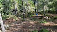
SaveThis region is blessed with some 100 springs, in the valleys between the hills and on the hillsides. Most of the springs flow from cracks in rock formations and every one of them is a celebration of nature. Many of the hillsides have ancient terraces built on them, silent testimony to ancient agricultural efforts.
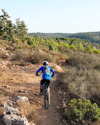
The many natural, historic, archeological, social and cultural sites in this large area make it an ideal and fascinating destination for tours. There are paths for hikers, roads for cars and bicycles and areas that can be reached with all-terrain vehicles. You can crawl through hidden tunnels, wade in the spring pools, pick sweet fruit in season, go horseback riding and take a tour of the hilltops with their magnificent views.
Many of the rural communities have opened wonderful restaurants and visitors can also tour the local wineries, art galleries and studios of artist who live in this area.
source: ...
AKA: הרי ירושלים
This region uses the Uk/Euro style trail grading system.
Region Details
- 3
- 5
- 20
- 20
- 2
Stats
- Avg Trail Rating
- Trails (view details)
- 52
- Trails Mountain Bike
- 50
- Trails E-Bike
- 38
- Trails Horse
- 1
- Trails Hike
- 48
- Trails Trail Running
- 47
- Trails Dirtbike/Moto
- 1
- Trails ATV/ORV/OHV
- 1
- Total Distance
- 105 miles
- Total Descent
- 28,326 ft
- Total Vertical
- 1,984 ft
- Highest Trailhead
- 2,688 ft
- Reports
- 188
- Photos
- 172
- Ridden Counter
- 2,992
Popular Jerusalem Mountains Mountain Biking Trails
• ★ 4.4 • 1 mile • 39 ft • 176 •
Highly rated blue difficulty singletrack. This mountain bike primary trail can be used downhill primary. On average it takes 11 minutes to complete this trail.
• 60 ★ 3.0 • 2 miles • 170 ft • 172 •
Moderately popular green difficulty singletrack. This mountain bike primary trail can be used one direction and has a moderate overall physical rating with a 170 ft green climb. On average it takes 17 minutes to complete this trail.
• 100 ★ 4.3 • 2 miles • 446 ft • 164 •
Popular green difficulty singletrack. This mountain bike primary trail can be used both directions and has a easy overall physical rating with a 446 ft green climb. On average it takes 22 minutes to complete this trail.
• 90 ★ 5.0 • 1 mile • 137 ft • 161 •
Popular blue difficulty singletrack. This mountain bike primary trail can be used downhill primary. On average it takes 10 minutes to complete this trail.
• ★ 0.0 • 3 miles • 416 ft • 129 •
Green difficulty singletrack. This mountain bike primary trail can be used one direction. On average it takes 31 minutes to complete this trail.
• ★ 0.0 • 2 miles • 319 ft • 111 •
Green difficulty singletrack. This mountain bike primary trail can be used one direction. On average it takes 29 minutes to complete this trail.
• ★ 0.0 • 1 mile • 34 ft • 100 •
Blue difficulty singletrack. This mountain bike primary trail can be used downhill primary. On average it takes 7 minutes to complete this trail.
• 75 ★ 5.0 • 2,937 ft • 5 ft • 55 •
Popular red difficulty singletrack. This mountain bike primary trail can be used downhill only. It features drop and rock face. On average it takes 9 minutes to complete this trail.
Jerusalem Mountains Mountain Bike Routes
★ 5.0 • 18 miles • 2,217 ft • 0 •
You can park you car at the parking area of the Zoo. - If you come by car, that is. A nice ride with...
1 mile • 47 ft • 0 • Point to Point •
Nachal Tzofim, Northern Side. There are many trails throughout Nachal Tzofim park, none of them marked as...
3,383 ft • 127 ft • 0 • Point to Point •
Nachal Tzofim, Southern Side. There are many trails throughout Nachal Tzofim park, none of them marked as...
21 miles • 2,673 ft • 0 •
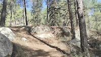
Photos of Jerusalem Mountains Mountain Bike
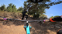
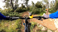
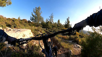
Videos of Jerusalem Mountains Mountain Bike
trail: Val Di Sol
0:45 |
38 |
May 31, 2025
trail: The Pirate
4:02 |
53 |
Aug 5, 2024
trail: IMBA - Part 1
0:23 |
18 |
Apr 10, 2023
trail: The Pirate
0:32 |
35 |
Apr 6, 2023
trail: The Pirate
0:18 |
24 |
Apr 6, 2023
trail: IMBA - Part 1
0:17 |
9 |
Apr 6, 2023

trail: Val Di Sol
0:16 |
|
Feb 3, 2023

trail: Val Di Sol
0:12 |
93 |
Feb 3, 2023
Recent Trail Reports
Activity Feed
| username | action | type | title | date |
|---|---|---|---|---|
| arieltisson | wishlist | trail | activity #95266429 | May 22, 2026 @ 2:00pm May 22, 2026 |
| CGe9gL | wishlist | trail | activity #94639213 | May 13, 2026 @ 11:09am May 13, 2026 |
| freshdan1 | ridden | trail | activity #92348206 | Apr 10, 2026 @ 3:36pm Apr 10, 2026 |
| freshdan1 | ridden | trail | activity #92348203 | Apr 10, 2026 @ 3:36pm Apr 10, 2026 |
| trailforks | add | video | activity #92197701 and 2 more | Apr 8, 2026 @ 11:00am Apr 8, 2026 |
Recent Comments
| username | type | title | comment | date |
|---|---|---|---|---|
| trail | Awesome rock garden. | Apr 6, 2023 @ 11:46am Apr 6, 2023 | ||
| trail | Downhill | Mar 31, 2022 @ 11:49am Mar 31, 2022 | ||
| trail | שם שמכבד אותו | Mar 31, 2022 @ 11:46am Mar 31, 2022 | ||
| trail | תלול ומדורדר מאוד | May 5, 2021 @ 9:26am May 5, 2021 | ||
| trail | מוזמן להוסיף את הסינגל... | Jan 13, 2021 @ 6:41am Jan 13, 2021 |
Local Badges
-

Epic Ride Climb 2k9 awarded -

Climbing 10k Badge21 awarded -

Climbing 100k Badge2 awarded -

Epic Ride Descent 2k9 awarded -

Descent 10k Badge23 awarded -

Descent 100k Badge2 awarded
Bike & Skill Parks
| name | type | city | rating |
|---|---|---|---|
| Modi'in Pump Track | skill park | Jerusalem |
Activity Type Stats
| activitytype | trails | distance | descent | descent distance | total vertical | rating | global rank | state rank | photos | reports | routes | ridelogs |
|---|---|---|---|---|---|---|---|---|---|---|---|---|
| Mountain Bike | 50 | 68 miles | 22,717 ft | 44 miles | 1,985 ft | 157 | 185 | 5 | 13,947 | |||
| E-Bike | 38 | 51 miles | 17,382 ft | 34 miles | 1,985 ft | 15 | 167 | 2 | 1,320 | |||
| Horse | 1 | 10 miles | 1,499 ft | 5 miles | 797 ft | 29 | ||||||
| Hike | 48 | 100 miles | 27,425 ft | 60 miles | 1,985 ft | 179 | 781 | |||||
| Trail Running | 47 | 99 miles | 26,923 ft | 59 miles | 1,985 ft | 178 | 64 | |||||
| Dirtbike/Moto | 1 | 10 miles | 1,499 ft | 5 miles | 797 ft | 29 | ||||||
| ATV/ORV/OHV | 1 | 10 miles | 1,499 ft | 5 miles | 797 ft | 29 | 1 |
Activities
Trails
- Hard trails in Jerusalem Mountains
- Easy trails in Jerusalem Mountains
- Favorite trails in Jerusalem Mountains
- Most ridden trails in Jerusalem Mountains
- Singletrack in Jerusalem Mountains
- Viewpoint trails in Jerusalem Mountains
- Trails with technical features in Jerusalem Mountains
- Race routes in Jerusalem Mountains
Points of Interest
- By ziv2102
 TRAILFORKS & contributors
 - Admins: ziv2102
- #6229 - 6,499 views
- jerusalem mountains activity log | embed map of Jerusalem Mountains mountain bike trails | jerusalem mountains mountain biking points of interest
Downloading of trail gps tracks in kml & gpx formats is enabled for Jerusalem Mountains.
You must login to download files.