close
-
Layers w
- Weather Layers
- Pro
- Pro
- Pro
- Pro
- Pro
- Pro
- More Layers
- Pro
- Pro
- Pro
- Pro
-
Upgrade to

3D
Trail Conditions
- Unknown
- Snow Groomed
- Snow Packed
- Snow Covered
- Snow Cover Partial
- Freeze/thaw Cycle
- Icy
- Prevalent Mud
- Wet
- Variable
- Ideal
- Dry
- Very Dry
Trail Flow (Ridden Direction)
Trailforks scans users ridelogs to determine the most popular direction each trail is ridden. A good flowing trail network will have most trails flowing in a single direction according to their intension.
The colour categories are based on what percentage of riders are riding a trail in its intended direction.
The colour categories are based on what percentage of riders are riding a trail in its intended direction.
- > 96%
- > 90%
- > 80%
- > 70%
- > 50%
- < 50%
- bi-directional trail
- no data
Trail Last Ridden
Trailforks scans ridelogs to determine the last time a trail was ridden.
- < 2 days
- < 1 week
- < 2 weeks
- < 1 month
- < 6 months
- > 6 months
Trail Ridden Direction
The intended direction a trail should be ridden.
- Downhill Only
- Downhill Primary
- Both Directions
- Uphill Primary
- Uphill Only
- One Direction
Contribute Details
Colors indicate trail is missing specified detail.
- Description
- Photos
- Description & Photos
- Videos
Trail Popularity ?
Trailforks scans ridelogs to determine which trails are ridden the most in the last 9 months.
Trails are compared with nearby trails in the same city region with a possible 25 colour shades.
Think of this as a heatmap, more rides = more kinetic energy = warmer colors.
- most popular
- popular
- less popular
- not popular
ATV/ORV/OHV Filter
Max Vehicle Width
inches
US Cell Coverage
Legend

Radar Time
Activity Recordings
Trailforks uses anonymized public activity data.
?
Activity Recordings
Trailforks uses anonymized public activity data.
?
Personal Heatmap
▶
Activity Types
all
/
none
▶
Options
2
Date range
month
–
Winter Trails
Warning
A routing network for winter maps does not exist. Selecting trails using the winter trails layer has been disabled.
Missing Trails
Most Popular
Least Popular
Trails are colored based on popularity. The more popular a trail is, the more red. Less popular trails trend towards green.
Jump Magnitude Heatmap
Heatmap of where riders jump on trails. Zoom in to see individual jumps, click circles to view jump details.
BC Backroad Status
![map legend]()
Service Road Atlas is a free to use, community-driven service for viewing and creating reports on the numerous back-country service roads around B.C. and Alberta.

Slope Aspect
Direction the slope faces
Trails Deemphasized
Trails are shown in grey.
Only show trails with no bike usage.
Suggested Layers
Based on selected activity type
Save the current map location and zoom level as your default home location whenever this page is loaded.
Save
No description for Jeseník has been added yet!
Login or register to submit one.
This region uses the Uk/Euro style trail grading system.
Activities Click to view
- Mountain Bike
54 trails
- Gravel Bike
0 trails
- Adaptive Bike
0 trails
- Winter Fat Bike
0 trails
- Hike
15 trails
- Trail Running
15 trails
Region Details
- 21
- 9
- 6
- 8
- 6
- 2
Region Status
Open as of Jun 7, 2026Stats
- Avg Trail Rating
- Trails (view details)
- 53
- Trails Mountain Bike
- 54
- Trails Hike
- 15
- Trails Trail Running
- 15
- Total Distance
- 46 miles
- Total Descent
- 7,538 ft
- Total Vertical
- 1,902 ft
- Highest Trailhead
- 2,678 ft
- Reports
- 1,662
- Photos
- 191
- Ridden Counter
- 29,477
Sub Regions
-
Lipovské Stezky
- 3
- 2
-
Rychlebské Stezky
- 6
- 4
- 8
- 6
- 2
Popular Jeseník Mountain Biking Trails
• 80 ★ 4.2 • 2,437 ft • 42 ft • 1,438 •
Highly rated popular blue difficulty singletrack. This mountain bike primary trail can be used one direction. On average it takes 3 minutes to complete this trail.
• 90 ★ 4.9 • 4,510 ft • 72 ft • 1,425 •
Highly rated popular blue difficulty mixed. This mountain bike primary trail can be used one direction and has a moderate overall physical rating. It features bridge, drop, jump, rock face, roller coaster and skinny. On average it takes 5 minutes to complete this trail.
• 95 ★ 4.3 • 4,281 ft • 74 ft • 1,402 •
Highly rated popular blue difficulty singletrack. This mountain bike primary trail can be used one direction and has a moderate overall physical rating. It features berm, jump and pump track. On average it takes 4 minutes to complete this trail.
• 80 ★ 4.8 • 4,769 ft • 4 ft • 1,400 •
Highly rated popular red difficulty singletrack. This mountain bike primary trail can be used one direction and has a moderate overall physical rating. It features berm, bridge and jump. On average it takes 6 minutes to complete this trail.
• 95 ★ 4.5 • 3,662 ft • 4 ft • 1,394 •
Highly rated popular red difficulty singletrack. This mountain bike primary trail can be used one direction and has a moderate overall physical rating. It features a-frame, berm and bridge. On average it takes 3 minutes to complete this trail.
• 85 ★ 4.9 • 4,519 ft • 0 ft • 1,390 •
Highly rated popular red difficulty singletrack. This mountain bike primary trail can be used one direction and has a moderate overall physical rating. It features berm, bridge, drop, jump, pump track and rock face. On average it takes 5 minutes to complete this trail.
• 90 ★ 4.7 • 2,405 ft • 0 ft • 1,371 •
Highly rated popular red difficulty singletrack. This mountain bike primary trail can be used one direction and has a moderate overall physical rating. It features berm, bridge, jump and pump track. On average it takes 2 minutes to complete this trail.
• 75 ★ 4.5 • 5,140 ft • 7 ft • 965 •
Highly rated popular red difficulty singletrack. This mountain bike primary trail can be used one direction. It features drop, jump and rock face. On average it takes 5 minutes to complete this trail.
Jeseník Mountain Bike Routes
• 14 miles • 2,374 ft • 12 •
• 14 miles • 2,965 ft • 16 •
• 17 miles • 1,842 ft • 8 •
• 12 miles • 2,139 ft • 13 •
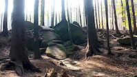
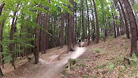
Photos of Jeseník Mountain Bike
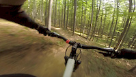
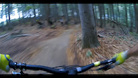
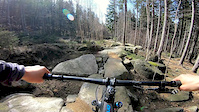
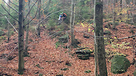
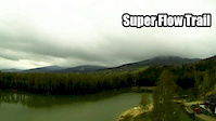
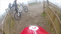
Videos of Jeseník Mountain Bike
trail: Naučná stezka
0:48 |
98 |
Sep 18, 2020
trail: Superflow sekce 1
7:19 |
125 |
Sep 6, 2018
trail: Superflow sekce 3
2:21 |
176 |
May 3, 2018
trail: Obelix
0:44 |
207 |
Apr 10, 2018
trail: Superflow sekce 2
0:14 |
156 |
Sep 28, 2017
trail: Superflow sekce 6
0:54 |
61 |
Sep 25, 2017
trail: Trail Dr. Wiessnera
12:16 |
576 |
Nov 1, 2016
trail: Wales
0:30 |
174 |
Aug 22, 2016
Recent Trail Reports
| status | trail | date | condition | info | user |
|---|---|---|---|---|---|
| Superflow sekce 7, 8 | Jun 7, 2026 @ 1:25pm (Europe/Prague) Jun 7, 2026 | Ideal | gilbertos | ||
| Superflow sekce 6 | Jun 7, 2026 @ 1:25pm (Europe/Prague) Jun 7, 2026 | Ideal | gilbertos | ||
| Superflow sekce 5 | Jun 7, 2026 @ 1:25pm (Europe/Prague) Jun 7, 2026 | Ideal | gilbertos | ||
| Superflow sekce 4 | Jun 7, 2026 @ 1:25pm (Europe/Prague) Jun 7, 2026 | Ideal | gilbertos | ||
| Superflow sekce 3 | Jun 7, 2026 @ 1:25pm (Europe/Prague) Jun 7, 2026 | Ideal | gilbertos | ||
| Superflow sekce 2 | Jun 7, 2026 @ 1:25pm (Europe/Prague) Jun 7, 2026 | Ideal | gilbertos | ||
| Forest Road | Jun 7, 2026 @ 1:25pm (Europe/Prague) Jun 7, 2026 | Variable | gilbertos | ||
| Superflow sekce 1 | Jun 7, 2026 @ 1:25pm (Europe/Prague) Jun 7, 2026 | Ideal | gilbertos | ||
| Access Road | Jun 7, 2026 @ 1:25pm (Europe/Prague) Jun 7, 2026 | Ideal | gilbertos | ||
| Sjezdy | Apr 6, 2026 @ 10:36am (Europe/Prague) Apr 6, 2026 | Ideal | katko |
Activity Feed
| username | action | type | title | date |
|---|---|---|---|---|
| MZ2005 | vote | trail | activity #97278149 | Jun 18, 2026 @ 3:06pm 3 days |
| lukeburrage | comment | trail | activity #97165756 | Jun 16, 2026 @ 11:55pm Jun 16, 2026 |
| lukeburrage | ridden | trail | activity #97165743 | Jun 16, 2026 @ 11:54pm Jun 16, 2026 |
| woocachek | wishlist | trail | activity #96944428 | Jun 14, 2026 @ 1:26am Jun 14, 2026 |
| gilbertos | add | report | activity #96592192 and 8 more | Jun 9, 2026 @ 2:23am Jun 9, 2026 |
Recent Comments
| username | type | title | comment | date |
|---|---|---|---|---|
| trail | Should you add this trail to the start of a... | Jun 16, 2026 @ 11:55pm Jun 16, 2026 | ||
| trail | I can support the previous comment. Bad... | Mar 9, 2026 @ 6:47am Mar 9, 2026 | ||
| trail | Closed | Jul 27, 2025 @ 3:37am Jul 27, 2025 | ||
| trail | Constant rock balancing acts keep you engaged... | Aug 19, 2024 @ 3:14am Aug 19, 2024 | ||
| trail | Amazing scenery and boulders around you, long... | Aug 19, 2024 @ 3:11am Aug 19, 2024 |
Local Badges
-

10 Blue Trails430 awarded -

Epic Ride Climb 2k149 awarded -

Climbing 10k Badge91 awarded -

Climbing 100k Badge0 awarded -

Epic Ride Descent 2k148 awarded -

Descent 10k Badge91 awarded
Bike & Skill Parks
| name | type | city | rating |
|---|---|---|---|
| Pumptrack | skill park | Jeseník |
Activity Type Stats
| activitytype | trails | distance | descent | descent distance | total vertical | rating | global rank | state rank | photos | reports | routes | ridelogs |
|---|---|---|---|---|---|---|---|---|---|---|---|---|
| Mountain Bike | 54 | 46 miles | 7,539 ft | 23 miles | 1,903 ft | #505 | #2 | 187 | 1,619 | 2 | 8,649 | |
| Hike | 15 | 15 miles | 837 ft | 4 miles | 1,903 ft | #2,576 | #18 | 1,469 | 278 | |||
| Trail Running | 15 | 15 miles | 837 ft | 4 miles | 1,903 ft | #2,125 | #18 | 1,469 | 22 |
Frequently Asked Questions About Jeseník
▼
What are the best places to ride in Jeseník?
Jeseník has 2 areas to explore for mountain biking. The top rated areas are:
▼
What are the highest rated mountain biking trails in Jeseník?
The highest rated mountain biking trails in Jeseník are:
- Superflow sekce 3 (4.8/5)
- Superflow sekce 2 (4.7/5)
- Superflow sekce 4 (4.7/5)
- Superflow sekce 5 (4.6/5)
- Obelix (4.6/5)
▼
What is the best time of the year to ride in Jeseník?
Based on ride log data, the most popular months to ride in Jeseník are:
- July (91 activities)
- August (76 activities)
- June (52 activities)
▼
Where can I park to ride in Jeseník?
There are 1 parking locations listed in Jeseník. The most popular parking spots are:
Trails
Points of Interest
- By zvirze
 ČeMBA & contributors
 - Admins: ČeMBA, ČeMBA, ČeMBA, ČeMBA, ČeMBA, ČeMBA, ČeMBA, ČeMBA, ČeMBA, ČeMBA
- #25530 - 5,511 views
- jeseník activity log | embed map of Jeseník mountain bike trails | jeseník mountain biking points of interest
Downloading of trail gps tracks in kml & gpx formats is enabled for Jeseník.
You must login to download files.