close
-
Layers w
- Weather Layers
- Pro
- Pro
- Pro
- Pro
- Pro
- Pro
- More Layers
- Pro
- Pro
- Pro
- Pro
-
Upgrade to

3D
Trail Conditions
- Unknown
- Snow Groomed
- Snow Packed
- Snow Covered
- Snow Cover Partial
- Freeze/thaw Cycle
- Icy
- Prevalent Mud
- Wet
- Variable
- Ideal
- Dry
- Very Dry
Trail Flow (Ridden Direction)
Trailforks scans users ridelogs to determine the most popular direction each trail is ridden. A good flowing trail network will have most trails flowing in a single direction according to their intension.
The colour categories are based on what percentage of riders are riding a trail in its intended direction.
The colour categories are based on what percentage of riders are riding a trail in its intended direction.
- > 96%
- > 90%
- > 80%
- > 70%
- > 50%
- < 50%
- bi-directional trail
- no data
Trail Last Ridden
Trailforks scans ridelogs to determine the last time a trail was ridden.
- < 2 days
- < 1 week
- < 2 weeks
- < 1 month
- < 6 months
- > 6 months
Trail Ridden Direction
The intended direction a trail should be ridden.
- Downhill Only
- Downhill Primary
- Both Directions
- Uphill Primary
- Uphill Only
- One Direction
Contribute Details
Colors indicate trail is missing specified detail.
- Description
- Photos
- Description & Photos
- Videos
Trail Popularity ?
Trailforks scans ridelogs to determine which trails are ridden the most in the last 9 months.
Trails are compared with nearby trails in the same city region with a possible 25 colour shades.
Think of this as a heatmap, more rides = more kinetic energy = warmer colors.
- most popular
- popular
- less popular
- not popular
ATV/ORV/OHV Filter
Max Vehicle Width
inches
US Cell Coverage
Legend

Radar Time
Activity Recordings
Trailforks uses anonymized public activity data.
?
Activity Recordings
Trailforks uses anonymized public activity data.
?
Personal Heatmap
▶
Activity Types
all
/
none
▶
Options
2
Date range
month
–
Winter Trails
Warning
A routing network for winter maps does not exist. Selecting trails using the winter trails layer has been disabled.
Missing Trails
Most Popular
Least Popular
Trails are colored based on popularity. The more popular a trail is, the more red. Less popular trails trend towards green.
Jump Magnitude Heatmap
Heatmap of where riders jump on trails. Zoom in to see individual jumps, click circles to view jump details.
BC Backroad Status
![map legend]()
Service Road Atlas is a free to use, community-driven service for viewing and creating reports on the numerous back-country service roads around B.C. and Alberta.

Slope Aspect
Direction the slope faces
Trails Deemphasized
Trails are shown in grey.
Only show trails with no bike usage.
Suggested Layers
Based on selected activity type
Save the current map location and zoom level as your default home location whenever this page is loaded.
SaveThis region is Unsanctioned, Ride at your own Risk!
No description for Jester has been added yet! Login or register to submit one. google parking directions
 Disclaimer:
These trails are not sanctioned by the City of Austin Parks and Recreation Department. Use of these trails is prohibited and are mapped solely for educational purposes. Please do not use unsanctioned trails.
Activities Click to view
- Mountain Bike
31 trails
- E-Bike
30 trails
- Hike
31 trails
- Trail Running
31 trails
Region Details
- 30
- 1
Region Status
Open as of Feb 23, 2025Stats
- Avg Trail Rating
- Trails (view details)
- 31
- Trails Mountain Bike
- 31
- Trails E-Bike
- 30
- Trails Hike
- 31
- Trails Trail Running
- 31
- Total Distance
- 9 miles
- Total Descent Distance
- 3 miles
- Total Descent
- 1,126 ft
- Total Vertical
- 336 ft
- Highest Trailhead
- 879 ft
- Reports
- 74
- Ridden Counter
- 3,384
Popular Jester Mountain Biking Trails
• 95 ★ 0.0 • 1,056 ft • 22 ft • 174 •
Popular blue difficulty singletrack. This multi-use trail can be used both directions and has a moderate overall physical rating with a 22 ft blue climb. Trail visibility is always easy to follow. On average it takes 1 minutes to complete this trail.
• 85 ★ 0.0 • 1,427 ft • 18 ft • 166 •
Popular blue difficulty singletrack. This multi-use trail can be used both directions and has a moderate overall physical rating with a 18 ft blue climb. Trail visibility is always easy to follow. On average it takes 2 minutes to complete this trail.
• 90 ★ 0.0 • 2,349 ft • 92 ft • 164 •
Popular blue difficulty singletrack. This multi-use trail can be used both directions and has a moderate overall physical rating with a 92 ft blue climb. Trail visibility is always easy to follow. On average it takes 4 minutes to complete this trail.
• 90 ★ 0.0 • 1,093 ft • 19 ft • 160 •
Popular blue difficulty singletrack. This multi-use trail can be used both directions and has a moderate overall physical rating with a 19 ft blue climb. Trail visibility is always easy to follow. On average it takes 2 minutes to complete this trail.
• 70 ★ 4.0 • 1,512 ft • 0 ft • 152 •
Popular blue difficulty singletrack. This multi-use trail can be used both directions and has a moderate overall physical rating with a 0 ft blue climb. Trail visibility is always easy to follow. On average it takes 2 minutes to complete this trail.
• 80 ★ 0.0 • 1,414 ft • 68 ft • 142 •
Popular blue difficulty singletrack. This multi-use trail can be used both directions and has a moderate overall physical rating with a 68 ft blue climb. Trail visibility is always easy to follow. On average it takes 4 minutes to complete this trail.
• 75 ★ 0.0 • 1,158 ft • 88 ft • 130 •
Popular blue difficulty singletrack. This multi-use trail can be used both directions and has a moderate overall physical rating with a 88 ft blue climb. Trail visibility is always easy to follow. On average it takes 5 minutes to complete this trail.
Videos of Jester Mountain Bike
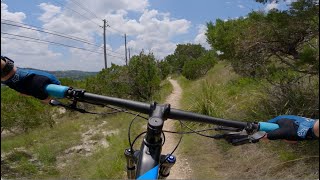
15:30 |
81 |
Mar 14, 2025
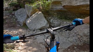
15:16 |
155 |
Mar 7, 2025
Recent Trail Reports
| status | trail | date | condition | info | user |
|---|---|---|---|---|---|
| JST11 | Feb 23, 2025 @ 12:57pm Feb 23, 2025 | Snow Groomed | droppableseatpost | ||
| JST06 | Feb 23, 2025 @ 12:57pm Feb 23, 2025 | Snow Groomed | droppableseatpost | ||
| JST05 | Feb 23, 2025 @ 12:57pm Feb 23, 2025 | Snow Groomed | droppableseatpost | ||
| JST09 | Feb 23, 2025 @ 12:57pm Feb 23, 2025 | Snow Groomed | droppableseatpost | ||
| JST03 | Feb 23, 2025 @ 12:57pm Feb 23, 2025 | Snow Groomed | droppableseatpost | ||
| JST08 | Feb 23, 2025 @ 12:57pm Feb 23, 2025 | Snow Groomed | droppableseatpost | ||
| JST02 | Feb 22, 2025 @ 10:24am Feb 22, 2025 | Variable | 2magichands | ||
| JST07 | Feb 22, 2025 @ 10:24am Feb 22, 2025 | Variable | 2magichands | ||
| JST18 | Feb 22, 2025 @ 10:24am Feb 22, 2025 | Variable | 2magichands | ||
| JST28 | Feb 22, 2025 @ 10:24am Feb 22, 2025 | Variable | 2magichands |
Activity Feed
| username | action | type | title | date |
|---|---|---|---|---|
| craig4o01CM | wishlist | trail | activity #94649495 | May 13, 2026 @ 2:28pm May 13, 2026 |
| JakeKelley | ridden | trail | activity #78858404 and 1 more | Aug 24, 2025 @ 11:41am Aug 24, 2025 |
| geostar | add | video | activity #67753768 | Mar 14, 2025 @ 2:02pm Mar 14, 2025 |
| geostar | add | video | activity #67346454 | Mar 7, 2025 @ 2:15pm Mar 7, 2025 |
| droppableseatpost | add | report | activity #66707057 and 7 more | Feb 23, 2025 @ 8:12pm Feb 23, 2025 |
Recent Comments
| username | type | title | comment | date |
|---|---|---|---|---|
| trail | How to be a Townie 101: 1. Bring your MX bike... | Nov 26, 2023 @ 12:57pm Nov 26, 2023 | ||
| trail | It ain't a the way I hit it ⬛ | Jul 1, 2023 @ 8:35pm Jul 1, 2023 | ||
| trail | Lots of branches down, very tight access on... | Mar 29, 2023 @ 4:23pm Mar 29, 2023 |
Nearby Areas
| name | distance | ||||
|---|---|---|---|---|---|
| Bull Creek Greenbelt | 24 | 0.6 km | |||
| Valburn | 7 | 1.1 km | |||
| Emma Long Metropolitan Park | 4 | 8 | 2.5 km | ||
| St. Edwards Greenbelt | 5 | 8 | 2.5 km | ||
| Dominion at Great Hills Park | 11 | 2.7 km |
Local Badges
-

Completionist0 awarded
Activity Type Stats
| activitytype | trails | distance | descent | descent distance | total vertical | rating | global rank | state rank | photos | reports | routes | ridelogs |
|---|---|---|---|---|---|---|---|---|---|---|---|---|
| Mountain Bike | 31 | 9 miles | 1,125 ft | 3 miles | 335 ft | #9,701 | #3,821 | 74 | 1,318 | |||
| E-Bike | 30 | 9 miles | 1,122 ft | 3 miles | 335 ft | #5,637 | #1,567 | 74 | 276 | |||
| Hike | 31 | 9 miles | 1,125 ft | 3 miles | 335 ft | #11,370 | #4,582 | 74 | 62 | |||
| Trail Running | 31 | 9 miles | 1,125 ft | 3 miles | 335 ft | #10,625 | #3,994 | 74 | 16 |
Frequently Asked Questions About Jester
▼
What are the highest rated mountain biking trails in Jester?
▼
What is the best time of the year to ride in Jester?
Based on ride log data, the most popular months to ride in Jester are:
- November (14 activities)
- December (8 activities)
- September (7 activities)
▼
Where can I park to ride in Jester?
▼
What is the longest trail in Jester?
The longest trail in Jester is JST09 at 1.7 miles. View all trails sorted by distance.
- By Turntex
 TRAILFORKS SMGA & contributors
 - Admins: mtbatx
- #47477 - 5,498 views
- jester activity log | embed map of Jester mountain bike trails | jester mountain biking points of interest
Downloading of trail gps tracks in kml & gpx formats is enabled for Jester.
You must login to download files.