close
-
Layers w
- Weather Layers
- Pro
- Pro
- Pro
- Pro
- Pro
- Pro
- More Layers
- Pro
- Pro
- Pro
- Pro
-
Upgrade to

3D
Trail Conditions
- Unknown
- Snow Groomed
- Snow Packed
- Snow Covered
- Snow Cover Partial
- Freeze/thaw Cycle
- Icy
- Prevalent Mud
- Wet
- Variable
- Ideal
- Dry
- Very Dry
Trail Flow (Ridden Direction)
Trailforks scans users ridelogs to determine the most popular direction each trail is ridden. A good flowing trail network will have most trails flowing in a single direction according to their intension.
The colour categories are based on what percentage of riders are riding a trail in its intended direction.
The colour categories are based on what percentage of riders are riding a trail in its intended direction.
- > 96%
- > 90%
- > 80%
- > 70%
- > 50%
- < 50%
- bi-directional trail
- no data
Trail Last Ridden
Trailforks scans ridelogs to determine the last time a trail was ridden.
- < 2 days
- < 1 week
- < 2 weeks
- < 1 month
- < 6 months
- > 6 months
Trail Ridden Direction
The intended direction a trail should be ridden.
- Downhill Only
- Downhill Primary
- Both Directions
- Uphill Primary
- Uphill Only
- One Direction
Contribute Details
Colors indicate trail is missing specified detail.
- Description
- Photos
- Description & Photos
- Videos
Trail Popularity ?
Trailforks scans ridelogs to determine which trails are ridden the most in the last 9 months.
Trails are compared with nearby trails in the same city region with a possible 25 colour shades.
Think of this as a heatmap, more rides = more kinetic energy = warmer colors.
- most popular
- popular
- less popular
- not popular
ATV/ORV/OHV Filter
Max Vehicle Width
inches
US Cell Coverage
Legend

Radar Time
Activity Recordings
Trailforks uses anonymized public activity data.
?
Activity Recordings
Trailforks uses anonymized public activity data.
?
Personal Heatmap
▶
Activity Types
all
/
none
▶
Options
2
Date range
month
–
Winter Trails
Warning
A routing network for winter maps does not exist. Selecting trails using the winter trails layer has been disabled.
Missing Trails
Most Popular
Least Popular
Trails are colored based on popularity. The more popular a trail is, the more red. Less popular trails trend towards green.
Jump Magnitude Heatmap
Heatmap of where riders jump on trails. Zoom in to see individual jumps, click circles to view jump details.
BC Backroad Status
![map legend]()
Service Road Atlas is a free to use, community-driven service for viewing and creating reports on the numerous back-country service roads around B.C. and Alberta.

Slope Aspect
Direction the slope faces
Trails Deemphasized
Trails are shown in grey.
Only show trails with no bike usage.
Suggested Layers
Based on selected activity type
Save the current map location and zoom level as your default home location whenever this page is loaded.
Save
No description for Jindabyne has been added yet!
Login or register to submit one.
Activities Click to view
- Mountain Bike
50 trails
- E-Bike
4 trails
- Gravel Bike
0 trails
- Adaptive Bike
0 trails
- Hike
51 trails
- Trail Running
51 trails
Region Details
- 2
- 11
- 27
- 10
Region Status
Open as of 20 hoursStats
- Avg Trail Rating
- Trails (view details)
- 50
- Trails Mountain Bike
- 50
- Trails E-Bike
- 4
- Trails Hike
- 51
- Trails Trail Running
- 51
- Total Distance
- 28 miles
- Total Descent
- 5,540 ft
- Total Vertical
- 1,166 ft
- Highest Trailhead
- 4,115 ft
- Reports
- 388
- Photos
- 288
- Ridden Counter
- 13,463
Sub Regions
-
Bungarra Mountain Bike Park
- 5
- 8
- 2
-
Tyrolean and Mill Creek
- 3
- 11
- 7
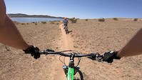
Popular Jindabyne Mountain Biking Trails
• 100 ★ 4.3 • 2 miles • 204 ft • 836 •
Popular green difficulty singletrack. This mountain bike primary trail can be used both directions. On average it takes 12 minutes to complete this trail.
• 90 ★ 4.8 • 3 miles • 734 ft • 704 •
Popular green difficulty singletrack. This mountain bike primary trail can be used both directions. On average it takes 30 minutes to complete this trail.
• 95 ★ 4.6 • 3 miles • 156 ft • 675 •
A great trail for all skill levels, winding it's way around the lake to . Passes through cattle grazing paddocks, so keep an eye out for the odd cow, and make sure you close the gates! Intermediate and advanced riders should look for...
• 70 ★ 3.0 • 4,386 ft • 77 ft • 636 •
Popular green difficulty singletrack. This mountain bike primary trail can be used both directions. On average it takes 5 minutes to complete this trail.
• 100 ★ 3.5 • 1,929 ft • 74 ft • 620 •
Popular black diamond difficulty singletrack. This mountain bike primary trail can be used both directions and has a hard overall physical rating with a 74 ft black diamond climb. On average it takes 2 minutes to complete this trail.
• 85 ★ 3.2 • 495 ft • 12 ft • 599 •
Julio is a fun little trail with fast switch backs, berms and a small uphill climb
• 80 ★ 3.0 • 908 ft • 12 ft • 569 •
Fun singletrack alternative to the concrete path along the lake.
• 100 ★ 4.6 • 3,753 ft • 0 ft • 495 •
Highly rated popular blue difficulty singletrack. This mountain bike primary trail can be used downhill only. On average it takes 4 minutes to complete this trail.
Jindabyne Mountain Bike Routes
★ 5.0 • 8 miles • 498 ft • 2 • Out & Back •
Easy ride from Sacred Ride in Jindayne to Gaden Trout Hatchery with scenic views of Lake Jindabyne along...
★ 5.0 • 8 miles • 1,046 ft • 20 • Out & Back •
Leave your swimmers and towel in the car at the Pooh bay trailhead (corner of Townsend St and Cobbin Cr)...
26 miles • 2,736 ft • 4 •
Jindabyne to Thredbo MTB Route. I'm not sure why this is showing as a hidden route. it's a legitimate...
4 miles • 382 ft • 6 • Loop • Race •
NICA's inclusive racing format offers participants the opportunity to experience and learn discipline,...
4 miles • 399 ft • 7 • Race •
NICA's inclusive racing format offers participants the opportunity to experience and learn discipline,...
5 miles • 427 ft • 10 • Race •
NICA's inclusive racing format offers participants the opportunity to experience and learn discipline,...
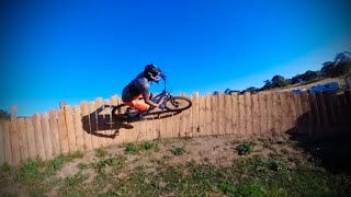
Photos of Jindabyne Mountain Bike
Videos of Jindabyne Mountain Bike
trail: Three Lions
0:56 |
275 |
Apr 1, 2021
trail: Mill Creek Trail
19:53 |
292 |
Jul 22, 2020
trail: Three Lions
0:51 |
433 |
Jul 7, 2020
trail: Huff 'n Puff
3:06 |
170 |
Jun 19, 2020

trail: Pink Trail
0:39 |
392 |
Nov 19, 2019
trail: Hatchery Bay Trail
0:18 |
512 |
Feb 15, 2019
7:36 |
405 |
Feb 2, 2023 , Jindabyne

trail: Pink Trail
16:42 |
454 |
Jan 27, 2022 , Jindabyne
Current Trail Warnings
| status | trail | date | condition | user | info |
|---|---|---|---|---|---|
| Sri Chinmoy | May 21, 2026 @ 10:39am (Australia/Sydney) May 20, 2026 | Ideal | Milesofmars JTS | Trail under construction/ realignment |
Recent Trail Reports
| status | trail | date | condition | info | user |
|---|---|---|---|---|---|
| Copper Tom Trail | Jun 7, 2026 @ 11:53am (Australia/Melbourne) Jun 6, 2026 | Ideal | cocoletitia | ||
| Bunty's North | Apr 28, 2026 @ 6:18am (Australia/Sydney) Apr 27, 2026 | Unknown | Milesofmars JTS | ||
| Centrelink | Apr 28, 2026 @ 6:17am (Australia/Sydney) Apr 27, 2026 | Unknown | Milesofmars JTS | ||
| Whoop D Doo | Apr 28, 2026 @ 6:15am (Australia/Sydney) Apr 27, 2026 | Unknown | Milesofmars JTS | ||
| Huff 'n Puff | Apr 28, 2026 @ 6:14am (Australia/Sydney) Apr 27, 2026 | Unknown | Milesofmars JTS | ||
| Missing Link | Apr 19, 2026 @ 2:29pm (Australia/Sydney) Apr 18, 2026 | Ideal | Milesofmars JTS | ||
| The Duff | Apr 6, 2026 @ 7:41pm (Australia/Sydney) Apr 6, 2026 | Unknown | MattXSDebN | ||
| Mill Creek Trail | Dec 29, 2025 @ 11:03am (Australia/Sydney) Dec 28, 2025 | Dry | oldmencanstilljump | ||
| Hatchery Bay Trail | Oct 24, 2025 @ 9:57am (Australia/Sydney) Oct 23, 2025 | Ideal | mhockings | ||
| Waterfall Trail | Apr 20, 2025 @ 1:59pm Apr 20, 2025 | Very Dry | noikmeister |
Activity Feed
| username | action | type | title | date |
|---|---|---|---|---|
| Hellsy28 | wishlist | trail | activity #96664928 and 1 more | Jun 10, 2026 @ 5:03am Jun 10, 2026 |
| cocoletitia | add | report | activity #96432747 | Jun 6, 2026 @ 11:32pm Jun 6, 2026 |
| Milesofmars | add | report | activity #95144639 | May 20, 2026 @ 5:39pm May 20, 2026 |
| Milesofmars | update | trail | activity #95144463 | May 20, 2026 @ 5:37pm May 20, 2026 |
| Milesofmars | add | report | activity #93536667 and 3 more | Apr 27, 2026 @ 1:14pm Apr 27, 2026 |
Recent Comments
| username | type | title | comment | date |
|---|---|---|---|---|
| report | this trail gets lots of use. it is a medium... | Apr 18, 2026 @ 9:31pm Apr 18, 2026 | ||
| trail | Fantastic descent after climbing around on the... | Jan 14, 2026 @ 5:57pm Jan 14, 2026 | ||
| trail | I remember when my missus was this fun a ride 😆 | Feb 26, 2025 @ 10:21pm Feb 26, 2025 | ||
| trail | Simple but scenic. Worth it for the views | Feb 26, 2025 @ 10:18pm Feb 26, 2025 | ||
| trail | Super flow with great berms and kickers. Lake... | Feb 26, 2025 @ 10:17pm Feb 26, 2025 |
Local Badges
-

10 Green Trails108 awarded -

10 Blue Trails103 awarded -

10 Black Trails56 awarded -

Epic Ride Climb 2k186 awarded -

Climbing 10k Badge44 awarded -

Climbing 100k Badge3 awarded
Bike & Skill Parks
| name | type | city | rating |
|---|---|---|---|
| Pump Track | skill park | Jindabyne | |
| Pocket Park | skill park | Jindabyne | |
| Skill Park | skill park | Jindabyne |
Activity Type Stats
| activitytype | trails | distance | descent | descent distance | total vertical | rating | global rank | state rank | photos | reports | routes | ridelogs |
|---|---|---|---|---|---|---|---|---|---|---|---|---|
| Mountain Bike | 50 | 28 miles | 5,538 ft | 13 miles | 1,165 ft | #1,062 | #60 | 287 | 388 | 11 | 10,008 | |
| E-Bike | 4 | 2,621 ft | 154 ft | 1,673 ft | 407 ft | #1,493 | #87 | 1 | 174 | 6 | 759 | |
| Hike | 51 | 27 miles | 5,423 ft | 13 miles | 1,165 ft | #1,660 | #50 | 376 | 293 | |||
| Trail Running | 51 | 27 miles | 5,423 ft | 13 miles | 1,165 ft | #1,180 | #37 | 376 | 1,569 |
Frequently Asked Questions About Jindabyne
▼
What are the best places to ride in Jindabyne?
Jindabyne has 2 areas to explore for mountain biking. The top rated areas are:
▼
What are the highest rated mountain biking trails in Jindabyne?
The highest rated mountain biking trails in Jindabyne are:
- Three Lions (4.5/5)
- Pink Trail (4.3/5)
- Hatchery Bay Trail (4.3/5)
- Mill Creek Trail (4.3/5)
- She'll Be Apples (4.3/5)
▼
What is the best time of the year to ride in Jindabyne?
Based on ride log data, the most popular months to ride in Jindabyne are:
- January (127 activities)
- February (88 activities)
- December (86 activities)
▼
Where can I park to ride in Jindabyne?
There are 5 parking locations listed in Jindabyne. The most popular parking spots are: View all parking and trailhead locations on the map to plan your visit.
Trails
- By ZippyBling
 & contributors
 - Admins: stuartrichardson, JTS, sgc7of7, Milesofmars
- #17231 - 64,752 views
- jindabyne activity log | embed map of Jindabyne mountain bike trails | jindabyne mountain biking points of interest
Downloading of trail gps tracks in kml & gpx formats is enabled for Jindabyne.
You must login to download files.