
close
-
Layers w
- Weather Layers
- Pro
- Pro
- Pro
- Pro
- Pro
- Pro
- More Layers
- Pro
- Pro
- Pro
- Pro
-
Upgrade to

3D
Trail Conditions
- Unknown
- Snow Groomed
- Snow Packed
- Snow Covered
- Snow Cover Partial
- Freeze/thaw Cycle
- Icy
- Prevalent Mud
- Wet
- Variable
- Ideal
- Dry
- Very Dry
Trail Flow (Ridden Direction)
Trailforks scans users ridelogs to determine the most popular direction each trail is ridden. A good flowing trail network will have most trails flowing in a single direction according to their intension.
The colour categories are based on what percentage of riders are riding a trail in its intended direction.
The colour categories are based on what percentage of riders are riding a trail in its intended direction.
- > 96%
- > 90%
- > 80%
- > 70%
- > 50%
- < 50%
- bi-directional trail
- no data
Trail Last Ridden
Trailforks scans ridelogs to determine the last time a trail was ridden.
- < 2 days
- < 1 week
- < 2 weeks
- < 1 month
- < 6 months
- > 6 months
Trail Ridden Direction
The intended direction a trail should be ridden.
- Downhill Only
- Downhill Primary
- Both Directions
- Uphill Primary
- Uphill Only
- One Direction
Contribute Details
Colors indicate trail is missing specified detail.
- Description
- Photos
- Description & Photos
- Videos
Trail Popularity ?
Trailforks scans ridelogs to determine which trails are ridden the most in the last 9 months.
Trails are compared with nearby trails in the same city region with a possible 25 colour shades.
Think of this as a heatmap, more rides = more kinetic energy = warmer colors.
- most popular
- popular
- less popular
- not popular
ATV/ORV/OHV Filter
Max Vehicle Width
inches
US Cell Coverage
Legend

Radar Time
Activity Recordings
Trailforks uses anonymized public activity data.
?
Activity Recordings
Trailforks uses anonymized public activity data.
?
Personal Heatmap
▶
Activity Types
all
/
none
▶
Options
2
Date range
month
–
Winter Trails
Warning
A routing network for winter maps does not exist. Selecting trails using the winter trails layer has been disabled.
Missing Trails
Most Popular
Least Popular
Trails are colored based on popularity. The more popular a trail is, the more red. Less popular trails trend towards green.
Jump Magnitude Heatmap
Heatmap of where riders jump on trails. Zoom in to see individual jumps, click circles to view jump details.
BC Backroad Status
![map legend]()
Service Road Atlas is a free to use, community-driven service for viewing and creating reports on the numerous back-country service roads around B.C. and Alberta.

Slope Aspect
Direction the slope faces
Trails Deemphasized
Trails are shown in grey.
Only show trails with no bike usage.
Suggested Layers
Based on selected activity type
Save the current map location and zoom level as your default home location whenever this page is loaded.
SaveThe Kalamunda Trail Network is Western Australia’s premier trail destination, located in the forested Perth Hills approximately 30 km east of Perth. Centered around the town of Kalamunda and extending through the surrounding jarrah forest, the network offers one of the state’s most extensive and diverse collections of purpose-built singletrack for mountain biking, hiking, and trail running.
Best known as the birthplace of mountain biking in Western Australia, Kalamunda combines flowing machine-built trails, rocky technical descents, cross-country singletrack, and natural bush trails woven through granite outcrops, eucalyptus forest, and seasonal creeks. Riders and hikers can expect a mix of smooth flow sections, fast bermed descents, punchy climbs, rocky features, and scenic ridgeline traverses, with trail experiences ranging from beginner-friendly green loops to advanced black diamond technical riding.
The network is divided into several interconnected riding zones, including the Camel Farm area, Mount Gunjin, Kalamunda National Park, and the dense web of trails around Paulls Valley and the Munda Biddi Trail terminus. Signature trails such as Dipsey Doodle, Scorpion, and numerous hand-built and machine-shaped descents have helped establish Kalamunda as the spiritual home of Western Australian trail culture.
In addition to mountain biking, the surrounding Perth Hills support extensive hiking and dual-use trails, making the area a year-round recreation destination. Visitors will find a dry Mediterranean climate with hot summers and cooler, greener winter riding conditions, though trail surfaces can become loose and dusty during extended dry periods.
Kalamunda is well suited to intermediate and advanced users seeking technical variety, but the growing trail offering also includes accessible beginner loops and family-friendly options. With close proximity to Perth, strong community stewardship, and an ever-expanding trail system, the Kalamunda Trail Network remains one of Australia’s benchmark trail destinations.
Best known as the birthplace of mountain biking in Western Australia, Kalamunda combines flowing machine-built trails, rocky technical descents, cross-country singletrack, and natural bush trails woven through granite outcrops, eucalyptus forest, and seasonal creeks. Riders and hikers can expect a mix of smooth flow sections, fast bermed descents, punchy climbs, rocky features, and scenic ridgeline traverses, with trail experiences ranging from beginner-friendly green loops to advanced black diamond technical riding.
The network is divided into several interconnected riding zones, including the Camel Farm area, Mount Gunjin, Kalamunda National Park, and the dense web of trails around Paulls Valley and the Munda Biddi Trail terminus. Signature trails such as Dipsey Doodle, Scorpion, and numerous hand-built and machine-shaped descents have helped establish Kalamunda as the spiritual home of Western Australian trail culture.
In addition to mountain biking, the surrounding Perth Hills support extensive hiking and dual-use trails, making the area a year-round recreation destination. Visitors will find a dry Mediterranean climate with hot summers and cooler, greener winter riding conditions, though trail surfaces can become loose and dusty during extended dry periods.
Kalamunda is well suited to intermediate and advanced users seeking technical variety, but the growing trail offering also includes accessible beginner loops and family-friendly options. With close proximity to Perth, strong community stewardship, and an ever-expanding trail system, the Kalamunda Trail Network remains one of Australia’s benchmark trail destinations.
Primary Trail Type: Cross-Country
eBikes Allowed:
Yes
Shuttleable: YES
AKA: Mt Gunjin
Land Status: National Park
 google parking directions
 Access Info:
Trailheads & Parking Access:
The Kalamunda Trail Network is accessed through several well-established trailheads spread across the Perth Hills, with the most popular entry points located at the Camel Farm, Farrell Grove, The Dell, and Black Stump areas. The Camel Farm trailhead near Kalamunda townsite serves as the primary hub for many riders and hikers, offering direct access to beginner-friendly loops, skills areas, and connections deeper into the network. Additional parking is available at The Dell and Farrell Grove for quicker access to descending trails and cross-country loops. Most trailheads provide informal or signed parking, trail maps, and access to connecting fire roads and singletrack, though spaces can fill quickly on weekends and during cooler riding months. Visitors are encouraged to plan routes in advance and check trail maps for the most suitable starting point depending on skill level and intended route.
The Kalamunda Trail Network is accessed through several well-established trailheads spread across the Perth Hills, with the most popular entry points located at the Camel Farm, Farrell Grove, The Dell, and Black Stump areas. The Camel Farm trailhead near Kalamunda townsite serves as the primary hub for many riders and hikers, offering direct access to beginner-friendly loops, skills areas, and connections deeper into the network. Additional parking is available at The Dell and Farrell Grove for quicker access to descending trails and cross-country loops. Most trailheads provide informal or signed parking, trail maps, and access to connecting fire roads and singletrack, though spaces can fill quickly on weekends and during cooler riding months. Visitors are encouraged to plan routes in advance and check trail maps for the most suitable starting point depending on skill level and intended route.
Disclaimer:
Permits & Rules:
No permit or trail fee is currently required to access the Kalamunda Trail Network, which is located across a mix of state forest, national park, and local government-managed land. Trails are shared between mountain bikers, hikers, and trail runners, and users should observe posted signage, directional trail designations, and seasonal closures where applicable. Riders are expected to stay on designated trails, avoid skidding or trail widening, and yield appropriately to other users. Trail conditions can vary significantly following storms or extreme heat, and temporary closures may occur for maintenance or fire danger. Dogs may be restricted in some protected areas, and visitors should always follow local land management regulations and Leave No Trace principles.
No permit or trail fee is currently required to access the Kalamunda Trail Network, which is located across a mix of state forest, national park, and local government-managed land. Trails are shared between mountain bikers, hikers, and trail runners, and users should observe posted signage, directional trail designations, and seasonal closures where applicable. Riders are expected to stay on designated trails, avoid skidding or trail widening, and yield appropriately to other users. Trail conditions can vary significantly following storms or extreme heat, and temporary closures may occur for maintenance or fire danger. Dogs may be restricted in some protected areas, and visitors should always follow local land management regulations and Leave No Trace principles.
Links
Activities Click to view
- Mountain Bike
100 trails
- E-Bike
100 trails
- Hike
32 trails
- Trail Running
33 trails
Region Details
- 23
- 20
- 48
- 9
Region Status
Open as of 19 hours
Stats
- Avg Trail Rating
- Trails (view details)
- 100
- Trails Mountain Bike
- 101
- Trails E-Bike
- 100
- Trails Gravel Bike
- 24
- Trails Adaptive Bike
- 23
- Trails Hike
- 32
- Trails Trail Running
- 33
- Total Distance
- 74 miles
- Total Descent
- 11,745 ft
- Total Vertical
- 926 ft
- Highest Trailhead
- 1,325 ft
- Reports
- 4,011
- Photos
- 324
- Ridden Counter
- 82,025
Popular Kalamunda Trail Network Mountain Biking Trails
• 95 ★ 3.8 • 3,002 ft • 186 ft • 1,686 •
Like the mother-in-law, this final part of the climb to Gunjin is going to be hard work. Try not to bite your tongue though, just think you could be climbing the pea gravel road to the left.
• 100 ★ 3.8 • 1,322 ft • 0 ft • 1,672 •
This flow trail might be short but it packs a lot of fun in. Descending from the west side of the clearing at the top of Gunjin it takes you to the start of or Three Bears.
• 100 ★ 2.0 • 410 ft • 18 ft • 1,603 •
Popular green difficulty singletrack. This mountain bike primary trail can be used downhill only and has a easy overall physical rating with a 18 ft green climb. On average it takes minutes to complete this trail.
• 100 ★ 3.6 • 1,220 ft • 82 ft • 1,581 •
Like Dolph Lundgren's character, Ivan , in Rocky III this climb is not as hard as . In fact its a simple non technical climb for those who want to cruise back to the top to do it all again. Continuing on from it merges with Rocky near...
• 100 ★ 4.5 • 1 mile • 23 ft • 1,537 •
A fast flowing trail, marked with a pair of Devil's Horns (trees) at its start. The first few corners are a bit tight but it just gets faster and faster until eventually spitting you out at the Black Stump car park.
• 100 ★ 4.2 • 3,655 ft • 100 ft • 1,534 •
Joeys Line: This section of trail named after Canadian trail builder Joey Klein who ran a tail workshop here. A tricky rocky climb to get the legs warmed up. Dugite: A snaking trail with one small jump and lots of fast corners.
Kalamunda Trail Network Mountain Bike Routes
★ 5.0 • 5 miles • 556 ft • 9 • Out & Back •
A perfect Out and Back run for those just starting off.
★ 4.0 • 9 miles • 1,108 ft • 32 • Out & Back •
A great chance to get several great descents into one ride. It is also easy to add repeats of anyone of...
★ 4.0 • 17 miles • 1,667 ft • 50 • Loop •
Camel Farm Loop with a bit of a challenge
69,582 miles • 29,406 ft • 13 • Loop •
Kalamunda Circuit is a 20km loop with a bit of everything start and end at rock and roll by Kian Gorman
12 miles • 1,422 ft • 16 • Loop •
Fun loop with a nice mix of flow, climbs and long runs back down, leaving from camel farm and back.
Photos of Kalamunda Trail Network Mountain Bike
Videos of Kalamunda Trail Network Mountain Bike
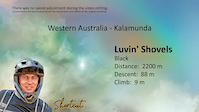
trail: Luvin' Shovels
7:13 |
89 |
Jan 4, 2025
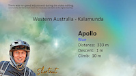
trail: Apollo
0:33 |
8 |
Jan 4, 2025
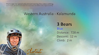
trail: 3 Bears
0:51 |
19 |
Dec 25, 2024
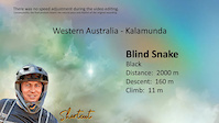
trail: Blind Snake
4:56 |
61 |
Dec 25, 2024
trail: Horny Devil
5:40 |
33 |
Dec 25, 2024
trail: Loco en el Coco
3:45 |
58 |
Dec 25, 2024
trail: Metasoma
4:01 |
10 |
Dec 25, 2024
trail: Nearly New
4:18 |
24 |
Dec 25, 2024
Current Trail Warnings
| status | trail | date | condition | user | info |
|---|---|---|---|---|---|
| Mo Fo | Jul 4, 2026 @ 9:02am (Australia/Perth) Jul 3, 2026 | Ideal | shortcut-western-australia | E-Bike | |
| Blind Snake | Jul 4, 2026 @ 9:02am (Australia/Perth) Jul 3, 2026 | Ideal | shortcut-western-australia | E-Bike | |
| Tangaroo Kick | Jul 4, 2026 @ 9:02am (Australia/Perth) Jul 3, 2026 | Ideal | shortcut-western-australia | E-Bike |
Recent Trail Reports
| status | trail | date | condition | info | user |
|---|---|---|---|---|---|
| 3 Bears | Jul 9, 2026 @ 10:58am (Australia/Perth) 19 hours | Ideal | sweatytechie MTBWA | ||
| Mother in Law | Jul 9, 2026 @ 10:58am (Australia/Perth) 19 hours | Ideal | sweatytechie MTBWA | ||
| Munda Biddi - Southbound | Jul 5, 2026 @ 8:57am (Australia/Perth) Jul 4, 2026 | Variable | shortcut-western-australia | ||
| Camel Train | Jul 5, 2026 @ 8:57am (Australia/Perth) Jul 4, 2026 | Ideal | shortcut-western-australia | ||
| Munda Biddi - Mundaring Weir | Jul 5, 2026 @ 8:57am (Australia/Perth) Jul 4, 2026 | Ideal | shortcut-western-australia | ||
| Rocky Balboa | Jul 5, 2026 @ 8:57am (Australia/Perth) Jul 4, 2026 | Ideal | shortcut-western-australia | ||
| Highway to Dell | Jul 5, 2026 @ 8:57am (Australia/Perth) Jul 4, 2026 | Variable | shortcut-western-australia | ||
| Lost n Found | Jul 5, 2026 @ 8:57am (Australia/Perth) Jul 4, 2026 | Ideal | shortcut-western-australia | ||
| Joeys Line & Dugite | Jul 5, 2026 @ 8:57am (Australia/Perth) Jul 4, 2026 | Ideal | shortcut-western-australia | ||
| Metasoma | Jul 5, 2026 @ 8:57am (Australia/Perth) Jul 4, 2026 | Variable | shortcut-western-australia |
Activity Feed
| username | action | type | title | date |
|---|---|---|---|---|
| sweatytechie | add | report | activity #98786119 and 1 more | Jul 9, 2026 @ 7:56am 7 hours |
| sweatytechie | update | trail | activity #98620811 | Jul 6, 2026 @ 10:58pm 3 days |
| AlexDej | add | report | activity #98568590 and 1 more | Jul 6, 2026 @ 5:59am Jul 6, 2026 |
| shortcut-western-australia | add | report | activity #98475369 and 46 more | Jul 4, 2026 @ 11:55pm Jul 4, 2026 |
| juli20cba | ridden | trail | activity #98388151 and 1 more | Jul 3, 2026 @ 10:41pm Jul 3, 2026 |
Recent Comments
| username | type | title | comment | date |
|---|---|---|---|---|
| report | Open - No issue | Jun 7, 2026 @ 2:07am Jun 7, 2026 | ||
| report | What’s the deal with the last 2 table tops.. | Nov 18, 2025 @ 5:24pm Nov 18, 2025 | ||
| trail | Looks like the lips of the jumps have become... | Sep 19, 2025 @ 10:07pm Sep 19, 2025 | ||
| report | The only thing that I have love about in the... | May 31, 2024 @ 5:29pm May 31, 2024 | ||
| report | I’m just trying not too hard to make you... | May 31, 2024 @ 5:25pm May 31, 2024 |
Nearby Areas
| name | distance | ||||
|---|---|---|---|---|---|
| Pickering Brook | 1 | 10 | 3.5 km | ||
| Parkerville | 1 | 4.1 km | |||
| Darlington / Glen Forrest | 4.5 km | ||||
| Goat Farm | 7 | 7 | 6 | 3 | 6.6 km |
| John Forrest National Park | 4 | 1 | 31 | 1 | 6.8 km |
Local Badges
-

Completionist0 awarded
Local Trail Supporters
- Munda Biddi Bike Hire
- Avanti Plus Cannington
- Discovery Holiday Parks
- Cambridge St. Associates
- Wembley Cycles
- Carine Cycles
![Australian Underground Drilling]()
- Camelbak
- Hillary's Boat and Tackle
- BankWest
- Castech
- Freewheel Cycles
![]()
- Single Track Minds
- Samios Plumbing Supplies
- Xodus Group
- ToxFree
![]()
- Sea to Summit



Activity Type Stats
| activitytype | trails | distance | descent | descent distance | total vertical | rating | global rank | state rank | photos | reports | routes | ridelogs |
|---|---|---|---|---|---|---|---|---|---|---|---|---|
| Mountain Bike | 100 | 74 miles | 11,745 ft | 35 miles | 925 ft | #61 | #3 | 323 | 4,014 | 34 | 44,674 | |
| E-Bike | 100 | 72 miles | 11,263 ft | 34 miles | 925 ft | #385 | #43 | 1 | 4,000 | 8 | 4,514 | |
| Gravel Bike | 24 | 18 miles | 2,467 ft | 8 miles | 906 ft | #49 | #4 | 337 | 3 | 38 | ||
| Adaptive Bike | 23 | 17 miles | 2,402 ft | 8 miles | 906 ft | #49 | #4 | 345 | 1 | 1 | ||
| Hike | 32 | 23 miles | 3,107 ft | 10 miles | 906 ft | #3,717 | #85 | 3,777 | 142 | |||
| Trail Running | 33 | 24 miles | 3,117 ft | 10 miles | 915 ft | #2,785 | #63 | 3,778 | 687 |
Frequently Asked Questions About Kalamunda Trail Network
▼
What are the highest rated mountain biking trails in Kalamunda Trail Network?
The highest rated mountain biking trails in Kalamunda Trail Network are:
- Camakazi (4.5/5)
- Mercury Street (4.5/5)
- Scorpion (4.4/5)
- Blind Snake (4.4/5)
- Flaccid Ashback (4.3/5)
▼
What is the best time of the year to ride in Kalamunda Trail Network?
Based on ride log data, the most popular months to ride in Kalamunda Trail Network are:
- July (536 activities)
- October (495 activities)
- May (483 activities)
▼
Where can I park to ride in Kalamunda Trail Network?
There are 3 parking locations listed in Kalamunda Trail Network. The most popular parking spots are: View all parking and trailhead locations on the map to plan your visit.
▼
What is the longest trail in Kalamunda Trail Network?
The longest trail in Kalamunda Trail Network is Camakazi at 4.0 km. View all trails sorted by distance.
Activities
Trails
- Hard trails in Kalamunda Trail Network
- Easy trails in Kalamunda Trail Network
- Favorite trails in Kalamunda Trail Network
- Most ridden trails in Kalamunda Trail Network
- Singletrack in Kalamunda Trail Network
- Viewpoint trails in Kalamunda Trail Network
- Trails with technical features in Kalamunda Trail Network
- Race routes in Kalamunda Trail Network
- By BELLMACHER & contributors
- Admins: KMBC
- #5696 - 67,175 views
- kalamunda trail network activity log | embed map of Kalamunda Trail Network mountain bike trails | kalamunda trail network mountain biking points of interest
Downloading of trail gps tracks in kml & gpx formats is enabled for Kalamunda Trail Network.
You must login to download files.