close
-
Layers w
- Weather Layers
- Pro
- Pro
- Pro
- Pro
- Pro
- Pro
- More Layers
- Pro
- Pro
- Pro
- Pro
-
Upgrade to

3D
Trail Conditions
- Unknown
- Snow Groomed
- Snow Packed
- Snow Covered
- Snow Cover Partial
- Freeze/thaw Cycle
- Icy
- Prevalent Mud
- Wet
- Variable
- Ideal
- Dry
- Very Dry
Trail Flow (Ridden Direction)
Trailforks scans users ridelogs to determine the most popular direction each trail is ridden. A good flowing trail network will have most trails flowing in a single direction according to their intension.
The colour categories are based on what percentage of riders are riding a trail in its intended direction.
The colour categories are based on what percentage of riders are riding a trail in its intended direction.
- > 96%
- > 90%
- > 80%
- > 70%
- > 50%
- < 50%
- bi-directional trail
- no data
Trail Last Ridden
Trailforks scans ridelogs to determine the last time a trail was ridden.
- < 2 days
- < 1 week
- < 2 weeks
- < 1 month
- < 6 months
- > 6 months
Trail Ridden Direction
The intended direction a trail should be ridden.
- Downhill Only
- Downhill Primary
- Both Directions
- Uphill Primary
- Uphill Only
- One Direction
Contribute Details
Colors indicate trail is missing specified detail.
- Description
- Photos
- Description & Photos
- Videos
Trail Popularity ?
Trailforks scans ridelogs to determine which trails are ridden the most in the last 9 months.
Trails are compared with nearby trails in the same city region with a possible 25 colour shades.
Think of this as a heatmap, more rides = more kinetic energy = warmer colors.
- most popular
- popular
- less popular
- not popular
ATV/ORV/OHV Filter
Max Vehicle Width
inches
US Cell Coverage
Legend

Radar Time
Activity Recordings
Trailforks uses anonymized public activity data.
?
Activity Recordings
Trailforks uses anonymized public activity data.
?
Personal Heatmap
▶
Activity Types
all
/
none
▶
Options
2
Date range
month
–
Winter Trails
Warning
A routing network for winter maps does not exist. Selecting trails using the winter trails layer has been disabled.
Missing Trails
Most Popular
Least Popular
Trails are colored based on popularity. The more popular a trail is, the more red. Less popular trails trend towards green.
Jump Magnitude Heatmap
Heatmap of where riders jump on trails. Zoom in to see individual jumps, click circles to view jump details.
BC Backroad Status
![map legend]()
Service Road Atlas is a free to use, community-driven service for viewing and creating reports on the numerous back-country service roads around B.C. and Alberta.

Slope Aspect
Direction the slope faces
Trails Deemphasized
Trails are shown in grey.
Only show trails with no bike usage.
Suggested Layers
Based on selected activity type
Save the current map location and zoom level as your default home location whenever this page is loaded.
Save
No description for Kalispell has been added yet!
Login or register to submit one.
Activities Click to view
- Mountain Bike
190 trails
- E-Bike
43 trails
- Gravel Bike
3 trails
- Adaptive Bike
3 trails
- Winter Fat Bike
3 trails
- Horse
54 trails
- Hike
220 trails
- Trail Running
220 trails
- Dirtbike/Moto
4 trails
- Snowshoe
11 trails
- Downhill Ski
28 trails
- Backcountry Ski
5 trails
Region Details
- 26
- 38
- 82
- 37
- 5
- 2
Region Status
Caution as of Jun 20, 2026Stats
- Avg Trail Rating
- Trails (view details)
- 242
- Trails Mountain Bike
- 190
- Trails E-Bike
- 43
- Trails Gravel Bike
- 3
- Trails Adaptive Bike
- 3
- Trails Winter Fat Bike
- 3
- Trails Horse
- 54
- Trails Hike
- 220
- Trails Trail Running
- 220
- Trails Dirtbike/Moto
- 4
- Trails ATV/ORV/OHV
- 1
- Trails Snowshoe
- 11
- Trails Downhill Ski
- 28
- Trails Backcountry Ski
- 5
- Total Distance
- 320 miles
- Total Descent
- 57,770 ft
- Total Vertical
- 5,792 ft
- Highest Trailhead
- 8,694 ft
- Reports
- 634
- Photos
- 242
- Ridden Counter
- 18,621
Articles

Video: Rowdy Flow in Montana’s Gem: The Legacy Bike Park
Jun 15, 2023 from pinkbike.com
A network of first-class trails in the Montana wilderness.
Sub Regions
-
Green Gates
- 1
- 32
- 17
- 4
-
Happy Valley State Trust
- 42
- 1
-
Herron Park
- 5
- 18
-
Lone Pine State Park
- 1
- 4
- 9
-
Somers Beach State Park
- 2
Popular Kalispell Mountain Biking Trails
• 100 ★ 4.2 • 2 miles • 631 ft • 529 •
A nice trail with lots of character. Best done as an out-and-back.
• 100 ★ 2.0 • 2 miles • 44 ft • 409 •
Popular green difficulty mixed. This multi-use trail can be used both directions and has a easy overall physical rating with a 44 ft green climb. On average it takes 11 minutes to complete this trail.
• 100 ★ 4.0 • 2 miles • 234 ft • 381 •
Popular blue difficulty singletrack. This multi-use trail can be used both directions and has a moderate overall physical rating with a 234 ft blue climb. On average it takes 7 minutes to complete this trail.
• 95 ★ 0.0 • 4,580 ft • 0 ft • 282 •
Like it's name implies it is the route back to the trailhead.
• 95 ★ 0.0 • 820 ft • 30 ft • 238 •
Popular blue difficulty singletrack. This multi-use trail can be used both directions. On average it takes 2 minutes to complete this trail.
• 100 ★ 4.5 • 1 mile • 291 ft • 220 •
Popular green difficulty doubletrack. This multi-use trail can be used downhill primary and has a easy overall physical rating with a 291 ft green climb. On average it takes 13 minutes to complete this trail.
• 90 ★ 3.5 • 2,126 ft • 0 ft • 219 •
This is a short little stretch of two track that begins to narrow into single track towards the top end of the section. A couple short, but moderately demanding climbs at the beginning. Lots of hikers, runners and sometimes horses, so...
• 95 ★ 3.4 • 3,520 ft • 271 ft • 193 •
Popular blue difficulty singletrack. This mountain bike primary trail can be used downhill primary and has a moderate overall physical rating with a 271 ft blue climb. On average it takes 7 minutes to complete this trail.
Kalispell Mountain Bike Routes
★ 2.0 • 11 miles • 1,113 ft • 2 • Shuttled •
This option is the longest, with many amazing viewpoints along the way. This route is over 80% single-track.
25 miles • 3,730 ft • 6 • Loop • Race •
This course is going to test every rider’s legs as well as their trail riding abilities. We are going to...
• 3 miles • 456 ft • 5 •
• 4 miles • 674 ft • 5 •
Photos of Kalispell Mountain Bike
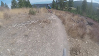
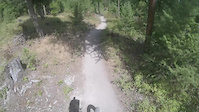
Videos of Kalispell Mountain Bike
trail: Lower Foy's To Blacktail
0:21 |
64 |
May 28, 2023
trail: Chase Overlook Trail
2:07 |
97 |
Aug 17, 2017
trail: Foy's Overlook
0:45 |
138 |
Aug 17, 2017
trail: Chase Overlook Trail
2:56 |
86 |
Aug 17, 2017
trail: Notch Trail Comnector
3:56 |
40 |
Aug 17, 2017
trail: Notch Trail Comnector
0:53 |
53 |
Aug 17, 2017
trail: Family
0:44 |
282 |
Jul 21, 2016
trail: Notch Trail Comnector
2:27 |
49 |
Mar 9, 2015
Current Trail Warnings
| status | trail | date | condition | user | info |
|---|---|---|---|---|---|
| Great Northern Historical Trail | Jun 20, 2026 @ 7:31am (America/Denver) Jun 20, 2026 | Prevalent Mud | HerronPark | E-Bike Large cracks in the trail. It has become... |
Recent Trail Reports
| status | trail | date | condition | info | user |
|---|---|---|---|---|---|
| Peter's Ridge | Jun 16, 2026 @ 9:27am (America/Denver) Jun 16, 2026 | Dry | b-man2u | ||
| Aspen Alley | May 27, 2026 @ 7:35pm (America/Denver) May 27, 2026 | Ideal | drinehart | ||
| Lower Strawberry Lake Trail | May 27, 2026 @ 7:34pm (America/Denver) May 27, 2026 | Ideal | drinehart | ||
| LTBT To Emmons Ridge Connector | May 23, 2026 @ 9:06am (America/Creston) May 23, 2026 | Snow Covered | brian-miller-ftbt FTBT | ||
| Lakeside to Blacktail | May 23, 2026 @ 9:06am (America/Creston) May 23, 2026 | Snow Covered | brian-miller-ftbt FTBT | ||
| Strawberry Lake Trail | May 22, 2026 @ 11:55am (America/Denver) May 22, 2026 | Snow Cover Partial | b-man2u | ||
| Plum Creek Road | May 12, 2026 @ 12:23pm (America/Creston) May 12, 2026 | Ideal | Krash1 | ||
| Notch Trail | May 12, 2026 @ 12:23pm (America/Creston) May 12, 2026 | Variable | Krash1 | ||
| Trail Access | May 12, 2026 @ 12:23pm (America/Creston) May 12, 2026 | Ideal | Krash1 | ||
| Boundary Trail | May 12, 2026 @ 12:23pm (America/Creston) May 12, 2026 | Ideal | Krash1 |
Activity Feed
| username | action | type | title | date |
|---|---|---|---|---|
| HerronPark | add | report | activity #97419219 | Jun 20, 2026 @ 11:50am Jun 20, 2026 |
| b-man2u | add | report | activity #97135307 | Jun 16, 2026 @ 1:36pm Jun 16, 2026 |
| Tjbabb | wishlist | trail | activity #97088347 | Jun 15, 2026 @ 10:28pm Jun 15, 2026 |
| brooksbolinger | ridden | trail | activity #96930319 | Jun 13, 2026 @ 6:00pm Jun 13, 2026 |
| seandonmt | wishlist | trail | activity #96919258 | Jun 13, 2026 @ 3:01pm Jun 13, 2026 |
Recent Comments
| username | type | title | comment | date |
|---|---|---|---|---|
| trail | Quality machine-built (2024) trail by Foys to... | Oct 2, 2025 @ 8:25pm Oct 2, 2025 | ||
| trail | Had to had, -4 stars. Just terrible road and... | Jul 17, 2025 @ 10:37am Jul 17, 2025 | ||
| trail | 4 stars? Bull not worth the time | Jul 17, 2025 @ 10:10am Jul 17, 2025 | ||
| trail | This trail is open to dirt biking too I... | Oct 16, 2024 @ 7:22am Oct 16, 2024 | ||
| trail | Rode this awesome downhill on 8/11/24. So... | Aug 12, 2024 @ 4:07am Aug 12, 2024 |
Local Badges
-

10 Green Trails146 awarded -

10 Blue Trails126 awarded -

Epic Ride Climb 2k73 awarded -

Climbing 10k Badge57 awarded -

Climbing 100k Badge3 awarded -

Epic Ride Descent 2k82 awarded
Local Mountain Biking Directory
-
Foys to Blacktail Trails
![Foys to Blacktail Trails]()
-
Flathead Trail FairiesTrail Association
![Flathead Trail Fairies]()
-
Sportsman & Ski HausBike Shop
-
Wheatons CycleBike Shop
Local Trail Supporters
- Foy's to Blacktail trails
- Flathead Area Mountain Bikers
![]()
Activity Type Stats
| activitytype | trails | distance | descent | descent distance | total vertical | rating | global rank | state rank | photos | reports | routes | ridelogs |
|---|---|---|---|---|---|---|---|---|---|---|---|---|
| Mountain Bike | 190 | 173 miles | 22,087 ft | 65 miles | 4,308 ft | #798 | #310 | 219 | 634 | 7 | 12,089 | |
| E-Bike | 43 | 78 miles | 7,047 ft | 28 miles | 3,799 ft | #2,280 | #968 | 370 | 211 | |||
| Gravel Bike | 3 | #524 | #1,060 | 2 | 4 | 157 | ||||||
| Adaptive Bike | 3 | #498 | #1,793 | 1 | ||||||||
| Winter Fat Bike | 3 | #313 | #1,077 | 41 | 1 | |||||||
| Horse | 54 | 163 miles | 26,818 ft | 71 miles | 4,039 ft | #191 | #414 | 334 | 5 | |||
| Hike | 220 | 302 miles | 44,209 ft | 122 miles | 5,791 ft | #247 | #127 | 21 | 634 | 1,556 | ||
| Trail Running | 220 | 302 miles | 44,209 ft | 122 miles | 5,791 ft | #354 | #136 | 634 | 5 | 2,590 | ||
| Dirtbike/Moto | 4 | 23 miles | 5,768 ft | 11 miles | 3,563 ft | #811 | #290 | 123 | 20 | |||
| ATV/ORV/OHV | 1 | 6 miles | 171 ft | 2 miles | 72 ft | 121 | 2 | |||||
| Snowshoe | 11 | 8 miles | 912 ft | 2 miles | 2,346 ft | #649 | #265 | 41 | 22 | |||
| Downhill Ski | 28 | 13 miles | 13,389 ft | 13 miles | 1,394 ft | #492 | #205 | 6 | 30 | |||
| Backcountry Ski | 5 | 9 miles | 1,220 ft | 3 miles | 2,411 ft | #416 | #92 | 1 | 29 |
Frequently Asked Questions About Kalispell
▼
What are the best places to ride in Kalispell?
Kalispell has 7 areas to explore for mountain biking. The top rated areas are:
▼
What are the highest rated mountain biking trails in Kalispell?
The highest rated mountain biking trails in Kalispell are:
- Kalispell Parkline Trail (4.1/5)
- Peter's Ridge (4.1/5)
- Family (4.1/5)
- Notch Trail (4/5)
- Boundary Trail (4/5)
▼
What is the best time of the year to ride in Kalispell?
Based on ride log data, the most popular months to ride in Kalispell are:
- July (375 activities)
- August (164 activities)
- June (149 activities)
▼
Where can I park to ride in Kalispell?
There are 45 parking locations listed in Kalispell. The most popular parking spots are: View all parking and trailhead locations on the map to plan your visit.
Activities
Trails
Points of Interest
- Information/Map
- Great Northern Mountain (8,691 ft) Summit
- Chair Mountain Summit
- Mount Furlong Summit
- Blacktail Mountain Summit
- Ousel Peak Summit
- Spruce Point Summit
- Red Plume Peak Summit
- Bench with view Viewpoint
- Trail Information
- Great Northern Mountain (8,560 ft)
- Red Sky Mountain (8,136 ft)
- Argosy Mountain (8,048 ft)
- By b-man2u
 & contributors
 - Admins: FTBT, FAMB, JeffVonKiper
- #5688 - 22,368 views
- kalispell activity log | embed map of Kalispell mountain bike trails | kalispell mountain biking points of interest polygons
Downloading of trail gps tracks in kml & gpx formats is enabled for Kalispell.
You must login to download files.