close
-
Layers w
- Weather Layers
- Pro
- Pro
- Pro
- Pro
- Pro
- Pro
- More Layers
- Pro
- Pro
- Pro
- Pro
-
Upgrade to

3D
Trail Conditions
- Unknown
- Snow Groomed
- Snow Packed
- Snow Covered
- Snow Cover Partial
- Freeze/thaw Cycle
- Icy
- Prevalent Mud
- Wet
- Variable
- Ideal
- Dry
- Very Dry
Trail Flow (Ridden Direction)
Trailforks scans users ridelogs to determine the most popular direction each trail is ridden. A good flowing trail network will have most trails flowing in a single direction according to their intension.
The colour categories are based on what percentage of riders are riding a trail in its intended direction.
The colour categories are based on what percentage of riders are riding a trail in its intended direction.
- > 96%
- > 90%
- > 80%
- > 70%
- > 50%
- < 50%
- bi-directional trail
- no data
Trail Last Ridden
Trailforks scans ridelogs to determine the last time a trail was ridden.
- < 2 days
- < 1 week
- < 2 weeks
- < 1 month
- < 6 months
- > 6 months
Trail Ridden Direction
The intended direction a trail should be ridden.
- Downhill Only
- Downhill Primary
- Both Directions
- Uphill Primary
- Uphill Only
- One Direction
Contribute Details
Colors indicate trail is missing specified detail.
- Description
- Photos
- Description & Photos
- Videos
Trail Popularity ?
Trailforks scans ridelogs to determine which trails are ridden the most in the last 9 months.
Trails are compared with nearby trails in the same city region with a possible 25 colour shades.
Think of this as a heatmap, more rides = more kinetic energy = warmer colors.
- most popular
- popular
- less popular
- not popular
ATV/ORV/OHV Filter
Max Vehicle Width
inches
US Cell Coverage
Legend

Radar Time
Activity Recordings
Trailforks uses anonymized public activity data.
?
Activity Recordings
Trailforks uses anonymized public activity data.
?
Personal Heatmap
▶
Activity Types
all
/
none
▶
Options
2
Date range
month
–
Winter Trails
Warning
A routing network for winter maps does not exist. Selecting trails using the winter trails layer has been disabled.
Missing Trails
Most Popular
Least Popular
Trails are colored based on popularity. The more popular a trail is, the more red. Less popular trails trend towards green.
Jump Magnitude Heatmap
Heatmap of where riders jump on trails. Zoom in to see individual jumps, click circles to view jump details.
BC Backroad Status
![map legend]()
Service Road Atlas is a free to use, community-driven service for viewing and creating reports on the numerous back-country service roads around B.C. and Alberta.

Slope Aspect
Direction the slope faces
Trails Deemphasized
Trails are shown in grey.
Only show trails with no bike usage.
Suggested Layers
Based on selected activity type
Save the current map location and zoom level as your default home location whenever this page is loaded.
SaveBudapest Kamaraerdő trails.
Primary Trail Type: All-Mountain & Downhill
eBikes Allowed:
Yes
Land Status: Community Forest
 google parking directions
 Access Info:
Susulyka utca, Vadász-hegy
This region uses the Uk/Euro style trail grading system.
Activities Click to view
- Mountain Bike
32 trails
- E-Bike
32 trails
- Hike
21 trails
- Trail Running
21 trails
Region Details
- 3
- 12
- 9
- 3
Region Status
Caution as of Apr 25, 2026Stats
- Avg Trail Rating
- Trails (view details)
- 27
- Trails Mountain Bike
- 32
- Trails E-Bike
- 32
- Trails Horse
- 1
- Trails Hike
- 21
- Trails Trail Running
- 21
- Total Distance
- 1,885 ft
- Total Descent
- 222 ft
- Total Vertical
- 223 ft
- Highest Trailhead
- 710 ft
- Reports
- 59
- Photos
- 3
- Ridden Counter
- 413
Popular Kamaraerdő Mountain Biking Trails
• 70 ★ 4.0 • 2,270 ft • 0 ft • 23 •
Popular blue difficulty singletrack. This mountain bike primary trail can be used downhill only and has a moderate overall physical rating. It features berm, drop, jump and gap jump. Trail visibility is always easy to follow.
• 80 ★ 0.0 • 1,585 ft • 0 ft • 19 •
Popular blue difficulty singletrack. This mountain bike primary trail can be used downhill only and has a moderate overall physical rating. It features berm. Trail visibility is always easy to follow.
• 80 ★ 0.0 • 3,599 ft • 176 ft • 19 •
Popular green difficulty family friendly doubletrack. This mountain bike primary trail can be used downhill primary and has a easy overall physical rating with a 176 ft green climb. Trail visibility is always easy to follow.
• 60 ★ 0.0 • 1,850 ft • 0 ft • 13 •
Moderately popular blue difficulty singletrack. This mountain bike primary trail can be used downhill only and has a moderate overall physical rating. It features berm and log ride. Trail visibility is always easy to follow.
• 65 ★ 0.0 • 3,507 ft • 190 ft • 13 •
Moderately popular green difficulty family friendly singletrack. This mountain bike primary trail can be used downhill primary and has a easy overall physical rating with a 190 ft green climb. Trail visibility is always easy to follow.
• 50 ★ 4.0 • 2,667 ft • 31 ft • 12 •
Moderately popular blue difficulty singletrack. This mountain bike primary trail can be used downhill only and has a moderate overall physical rating. It features berm, drop, jump and gap jump.
• 70 ★ 0.0 • 856 ft • 0 ft • 11 •
Popular blue difficulty singletrack. This mountain bike primary trail can be used downhill only and has a moderate overall physical rating. It features berm and gap jump. Trail visibility is always easy to follow.
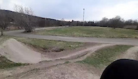
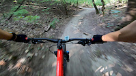
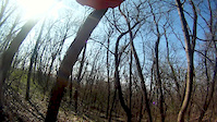
Videos of Kamaraerdő Mountain Bike

trail: Kamaraerdő (A)
0:06 |
487 |
Mar 29, 2021
trail: Kamaraerdő (A)
0:06 |
245 |
Mar 19, 2021
trail: Kamaraerdő (A)
0:40 |
595 |
Sep 22, 2020

trail: Kamaraerdő (A)
0:29 |
345 |
Jun 9, 2020
trail: Kamaraerdő (A)
0:55 |
539 |
Mar 22, 2019
Recent Trail Reports
| status | trail | date | condition | info | user |
|---|---|---|---|---|---|
| Kamara DH v1 | Apr 25, 2026 @ 1:02pm (Europe/Budapest) Apr 25, 2026 | Dry | Sndora6y0et | ||
| Kamara DH Csiki-csuki Section I. | Apr 25, 2026 @ 1:00pm (Europe/Budapest) Apr 25, 2026 | Very Dry | Sndora6y0et | ||
| Kamara DH Avaros Climb & DH | Feb 16, 2026 @ 1:16pm (Europe/Budapest) Feb 16, 2026 | Wet | fzsombor | ||
| Kamara DH Pereszke Climb & DH | Dec 16, 2025 @ 4:53pm (Europe/Budapest) Dec 16, 2025 | Wet | kovacsgergely83 | ||
| Kamara DH Csiki-csuki Section II. | Dec 16, 2025 @ 4:53pm (Europe/Budapest) Dec 16, 2025 | Ideal | kovacsgergely83 | ||
| Kamara Climb v2 | Dec 16, 2025 @ 4:53pm (Europe/Budapest) Dec 16, 2025 | Ideal | kovacsgergely83 | ||
| Kamara Trails v1 Bonus Track | Dec 16, 2025 @ 4:53pm (Europe/Budapest) Dec 16, 2025 | Ideal | kovacsgergely83 | ||
| Kamara Trails v1 | Dec 16, 2025 @ 4:53pm (Europe/Budapest) Dec 16, 2025 | Ideal | kovacsgergely83 | ||
| Tétény Heights Carousel | Dec 16, 2025 @ 4:53pm (Europe/Budapest) Dec 16, 2025 | Ideal | kovacsgergely83 | ||
| Kamara Climb v1 | Dec 16, 2025 @ 4:53pm (Europe/Budapest) Dec 16, 2025 | Ideal | kovacsgergely83 |
Activity Feed
| username | action | type | title | date |
|---|---|---|---|---|
| ezaNandorrr | ridden | trail | activity #95423049 | May 24, 2026 @ 10:15am May 24, 2026 |
| MarciZ1yJSZ | checkin | trail | activity #94437264 | May 10, 2026 @ 9:53am May 10, 2026 |
| MarciZ1yJSZ | ridden | trail | activity #94437263 | May 10, 2026 @ 9:53am May 10, 2026 |
| Sndora6y0et | add | report | activity #93340165 and 1 more | Apr 25, 2026 @ 4:00am Apr 25, 2026 |
| adamreszegi | ridden | trail | activity #90966513 | Mar 21, 2026 @ 1:11am Mar 21, 2026 |
Recent Comments
| username | type | title | comment | date |
|---|---|---|---|---|
| report | Lopva helyett kopva, bocsesz :D | Jun 6, 2022 @ 12:01pm Jun 6, 2022 |
Nearby Areas
| name | distance | ||||
|---|---|---|---|---|---|
| Anna-hegy | 2 | 2 | 3 km | ||
| Budai-hegység | 24 | 23 | 5 | 6.9 km | |
| Nyakas Enduro Trails | 1 | 2 | 7.5 km | ||
| Bro'Hill Freeride Park | 2 | 8.5 km | |||
| Háromhegyek | 2 | 8 | 1 | 10.5 km |
Local Badges
-

Completionist0 awarded
Activity Type Stats
| activitytype | trails | distance | descent | descent distance | total vertical | rating | global rank | state rank | photos | reports | routes | ridelogs |
|---|---|---|---|---|---|---|---|---|---|---|---|---|
| Mountain Bike | 32 | 1,886 ft | 223 ft | 1,650 ft | 223 ft | #5,092 | #19 | 3 | 59 | 2,334 | ||
| E-Bike | 32 | 1,886 ft | 223 ft | 1,650 ft | 223 ft | #1,375 | #12 | 62 | 352 | |||
| Horse | 1 | |||||||||||
| Hike | 21 | 1,886 ft | 223 ft | 1,650 ft | 223 ft | #2,291 | #15 | 56 | 34 | |||
| Trail Running | 21 | 1,886 ft | 223 ft | 1,650 ft | 223 ft | #1,588 | #16 | 56 | 16 |
Frequently Asked Questions About Kamaraerdő
▼
What are the highest rated mountain biking trails in Kamaraerdő?
The highest rated mountain biking trails in Kamaraerdő are:
- Kamaraerdő (A) (4.1/5)
- Kamara Climb v3 (4/5)
- Kamara DH v1 (4/5)
- Kamara DH Back to Parking (4/5)
- kamara Trails v2 (4/5)
▼
What is the best time of the year to ride in Kamaraerdő?
Based on ride log data, the most popular months to ride in Kamaraerdő are:
- August (12 activities)
- July (7 activities)
- October (5 activities)
▼
Where can I park to ride in Kamaraerdő?
There are 2 parking locations listed in Kamaraerdő. The most popular parking spots are:
▼
What is the longest trail in Kamaraerdő?
The longest trail in Kamaraerdő is Tétény Heights Carousel at 2.5 miles. View all trails sorted by distance.
Activities
- By Tailor13 & contributors
- Admins: vanczakp, Beaust, GeigerKristof
- #25613 - 9,185 views
- kamaraerdő activity log | embed map of Kamaraerdő mountain bike trails | kamaraerdő mountain biking points of interest
Downloading of trail gps tracks in kml & gpx formats is enabled for Kamaraerdő.
You must login to download files.