close
-
Layers w
- Weather Layers
- Pro
- Pro
- Pro
- Pro
- Pro
- Pro
- More Layers
- Pro
- Pro
- Pro
- Pro
-
Upgrade to

3D
Trail Conditions
- Unknown
- Snow Groomed
- Snow Packed
- Snow Covered
- Snow Cover Partial
- Freeze/thaw Cycle
- Icy
- Prevalent Mud
- Wet
- Variable
- Ideal
- Dry
- Very Dry
Trail Flow (Ridden Direction)
Trailforks scans users ridelogs to determine the most popular direction each trail is ridden. A good flowing trail network will have most trails flowing in a single direction according to their intension.
The colour categories are based on what percentage of riders are riding a trail in its intended direction.
The colour categories are based on what percentage of riders are riding a trail in its intended direction.
- > 96%
- > 90%
- > 80%
- > 70%
- > 50%
- < 50%
- bi-directional trail
- no data
Trail Last Ridden
Trailforks scans ridelogs to determine the last time a trail was ridden.
- < 2 days
- < 1 week
- < 2 weeks
- < 1 month
- < 6 months
- > 6 months
Trail Ridden Direction
The intended direction a trail should be ridden.
- Downhill Only
- Downhill Primary
- Both Directions
- Uphill Primary
- Uphill Only
- One Direction
Contribute Details
Colors indicate trail is missing specified detail.
- Description
- Photos
- Description & Photos
- Videos
Trail Popularity ?
Trailforks scans ridelogs to determine which trails are ridden the most in the last 9 months.
Trails are compared with nearby trails in the same city region with a possible 25 colour shades.
Think of this as a heatmap, more rides = more kinetic energy = warmer colors.
- most popular
- popular
- less popular
- not popular
ATV/ORV/OHV Filter
Max Vehicle Width
inches
US Cell Coverage
Legend

Radar Time
Activity Recordings
Trailforks uses anonymized public activity data.
?
Activity Recordings
Trailforks uses anonymized public activity data.
?
Personal Heatmap
▶
Activity Types
all
/
none
▶
Options
2
Date range
month
–
Winter Trails
Warning
A routing network for winter maps does not exist. Selecting trails using the winter trails layer has been disabled.
Missing Trails
Most Popular
Least Popular
Trails are colored based on popularity. The more popular a trail is, the more red. Less popular trails trend towards green.
Jump Magnitude Heatmap
Heatmap of where riders jump on trails. Zoom in to see individual jumps, click circles to view jump details.
BC Backroad Status
![map legend]()
Service Road Atlas is a free to use, community-driven service for viewing and creating reports on the numerous back-country service roads around B.C. and Alberta.

Slope Aspect
Direction the slope faces
Trails Deemphasized
Trails are shown in grey.
Only show trails with no bike usage.
Suggested Layers
Based on selected activity type
Save the current map location and zoom level as your default home location whenever this page is loaded.
Save
No description for Kandersteg has been added yet!
Login or register to submit one.
This region uses the Uk/Euro style trail grading system.
Activities Click to view
- Mountain Bike
28 trails
- E-Bike
10 trails
- Gravel Bike
0 trails
- Adaptive Bike
0 trails
- Hike
27 trails
- Trail Running
27 trails
Region Details
- 5
- 4
- 6
- 6
- 7
Region Status
Open as of Apr 20, 2026Local Trail Association
Stats
- Avg Trail Rating
- Trails (view details)
- 29
- Trails Mountain Bike
- 28
- Trails E-Bike
- 10
- Trails Hike
- 27
- Trails Trail Running
- 27
- Total Distance
- 18 miles
- Total Descent
- 10,704 ft
- Total Vertical
- 4,309 ft
- Highest Trailhead
- 8,155 ft
- Reports
- 68
- Photos
- 58
- Ridden Counter
- 683
Sub Regions
-
HÖH Trails and Boulders
- 3
- 3
Popular Kandersteg Mountain Biking Trails
• 100 ★ 4.4 • 2 miles • 366 ft • 147 •
A fun trail Built by the local bike club to save the Gondola from being closed. All types of terrain and lots of features to choose from for all levels of riders. Also has a Kicker line mid trail.
• 100 ★ 0.0 • 492 ft • 4 ft • 44 •
DE: Kurzer, spassiger Trail Abschnitt kurz vor der Talstation Luftseilbahn Kandersteg-Sunnbüel / EN: Short, fun trail section just before the Kandersteg- cable car valley station
• 65 ★ 4.0 • 1,804 ft • 0 ft • 12 •
Short but fun. A good starter or dessert. Yummy trail.
• 5 ★ 5.0 • 2,201 ft • 0 ft • 10 •
Great scenic ride on premium gravel. The beginning ist a bit exposed, then it flows.
• 5 ★ 4.4 • 3,177 ft • 69 ft • 8 •
A single trail with a view. After a smooth start you face some technical parts with switchbacks and steps.
• 5 ★ 4.3 • 1,109 ft • 0 ft • 8 •
Short but fun. A good starter or dessert. Yummy trail.
• 5 ★ 4.8 • 3,169 ft • 0 ft • 8 •
Short easy but fast single trail in the oeschiwald. loos gravel, bridges and Steps. nice to ride a few times in a row
• 5 ★ 4.7 • 2 miles • 37 ft • 7 •
Less popular red difficulty singletrack. This mountain bike primary trail can be used downhill primary. On average it takes 12 minutes to complete this trail.
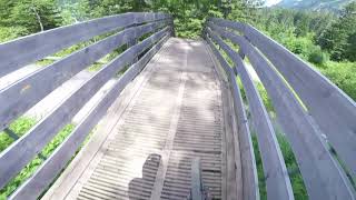
Photos of Kandersteg Mountain Bike
Videos of Kandersteg Mountain Bike
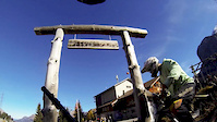
trail: Sunnbuel Freeride
7:38 |
175 |
Nov 14, 2016
trail: Sunnbuel Freeride
0:38 |
72 |
Jun 22, 2016
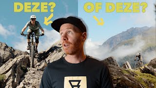
youtuber
![Een MTB uitdaging in Zwitserland // 2 dagen in...]()
trail: Sunnbuel Freeride
14:45 |
55 |
Oct 6, 2025 , Kandersteg
trail: Sunnbuel Freeride
14:17 |
225 |
Jul 29, 2023 , Kandersteg
trail: Sunnbuel Freeride
10:06 |
616 |
Aug 23, 2018 , Kandersteg
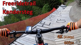
trail: 5P.M. Trail
2:59 |
806 |
Jun 26, 2017 , Kandersteg
Recent Trail Reports
| status | trail | date | condition | info | user |
|---|---|---|---|---|---|
| Ledi ShortTrail | Sep 7, 2025 @ 12:00am Sep 7, 2025 | Variable | paraenggu VS-Admin | ||
| Sunnbuel Freeride | Sep 7, 2025 @ 12:00am Sep 7, 2025 | Variable | paraenggu VS-Admin | ||
| Luftseilbahn Kandersteg-Sunnbüel | Jul 9, 2021 @ 3:46am Jul 9, 2021 | Very Dry | matherj | ||
| Pano Trail | Apr 4, 2021 @ 7:53am Apr 4, 2021 | Dry | danielkatzenaug | ||
| Meri Swag | Apr 2, 2020 @ 8:57am Apr 2, 2020 | Dry | EZS | ||
| ARA Uphill | Sep 28, 2017 @ 10:07am Sep 28, 2017 | Unknown | MARIOHARI | ||
| Riseti Trail | Sep 28, 2017 @ 10:07am Sep 28, 2017 | Dry | MARIOHARI | ||
| Prattels Trail | Sep 28, 2017 @ 10:07am Sep 28, 2017 | Wet | MARIOHARI | ||
| Bütschels Trail | Sep 28, 2017 @ 10:07am Sep 28, 2017 | Variable | MARIOHARI |
Activity Feed
| username | action | type | title | date |
|---|---|---|---|---|
| mtb-challenge | add | photo | activity #84617085 and 4 more | Nov 23, 2025 @ 11:51am Nov 23, 2025 |
| mtb-challenge | add | photo | activity #84616779 and 8 more | Nov 23, 2025 @ 11:47am Nov 23, 2025 |
| Shr3dability | wishlist | trail | activity #83610487 | Nov 5, 2025 @ 4:10am Nov 5, 2025 |
| JoanPRVbMU | ridden | trail | activity #82629925 | Oct 19, 2025 @ 2:12am Oct 19, 2025 |
| trailforks | add | video | activity #81822020 | Oct 6, 2025 @ 8:00am Oct 6, 2025 |
Recent Comments
| username | type | title | comment | date |
|---|---|---|---|---|
| trail | Nicely build trail! Some of the jumps are big... | Jun 27, 2025 @ 11:20pm Jun 27, 2025 | ||
| trail | OSM digital elevation model is not very... | Mar 11, 2025 @ 6:46pm Mar 11, 2025 | ||
| trail | I have done this trail by foot. Note that the... | Aug 21, 2024 @ 2:52am Aug 21, 2024 | ||
| trail | Beautiful trail but wood steps inside from the... | Oct 7, 2020 @ 2:45am Oct 7, 2020 | ||
| trail | Unfortunately there are there now lots of... | Oct 7, 2020 @ 2:43am Oct 7, 2020 |
Local Badges
-

Epic Ride Climb 2k62 awarded -

Climbing 10k Badge3 awarded -

Climbing 100k Badge0 awarded -

Epic Ride Descent 2k100 awarded -

Descent 10k Badge12 awarded -

Descent 100k Badge0 awarded
Activity Type Stats
| activitytype | trails | distance | descent | descent distance | total vertical | rating | global rank | state rank | photos | reports | routes | ridelogs |
|---|---|---|---|---|---|---|---|---|---|---|---|---|
| Mountain Bike | 28 | 16 miles | 9,324 ft | 9 miles | 4,311 ft | #4,408 | #87 | 58 | 67 | 663 | ||
| E-Bike | 10 | 8 miles | 2,904 ft | 3 miles | 2,484 ft | #3,827 | #154 | 53 | 38 | |||
| Hike | 27 | 15 miles | 8,451 ft | 9 miles | 4,311 ft | #4,548 | #94 | 64 | 973 | |||
| Trail Running | 27 | 15 miles | 8,451 ft | 9 miles | 4,311 ft | #4,495 | #97 | 64 | 28 |
Frequently Asked Questions About Kandersteg
▼
What are the best places to ride in Kandersteg?
Kandersteg has 1 areas to explore for mountain biking. The top rated areas are:
▼
What are the highest rated mountain biking trails in Kandersteg?
The highest rated mountain biking trails in Kandersteg are:
- Riseti Trail (4.3/5)
- Vita Trail (4.3/5)
- Üschene Trail (4.2/5)
- Sunnbuel Freeride (4.2/5)
- Pano Trail (4.2/5)
▼
What is the best time of the year to ride in Kandersteg?
Based on ride log data, the most popular months to ride in Kandersteg are:
- July (14 activities)
- April (8 activities)
- May (7 activities)
▼
Where can I park to ride in Kandersteg?
There are 1 parking locations listed in Kandersteg. The most popular parking spots are:
Activities
Trails
Points of Interest
- By davemontana & contributors
- Admins: Thun Kandertal, Kandertal
- #9281 - 6,019 views
- kandersteg activity log | embed map of Kandersteg mountain bike trails | kandersteg mountain biking points of interest
Downloading of trail gps tracks in kml & gpx formats is enabled for Kandersteg.
You must login to download files.