close
-
Layers w
- Weather Layers
- Pro
- Pro
- Pro
- Pro
- Pro
- Pro
- More Layers
- Pro
- Pro
- Pro
- Pro
-
Upgrade to

3D
Trail Conditions
- Unknown
- Snow Groomed
- Snow Packed
- Snow Covered
- Snow Cover Partial
- Freeze/thaw Cycle
- Icy
- Prevalent Mud
- Wet
- Variable
- Ideal
- Dry
- Very Dry
Trail Flow (Ridden Direction)
Trailforks scans users ridelogs to determine the most popular direction each trail is ridden. A good flowing trail network will have most trails flowing in a single direction according to their intension.
The colour categories are based on what percentage of riders are riding a trail in its intended direction.
The colour categories are based on what percentage of riders are riding a trail in its intended direction.
- > 96%
- > 90%
- > 80%
- > 70%
- > 50%
- < 50%
- bi-directional trail
- no data
Trail Last Ridden
Trailforks scans ridelogs to determine the last time a trail was ridden.
- < 2 days
- < 1 week
- < 2 weeks
- < 1 month
- < 6 months
- > 6 months
Trail Ridden Direction
The intended direction a trail should be ridden.
- Downhill Only
- Downhill Primary
- Both Directions
- Uphill Primary
- Uphill Only
- One Direction
Contribute Details
Colors indicate trail is missing specified detail.
- Description
- Photos
- Description & Photos
- Videos
Trail Popularity ?
Trailforks scans ridelogs to determine which trails are ridden the most in the last 9 months.
Trails are compared with nearby trails in the same city region with a possible 25 colour shades.
Think of this as a heatmap, more rides = more kinetic energy = warmer colors.
- most popular
- popular
- less popular
- not popular
ATV/ORV/OHV Filter
Max Vehicle Width
inches
US Cell Coverage
Legend

Radar Time
Activity Recordings
Trailforks uses anonymized public activity data.
?
Activity Recordings
Trailforks uses anonymized public activity data.
?
Personal Heatmap
▶
Activity Types
all
/
none
▶
Options
2
Date range
month
–
Winter Trails
Warning
A routing network for winter maps does not exist. Selecting trails using the winter trails layer has been disabled.
Missing Trails
Most Popular
Least Popular
Trails are colored based on popularity. The more popular a trail is, the more red. Less popular trails trend towards green.
Jump Magnitude Heatmap
Heatmap of where riders jump on trails. Zoom in to see individual jumps, click circles to view jump details.
BC Backroad Status
![map legend]()
Service Road Atlas is a free to use, community-driven service for viewing and creating reports on the numerous back-country service roads around B.C. and Alberta.

Slope Aspect
Direction the slope faces
Trails Deemphasized
Trails are shown in grey.
Only show trails with no bike usage.
Suggested Layers
Based on selected activity type
Save the current map location and zoom level as your default home location whenever this page is loaded.
SavePopular Trail Networks
view all areas »
No description for Kansas has been added yet!
Login or register to submit one.
Region Details
- 92
- 17
- 131
- 142
- 25
Stats
- Avg Trail Rating
- Trails (view details)
- 475
- Trails Mountain Bike
- 409
- Trails E-Bike
- 148
- Trails Gravel Bike
- 87
- Trails Adaptive Bike
- 78
- Trails Winter Fat Bike
- 13
- Trails Horse
- 18
- Trails Hike
- 466
- Trails Trail Running
- 466
- Trails Dirtbike/Moto
- 2
- Trails ATV/ORV/OHV
- 1
- Total Distance
- 893 miles
- Total Descent
- 43,320 ft
- Total Vertical
- 2,896 ft
- Highest Trailhead
- 3,648 ft
- Reports
- 1,121
- Photos
- 400
- Ridden Counter
- 23,964
Articles
7 of the Best Bikepacking Trips Across the U.S.
Jul 11, 2025 from outsideonline.com
Load up your bike and disappear into America's wildest places on these incredible multi-day rides
Sub Regions
- Kansas City Metro (KS) (155)
- Douglas County (5)
- Jefferson County (12)
- Johnson County (88)
- Leavenworth County (1)
- Wyandotte County (41)
- North Central (19)
- Northeast KS (83)
- Atchison County (1)
- Brown County (4)
- Clay County (1)
- Dickinson County (1)
- Doniphan County (1)
- Geary County (1)
- Jackson County (1)
- Marshall County (4)
- Nemaha County (1)
- Pottawatomi County (3)
- Pottawatomie County (2)
- Riley County (24)
- Shawnee County (38)
- Wabaunsee County (2)
- Washington County (1)
- Northwest (6)
- South Central Region - KS (100)
- Butler County (9)
- Cowley County (33)
- Greenwood County (9)
- Reno County (5)
- Sedgewick County (37)
- Southeast KS (65)
- Chase County (1)
- Lyon County (7)
- Southwest (5)
Popular Kansas Mountain Biking Trails
• 100 ★ 3.8 • 3 miles • 136 ft • 421 •
One of the older trails built in Kansas City, this trail is considered an Easy/Beginner Friendly trail. was rehabbed/rerouted in 2023 to bring it back to its beginner status. There are a few rock gardens to keep you on your toes.
• 95 ★ 4.2 • 4 miles • 398 ft • 390 •
This trail is part of the East Dam Trails at WYCO. Whitetail Trail is a just pure fun. The trail has good flow, steady climbs, and winding descents. You'll also find some nice toys to play with on the trail. There are a few different...
• 95 ★ 3.8 • 794 ft • 10 ft • 354 •
Popular green difficulty singletrack. This mountain bike primary trail can be used downhill primary. On average it takes minutes to complete this trail.
• 80 ★ 3.6 • 5 miles • 411 ft • 346 •
Popular black diamond difficulty singletrack. This multi-use trail can be used both directions and has a hard overall physical rating with a 411 ft black diamond climb. It features rock garden. Trail visibility is always easy to follow. On average it takes 49 minutes to complete this trail.
• 85 ★ 4.8 • 4 miles • 601 ft • 337 •
Mostly intermediate trail with some rock gardens (like the Causeway) and little sections that will challenge you. Use Cabin Hill and the Rock Garden to make the full (GBL)
• 85 ★ 4.8 • 1 mile • 101 ft • 316 •
is a fast and flowing trail that is has a long sustained downhill when riding counter-clockwise. Be ready for the steep staircase climb on a revealing edge on your return.
• 95 ★ 4.8 • 5 miles • 264 ft • 324 •
Highly rated popular blue difficulty singletrack. This multi-use trail can be used both directions and has a moderate overall physical rating with a 264 ft blue climb. It features berm, drop and jump. Trail visibility is always easy to follow. On average it takes 33 minutes to complete this trail.
• 100 ★ 4.4 • 2,992 ft • 39 ft • 309 •
Popular blue difficulty singletrack. This multi-use trail can be used both directions and has a moderate overall physical rating with a 39 ft blue climb. Trail visibility is always easy to follow. On average it takes 4 minutes to complete this trail.
Kansas Mountain Bike Routes
★ 5.0 • 2 miles • 138 ft • 1 • Loop •
Welcome to SMP! This trail is notoriously the rockiest of the KC trails. This loop however is the easiest...
★ 4.0 • 22 miles • 1,745 ft • 8 •
22-mile cross-country route at Wilson State Park.
11 miles • 919 ft • 6 • Loop •
Route that covers every one of the northern singletrack trails at Shawnee Mission Park
7 miles • 389 ft • 2 •
If you don't want to do the Full Switchgrass epic, this is a great loop that covers the western half of...
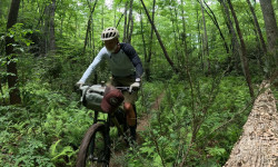
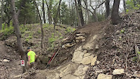
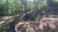
Photos of Kansas Mountain Bike
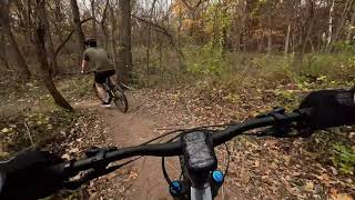
Videos of Kansas Mountain Bike
trail: Dirt Dauber
0:06 |
27 |
Sep 16, 2025
trail: Dirt Dauber
0:07 |
21 |
Sep 16, 2025

trail: Lawrence River Trail
0:08 |
39 |
May 19, 2025
trail: Mischief
25:11 |
77 |
Dec 10, 2025 , Shawnee
trail: Eastside Loop
28:46 |
36 |
Oct 4, 2025 , Salina

trail: Concrete Jungle
7:02 |
125 |
Mar 27, 2024 , Emporia
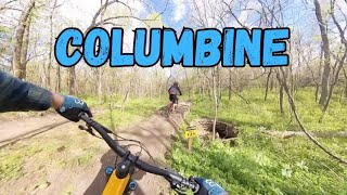
trail: Columbine
7:27 |
466 |
Oct 2, 2023 , Olathe
trail: Charcoal Loop
8:02 |
320 |
Nov 4, 2022 , De Soto
Activity Feed
| username | action | type | title | date |
|---|---|---|---|---|
| jarrod81 | ridden | trail | activity #97198484 | Jun 17, 2026 @ 11:26am 1 day |
| martyglenn | wishlist | trail | activity #97197636 | Jun 17, 2026 @ 11:15am 2 days |
| martyglenn | wishlist | region | activity #97196220 | Jun 17, 2026 @ 10:56am 2 days |
| hunterm87 | add | report | activity #96749618 | Jun 11, 2026 @ 11:03am Jun 11, 2026 |
| ziptie-mcstitch | add | photo | activity #96613289 | Jun 9, 2026 @ 10:02am Jun 9, 2026 |
Recent Comments
| username | type | title | comment | date |
|---|---|---|---|---|
| trail | Says it is private property | May 20, 2026 @ 7:25am May 20, 2026 | ||
| trail | Great fucking flow. Trail builders have done a... | May 1, 2026 @ 5:22am May 1, 2026 | ||
| trail | A lot of good work has been done on this trail... | Nov 10, 2025 @ 4:56am Nov 10, 2025 | ||
| trail | The trail is in the River Woods Nature Area in... | Oct 4, 2025 @ 12:38pm Oct 4, 2025 | ||
| trail | The northern section has a mix of jumps that... | Sep 21, 2025 @ 6:43am Sep 21, 2025 |
Local Badges
-

Descent 100k Badge0 awarded -

Top 10 Trails0 awarded -
Top 10 Trails0 awarded -

Epic Ride 50k1 awarded -
Epic Ride 50k329 awarded -

Descent 10k Badge1 awarded
Bike & Skill Parks
| name | type | city | rating |
|---|---|---|---|
| Heartland BMX Track | skill park | Topeka | |
| Skills Loop | skill park | Lawrence | |
| Bar 2 Bar MX | skill park | Wichita | |
| Inman Motocross | skill park | ||
| The Prairie Bike Park | skill park | Shawnee |
Activity Type Stats
| activitytype | trails | distance | descent | descent distance | total vertical | rating | global rank | state rank | photos | reports | routes | ridelogs |
|---|---|---|---|---|---|---|---|---|---|---|---|---|
| Mountain Bike | 408 | 787 miles | 36,066 ft | 292 miles | 2,897 ft | #56 | 349 | 1,121 | 17 | 77,762 | ||
| E-Bike | 148 | 238 miles | 7,648 ft | 76 miles | 673 ft | #56 | 850 | 5 | 2,928 | |||
| Gravel Bike | 87 | 405 miles | 6,867 ft | 166 miles | 1,129 ft | #39 | 122 | 6 | 2,320 | |||
| Adaptive Bike | 78 | 189 miles | 4,242 ft | 68 miles | 1,112 ft | #45 | 89 | 1 | 4 | |||
| Winter Fat Bike | 13 | 6 miles | 262 ft | 1 mile | 1,096 ft | #53 | 18 | 22 | ||||
| Horse | 18 | 29 miles | 2,766 ft | 12 miles | 279 ft | #59 | 236 | 111 | ||||
| Hike | 466 | 886 miles | 42,569 ft | 329 miles | 2,897 ft | #54 | 50 | 1,098 | 3 | 2,477 | ||
| Trail Running | 466 | 884 miles | 42,500 ft | 328 miles | 2,897 ft | #57 | 1,098 | 5 | 1,687 | |||
| Dirtbike/Moto | 2 | 3 miles | 174 ft | 1 mile | 390 ft | #54 | 219 | 3 | ||||
| ATV/ORV/OHV | 1 | 1 mile | 66 ft | 2,851 ft | 39 ft | #53 | 218 | 15 |
Activities
Trails
- By canadaka
 Trailforks & contributors
 - Admins: Map Team, IMBA, chuktA, msmcfate, WillieJacobsz, PlumbBobM, ReckitRolley, colinreuter
- #3190 - 21,921 views
- kansas activity log | embed map of Kansas mountain bike trails | kansas mountain biking points of interest
Downloading of trail gps tracks in kml & gpx formats is enabled for Kansas.
You must login to download files.