close
-
Layers w
- Weather Layers
- Pro
- Pro
- Pro
- Pro
- Pro
- Pro
- More Layers
- Pro
- Pro
- Pro
- Pro
-
Upgrade to

3D
Trail Conditions
- Unknown
- Snow Groomed
- Snow Packed
- Snow Covered
- Snow Cover Partial
- Freeze/thaw Cycle
- Icy
- Prevalent Mud
- Wet
- Variable
- Ideal
- Dry
- Very Dry
Trail Flow (Ridden Direction)
Trailforks scans users ridelogs to determine the most popular direction each trail is ridden. A good flowing trail network will have most trails flowing in a single direction according to their intension.
The colour categories are based on what percentage of riders are riding a trail in its intended direction.
The colour categories are based on what percentage of riders are riding a trail in its intended direction.
- > 96%
- > 90%
- > 80%
- > 70%
- > 50%
- < 50%
- bi-directional trail
- no data
Trail Last Ridden
Trailforks scans ridelogs to determine the last time a trail was ridden.
- < 2 days
- < 1 week
- < 2 weeks
- < 1 month
- < 6 months
- > 6 months
Trail Ridden Direction
The intended direction a trail should be ridden.
- Downhill Only
- Downhill Primary
- Both Directions
- Uphill Primary
- Uphill Only
- One Direction
Contribute Details
Colors indicate trail is missing specified detail.
- Description
- Photos
- Description & Photos
- Videos
Trail Popularity ?
Trailforks scans ridelogs to determine which trails are ridden the most in the last 9 months.
Trails are compared with nearby trails in the same city region with a possible 25 colour shades.
Think of this as a heatmap, more rides = more kinetic energy = warmer colors.
- most popular
- popular
- less popular
- not popular
ATV/ORV/OHV Filter
Max Vehicle Width
inches
US Cell Coverage
Legend

Radar Time
Activity Recordings
Trailforks uses anonymized public activity data.
?
Activity Recordings
Trailforks uses anonymized public activity data.
?
Personal Heatmap
▶
Activity Types
all
/
none
▶
Options
2
Date range
month
–
Winter Trails
Warning
A routing network for winter maps does not exist. Selecting trails using the winter trails layer has been disabled.
Missing Trails
Most Popular
Least Popular
Trails are colored based on popularity. The more popular a trail is, the more red. Less popular trails trend towards green.
Jump Magnitude Heatmap
Heatmap of where riders jump on trails. Zoom in to see individual jumps, click circles to view jump details.
BC Backroad Status
![map legend]()
Service Road Atlas is a free to use, community-driven service for viewing and creating reports on the numerous back-country service roads around B.C. and Alberta.

Slope Aspect
Direction the slope faces
Trails Deemphasized
Trails are shown in grey.
Only show trails with no bike usage.
Suggested Layers
Based on selected activity type
Save the current map location and zoom level as your default home location whenever this page is loaded.
Save
No description for Kaprun has been added yet!
Login or register to submit one.
This region uses the Uk/Euro style trail grading system.
Activities Click to view
- Mountain Bike
5 trails
- E-Bike
5 trails
- Adaptive Bike
0 trails
- Hike
1 trails
- Trail Running
1 trails
Region Details
- 1
- 2
- 2
Region Status
Open as of May 29, 2026Stats
- Avg Trail Rating
- Trails (view details)
- 5
- Trails Mountain Bike
- 5
- Trails E-Bike
- 5
- Trails Hike
- 1
- Trails Trail Running
- 1
- Total Distance
- 24 miles
- Total Descent Distance
- 11 miles
- Total Descent
- 9,267 ft
- Total Vertical
- 5,451 ft
- Highest Trailhead
- 7,973 ft
- Reports
- 36
- Photos
- 29
- Ridden Counter
- 493
Sub Regions
-
Kitzsteinhorn
- 2
- 2
Popular Kaprun Mountain Biking Trails
• 60 ★ 4.7 • 2 miles • 56 ft • 97 •
Natural singletrack with natural features like a wallride, double and a constant breathtaking panoramic view.
• 80 ★ 4.1 • 4 miles • 244 ft • 92 •
Natural, very long singletrack with manmade berms in the upper section.
• 100 ★ 5.0 • 2 miles • 25 ft • 35 •
Dieser Trail führt von der Bergstation der MK Maiskogelbahn über zahlreiche weite und eng gezogene Steilkurven, Wellen und kleine Sprünge bis zur Mittelstation Stanger. Der Trail ist breit angelegt und durch die geringe Hangneigung...
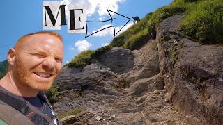
Photos of Kaprun Mountain Bike
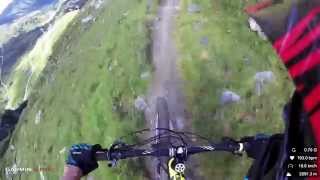
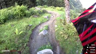
Videos of Kaprun Mountain Bike
youtuber
![Kaprun Geisstein en Wustlau]()
trail: Geißstein Trail
5:54 |
172 |
Mar 24, 2025 , Kaprun
youtuber
![Wat deze Trail met mijn Zelfvertrouwen deed //...]()

trail: Wüstlau Trail
5:54 |
234 |
Mar 17, 2025 , Kaprun

trail: Bachler Trail
13:22 |
592 |
Sep 28, 2022 , Kaprun
trail: Geißstein Trail
1492 |
Mar 21, 2016 , Kaprun
trail: Wüstlau Trail
2212 |
Mar 21, 2016 , Kaprun
Current Trail Warnings
| status | trail | date | condition | user | info |
|---|---|---|---|---|---|
| Bachler Trail | May 29, 2026 @ 7:22pm (Europe/Vienna) May 29, 2026 | Unknown | elektronaut |
Recent Trail Reports
| status | trail | date | condition | info | user |
|---|---|---|---|---|---|
| Maiskogel Trail | May 29, 2026 @ 7:20pm (Europe/Vienna) May 29, 2026 | Dry | elektronaut | ||
| Wüstlau Trail | Aug 13, 2025 @ 2:53pm Aug 13, 2025 | Dry | snommelier | ||
| Kaprun Uphill to Alpincenter | Aug 13, 2025 @ 2:52pm Aug 13, 2025 | Dry | snommelier | ||
| Geißstein Trail | Aug 4, 2024 @ 11:12am Aug 4, 2024 | Wet | psilon | ||
| MK Maiskogelbahn | Aug 13, 2023 @ 12:54am Aug 13, 2023 | Ideal | Marcinwojtczak |
Activity Feed
| username | action | type | title | date |
|---|---|---|---|---|
| Igorvisko | wishlist | trail | activity #96724472 | Jun 11, 2026 @ 2:05am Jun 11, 2026 |
| elektronaut | add | report | activity #95786845 and 1 more | May 29, 2026 @ 10:20am May 29, 2026 |
| kampfgulasch | comment | trail | activity #95380842 | May 23, 2026 @ 11:26pm May 23, 2026 |
| its-all-about-bikes | ridden | trail | activity #93274208 | Apr 24, 2026 @ 5:35am Apr 24, 2026 |
| slast | wishlist | trail | activity #86937325 and 1 more | Jan 10, 2026 @ 3:47am Jan 10, 2026 |
Recent Comments
| username | type | title | comment | date |
|---|---|---|---|---|
| trail | Kurvig, wenig jumps, wie beschrieben für... | May 23, 2026 @ 11:26pm May 23, 2026 | ||
| trail | Truly great trail (incl the upper half of... | Aug 24, 2025 @ 11:48am Aug 24, 2025 | ||
| trail | it is a really good and a litte bit... | Jul 23, 2025 @ 2:35am Jul 23, 2025 | ||
| trail | great trail and amazing scenery - the builders... | Jul 23, 2025 @ 2:32am Jul 23, 2025 | ||
| trail | Oberster Abschnitt derzeit (06.2025) gesperrt.... | Jun 25, 2025 @ 6:35am Jun 25, 2025 |
Bike & Skill Parks
| name | type | city | rating |
|---|---|---|---|
| Kitzsteinhorn | bike park | Kaprun |
Activity Type Stats
| activitytype | trails | distance | descent | descent distance | total vertical | rating | global rank | state rank | photos | reports | routes | ridelogs |
|---|---|---|---|---|---|---|---|---|---|---|---|---|
| Mountain Bike | 5 | 24 miles | 9,268 ft | 11 miles | 5,453 ft | #2,730 | #20 | 26 | 35 | 1,220 | ||
| E-Bike | 5 | 24 miles | 9,268 ft | 11 miles | 5,453 ft | #1,745 | #21 | 3 | 31 | 123 | ||
| Hike | 1 | 14 miles | 1,148 ft | 2 miles | 5,453 ft | #3,425 | #41 | 13 | 501 | |||
| Trail Running | 1 | 14 miles | 1,148 ft | 2 miles | 5,453 ft | #2,921 | #32 | 13 | 11 |
- By lines
 TRAILFORKS & contributors
 - Admins: ktm-boy-69, lgs1
- #13524 - 5,241 views
- kaprun activity log | embed map of Kaprun mountain bike trails | kaprun mountain biking points of interest
Downloading of trail gps tracks in kml & gpx formats is enabled for Kaprun.
You must login to download files.