close
-
Layers w
- Weather Layers
- Pro
- Pro
- Pro
- Pro
- Pro
- Pro
- More Layers
- Pro
- Pro
- Pro
- Pro
-
Upgrade to

3D
Trail Conditions
- Unknown
- Snow Groomed
- Snow Packed
- Snow Covered
- Snow Cover Partial
- Freeze/thaw Cycle
- Icy
- Prevalent Mud
- Wet
- Variable
- Ideal
- Dry
- Very Dry
Trail Flow (Ridden Direction)
Trailforks scans users ridelogs to determine the most popular direction each trail is ridden. A good flowing trail network will have most trails flowing in a single direction according to their intension.
The colour categories are based on what percentage of riders are riding a trail in its intended direction.
The colour categories are based on what percentage of riders are riding a trail in its intended direction.
- > 96%
- > 90%
- > 80%
- > 70%
- > 50%
- < 50%
- bi-directional trail
- no data
Trail Last Ridden
Trailforks scans ridelogs to determine the last time a trail was ridden.
- < 2 days
- < 1 week
- < 2 weeks
- < 1 month
- < 6 months
- > 6 months
Trail Ridden Direction
The intended direction a trail should be ridden.
- Downhill Only
- Downhill Primary
- Both Directions
- Uphill Primary
- Uphill Only
- One Direction
Contribute Details
Colors indicate trail is missing specified detail.
- Description
- Photos
- Description & Photos
- Videos
Trail Popularity ?
Trailforks scans ridelogs to determine which trails are ridden the most in the last 9 months.
Trails are compared with nearby trails in the same city region with a possible 25 colour shades.
Think of this as a heatmap, more rides = more kinetic energy = warmer colors.
- most popular
- popular
- less popular
- not popular
ATV/ORV/OHV Filter
Max Vehicle Width
inches
US Cell Coverage
Legend

Radar Time
Activity Recordings
Trailforks uses anonymized public activity data.
?
Activity Recordings
Trailforks uses anonymized public activity data.
?
Personal Heatmap
▶
Activity Types
all
/
none
▶
Options
2
Date range
month
–
Winter Trails
Warning
A routing network for winter maps does not exist. Selecting trails using the winter trails layer has been disabled.
Missing Trails
Most Popular
Least Popular
Trails are colored based on popularity. The more popular a trail is, the more red. Less popular trails trend towards green.
Jump Magnitude Heatmap
Heatmap of where riders jump on trails. Zoom in to see individual jumps, click circles to view jump details.
BC Backroad Status
![map legend]()
Service Road Atlas is a free to use, community-driven service for viewing and creating reports on the numerous back-country service roads around B.C. and Alberta.

Slope Aspect
Direction the slope faces
Trails Deemphasized
Trails are shown in grey.
Only show trails with no bike usage.
Suggested Layers
Based on selected activity type
Save the current map location and zoom level as your default home location whenever this page is loaded.
Save
No description for Kaštel has been added yet!
Login or register to submit one.
This region uses the Uk/Euro style trail grading system.
Activities Click to view
- Mountain Bike
2 trails
- E-Bike
1 trails
- Gravel Bike
0 trails
- Adaptive Bike
0 trails
- Hike
2 trails
- Trail Running
2 trails
Region Details
- 2
Region Status
Caution as of May 24, 2026Stats
- Avg Trail Rating
- Trails (view details)
- 2
- Trails Mountain Bike
- 2
- Trails E-Bike
- 1
- Trails Hike
- 2
- Trails Trail Running
- 2
- Total Distance
- 2 miles
- Total Descent
- 914 ft
- Total Vertical
- 1,155 ft
- Highest Trailhead
- 1,232 ft
- Reports
- 65
- Photos
- 19
- Ridden Counter
- 369
Popular Kaštel Mountain Biking Trails
• 100 ★ 4.6 • 4,192 ft • 12 ft • 307 •
Highly rated popular blue difficulty singletrack. This mountain bike primary trail can be used downhill primary and has a moderate overall physical rating with a 12 ft blue climb. On average it takes 11 minutes to complete this trail.
• 5 ★ 3.0 • 4,388 ft • 24 ft • 5 •
In the first 50 meters it's an easy tool road but after that it becomes a single track whith some tight bends which will get you to the HR/SLO border. you have to remember 3 important things: 1)At the last forking steer right (you will...
Kaštel Mountain Bike Routes
25 miles • 1,571 ft • 0 •
Start on the parking lot neat the football field along the narrow road uphill until you reach the road...
23 miles • 1,302 ft • 0 •
Start in the town square in Brtonigla, take the road for Grobice and you will soon reach Baredine from...
20 miles • 1,851 ft • 0 •
Start in Buje (football field) to Bibali and take the unpaved road through Kruge and Smilovići to Momjan....
Videos of Kaštel Mountain Bike
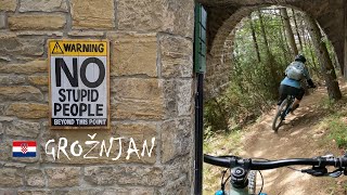
trail: Sv Juraj
21:33 |
142 |
Oct 10, 2024 , Kaštel
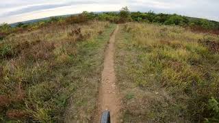
trail: Sv Juraj
4:33 |
513 |
Oct 24, 2021 , Kaštel
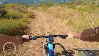
trail: Sv Juraj
4:10 |
362 |
Sep 25, 2021 , Kaštel
trail: Kaštel's border trail
651 |
Aug 5, 2017 , Kaštel
Recent Trail Reports
| status | trail | date | condition | info | user |
|---|---|---|---|---|---|
| Sv Juraj | May 24, 2026 @ 9:49pm (Europe/Zagreb) May 24, 2026 | Dry | Flow-24 | ||
| Kaštel's border trail | May 2, 2019 @ 1:25pm May 2, 2019 | Variable | Stenimir BKO |
Activity Feed
| username | action | type | title | date |
|---|---|---|---|---|
| Flow-24 | add | report | activity #95437808 | May 24, 2026 @ 12:49pm May 24, 2026 |
| MatejSpindler | difficultyvote | trail | activity #94011484 | May 4, 2026 @ 1:47am May 4, 2026 |
| MajaR2vx8v | wishlist | trail | activity #89995956 | Mar 5, 2026 @ 12:36am Mar 5, 2026 |
| astraoli | ridden | trail | activity #88318917 | Feb 4, 2026 @ 5:02am Feb 4, 2026 |
| astraoli | vote | trail | activity #88318916 | Feb 4, 2026 @ 5:02am Feb 4, 2026 |
Recent Comments
| username | type | title | comment | date |
|---|---|---|---|---|
| trail | Less interesting than some of the other lines... | Oct 15, 2025 @ 2:29pm Oct 15, 2025 | ||
| trail | The trail is nice, simple and flowy. One... | Sep 30, 2023 @ 11:20am Sep 30, 2023 | ||
| trail | Very nice and clean. Flowy but extremely muddy... | Jul 22, 2023 @ 5:26am Jul 22, 2023 | ||
| trail | Very nice trail, unfortunatley muddy and ... | Jul 22, 2023 @ 1:14am Jul 22, 2023 | ||
| trail | Great natural and dynamic flow! Great views... | Jun 20, 2021 @ 1:35am Jun 20, 2021 |
Activity Type Stats
| activitytype | trails | distance | descent | descent distance | total vertical | rating | global rank | state rank | photos | reports | routes | ridelogs |
|---|---|---|---|---|---|---|---|---|---|---|---|---|
| Mountain Bike | 2 | 2 miles | 912 ft | 1 mile | 1,155 ft | #5,173 | #31 | 19 | 65 | 3 | 1,179 | |
| E-Bike | 1 | 4,193 ft | 404 ft | 3,484 ft | 397 ft | #4,039 | #33 | 62 | 72 | |||
| Hike | 2 | 2 miles | 912 ft | 1 mile | 1,155 ft | #7,017 | #45 | 65 | 50 | |||
| Trail Running | 2 | 2 miles | 912 ft | 1 mile | 1,155 ft | #6,461 | #45 | 65 | 4 |
- By Seba99 & contributors
- Admins: VjekoslavKrsanac
- #19592 - 1,861 views
- kaštel activity log | embed map of Kaštel mountain bike trails | kaštel mountain biking points of interest
Downloading of trail gps tracks in kml & gpx formats is enabled for Kaštel.
You must login to download files.