close
-
Layers w
- Weather Layers
- Pro
- Pro
- Pro
- Pro
- Pro
- Pro
- More Layers
- Pro
- Pro
- Pro
- Pro
-
Upgrade to

3D
Trail Conditions
- Unknown
- Snow Groomed
- Snow Packed
- Snow Covered
- Snow Cover Partial
- Freeze/thaw Cycle
- Icy
- Prevalent Mud
- Wet
- Variable
- Ideal
- Dry
- Very Dry
Trail Flow (Ridden Direction)
Trailforks scans users ridelogs to determine the most popular direction each trail is ridden. A good flowing trail network will have most trails flowing in a single direction according to their intension.
The colour categories are based on what percentage of riders are riding a trail in its intended direction.
The colour categories are based on what percentage of riders are riding a trail in its intended direction.
- > 96%
- > 90%
- > 80%
- > 70%
- > 50%
- < 50%
- bi-directional trail
- no data
Trail Last Ridden
Trailforks scans ridelogs to determine the last time a trail was ridden.
- < 2 days
- < 1 week
- < 2 weeks
- < 1 month
- < 6 months
- > 6 months
Trail Ridden Direction
The intended direction a trail should be ridden.
- Downhill Only
- Downhill Primary
- Both Directions
- Uphill Primary
- Uphill Only
- One Direction
Contribute Details
Colors indicate trail is missing specified detail.
- Description
- Photos
- Description & Photos
- Videos
Trail Popularity ?
Trailforks scans ridelogs to determine which trails are ridden the most in the last 9 months.
Trails are compared with nearby trails in the same city region with a possible 25 colour shades.
Think of this as a heatmap, more rides = more kinetic energy = warmer colors.
- most popular
- popular
- less popular
- not popular
ATV/ORV/OHV Filter
Max Vehicle Width
inches
US Cell Coverage
Legend

Radar Time
Activity Recordings
Trailforks uses anonymized public activity data.
?
Activity Recordings
Trailforks uses anonymized public activity data.
?
Personal Heatmap
▶
Activity Types
all
/
none
▶
Options
2
Date range
month
–
Winter Trails
Warning
A routing network for winter maps does not exist. Selecting trails using the winter trails layer has been disabled.
Missing Trails
Most Popular
Least Popular
Trails are colored based on popularity. The more popular a trail is, the more red. Less popular trails trend towards green.
Jump Magnitude Heatmap
Heatmap of where riders jump on trails. Zoom in to see individual jumps, click circles to view jump details.
BC Backroad Status
![map legend]()
Service Road Atlas is a free to use, community-driven service for viewing and creating reports on the numerous back-country service roads around B.C. and Alberta.

Slope Aspect
Direction the slope faces
Trails Deemphasized
Trails are shown in grey.
Only show trails with no bike usage.
Suggested Layers
Based on selected activity type
Save the current map location and zoom level as your default home location whenever this page is loaded.
Save
No description for Kaštela has been added yet!
Login or register to submit one.
This region uses the Uk/Euro style trail grading system.
Activities Click to view
- Mountain Bike
10 trails
- Gravel Bike
0 trails
- Adaptive Bike
0 trails
- Winter Fat Bike
0 trails
- Hike
10 trails
- Trail Running
10 trails
Region Details
- 3
- 1
- 5
- 1
Region Status
Caution as of Apr 25, 2026Stats
- Avg Trail Rating
- Trails (view details)
- 10
- Trails Mountain Bike
- 10
- Trails E-Bike
- 3
- Trails Hike
- 10
- Trails Trail Running
- 10
- Trails Dirtbike/Moto
- 1
- Total Distance
- 14 miles
- Total Descent
- 4,005 ft
- Total Vertical
- 1,627 ft
- Highest Trailhead
- 1,881 ft
- Reports
- 50
- Photos
- 23
- Ridden Counter
- 92
Popular Kaštela Mountain Biking Trails
• 80 ★ 5.0 • 1 mile • 62 ft • 17 •
is freeride trail for all mountainbikers. videos and info : http://www.pedalinkastela.hr/
• 100 ★ 0.0 • 1 mile • 60 ft • 9 •
Popular blue difficulty singletrack. This mountain bike primary trail can be used downhill primary and has a easy overall physical rating. It features rock face, rock garden and skinny. On average it takes 10 minutes to complete this trail.
• 90 ★ 4.0 • 1,953 ft • 7 ft • 7 •
Popular green difficulty singletrack. This mountain bike primary trail can be used downhill primary and has a easy overall physical rating with a 7 ft blue climb. It features skinny. On average it takes 1 minutes to complete this trail.
• 5 ★ 0.0 • 3,972 ft • 10 ft • 7 •
Malačka Trail is skinny simple trail for Mountain biking and hiking. Shuttle will take you to the starting point, or you can pedal uphill. There you can take a hit of a cold beer and rush it down the trail. Trail is skinny, with nice...
• 5 ★ 5.0 • 784 ft • 0 ft • 6 •
Pretty technical and sketchy, all rocks so be careful with brakes.
• 5 ★ 5.0 • 5,013 ft • 0 ft • 5 •
Typical Dalmatian rocky trail. Upper section pretty technical, lower flowy.
• 5 ★ 0.0 • 5,233 ft • 32 ft • 2 •
Less popular blue difficulty wilderness trail. This mountain bike primary trail can be used downhill primary and has a hard overall physical rating with a 32 ft blue climb.
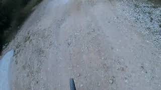
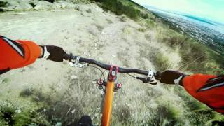
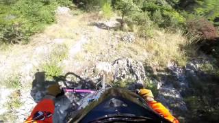
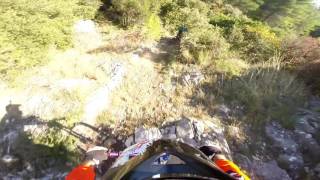
Photos of Kaštela Mountain Bike
Videos of Kaštela Mountain Bike
trail: sv. Jure trail
4:54 |
693 |
Jan 17, 2020 , Kaštela
trail: Malačka Trail
655 |
Feb 19, 2017 , Kaštela
trail: Terapija Trail
1007 |
Feb 1, 2017 , Kaštela
trail: Terapija Trail
557 |
Feb 1, 2017 , Kaštela
Recent Trail Reports
| status | trail | date | condition | info | user |
|---|---|---|---|---|---|
| Terapija Trail | Nov 30, 2025 @ 10:18pm (Europe/Zagreb) Nov 30, 2025 | Dry | Dario0aAEA1 | ||
| Sv. Lovre trail | Aug 12, 2024 @ 6:48pm Aug 12, 2024 | Ideal | Marac0024 | ||
| Križna | Jun 25, 2024 @ 11:14am Jun 25, 2024 | Very Dry | Marac0024 |
Activity Feed
| username | action | type | title | date |
|---|---|---|---|---|
| Marjan81 | ridden | trail | activity #93437994 | Apr 26, 2026 @ 6:53am Apr 26, 2026 |
| Marjan81 | ridden | trail | activity #92710809 | Apr 16, 2026 @ 2:08am Apr 16, 2026 |
| ManueluqtSj | add | trail | activity #91222789 | Mar 24, 2026 @ 1:27pm Mar 24, 2026 |
| DayluWo7l0Q | ridden | trail | activity #86236258 | Dec 28, 2025 @ 1:40pm Dec 28, 2025 |
| Dario0aAEA1 | add | report | activity #84985963 | Nov 30, 2025 @ 1:18pm Nov 30, 2025 |
Recent Comments
| username | type | title | comment | date |
|---|---|---|---|---|
| trail | Overgrown | Aug 16, 2019 @ 1:03am Aug 16, 2019 |
Activity Type Stats
| activitytype | trails | distance | descent | descent distance | total vertical | rating | global rank | state rank | photos | reports | routes | ridelogs |
|---|---|---|---|---|---|---|---|---|---|---|---|---|
| Mountain Bike | 10 | 14 miles | 4,006 ft | 7 miles | 1,627 ft | #3,331 | #23 | 23 | 50 | 251 | ||
| E-Bike | 3 | 4 miles | 745 ft | 1 mile | 1,043 ft | 43 | 142 | |||||
| Hike | 10 | 14 miles | 4,006 ft | 7 miles | 1,627 ft | #4,570 | #29 | 50 | 29 | |||
| Trail Running | 10 | 14 miles | 4,006 ft | 7 miles | 1,627 ft | #3,992 | #28 | 50 | 7 | |||
| Dirtbike/Moto | 1 | 2 miles | 991 ft | 1 |
Frequently Asked Questions About Kaštela
▼
What are the highest rated mountain biking trails in Kaštela?
The highest rated mountain biking trails in Kaštela are:
- Terapija Trail (4.1/5)
- Nina (4.1/5)
- sv. Jure trail (4.1/5)
- Sv. Lovre trail (4/5)
- Križna (0/5)
▼
What is the best time of the year to ride in Kaštela?
Based on ride log data, the most popular months to ride in Kaštela are:
- July (7 activities)
- August (1 activities)
- October (1 activities)
▼
Where can I park to ride in Kaštela?
Check the Kaštela trail map for trailhead and parking information. Community members regularly update access and parking details for trails in the area.
▼
What is the longest trail in Kaštela?
The longest trail in Kaštela is Terapija Trail at 1.7 km. View all trails sorted by distance.
- By Pedalin & contributors
- Admins: VjekoslavKrsanac
- #17615 - 3,004 views
- kaštela activity log | embed map of Kaštela mountain bike trails | kaštela mountain biking points of interest
Downloading of trail gps tracks in kml & gpx formats is enabled for Kaštela.
You must login to download files.