close
-
Layers w
- Weather Layers
- Pro
- Pro
- Pro
- Pro
- Pro
- Pro
- More Layers
- Pro
- Pro
- Pro
- Pro
-
Upgrade to

3D
Trail Conditions
- Unknown
- Snow Groomed
- Snow Packed
- Snow Covered
- Snow Cover Partial
- Freeze/thaw Cycle
- Icy
- Prevalent Mud
- Wet
- Variable
- Ideal
- Dry
- Very Dry
Trail Flow (Ridden Direction)
Trailforks scans users ridelogs to determine the most popular direction each trail is ridden. A good flowing trail network will have most trails flowing in a single direction according to their intension.
The colour categories are based on what percentage of riders are riding a trail in its intended direction.
The colour categories are based on what percentage of riders are riding a trail in its intended direction.
- > 96%
- > 90%
- > 80%
- > 70%
- > 50%
- < 50%
- bi-directional trail
- no data
Trail Last Ridden
Trailforks scans ridelogs to determine the last time a trail was ridden.
- < 2 days
- < 1 week
- < 2 weeks
- < 1 month
- < 6 months
- > 6 months
Trail Ridden Direction
The intended direction a trail should be ridden.
- Downhill Only
- Downhill Primary
- Both Directions
- Uphill Primary
- Uphill Only
- One Direction
Contribute Details
Colors indicate trail is missing specified detail.
- Description
- Photos
- Description & Photos
- Videos
Trail Popularity ?
Trailforks scans ridelogs to determine which trails are ridden the most in the last 9 months.
Trails are compared with nearby trails in the same city region with a possible 25 colour shades.
Think of this as a heatmap, more rides = more kinetic energy = warmer colors.
- most popular
- popular
- less popular
- not popular
ATV/ORV/OHV Filter
Max Vehicle Width
inches
US Cell Coverage
Legend

Radar Time
Activity Recordings
Trailforks uses anonymized public activity data.
?
Activity Recordings
Trailforks uses anonymized public activity data.
?
Personal Heatmap
▶
Activity Types
all
/
none
▶
Options
2
Date range
month
–
Winter Trails
Warning
A routing network for winter maps does not exist. Selecting trails using the winter trails layer has been disabled.
Missing Trails
Most Popular
Least Popular
Trails are colored based on popularity. The more popular a trail is, the more red. Less popular trails trend towards green.
Jump Magnitude Heatmap
Heatmap of where riders jump on trails. Zoom in to see individual jumps, click circles to view jump details.
BC Backroad Status
![map legend]()
Service Road Atlas is a free to use, community-driven service for viewing and creating reports on the numerous back-country service roads around B.C. and Alberta.

Slope Aspect
Direction the slope faces
Trails Deemphasized
Trails are shown in grey.
Only show trails with no bike usage.
Suggested Layers
Based on selected activity type
Save the current map location and zoom level as your default home location whenever this page is loaded.
Save
No description for Kenmore has been added yet!
Login or register to submit one.
Activities Click to view
- Mountain Bike
59 trails
- E-Bike
29 trails
- Gravel Bike
0 trails
- Adaptive Bike
- Winter Fat Bike
0 trails
- Hike
68 trails
- Trail Running
69 trails
Region Details
- 4
- 1
- 45
- 5
- 2
Region Status
Open as of May 24, 2026Local Trail Association
Stats
- Avg Trail Rating
- Trails (view details)
- 64
- Trails Mountain Bike
- 59
- Trails E-Bike
- 29
- Trails Hike
- 69
- Trails Trail Running
- 69
- Total Distance
- 15 miles
- Total Descent
- 3,642 ft
- Total Vertical
- 572 ft
- Highest Trailhead
- 592 ft
- Reports
- 1,933
- Photos
- 325
- Ridden Counter
- 9,342
Sub Regions
-
Big Finn Hill Park
- 22
- 2
-
Juanita Woodlands Park Trails
- 6
- 1
-
St. Edward State Park
- 1
- 23
- 3
- 2
Popular Kenmore Mountain Biking Trails
• 100 ★ 2.0 • 670 ft • 12 ft • 1,344 •
Popular green difficulty singletrack. This mountain bike primary trail can be used both directions. On average it takes minutes to complete this trail.
• 85 ★ 3.4 • 2,387 ft • 222 ft • 1,321 •
is fairly direct, and because of that there are quite a few straight up climbs and straight down shots, but the trail is mostly clean and smooth. If you are with kiddos though, it's still the best way between St. Edwards and Big Finn...
• 90 ★ 2.0 • 861 ft • 35 ft • 1,193 •
A wide trail that is kid friendly and functions as a primary dual direction access trail.
• 90 ★ 2.0 • 938 ft • 26 ft • 1,171 •
Popular green difficulty singletrack. This mountain bike primary trail can be used both directions. On average it takes 1 minutes to complete this trail.
• 100 ★ 4.7 • 829 ft • 43 ft • 1,166 •
Stupid fun. Quite simply, one of the most fun trails in the entire park. Most riders will zip on by on the way over to Big Finn Hill. Make sure to swing on through and lap this a few times.
• 90 ★ 4.3 • 1,631 ft • 129 ft • 1,156 • • hike
Fun flowy trail that runs right along Juanita Drive, when riding downhill be aware of uphill traffic.
• 90 ★ 3.9 • 2,974 ft • 318 ft • 1,151 •
is a fairly fast and fun trail, but be ware of other bikers and foot traffic, as it is pretty well-traveled by both bikers and hikers.
Kenmore Mountain Bike Routes
9 miles • 521 ft • 26 •
Great XC route with small rooty sections, bridges, a couple switchbacks, and short punchy climbs. Perfect...
• 24 miles • 1,273 ft • 0 •
• 7 miles • 651 ft • 33 •
• 3 miles • 202 ft • 11 •
• 4 miles • 269 ft • 12 •
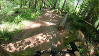
Photos of Kenmore Mountain Bike
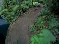
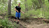
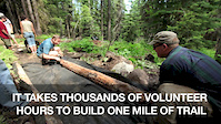
Videos of Kenmore Mountain Bike
trail: Panta Rhei
0:17 |
5 |
May 25, 2026
trail: Panta Rhei
0:43 |
1825 |
May 17, 2015
trail: Switchback
3:14 |
1539 |
Nov 10, 2013
trail: Volunteer Trail
3:02 |
867 |
Aug 30, 2013

trail: Hike Up
0:58 |
39930 |
Feb 22, 2013

trail: Switchback
0:53 |
126 |
Feb 10, 2011
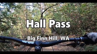
trail: Hall Pass
0:31 |
603 |
Oct 17, 2022 , Kenmore

trail: Mainline
0:18 |
336 |
Oct 17, 2022 , Kenmore
Recent Trail Reports
Activity Feed
| username | action | type | title | date |
|---|---|---|---|---|
| YurinXaLtG | ridden | trail | activity #97707969 | Jun 24, 2026 @ 10:29am 5 hours |
| Diamondwoman | comment | report | activity #97210427 | Jun 17, 2026 @ 2:44pm Jun 17, 2026 |
| YQgedj | wishlist | poi | activity #96838110 | Jun 12, 2026 @ 5:22pm Jun 12, 2026 |
| Amberbikeshard | wishlist | route | activity #96743649 | Jun 11, 2026 @ 9:37am Jun 11, 2026 |
| YQgedj | wishlist | trail | activity #95958448 and 1 more | May 31, 2026 @ 10:55am May 31, 2026 |
Recent Comments
| username | type | title | comment | date |
|---|---|---|---|---|
| report | Hm huh now | Jun 17, 2026 @ 2:44pm Jun 17, 2026 | ||
| trail | Visually intimidating steep hill/valley. It... | Jul 21, 2025 @ 11:58am Jul 21, 2025 | ||
| trail | I wish there were more like this without... | Nov 29, 2023 @ 3:25pm Nov 29, 2023 | ||
| report | R | Nov 18, 2023 @ 2:51pm Nov 18, 2023 | ||
| report | Thank you, looks like you guys have been busy too. | Nov 28, 2022 @ 5:58pm Nov 28, 2022 |
Local Badges
-

10 Green Trails86 awarded -

Epic Mountain Bike Climb 2k0 awarded -

Climbing 10k Badge1 awarded -

Mountain Biking 100k Badge0 awarded -

Epic Ride Descent 2k0 awarded -

Descent 10k Badge2 awarded
Activity Type Stats
| activitytype | trails | distance | descent | descent distance | total vertical | rating | global rank | state rank | photos | reports | routes | ridelogs |
|---|---|---|---|---|---|---|---|---|---|---|---|---|
| Mountain Bike | 59 | 12 miles | 3,094 ft | 5 miles | 558 ft | #474 | #171 | 285 | 1,932 | 2 | 28,826 | |
| E-Bike | 29 | 6 miles | 1,775 ft | 2 miles | 558 ft | #4,691 | #1,500 | 1,656 | 762 | |||
| Hike | 68 | 15 miles | 3,642 ft | 6 miles | 571 ft | #3,021 | #1,094 | 40 | 1,911 | 2 | 941 | |
| Trail Running | 69 | 15 miles | 3,642 ft | 6 miles | 571 ft | #4,462 | #1,371 | 1,911 | 2 | 2,125 |
Frequently Asked Questions About Kenmore
▼
What are the best places to ride in Kenmore?
Kenmore has 2 areas to explore for mountain biking. The top rated areas are:
▼
What are the highest rated mountain biking trails in Kenmore?
The highest rated mountain biking trails in Kenmore are:
- Panta Rhei (4.6/5)
- Juanita Trail (4.1/5)
- Trail 6 - NE Corner (4.1/5)
- South Chute (4.1/5)
- St Edwards (4.1/5)
▼
What is the best time of the year to ride in Kenmore?
Based on ride log data, the most popular months to ride in Kenmore are:
- July (407 activities)
- August (391 activities)
- June (304 activities)
▼
Where can I park to ride in Kenmore?
There are 10 parking locations listed in Kenmore. The most popular parking spots are: View all parking and trailhead locations on the map to plan your visit.
Activities
Trails
- By tnkasper
 & contributors
 - Admins: EMBA-C2S, EMBA-C2S
- #12085 - 2,988 views
- kenmore activity log | embed map of Kenmore mountain bike trails | kenmore mountain biking points of interest
Downloading of trail gps tracks in kml & gpx formats is enabled for Kenmore.
You must login to download files.