close
-
Layers w
- Weather Layers
- Pro
- Pro
- Pro
- Pro
- Pro
- Pro
- More Layers
- Pro
- Pro
- Pro
- Pro
-
Upgrade to

3D
Trail Conditions
- Unknown
- Snow Groomed
- Snow Packed
- Snow Covered
- Snow Cover Partial
- Freeze/thaw Cycle
- Icy
- Prevalent Mud
- Wet
- Variable
- Ideal
- Dry
- Very Dry
Trail Flow (Ridden Direction)
Trailforks scans users ridelogs to determine the most popular direction each trail is ridden. A good flowing trail network will have most trails flowing in a single direction according to their intension.
The colour categories are based on what percentage of riders are riding a trail in its intended direction.
The colour categories are based on what percentage of riders are riding a trail in its intended direction.
- > 96%
- > 90%
- > 80%
- > 70%
- > 50%
- < 50%
- bi-directional trail
- no data
Trail Last Ridden
Trailforks scans ridelogs to determine the last time a trail was ridden.
- < 2 days
- < 1 week
- < 2 weeks
- < 1 month
- < 6 months
- > 6 months
Trail Ridden Direction
The intended direction a trail should be ridden.
- Downhill Only
- Downhill Primary
- Both Directions
- Uphill Primary
- Uphill Only
- One Direction
Contribute Details
Colors indicate trail is missing specified detail.
- Description
- Photos
- Description & Photos
- Videos
Trail Popularity ?
Trailforks scans ridelogs to determine which trails are ridden the most in the last 9 months.
Trails are compared with nearby trails in the same city region with a possible 25 colour shades.
Think of this as a heatmap, more rides = more kinetic energy = warmer colors.
- most popular
- popular
- less popular
- not popular
ATV/ORV/OHV Filter
Max Vehicle Width
inches
US Cell Coverage
Legend

Radar Time
Activity Recordings
Trailforks uses anonymized public activity data.
?
Activity Recordings
Trailforks uses anonymized public activity data.
?
Personal Heatmap
▶
Activity Types
all
/
none
▶
Options
2
Date range
month
–
Winter Trails
Warning
A routing network for winter maps does not exist. Selecting trails using the winter trails layer has been disabled.
Missing Trails
Most Popular
Least Popular
Trails are colored based on popularity. The more popular a trail is, the more red. Less popular trails trend towards green.
Jump Magnitude Heatmap
Heatmap of where riders jump on trails. Zoom in to see individual jumps, click circles to view jump details.
BC Backroad Status
![map legend]()
Service Road Atlas is a free to use, community-driven service for viewing and creating reports on the numerous back-country service roads around B.C. and Alberta.

Slope Aspect
Direction the slope faces
Trails Deemphasized
Trails are shown in grey.
Only show trails with no bike usage.
Suggested Layers
Based on selected activity type
Save the current map location and zoom level as your default home location whenever this page is loaded.
Save
No description for Kennewick has been added yet!
Login or register to submit one.
Activities Click to view
- Mountain Bike
67 trails
- E-Bike
5 trails
- Gravel Bike
0 trails
- Adaptive Bike
0 trails
- Winter Fat Bike
0 trails
- Hike
91 trails
- Trail Running
91 trails
Region Details
- 9
- 19
- 15
- 9
- 3
- 1
Region Status
Open as of 1 dayLocal Trail Association
Stats
- Avg Trail Rating
- Trails (view details)
- 57
- Trails Mountain Bike
- 92
- Trails E-Bike
- 5
- Trails Horse
- 1
- Trails Hike
- 91
- Trails Trail Running
- 91
- Total Distance
- 61 miles
- Total Descent
- 9,382 ft
- Total Vertical
- 1,773 ft
- Highest Trailhead
- 2,125 ft
- Reports
- 494
- Photos
- 308
- Ridden Counter
- 2,874
Sub Regions
-
State Patrol Trails
- 22
- 16
- 9
- 3
- 1
Popular Kennewick Mountain Biking Trails
• 100 ★ 3.8 • 2 miles • 66 ft • 253 •
A very constantly curvy descending trail with cupped-banked corners, good soil and short climbs between descending sections.
• 90 ★ 5.0 • 374 ft • 0 ft • 179 •
A short, fun section of track with pumps, and some smaller jumps that are great to practice your skills on.
• 95 ★ 4.7 • 1 mile • 107 ft • 154 •
The main climbing trail to access the State Patrol Trails
• 100 ★ 4.0 • 925 ft • 0 ft • 136 •
Popular blue difficulty singletrack. This mountain bike primary trail. On average it takes 6 minutes to complete this trail.
• 100 ★ 4.3 • 1 mile • 4 ft • 120 •
A State Patrol classic, one of the originals, and the most popular. More of a straight-line trail with some corners and optional tabletops. The upper portion to the access road is mellow, and the bottom portion gets more spicy with a...
• 75 ★ 4.0 • 1 mile • 8 ft • 109 •
A technical descending only trail with mix of loose jumps, wooden structures and other technical challenges
• 80 ★ 5.0 • 5,066 ft • 3 ft • 105 •
Popular blue difficulty singletrack. This mountain bike primary trail can be used downhill primary. On average it takes 5 minutes to complete this trail.
• 90 ★ 3.5 • 1 mile • 25 ft • 104 •
Popular green difficulty singletrack. This mountain bike primary trail can be used downhill primary. On average it takes 6 minutes to complete this trail.
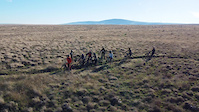
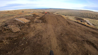
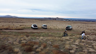
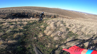
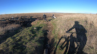
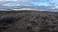
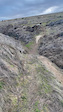
Photos of Kennewick Mountain Bike
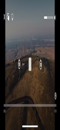
Videos of Kennewick Mountain Bike
trail: No Spandex
0:39 |
35 |
Dec 16, 2025
trail: Pick your Poison
2:30 |
68 |
Jan 11, 2025
trail: Pick your Poison
0:52 |
29 |
Jan 11, 2025
trail: Skateboard
0:28 |
45 |
Jan 11, 2025
trail: Slime
0:45 |
55 |
Jan 11, 2025
trail: Owens Road
2:16 |
27 |
Aug 1, 2024
trail: Fred and John’s
3:47 |
81 |
Feb 12, 2024
trail: Fred and John’s
0:11 |
64 |
Feb 12, 2024
Recent Trail Reports
| status | trail | date | condition | info | user |
|---|---|---|---|---|---|
| Fred and John’s | Jun 24, 2026 @ 10:44am (America/Los_Angeles) Jun 24, 2026 | Dry | liamklenke | ||
| Child’s play | May 21, 2026 @ 2:49pm (America/Los_Angeles) May 21, 2026 | Unknown | liamklenke | ||
| Bermalicious | May 3, 2026 @ 12:19pm (America/Los_Angeles) May 3, 2026 | Unknown | NobleSTR | ||
| X-Cut | May 3, 2026 @ 12:18pm (America/Los_Angeles) May 3, 2026 | Ideal | NobleSTR | ||
| To the Bike Shop | Apr 29, 2026 @ 5:28pm (America/Los_Angeles) Apr 29, 2026 | Very Dry | drakem49 | ||
| Pumpty Bumbty | Apr 5, 2026 @ 11:41am (America/Boise) Apr 5, 2026 | Ideal | NobleSTR | ||
| Whale's back | Mar 27, 2026 @ 9:46am (America/Los_Angeles) Mar 27, 2026 | Unknown | dbierwi440 | ||
| Woodys - Provides access to Big Tire 2 from Main Street or Freeway | Mar 25, 2026 @ 10:32am (America/Los_Angeles) Mar 25, 2026 | Ideal | WillieJacobsz Trailforks | ||
| Wind Advisory | Mar 25, 2026 @ 10:32am (America/Los_Angeles) Mar 25, 2026 | Ideal | WillieJacobsz Trailforks | ||
| Tire 2 Fred John | Mar 25, 2026 @ 10:32am (America/Los_Angeles) Mar 25, 2026 | Ideal | WillieJacobsz Trailforks |
Activity Feed
| username | action | type | title | date |
|---|---|---|---|---|
| liamklenke | add | video | activity #97875817 and 1 more | Jun 26, 2026 @ 9:29pm Jun 26, 2026 |
| KendallRandi | wishlist | trail | activity #97848099 | Jun 26, 2026 @ 11:44am Jun 26, 2026 |
| sachou | update | trail | activity #97720009 | Jun 24, 2026 @ 1:13pm Jun 24, 2026 |
| liamklenke | add | report | activity #97709169 | Jun 24, 2026 @ 10:45am Jun 24, 2026 |
| liamklenke | add | photo | activity #97708152 and 13 more | Jun 24, 2026 @ 10:31am Jun 24, 2026 |
Recent Comments
| username | type | title | comment | date |
|---|---|---|---|---|
| trail | I am a wandering truck driver and I pack my... | May 18, 2025 @ 2:40pm May 18, 2025 | ||
| trail | Just rode it today and trail is dry and parts... | Oct 22, 2023 @ 4:57pm Oct 22, 2023 | ||
| trail | Lines ranging from black to pro line | Sep 21, 2023 @ 4:11pm Sep 21, 2023 | ||
| trail | Different lines ranging from blue to double black | Sep 21, 2023 @ 4:10pm Sep 21, 2023 | ||
| trail | Multiple large gaps | Sep 21, 2023 @ 4:10pm Sep 21, 2023 |
Local Badges
-

10 Green Trails39 awarded -

10 Blue Trails39 awarded -

Epic Ride Climb 2k8 awarded -

Climbing 10k Badge15 awarded -

Climbing 100k Badge1 awarded -

Epic Ride Descent 2k8 awarded
Activity Type Stats
| activitytype | trails | distance | descent | descent distance | total vertical | rating | global rank | state rank | photos | reports | routes | ridelogs |
|---|---|---|---|---|---|---|---|---|---|---|---|---|
| Mountain Bike | 67 | 61 miles | 9,327 ft | 30 miles | 1,772 ft | #2,782 | #989 | 317 | 497 | 3,750 | ||
| E-Bike | 5 | 3 miles | 364 ft | 4,951 ft | 1,312 ft | #8,176 | #2,479 | 2 | 328 | 267 | ||
| Horse | 1 | 4,908 ft | 115 ft | 935 ft | 197 ft | 94 | ||||||
| Hike | 91 | 59 miles | 9,318 ft | 30 miles | 1,772 ft | #2,224 | #904 | 19 | 500 | 58 | ||
| Trail Running | 91 | 59 miles | 9,318 ft | 30 miles | 1,772 ft | #3,530 | #1,053 | 1 | 500 | 100 |
Frequently Asked Questions About Kennewick
▼
What are the best places to ride in Kennewick?
Kennewick has 1 areas to explore for mountain biking. The top rated areas are:
▼
What are the highest rated mountain biking trails in Kennewick?
The highest rated mountain biking trails in Kennewick are:
- Humpty Pumpty (4.2/5)
- Bump and Grind (4.2/5)
- Freeway (4.2/5)
- Baby Chute (4.1/5)
- Slick Rock Plus (4.1/5)
▼
What is the best time of the year to ride in Kennewick?
Based on ride log data, the most popular months to ride in Kennewick are:
- April (46 activities)
- May (45 activities)
- June (30 activities)
▼
Where can I park to ride in Kennewick?
There are 22 parking locations listed in Kennewick. The most popular parking spots are: View all parking and trailhead locations on the map to plan your visit.
Activities
Trails
Points of Interest
- By claart & contributors
- Admins: EMBA-CBC
- #8444 - 5,880 views
- kennewick activity log | embed map of Kennewick mountain bike trails | kennewick mountain biking points of interest
Downloading of trail gps tracks in kml & gpx formats is enabled for Kennewick.
You must login to download files.