close
-
Layers w
- Weather Layers
- Pro
- Pro
- Pro
- Pro
- Pro
- Pro
- More Layers
- Pro
- Pro
- Pro
- Pro
-
Upgrade to

3D
Trail Conditions
- Unknown
- Snow Groomed
- Snow Packed
- Snow Covered
- Snow Cover Partial
- Freeze/thaw Cycle
- Icy
- Prevalent Mud
- Wet
- Variable
- Ideal
- Dry
- Very Dry
Trail Flow (Ridden Direction)
Trailforks scans users ridelogs to determine the most popular direction each trail is ridden. A good flowing trail network will have most trails flowing in a single direction according to their intension.
The colour categories are based on what percentage of riders are riding a trail in its intended direction.
The colour categories are based on what percentage of riders are riding a trail in its intended direction.
- > 96%
- > 90%
- > 80%
- > 70%
- > 50%
- < 50%
- bi-directional trail
- no data
Trail Last Ridden
Trailforks scans ridelogs to determine the last time a trail was ridden.
- < 2 days
- < 1 week
- < 2 weeks
- < 1 month
- < 6 months
- > 6 months
Trail Ridden Direction
The intended direction a trail should be ridden.
- Downhill Only
- Downhill Primary
- Both Directions
- Uphill Primary
- Uphill Only
- One Direction
Contribute Details
Colors indicate trail is missing specified detail.
- Description
- Photos
- Description & Photos
- Videos
Trail Popularity ?
Trailforks scans ridelogs to determine which trails are ridden the most in the last 9 months.
Trails are compared with nearby trails in the same city region with a possible 25 colour shades.
Think of this as a heatmap, more rides = more kinetic energy = warmer colors.
- most popular
- popular
- less popular
- not popular
ATV/ORV/OHV Filter
Max Vehicle Width
inches
US Cell Coverage
Legend

Radar Time
Activity Recordings
Trailforks uses anonymized public activity data.
?
Activity Recordings
Trailforks uses anonymized public activity data.
?
Personal Heatmap
▶
Activity Types
all
/
none
▶
Options
2
Date range
month
–
Winter Trails
Warning
A routing network for winter maps does not exist. Selecting trails using the winter trails layer has been disabled.
Missing Trails
Most Popular
Least Popular
Trails are colored based on popularity. The more popular a trail is, the more red. Less popular trails trend towards green.
Jump Magnitude Heatmap
Heatmap of where riders jump on trails. Zoom in to see individual jumps, click circles to view jump details.
BC Backroad Status
![map legend]()
Service Road Atlas is a free to use, community-driven service for viewing and creating reports on the numerous back-country service roads around B.C. and Alberta.

Slope Aspect
Direction the slope faces
Trails Deemphasized
Trails are shown in grey.
Only show trails with no bike usage.
Suggested Layers
Based on selected activity type
Save the current map location and zoom level as your default home location whenever this page is loaded.
Save
No description for Kenosha County has been added yet!
Login or register to submit one.
Activities Click to view
- Mountain Bike
84 trails
- E-Bike
27 trails
- Hike
60 trails
- Trail Running
59 trails
- Downhill Ski
37 trails
Stats
- Avg Trail Rating
- Trails (view details)
- 128
- Trails Mountain Bike
- 84
- Trails E-Bike
- 27
- Trails Gravel Bike
- 29
- Trails Adaptive Bike
- 30
- Trails Winter Fat Bike
- 3
- Trails Horse
- 1
- Trails Hike
- 60
- Trails Trail Running
- 59
- Trails Downhill Ski
- 37
- Total Distance
- 74 miles
- Total Descent
- 4,101 ft
- Total Vertical
- 569 ft
- Highest Trailhead
- 1,151 ft
- Reports
- 795
- Photos
- 43
- Ridden Counter
- 8,274
Popular Kenosha County Mountain Biking Trails
• 55 ★ 4.7 • 1 mile • 235 ft • 463 •
Highly rated moderately popular blue difficulty singletrack. This mountain bike primary trail can be used one direction. On average it takes 11 minutes to complete this trail.
• 95 ★ 4.5 • 3,406 ft • 43 ft • 454 •
Nothing too difficult, just winds around the forest. A bit bumpy with small rootes in sections.
• 85 ★ 4.6 • 3,182 ft • 17 ft • 448 •
Highly rated popular blue difficulty singletrack. This mountain bike primary trail can be used one direction. On average it takes 3 minutes to complete this trail.
• 90 ★ 4.5 • 3,494 ft • 18 ft • 422 •
Highly rated popular green difficulty singletrack. This mountain bike primary trail can be used one direction. On average it takes 5 minutes to complete this trail.
• 80 ★ 3.9 • 3,281 ft • 177 ft • 420 •
Popular black diamond difficulty singletrack. This mountain bike primary trail can be used one direction. On average it takes 5 minutes to complete this trail.
• 70 ★ 3.7 • 2,779 ft • 35 ft • 414 •
Popular green difficulty singletrack. This multi-use trail can be used both directions. On average it takes 4 minutes to complete this trail.
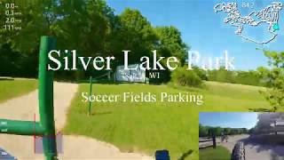
Kenosha County Mountain Bike Routes
8 miles • 601 ft • 12 • Loop •
Route that includes the majority of the single track available in 2020 at Silver Lake County Park
3 miles • 119 ft • 5 • Loop • Race •
Planned Route for the annual SLiP N Ride relay race 2025.
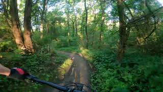
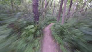
Photos of Kenosha County Mountain Bike
Videos of Kenosha County Mountain Bike
youtuber
![Silver Lake ft. The Dusty Dutchman | Salem, WI]()
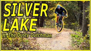
8:21 |
277 |
Feb 11, 2024
7:24 |
207 |
Sep 16, 2022
56:46 |
783 |
Jun 10, 2020
trail: Little Wing
8:36 |
1242 |
Feb 7, 2018 , Salem
trail: Barbed Wire
7:04 |
763 |
Feb 7, 2018 , Salem
Recent Trail Reports
Activity Feed
| username | action | type | title | date |
|---|---|---|---|---|
| Barca4ever | wishlist | region | activity #96426043 | Jun 6, 2026 @ 7:54pm Jun 6, 2026 |
| TheJayMann9gC2R | wishlist | region | activity #95463088 | May 24, 2026 @ 8:00pm May 24, 2026 |
| TheJayMann9gC2R | wishlist | region | activity #95436544 | May 24, 2026 @ 12:35pm May 24, 2026 |
| 21v7zm | ridden | trail | activity #95403915 and 3 more | May 24, 2026 @ 6:38am May 24, 2026 |
| 21v7zm | wishlist | region | activity #94759903 | May 15, 2026 @ 11:40am May 15, 2026 |
Recent Comments
| username | type | title | comment | date |
|---|---|---|---|---|
| trail | Trail is fast and fun. However, and maybe I'm... | Oct 5, 2025 @ 8:38am Oct 5, 2025 | ||
| trail | heads up, the trail signage on site is a... | Sep 12, 2025 @ 5:17pm Sep 12, 2025 | ||
| trail | The same comment applies to this section of... | May 26, 2025 @ 2:07pm May 26, 2025 | ||
| trail | Whoever labeled this a black diamond doesn’t... | May 26, 2025 @ 2:04pm May 26, 2025 | ||
| report | Sorry, meant variable not dry. | Apr 11, 2022 @ 11:25am Apr 11, 2022 |
Local Badges
-

Completionist2 awarded -

Climbing 10k Badge1 awarded -

Epic Mountain Bike Climb 2k0 awarded -

10 Blue Trails16 awarded -

Mountain Biking 100k Badge0 awarded -

Epic Ride 50k108 awarded
Activity Type Stats
| activitytype | trails | distance | descent | descent distance | total vertical | rating | global rank | state rank | photos | reports | routes | ridelogs |
|---|---|---|---|---|---|---|---|---|---|---|---|---|
| Mountain Bike | 84 | 47 miles | 2,703 ft | 16 miles | 269 ft | 43 | 795 | 2 | 10,051 | |||
| E-Bike | 27 | 15 miles | 1,490 ft | 5 miles | 226 ft | 745 | 1 | 231 | ||||
| Gravel Bike | 29 | 21 miles | 860 ft | 8 miles | 240 ft | 51 | 48 | |||||
| Adaptive Bike | 30 | 23 miles | 965 ft | 9 miles | 240 ft | 87 | ||||||
| Winter Fat Bike | 3 | 4 miles | 167 ft | 4,843 ft | 190 ft | 1 | 19 | |||||
| Horse | 1 | 10 miles | 138 ft | 3 miles | 56 ft | 59 | ||||||
| Hike | 60 | 61 miles | 2,687 ft | 21 miles | 269 ft | 761 | 124 | |||||
| Trail Running | 59 | 57 miles | 2,415 ft | 19 miles | 269 ft | 761 | 95 | |||||
| Downhill Ski | 37 | 5 miles | 732 ft | 2 miles | 384 ft | 124 |
Frequently Asked Questions About Kenosha County
▼
What are the best places to ride in Kenosha County?
Kenosha County has 7 areas to explore for mountain biking. The top rated areas are:
▼
What are the highest rated mountain biking trails in Kenosha County?
The highest rated mountain biking trails in Kenosha County are:
- Little Wing (4.3/5)
- Rudie's Run (4.3/5)
- K-D Line (4.3/5)
- Barbed Wire (4.3/5)
- Yeti (4.2/5)
▼
What is the best time of the year to ride in Kenosha County?
Based on ride log data, the most popular months to ride in Kenosha County are:
- August (72 activities)
- July (66 activities)
- September (64 activities)
▼
What is the longest trail in Kenosha County?
The longest trail in Kenosha County is North Loop at 7.0 miles. View all trails sorted by distance.
Activities
Trails
Points of Interest
- By brenthillier
 NSMBA TRAILFORKS & contributors
 - Admins: MW HIKING, feardabeast, KAMBA, KCDP
- #10968 - 4,788 views
- kenosha county activity log | embed map of Kenosha County mountain bike trails | kenosha county mountain biking points of interest
Downloading of trail gps tracks in kml & gpx formats is enabled for Kenosha County.
You must login to download files.