close
-
Layers w
- Weather Layers
- Pro
- Pro
- Pro
- Pro
- Pro
- Pro
- More Layers
- Pro
- Pro
- Pro
- Pro
-
Upgrade to

3D
Trail Conditions
- Unknown
- Snow Groomed
- Snow Packed
- Snow Covered
- Snow Cover Partial
- Freeze/thaw Cycle
- Icy
- Prevalent Mud
- Wet
- Variable
- Ideal
- Dry
- Very Dry
Trail Flow (Ridden Direction)
Trailforks scans users ridelogs to determine the most popular direction each trail is ridden. A good flowing trail network will have most trails flowing in a single direction according to their intension.
The colour categories are based on what percentage of riders are riding a trail in its intended direction.
The colour categories are based on what percentage of riders are riding a trail in its intended direction.
- > 96%
- > 90%
- > 80%
- > 70%
- > 50%
- < 50%
- bi-directional trail
- no data
Trail Last Ridden
Trailforks scans ridelogs to determine the last time a trail was ridden.
- < 2 days
- < 1 week
- < 2 weeks
- < 1 month
- < 6 months
- > 6 months
Trail Ridden Direction
The intended direction a trail should be ridden.
- Downhill Only
- Downhill Primary
- Both Directions
- Uphill Primary
- Uphill Only
- One Direction
Contribute Details
Colors indicate trail is missing specified detail.
- Description
- Photos
- Description & Photos
- Videos
Trail Popularity ?
Trailforks scans ridelogs to determine which trails are ridden the most in the last 9 months.
Trails are compared with nearby trails in the same city region with a possible 25 colour shades.
Think of this as a heatmap, more rides = more kinetic energy = warmer colors.
- most popular
- popular
- less popular
- not popular
ATV/ORV/OHV Filter
Max Vehicle Width
inches
US Cell Coverage
Legend

Radar Time
Activity Recordings
Trailforks uses anonymized public activity data.
?
Activity Recordings
Trailforks uses anonymized public activity data.
?
Personal Heatmap
▶
Activity Types
all
/
none
▶
Options
2
Date range
month
–
Winter Trails
Warning
A routing network for winter maps does not exist. Selecting trails using the winter trails layer has been disabled.
Missing Trails
Most Popular
Least Popular
Trails are colored based on popularity. The more popular a trail is, the more red. Less popular trails trend towards green.
Jump Magnitude Heatmap
Heatmap of where riders jump on trails. Zoom in to see individual jumps, click circles to view jump details.
BC Backroad Status
![map legend]()
Service Road Atlas is a free to use, community-driven service for viewing and creating reports on the numerous back-country service roads around B.C. and Alberta.

Slope Aspect
Direction the slope faces
Trails Deemphasized
Trails are shown in grey.
Only show trails with no bike usage.
Suggested Layers
Based on selected activity type
Save the current map location and zoom level as your default home location whenever this page is loaded.
SavePopular Trail Networks
view all areas »
No description for Kentucky has been added yet!
Login or register to submit one.
Region Details
- 156
- 36
- 271
- 356
- 79
- 5
- 1
Stats
- Avg Trail Rating
- Trails (view details)
- 1,538
- Trails Mountain Bike
- 904
- Trails E-Bike
- 398
- Trails Gravel Bike
- 147
- Trails Adaptive Bike
- 115
- Trails Winter Fat Bike
- 53
- Trails Horse
- 186
- Trails Hike
- 1,431
- Trails Trail Running
- 1,404
- Trails Dirtbike/Moto
- 99
- Trails Observed Trials
- 4
- Trails ATV/ORV/OHV
- 107
- Trails Snowshoe
- 3
- Trails Downhill Ski
- 1
- Trails Backcountry Ski
- 2
- Trails Nordic Ski
- 2
- Total Distance
- 1,693 miles
- Total Descent
- 209,298 ft
- Total Vertical
- 3,133 ft
- Highest Trailhead
- 3,448 ft
- Reports
- 7,474
- Photos
- 1,488
- Ridden Counter
- 60,074
Articles

The 12 Most Stunning Trails in the U.S.
May 29, 2025 from outsideonline.com
In celebration of National Trails Day, discover some of the best hikes in the U.S.—from slot canyons to grasslands, waterfalls, and secluded...
Lesser-Known Lake Escapes in the U.S.
May 22, 2025 from outsideonline.com
From turquoise gems in the Rockies to forest-fringed glacial lakes in New England, escape the crowds at these nine lakes in the U.S. where...

Trail Towns: What Erica Williams Loves About Lexington, Kentucky
Oct 25, 2021 from trailrunnermag.com
Fall colors, and sneaky vert. Here's what trail runners love about Lexington.
Sub Regions
- Central Region - KY (Bluegrass) (226)
- Anderson County (1)
- Bullitt County (0)
- Carroll County (17)
- Fayette County (25)
- Franklin County (26)
- Jefferson County (73)
- Madison County (23)
- Oldham County (5)
- Scott County (17)
- Shelby County (3)
- Spencer County (18)
- Woodford County (17)
- Eastern Region - KY (258)
- Bath County (35)
- Bell County (4)
- Boyd County (31)
- Carter County (25)
- Clay County (41)
- Daniel Boone National Forest (3)
- Elliot County (0)
- Floyd County (39)
- Greenup County (12)
- Harlan County (0)
- Jackson County (13)
- Knott County (2)
- Laurel County (12)
- Lawrence County (0)
- Lee County (0)
- Leslie County (23)
- Montgomery County (1)
- Perry County (31)
- Powel County (1)
- Rockcastle County (1)
- Rowan County (3)
- Whitley County (2)
- Wolfe County (1)
- Northern Region (KY) (87)
- Boone County (14)
- Campbell County (14)
- Kenton County (59)
- South Central Region - KY (50)
- McCreary County (9)
- Pulaski County (38)
- Southwest Region - KY (213)
- Allen County (7)
- Barren County (13)
- Christian County (0)
- Daviess County (11)
- Edmonson County (18)
- Henderson County (0)
- Hopkins County (10)
- Livingston County (57)
- Lyon County (13)
- Marshall County (3)
- McCracken County (16)
- Ohio County (1)
- Trigg County (52)
- Warren County (12)
- West Central Region - KY (80)
- Boyle County (2)
- Grayson County (7)
- Hardin County (36)
- Larue County (7)
- Marion County (0)
- Meade County (6)
- Mercer County (0)
- Nelson County (0)
- Taylor County (24)
Popular Kentucky Mountain Biking Trails
• 100 ★ 4.8 • 1 mile • 290 ft • 465 •
The OG! So sweet!! Some upgrades at the beginning of bottom. Thanks!!
• 90 ★ 4.5 • 3,750 ft • 103 ft • 412 •
If you hit it at just the right time it will feel like you are surfing on top of a train
• 95 ★ 4.8 • 1,713 ft • 36 ft • 397 •
Popular blue difficulty singletrack. This mountain bike primary trail can be used both directions. On average it takes 2 minutes to complete this trail.
• 80 ★ 4.0 • 2,564 ft • 49 ft • 384 •
Flat and flowy trail with a few small drops and rocky sections.
• 90 ★ 4.8 • 3,516 ft • 78 ft • 378 •
Popular blue difficulty singletrack. This mountain bike primary trail can be used both directions. On average it takes 5 minutes to complete this trail.
• 95 ★ 4.9 • 2 miles • 213 ft • 399 •
A few rock areas making it intermediate. A few quick drops with smallish jumps. Climbs are some what stout, not too hard though
• 100 ★ 3.0 • 574 ft • 10 ft • 357 •
Popular white difficulty gravel path. This mountain bike primary trail can be used both directions. On average it takes 1 minutes to complete this trail.
• 90 ★ 5.0 • 4,984 ft • 89 ft • 359 •
The latest and greatest in trail design. (2014) Roller coaster goodness. Big jumps, but not too steep. We feel it is the perfect intermediate flow trail. Big and fast enough for the experts, but not too big preventing confidence and...
Kentucky Mountain Bike Routes
War Hammer Loop (Blue) Featured
3 miles • 344 ft • 10 • Loop •
The full Warhammer Loop (without the Extras)
War Hammer Loop (Black) Featured
4 miles • 412 ft • 18 • Loop •
The full Wall Hammer Route with all of the extras
★ 5.0 • 11 miles • 610 ft • 9 • Loop •
The Big Hollow route takes you from the parking lot, through the gravel connector, then onto the east side...
★ 5.0 • 11 miles • 1,791 ft • 8 • Shuttled •
This is the route BKXC took in the YouTube video "Land of the rising STOKE" during his 50 state shred...
★ 5.0 • 7 miles • 717 ft • 2 • Loop •
Knucklehead is part of the Life Adventure Center. This trail has a little something for everyone. You will...
★ 5.0 • 7 miles • 512 ft • 4 • Loop •
This is a great trail that has something for everyone. Much of the trail runs beside the lake which is...
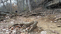
Photos of Kentucky Mountain Bike
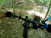
Videos of Kentucky Mountain Bike
0:38 |
5 |
Oct 29, 2025
trail: Cherokee Loop
0:09 |
45 |
Jul 10, 2024
trail: 100 Proof
0:10 |
197 |
Dec 6, 2022
trail: Crazy Reds
0:35 |
385 |
Nov 23, 2020
trail: Cherokee Loop
0:09 |
302 |
Nov 19, 2019

0:03 |
520 |
Sep 29, 2019
trail: Fresh Air Loop
4:17 |
267 |
Sep 13, 2019

trail: Full Monty
0:36 |
635 |
Sep 12, 2019
Activity Feed
| username | action | type | title | date |
|---|---|---|---|---|
| rtstudios | wishlist | trail | activity #97314901 | Jun 19, 2026 @ 7:11am 6 hours |
| QIXSyj | wishlist | trail | activity #97290364 | Jun 18, 2026 @ 7:03pm 18 hours |
| Lyda19687 | wishlist | trail | activity #97141594 and 10 more | Jun 16, 2026 @ 3:32pm 3 days |
| Woosenheimer | wishlist | region | activity #97104707 | Jun 16, 2026 @ 6:20am Jun 16, 2026 |
| Jimmymatt | vote | trail | activity #97063732 | Jun 15, 2026 @ 1:51pm Jun 15, 2026 |
Recent Comments
| username | type | title | comment | date |
|---|---|---|---|---|
| report | So good | May 10, 2026 @ 8:54am May 10, 2026 | ||
| report | Little overgrown but great | May 10, 2026 @ 8:53am May 10, 2026 | ||
| trail | Nice, easy wide trail. Open to horses from the... | May 5, 2026 @ 6:58pm May 5, 2026 | ||
| trail | Two downed trees on the trail | Jan 3, 2026 @ 11:41am Jan 3, 2026 | ||
| trail | Recent development has ended some trails | Nov 15, 2025 @ 5:54pm Nov 15, 2025 |
Local Badges
-
Quadzilla vs. Human3 awarded -

10 Green Trails158 awarded -

Climbing 10k Badge1 awarded -

Epic Ride Climb 2k8 awarded -

Climbing 100k Badge0 awarded -

Top 10 Trails0 awarded
Bike & Skill Parks
| name | type | city | rating |
|---|---|---|---|
| Mega Cavern | bike park | Louisville | |
| Derby City BMX Park | skill park | Louisville | |
| Silo Center Bike Park | skill park | Jeffersontown | |
| England-Idlewild Bike Park | skill park | Burlington | |
| Dunn's Playground | skill park | Leitchfield |
Upcoming Local Events
Activity Type Stats
| activitytype | trails | distance | descent | descent distance | total vertical | rating | global rank | state rank | photos | reports | routes | ridelogs |
|---|---|---|---|---|---|---|---|---|---|---|---|---|
| Mountain Bike | 904 | 1,010 miles | 119,790 ft | 408 miles | 3,022 ft | #47 | 1,338 | 7,464 | 68 | 101,671 | ||
| E-Bike | 398 | 423 miles | 45,958 ft | 164 miles | 3,022 ft | #45 | 39 | 5,947 | 26 | 5,803 | ||
| Gravel Bike | 147 | 200 miles | 15,289 ft | 77 miles | 1,558 ft | #45 | 682 | 3 | 542 | |||
| Adaptive Bike | 115 | 143 miles | 8,127 ft | 52 miles | 1,191 ft | #48 | 307 | 4 | ||||
| Winter Fat Bike | 53 | 58 miles | 3,573 ft | 19 miles | 1,017 ft | #48 | 62 | 1 | ||||
| Horse | 186 | 385 miles | 49,291 ft | 161 miles | 2,995 ft | #42 | 2 | 1,231 | 4 | 86 | ||
| Hike | 1,431 | 1,604 miles | 197,310 ft | 650 miles | 3,133 ft | #44 | 89 | 7,355 | 18 | 8,174 | ||
| Trail Running | 1,404 | 1,593 miles | 196,234 ft | 647 miles | 3,133 ft | #45 | 8 | 7,354 | 26 | 4,527 | ||
| Dirtbike/Moto | 99 | 157 miles | 20,984 ft | 64 miles | 1,109 ft | #39 | 10 | 1,217 | 66 | |||
| Observed Trials | 4 | 5 miles | 69 ft | 1 mile | 689 ft | #40 | 29 | 28 | ||||
| ATV/ORV/OHV | 107 | 196 miles | 23,337 ft | 81 miles | 1,109 ft | #36 | 2 | 1,217 | 1 | 16 | ||
| Snowshoe | 3 | 3 miles | 404 ft | 4,711 ft | 843 ft | #51 | 28 | 5 | ||||
| Downhill Ski | 1 | 696 ft | 20 ft | 430 ft | 23 ft | #49 | 1 | 134 | ||||
| Backcountry Ski | 2 | 1 mile | 72 ft | 4,183 ft | 856 ft | #44 | 24 | 9 | ||||
| Nordic Ski | 2 | 2 miles | 79 ft | 2,976 ft | 863 ft | #52 | 25 | 42 |
Activities
Trails
Points of Interest
- East Pinnacle Viewpoint
- Cave Sight
- Pilot Knob Summit
- Turkey Foot Campground Camping
- S-Tree Campground Camping
- S Tree lookout Tower Sight
- Indian Fort Lookout Viewpoint
- Indian Fort Mountain Summit
- Eagle's Nest Viewpoint
- Basin Mountain Summit
- Fox Knob (3,271 ft)
- Reynolds Mountain (3,123 ft)
- Potato Knob (3,087 ft)
- By canadaka
 Trailforks & contributors
 - Admins: Map Team, IMBA, chuktA, msmcfate, WillieJacobsz, PlumbBobM, ReckitRolley, colinreuter, Chris-Campbell
- #3215 - 27,656 views
- kentucky activity log | embed map of Kentucky mountain bike trails | kentucky mountain biking points of interest polygons
Downloading of trail gps tracks in kml & gpx formats is enabled for Kentucky.
You must login to download files.