close
-
Layers w
- Weather Layers
- Pro
- Pro
- Pro
- Pro
- Pro
- Pro
- More Layers
- Pro
- Pro
- Pro
- Pro
-
Upgrade to

3D
Trail Conditions
- Unknown
- Snow Groomed
- Snow Packed
- Snow Covered
- Snow Cover Partial
- Freeze/thaw Cycle
- Icy
- Prevalent Mud
- Wet
- Variable
- Ideal
- Dry
- Very Dry
Trail Flow (Ridden Direction)
Trailforks scans users ridelogs to determine the most popular direction each trail is ridden. A good flowing trail network will have most trails flowing in a single direction according to their intension.
The colour categories are based on what percentage of riders are riding a trail in its intended direction.
The colour categories are based on what percentage of riders are riding a trail in its intended direction.
- > 96%
- > 90%
- > 80%
- > 70%
- > 50%
- < 50%
- bi-directional trail
- no data
Trail Last Ridden
Trailforks scans ridelogs to determine the last time a trail was ridden.
- < 2 days
- < 1 week
- < 2 weeks
- < 1 month
- < 6 months
- > 6 months
Trail Ridden Direction
The intended direction a trail should be ridden.
- Downhill Only
- Downhill Primary
- Both Directions
- Uphill Primary
- Uphill Only
- One Direction
Contribute Details
Colors indicate trail is missing specified detail.
- Description
- Photos
- Description & Photos
- Videos
Trail Popularity ?
Trailforks scans ridelogs to determine which trails are ridden the most in the last 9 months.
Trails are compared with nearby trails in the same city region with a possible 25 colour shades.
Think of this as a heatmap, more rides = more kinetic energy = warmer colors.
- most popular
- popular
- less popular
- not popular
ATV/ORV/OHV Filter
Max Vehicle Width
inches
US Cell Coverage
Legend

Radar Time
Activity Recordings
Trailforks uses anonymized public activity data.
?
Activity Recordings
Trailforks uses anonymized public activity data.
?
Personal Heatmap
▶
Activity Types
all
/
none
▶
Options
2
Date range
month
–
Winter Trails
Warning
A routing network for winter maps does not exist. Selecting trails using the winter trails layer has been disabled.
Missing Trails
Most Popular
Least Popular
Trails are colored based on popularity. The more popular a trail is, the more red. Less popular trails trend towards green.
Jump Magnitude Heatmap
Heatmap of where riders jump on trails. Zoom in to see individual jumps, click circles to view jump details.
BC Backroad Status
![map legend]()
Service Road Atlas is a free to use, community-driven service for viewing and creating reports on the numerous back-country service roads around B.C. and Alberta.

Slope Aspect
Direction the slope faces
Trails Deemphasized
Trails are shown in grey.
Only show trails with no bike usage.
Suggested Layers
Based on selected activity type
Save the current map location and zoom level as your default home location whenever this page is loaded.
SaveKeppoch Mountain is operated by Positive Action for Keppoch Society (PAK). They are a non-profit, charitable society that is primarily volunteer based with several permanent and part-time staff. Operations are sustained through private donations, memberships and trail use fees. Please consider donating to our Society - contact us at [email protected] or drop a bill or two in the donation box at the lodge.
Keppoch has a "Band Together" Membership Campaign to help with our costs. The costs for Keppoch membership is $60/year for individuals or $120/year for a family. Being a member is not mandatory, but allows users to skip the day use fees ($5 for walking hiking and snowshoeing, and $10 for biking and skiing).
We continuously maintain the trails throughout the year and they are open 24/7 365 (except during soft and wet Spring/Fall conditions).
The Summit Shuttle Service runs Saturdays and Sundays from the late Spring and to early Fall from 11am to 5pm. A Shuttle pass costs $50 ($40 for Members, tax included). Volunteers can earn credits towards the Shuttle Service. Shuttles are served up by our 4×4 truck and trailer capable of carrying 24 riders and bikes/trip (every 15mins).
The lodge is available for rent hourly or daily.
Contact [email protected]
source: Keppoch Mountain
Primary Trail Type: All-Mountain & Downhill
Shuttleable: YES
Land Status: Managed by Local Riding Association
Land Manager: Positive Action for Keppoch Society (PAK)
 google parking directions
 Access Info:
Take Exit 30 off the TCH at James River and follow the signs in. 5 mins south off the exit.
Links
- https://www.facebook.com/TheKeppoch
- https://twitter.com/keppoch_trails
- https://www.thekeppoch.ca
- https://instagram.com/keppochmountain/
Files
- The_Keppoch_Offering_-_April_2015.pdf (774 KB)
- Keppoch_Trails_Map_Jun_2017.pdf (2.91 MB)
Activities Click to view
- Mountain Bike
40 trails
- E-Bike
28 trails
- Hike
27 trails
- Trail Running
25 trails
- Snowshoe
32 trails
- Backcountry Ski
3 trails
- Nordic Ski
6 trails
Bike Park Details
- 1
- 14
- 17
- 7
- 1
Region Status
Open as of 19 hours- Day Ticket
- $50 CAD
- Uplift Type
- Shuttle
- Season start
- Jan 1
- Season end
- Dec 31
Stats
- Avg Trail Rating
- Trails (view details)
- 43
- Trails Mountain Bike
- 40
- Trails E-Bike
- 28
- Trails Hike
- 27
- Trails Trail Running
- 25
- Trails Snowshoe
- 32
- Trails Backcountry Ski
- 3
- Trails Nordic Ski
- 6
- Total Distance
- 22 miles
- Total Descent
- 5,372 ft
- Total Vertical
- 599 ft
- Highest Trailhead
- 717 ft
- Reports
- 1,444
- Photos
- 70
- Ridden Counter
- 8,364
Popular Keppoch Mountain Mountain Biking Trails
• 100 ★ 4.7 • 4,045 ft • 0 ft • 410 •
Very fluid and fast beginnerish downhill/all mountain trail - old machine built 5' wide dirt tread.
• 100 ★ 4.4 • 1 mile • 442 ft • 358 •
is a meandering cross-country style climb. Several switchback turns make the trail fun and doable to go up and just as fun to go down if you are looking for a more lengthy descent. West side is fast, fun cross-country/all-mountain...
• 80 ★ 4.0 • 1,368 ft • 12 ft • 299 •
Small, beginner cross-country loop with half crusher dust and half singletrack trail base
• 95 ★ 4.8 • 2,772 ft • 0 ft • 274 •
Less Rooty now after some Sept 2024 upgrades, Nice downhill trail with a couple fun jumps; sizely tabletop jump near the bottom !
• 90 ★ 4.7 • 3,222 ft • 0 ft • 265 •
Fast, challenging downhill trail. Refreshed by TrailFlow in spring of 2023.
• 85 ★ 4.4 • 620 ft • 0 ft • 264 •
Multiple large table tops jumps. Please inspect all features before riding. Do not ride out of your ability level and use caution at all times. Ensure there are no other riders or people on the landings of all features. One rider at a...
• 95 ★ 4.0 • 2,546 ft • 0 ft • 247 •
Refreshed by TrailFlow in spring of 2023, originally by Shoreline Dirtworks, is a machine built DH trail with lots of berms and jumps. Very Fast and can be loose which gives it the black diamond rating. Ride within your limits!
Keppoch Mountain Mountain Bike Routes
2,559 ft • 1 • Point to Point • Race •
Keppoch Enduro 2023 Run 3: to
★ 2.5 • 2,041 ft • 1 • Point to Point • Race •
Keppoch Enduro 2023 Route 4: (ends before Jumpline!)
• 22 miles • 6,385 ft • 92 •
• 27 miles • 7,322 ft • 96 •
• 20 miles • 6,018 ft • 83 •
• 8 miles • 1,552 ft • 19 •
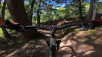
Videos of Keppoch Mountain Mountain Bike
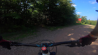
2:18 |
68 |
Aug 15, 2021
trail: Money Shot
2:58 |
55 |
Aug 15, 2021

trail: Chicken Cougar
2:49 |
45 |
Aug 15, 2021

trail: Money Shot
2:59 |
147 |
Sep 7, 2019

trail: Freeride
2:04 |
148 |
Aug 10, 2019

trail: Switchcraft
2:15 |
367 |
Aug 10, 2019

trail: Chicken Cougar
3:10 |
65 |
Aug 10, 2019

trail: Money Shot
0:58 |
251 |
Nov 13, 2016
Current Trail Warnings
| status | trail | date | condition | user | info |
|---|---|---|---|---|---|
| Whiterock Way | Jun 6, 2026 @ 10:13am (America/Glace_Bay) Jun 6, 2026 | Dry | greg13 KEPPOCH | Deep washout at bottom of hill to watch... |
Recent Trail Reports
Activity Feed
| username | action | type | title | date |
|---|---|---|---|---|
| greg13 | add | report | activity #97304043 and 11 more | Jun 19, 2026 @ 2:28am 7 hours |
| MichaelEM | wishlist | trail | activity #96674795 | Jun 10, 2026 @ 8:28am Jun 10, 2026 |
| Julie1979 | wishlist | region | activity #96530833 | Jun 8, 2026 @ 4:38am Jun 8, 2026 |
| greg13 | add | report | activity #96417250 and 6 more | Jun 6, 2026 @ 5:09pm Jun 6, 2026 |
| greg13 | add | report | activity #95420830 and 13 more | May 24, 2026 @ 9:52am May 24, 2026 |
Recent Comments
| username | type | title | comment | date |
|---|---|---|---|---|
| report | Heheh oh it’s yu | Jul 29, 2024 @ 8:40am Jul 29, 2024 | ||
| trail | Fast, flow, berms and jumps! Good times! ... | Aug 22, 2019 @ 3:45am Aug 22, 2019 | ||
| report | Watch for washouts | May 4, 2019 @ 3:12am May 4, 2019 | ||
| trail | Trail is Under Construction and will be open... | Jan 8, 2019 @ 9:22am Jan 8, 2019 | ||
| trail | A really nice flow trail. Fast & loose... | Oct 2, 2017 @ 2:34pm Oct 2, 2017 |
Nearby Areas
| name | distance | ||||
|---|---|---|---|---|---|
| Melmerby Beach Provincial Park | 21.6 km | ||||
| Liscomb Game Sanctuary | 25 km |
Local Badges
-

Completionist4 awarded
Activity Type Stats
| activitytype | trails | distance | descent | descent distance | total vertical | rating | global rank | state rank | photos | reports | routes | ridelogs |
|---|---|---|---|---|---|---|---|---|---|---|---|---|
| Mountain Bike | 40 | 20 miles | 5,354 ft | 10 miles | 600 ft | #1,484 | #4 | 62 | 1,409 | 10 | 4,107 | |
| E-Bike | 28 | 15 miles | 4,977 ft | 9 miles | 486 ft | #3,956 | #12 | 1,149 | 87 | |||
| Hike | 27 | 15 miles | 1,703 ft | 5 miles | 600 ft | #6,923 | #21 | 1,341 | 176 | |||
| Trail Running | 25 | 14 miles | 1,585 ft | 5 miles | 600 ft | #6,378 | #16 | 1,326 | 1 | 102 | ||
| Snowshoe | 32 | 17 miles | 4,980 ft | 9 miles | 591 ft | #395 | #10 | 267 | 26 | |||
| Backcountry Ski | 3 | 3 miles | 66 ft | 1,490 ft | 581 ft | #254 | #1 | 192 | 2 | |||
| Nordic Ski | 6 | 5 miles | 299 ft | 2 miles | 148 ft | #656 | #8 | 8 | 123 | 107 |
Frequently Asked Questions About Keppoch Mountain
▼
What are the highest rated mountain biking trails in Keppoch Mountain?
The highest rated mountain biking trails in Keppoch Mountain are:
- Chicken Cougar (4.4/5)
- Roller (4.4/5)
- Dirt Surfer (4.3/5)
- Glass Slipper (4.3/5)
- Skyline (4.3/5)
▼
What is the best time of the year to ride in Keppoch Mountain?
Based on ride log data, the most popular months to ride in Keppoch Mountain are:
- August (118 activities)
- July (107 activities)
- September (69 activities)
▼
Where can I park to ride in Keppoch Mountain?
There are 1 parking locations listed in Keppoch Mountain. The most popular parking spots are:
▼
What is the longest trail in Keppoch Mountain?
The longest trail in Keppoch Mountain is Whiterock Way at 1.7 miles. View all trails sorted by distance.
Activities
- By hyperstone & contributors
- Admins: KEPPOCH, alpine-e
- #5610 - 30,445 views
- keppoch mountain activity log | embed map of Keppoch Mountain mountain bike trails | keppoch mountain mountain biking points of interest
Downloading of trail gps tracks in kml & gpx formats is enabled for Keppoch Mountain.
You must login to download files.