close
-
Layers w
- Weather Layers
- Pro
- Pro
- Pro
- Pro
- Pro
- Pro
- More Layers
- Pro
- Pro
- Pro
- Pro
-
Upgrade to

3D
Trail Conditions
- Unknown
- Snow Groomed
- Snow Packed
- Snow Covered
- Snow Cover Partial
- Freeze/thaw Cycle
- Icy
- Prevalent Mud
- Wet
- Variable
- Ideal
- Dry
- Very Dry
Trail Flow (Ridden Direction)
Trailforks scans users ridelogs to determine the most popular direction each trail is ridden. A good flowing trail network will have most trails flowing in a single direction according to their intension.
The colour categories are based on what percentage of riders are riding a trail in its intended direction.
The colour categories are based on what percentage of riders are riding a trail in its intended direction.
- > 96%
- > 90%
- > 80%
- > 70%
- > 50%
- < 50%
- bi-directional trail
- no data
Trail Last Ridden
Trailforks scans ridelogs to determine the last time a trail was ridden.
- < 2 days
- < 1 week
- < 2 weeks
- < 1 month
- < 6 months
- > 6 months
Trail Ridden Direction
The intended direction a trail should be ridden.
- Downhill Only
- Downhill Primary
- Both Directions
- Uphill Primary
- Uphill Only
- One Direction
Contribute Details
Colors indicate trail is missing specified detail.
- Description
- Photos
- Description & Photos
- Videos
Trail Popularity ?
Trailforks scans ridelogs to determine which trails are ridden the most in the last 9 months.
Trails are compared with nearby trails in the same city region with a possible 25 colour shades.
Think of this as a heatmap, more rides = more kinetic energy = warmer colors.
- most popular
- popular
- less popular
- not popular
ATV/ORV/OHV Filter
Max Vehicle Width
inches
US Cell Coverage
Legend

Radar Time
Activity Recordings
Trailforks uses anonymized public activity data.
?
Activity Recordings
Trailforks uses anonymized public activity data.
?
Personal Heatmap
▶
Activity Types
all
/
none
▶
Options
2
Date range
month
–
Winter Trails
Warning
A routing network for winter maps does not exist. Selecting trails using the winter trails layer has been disabled.
Missing Trails
Most Popular
Least Popular
Trails are colored based on popularity. The more popular a trail is, the more red. Less popular trails trend towards green.
Jump Magnitude Heatmap
Heatmap of where riders jump on trails. Zoom in to see individual jumps, click circles to view jump details.
BC Backroad Status
![map legend]()
Service Road Atlas is a free to use, community-driven service for viewing and creating reports on the numerous back-country service roads around B.C. and Alberta.

Slope Aspect
Direction the slope faces
Trails Deemphasized
Trails are shown in grey.
Only show trails with no bike usage.
Suggested Layers
Based on selected activity type
Save the current map location and zoom level as your default home location whenever this page is loaded.
Save
No description for Kern County has been added yet!
Login or register to submit one.
Activities Click to view
- Mountain Bike
521 trails
- E-Bike
189 trails
- Horse
53 trails
- Hike
562 trails
- Trail Running
561 trails
- Dirtbike/Moto
182 trails
- ATV/ORV/OHV
103 trails
- Snowmobile
5 trails
- Snowshoe
57 trails
- Downhill Ski
9 trails
Region Details
- 204
- 1
- 98
- 147
- 64
- 6
Stats
- Avg Trail Rating
- Trails (view details)
- 585
- Trails Mountain Bike
- 521
- Trails E-Bike
- 189
- Trails Horse
- 53
- Trails Hike
- 562
- Trails Trail Running
- 561
- Trails Dirtbike/Moto
- 182
- Trails Observed Trials
- 1
- Trails ATV/ORV/OHV
- 103
- Trails Snowmobile
- 5
- Trails Snowshoe
- 57
- Trails Downhill Ski
- 9
- Trails Backcountry Ski
- 1
- Trails Nordic Ski
- 2
- Total Distance
- 1,536 miles
- Total Descent
- 256,258 ft
- Total Vertical
- 12,881 ft
- Highest Trailhead
- 13,203 ft
- Reports
- 2,162
- Photos
- 1,801
- Ridden Counter
- 15,397
Sub Regions
- Bakersfield (9)
- Bear Valley Springs (1)
- Frazier park (20)
- Frazier Mountain (14)
- Mt. Pinos (2)
- Kernville (91)
- Lake Isabella (3)
- Mojave (3)
- Ridgecrest (62)
- Rosamond (191)
- Edwards AFB Trails (173)
- Rosamond Trail Network (18)
- Tehachapi (49)
- TMTA Trails (44)
- Wofford Heights (91)
Popular Kern County Mountain Biking Trails
• 100 ★ 4.8 • 8 miles • 1,040 ft • 458 •
- AKA The - is the crown jewel of the Kern Plateau. This trail has lots of everything - lots of crazy descending, long flat buff runs along big meadows, rocky and difficult climbing, fire roads, stream crossings, wildlife, wildflowers,...
• 100 ★ 4.9 • 12 miles • 402 ft • 452 •
Lower section of the . Fun trail going down, with some buff sections, but lots of big rocks with flat rocks and little drops.
• 100 ★ 4.8 • 5 miles • 184 ft • 423 •
is a fun downhill singletrack ride through the trees. It offers some nice corners, semi-technical areas as well as some spots where you can really fly if you dare. And of course there is the famous Manzanita Tunnel section where you are...
• 100 ★ 4.4 • 1,330 ft • 0 ft • 398 •
Popular blue difficulty singletrack. This mountain bike primary trail. On average it takes minutes to complete this trail.
• 100 ★ 3.0 • 2,035 ft • 11 ft • 389 •
Popular green difficulty singletrack. This mountain bike primary trail can be used both directions. On average it takes 3 minutes to complete this trail.
• 100 ★ 4.4 • 3,326 ft • 233 ft • 363 •
Connector trail to/from Aimee's Loop and Jane's/ s
• 95 ★ 3.7 • 902 ft • 27 ft • 318 •
trail that connects Aimee's Loop and Mifflin Loop
• 100 ★ 3.0 • 820 ft • 8 ft • 272 •
McCool's is named after our lead trail builder and is a quick tech section to add a little more to your ride.
Kern County Mountain Bike Routes
★ 4.4 • 25 miles • 1,816 ft • 3 • Point to Point •
An all day adventure that is physically and mentally tiring
★ 4.5 • 8 miles • 964 ft • 4 • Loop •
8 mile ride that can take anywhere between 30-90 minutes for 90% of the population. The downhill portion...
★ 5.0 • 8 miles • 812 ft • 1 • Loop •
There are not many recognized or mapped trails in this area. This includes the Cactus and trails into an 8...
★ 4.0 • 5 miles • 61 ft • 3 • Shuttled •
A common extended route for shuttling the .
★ 5.0 • 27 miles • 2,458 ft • 6 • Loop •
The Expert / Pro route of the RDC that happens every year around mid-November
★ 5.0 • 11 miles • 923 ft • 3 • Shuttled •
A common shuttled route for riding the Just Outstanding (JO) trail.
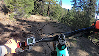
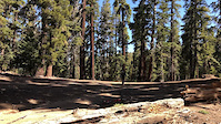
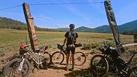
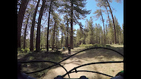
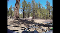
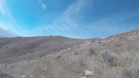
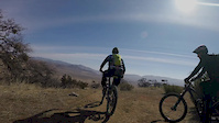
Photos of Kern County Mountain Bike
Videos of Kern County Mountain Bike
trail: Mt Pinos via McGill Trail
5:37 |
|
Feb 21, 2023
trail: The Cannell Meadow Trail
0:08 |
48 |
May 27, 2022
trail: The Cannell Meadow Trail
3:52 |
89 |
Feb 23, 2022
trail: Summit Trail (South)
0:56 |
805 |
Jul 24, 2021
trail: Mt Pinos via McGill Trail
3:48 |
186 |
Jun 26, 2021
trail: Mt Pinos via McGill Trail
3:09 |
65 |
Apr 22, 2021
trail: Crazy Horse (Upper)
3:44 |
216 |
Feb 15, 2020
trail: Upper Oaks & Stones
2:12 |
85 |
Feb 15, 2020
Current Trail Warnings
| status | trail | date | condition | user | info |
|---|---|---|---|---|---|
| Dutch Flat Trail Southern Sequoia National Forest | Jun 10, 2026 @ 8:28am (America/Los_Angeles) Jun 10, 2026 | Dry | paterjo | Really dry and rutted as mentioned in... |
Recent Trail Reports
Activity Feed
| username | action | type | title | date |
|---|---|---|---|---|
| ScoutCamp | wishlist | trail | activity #97293052 | Jun 18, 2026 @ 8:00pm 2 days |
| NuckaMan | vote | trail | activity #96940311 | Jun 13, 2026 @ 11:07pm Jun 13, 2026 |
| aubster701 | ridden | route | activity #96908078 | Jun 13, 2026 @ 12:51pm Jun 13, 2026 |
| AmeeCCp9MP | wishlist | region | activity #96907212 | Jun 13, 2026 @ 12:42pm Jun 13, 2026 |
| ckingwv | wishlist | trail | activity #96819447 | Jun 12, 2026 @ 11:51am Jun 12, 2026 |
Recent Comments
| username | type | title | comment | date |
|---|---|---|---|---|
| trail | The other side of the loop is much more fun... | May 20, 2026 @ 7:55am May 20, 2026 | ||
| trail | Hit this in the reverse direction after riding... | May 20, 2026 @ 7:52am May 20, 2026 | ||
| report | No way...not even Hans Ray you say? | Apr 1, 2026 @ 10:07pm Apr 1, 2026 | ||
| trail | This is basically an Enduro motorcycle trail... | Mar 10, 2026 @ 7:03pm Mar 10, 2026 | ||
| report | This should absolutely be labeled as a... | Mar 10, 2026 @ 6:59pm Mar 10, 2026 |
Local Badges
-

Descent 10k Badge6 awarded -

Climbing 10k Badge4 awarded -

Mountain Biking 100k Badge0 awarded -

Epic Ride Descent 2k20 awarded -

Epic Mountain Bike Climb 2k20 awarded -

Descent 100k Badge1 awarded
Bike & Skill Parks
| name | type | city | rating |
|---|---|---|---|
| Honolulu Hills Raceway | skill park | Taft | |
| Cal City MX Park | skill park | California City | |
| Cyrus Canyon Motocross | skill park | Wofford Heights | |
| Ballinger Canyon OHV Area | skill park | Pine Mountain Club | |
| Ridgecrest MX | skill park | Ridgecrest |
Activity Type Stats
| activitytype | trails | distance | descent | descent distance | total vertical | rating | global rank | state rank | photos | reports | routes | ridelogs |
|---|---|---|---|---|---|---|---|---|---|---|---|---|
| Mountain Bike | 521 | 1,259 miles | 209,931 ft | 562 miles | 11,385 ft | 1,758 | 2,162 | 34 | 43,075 | |||
| E-Bike | 189 | 433 miles | 57,667 ft | 174 miles | 9,062 ft | 6 | 1,952 | 5 | 3,038 | |||
| Horse | 53 | 445 miles | 56,362 ft | 191 miles | 8,560 ft | 336 | 2 | |||||
| Hike | 562 | 1,508 miles | 251,932 ft | 674 miles | 12,881 ft | 35 | 2,152 | 8 | 3,136 | |||
| Trail Running | 561 | 1,508 miles | 251,739 ft | 674 miles | 12,881 ft | 2 | 2,152 | 8 | 580 | |||
| Dirtbike/Moto | 182 | 629 miles | 98,337 ft | 276 miles | 7,513 ft | 4 | 382 | 190 | ||||
| Observed Trials | 1 | 2,956 ft | 59 ft | 1,919 ft | 43 ft | 48 | 2 | |||||
| ATV/ORV/OHV | 103 | 185 miles | 16,617 ft | 62 miles | 6,260 ft | 325 | 14 | |||||
| Snowmobile | 5 | 8 miles | 541 ft | 2 miles | 3,901 ft | 1 | ||||||
| Snowshoe | 57 | 99 miles | 22,979 ft | 48 miles | 7,477 ft | 3 | 13 | |||||
| Downhill Ski | 9 | 2 miles | 1,106 ft | 1 mile | 515 ft | 13 | ||||||
| Backcountry Ski | 1 | 2,956 ft | 59 ft | 1,919 ft | 43 ft | 2 | 31 | |||||
| Nordic Ski | 2 | 2 miles | 75 ft | 3,875 ft | 167 ft | 2 | 12 |
Frequently Asked Questions About Kern County
▼
What are the best places to ride in Kern County?
Kern County has 13 areas to explore for mountain biking. The top rated areas are:
▼
What are the highest rated mountain biking trails in Kern County?
The highest rated mountain biking trails in Kern County are:
- Just Outstanding (4.6/5)
- Cannell Plunge (4.6/5)
- The Cannell Meadow Trail (4.6/5)
- Nelson Trail (4.5/5)
- Mt Pinos via McGill Trail (4.3/5)
▼
What is the best time of the year to ride in Kern County?
Based on ride log data, the most popular months to ride in Kern County are:
- July (304 activities)
- May (251 activities)
- August (220 activities)
▼
What is the longest trail in Kern County?
The longest trail in Kern County is Woolstaff Meadow Trail at 18.2 miles. View all trails sorted by distance.
Activities
- Kern County Mountain Biking Trails
- Kern County E-Biking Trails
- Kern County Horseback Trails
- Kern County Hiking Trails
- Kern County Trail Running Trails
- Kern County Dirtbiking Trails
- Kern County ATVing/Offroading Trails
- Kern County Snowmobiling Trails
- Kern County Snowshoeing Trails
- Kern County Skiing Trails
Trails
Points of Interest
- Sentinel Campground Camping
- Viola Falls Sight
- Frypan Meadow Campsite Camping
- Tehachapi Mountain Summit
- TK Bridge
- The Stick Huts Cabin
- Junction Pass Summit
- Canyon View Campground Camping
- Moraine Campground Camping
- Sheep Creek Campground Camping
- Mount Keith (13,940 ft)
- University Peak (13,576 ft)
- Mount Bradley (13,264 ft)
- By brenthillier
 NSMBA TRAILFORKS & contributors
 - Admins: jpmcghee, sanfret, brianpetry
- #7922 - 10,979 views
- kern county activity log | embed map of Kern County mountain bike trails | kern county mountain biking points of interest
Downloading of trail gps tracks in kml & gpx formats is enabled for Kern County.
You must login to download files.