close
-
Layers w
- Weather Layers
- Pro
- Pro
- Pro
- Pro
- Pro
- Pro
- More Layers
- Pro
- Pro
- Pro
- Pro
-
Upgrade to

3D
Trail Conditions
- Unknown
- Snow Groomed
- Snow Packed
- Snow Covered
- Snow Cover Partial
- Freeze/thaw Cycle
- Icy
- Prevalent Mud
- Wet
- Variable
- Ideal
- Dry
- Very Dry
Trail Flow (Ridden Direction)
Trailforks scans users ridelogs to determine the most popular direction each trail is ridden. A good flowing trail network will have most trails flowing in a single direction according to their intension.
The colour categories are based on what percentage of riders are riding a trail in its intended direction.
The colour categories are based on what percentage of riders are riding a trail in its intended direction.
- > 96%
- > 90%
- > 80%
- > 70%
- > 50%
- < 50%
- bi-directional trail
- no data
Trail Last Ridden
Trailforks scans ridelogs to determine the last time a trail was ridden.
- < 2 days
- < 1 week
- < 2 weeks
- < 1 month
- < 6 months
- > 6 months
Trail Ridden Direction
The intended direction a trail should be ridden.
- Downhill Only
- Downhill Primary
- Both Directions
- Uphill Primary
- Uphill Only
- One Direction
Contribute Details
Colors indicate trail is missing specified detail.
- Description
- Photos
- Description & Photos
- Videos
Trail Popularity ?
Trailforks scans ridelogs to determine which trails are ridden the most in the last 9 months.
Trails are compared with nearby trails in the same city region with a possible 25 colour shades.
Think of this as a heatmap, more rides = more kinetic energy = warmer colors.
- most popular
- popular
- less popular
- not popular
ATV/ORV/OHV Filter
Max Vehicle Width
inches
US Cell Coverage
Legend

Radar Time
Activity Recordings
Trailforks uses anonymized public activity data.
?
Activity Recordings
Trailforks uses anonymized public activity data.
?
Personal Heatmap
▶
Activity Types
all
/
none
▶
Options
2
Date range
month
–
Winter Trails
Warning
A routing network for winter maps does not exist. Selecting trails using the winter trails layer has been disabled.
Missing Trails
Most Popular
Least Popular
Trails are colored based on popularity. The more popular a trail is, the more red. Less popular trails trend towards green.
Jump Magnitude Heatmap
Heatmap of where riders jump on trails. Zoom in to see individual jumps, click circles to view jump details.
BC Backroad Status
![map legend]()
Service Road Atlas is a free to use, community-driven service for viewing and creating reports on the numerous back-country service roads around B.C. and Alberta.

Slope Aspect
Direction the slope faces
Trails Deemphasized
Trails are shown in grey.
Only show trails with no bike usage.
Suggested Layers
Based on selected activity type
Save the current map location and zoom level as your default home location whenever this page is loaded.
Save
No description for Keswick has been added yet!
Login or register to submit one.
This region uses the Uk/Euro style trail grading system.
Activities Click to view
- Mountain Bike
77 trails
- E-Bike
14 trails
- Gravel Bike
0 trails
- Adaptive Bike
0 trails
- Winter Fat Bike
0 trails
- Hike
65 trails
- Trail Running
69 trails
Region Details
- 27
- 12
- 13
- 21
Region Status
Open as of Jun 15, 2026Stats
- Avg Trail Rating
- Trails (view details)
- 80
- Trails Mountain Bike
- 77
- Trails E-Bike
- 14
- Trails Hike
- 65
- Trails Trail Running
- 69
- Total Distance
- 68 miles
- Total Descent
- 28,425 ft
- Total Vertical
- 2,792 ft
- Highest Trailhead
- 3,090 ft
- Reports
- 988
- Photos
- 205
- Ridden Counter
- 44,527
Sub Regions
-
Whinlatter
- 7
- 10
- 15
Popular Keswick Mountain Biking Trails
• 95 ★ 3.8 • 1 mile • 85 ft • 1,860 •
Starts off fast with mellow berms, before a still fast but more technical section in the trees, with turns, rock rolls, and small kickers, stumps etc that you can gap off if looking for extra fun or that faster line. Has a flattish...
• 100 ★ 4.4 • 4,285 ft • 11 ft • 1,858 •
Short section traverses through the trees before opening out into exposed descent with views across the valley. On hardpack / gravel this fast descent goes through well-built berms with several switchbacks to finish the Loop. Optional...
• 90 ★ 3.4 • 1 mile • 240 ft • 1,821 •
Popular red difficulty singletrack. This mountain bike primary trail can be used downhill primary. On average it takes 12 minutes to complete this trail.
• 95 ★ 3.6 • 2,457 ft • 54 ft • 1,729 •
Popular red difficulty singletrack. This mountain bike primary trail can be used downhill primary. On average it takes 2 minutes to complete this trail.
• 90 ★ 3.3 • 4,283 ft • 309 ft • 1,659 •
Popular red difficulty singletrack. This mountain bike primary trail can be used one direction. On average it takes 10 minutes to complete this trail.
• 95 ★ 3.7 • 3,521 ft • 249 ft • 1,656 •
Popular red difficulty singletrack. This mountain bike primary trail can be used uphill only. On average it takes 8 minutes to complete this trail.
• 100 ★ 4.1 • 3,556 ft • 3 ft • 1,630 •
Highly rated popular red difficulty singletrack. This mountain bike primary trail can be used downhill primary. On average it takes 3 minutes to complete this trail.
• 100 ★ 3.0 • 482 ft • 0 ft • 1,567 •
Popular red difficulty singletrack. This mountain bike primary trail can be used downhill primary. On average it takes minutes to complete this trail.
Keswick Mountain Bike Routes
★ 3.0 • 6 miles • 909 ft • 15 • Loop •
Waymarked, with 200 metres height gain of climbing. This is a singletrack trail, with steep climbs,...
4 miles • 643 ft • 20 • Loop •
This fantastic blue grade route is 7.5km long with a shorter 3.5 km option. It is a gem waiting to be...
★ 3.0 • 4 miles • 661 ft • 25 • Loop •
Waymarked with a long ambitious climb to the top of Hospital Fell Ridge. The descent now awaits you....
17 miles • 3,912 ft • 1 •
Setting off from Keswick in the Lake District this route takes you to the summit of Skiddaw via Skiddaw house
★ 4.3 • 19 miles • 3,145 ft • 0 • Loop •
Borrowdale Bash is a well known local loop starting and ending in Keswick
6 miles • 984 ft • 16 • Loop •
10km route to follow, sticking mostly to well-surfaced s, taking you to the best parts of the forest. With...
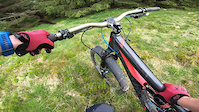
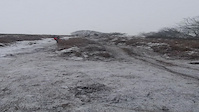
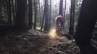
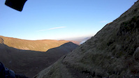
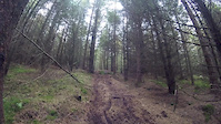
Photos of Keswick Mountain Bike
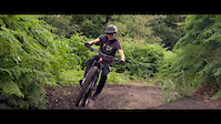
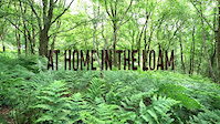
Videos of Keswick Mountain Bike
trail: Loam!
3:26 |
152 |
Jun 8, 2021

trail: Grisedale Valley
9:22 |
72 |
Apr 20, 2021
trail: Loam!
0:14 |
1034 |
Jan 8, 2021
trail: Loam!
3:01 |
70 |
Aug 2, 2020
trail: Loam!
0:49 |
9550 |
Jun 14, 2020
trail: Loam!
5:13 |
107 |
Apr 8, 2019
trail: Sticks Pass
2:02 |
495 |
Dec 8, 2018
trail: Loam!
0:26 |
21 |
Oct 23, 2018
Recent Trail Reports
Activity Feed
| username | action | type | title | date |
|---|---|---|---|---|
| jode | wishlist | trail | activity #97116464 | Jun 16, 2026 @ 9:25am Jun 16, 2026 |
| jode | wishlist | route | activity #97107844 | Jun 16, 2026 @ 7:14am Jun 16, 2026 |
| JonasPjCRns | ridden | route | activity #97097208 | Jun 16, 2026 @ 3:29am Jun 16, 2026 |
| jode | wishlist | trail | activity #97087939 | Jun 15, 2026 @ 10:13pm Jun 15, 2026 |
| 07wlee | add | report | activity #97045167 and 8 more | Jun 15, 2026 @ 9:01am Jun 15, 2026 |
Recent Comments
| username | type | title | comment | date |
|---|---|---|---|---|
| trail | T | Apr 16, 2026 @ 6:21am Apr 16, 2026 | ||
| trail | Needs some serious tlc. Huge water and root... | Oct 28, 2025 @ 3:36am Oct 28, 2025 | ||
| trail | This makes absolutely no sense to me that... | Oct 19, 2025 @ 3:12pm Oct 19, 2025 | ||
| report | Steep and technical. Runs fine in the dry.... | May 4, 2025 @ 9:20am May 4, 2025 | ||
| trail | Tree down at the end. | Mar 28, 2025 @ 8:45am Mar 28, 2025 |
Local Badges
-

10 Blue Trails226 awarded -

Epic Ride Climb 2k248 awarded -

Climbing 10k Badge126 awarded -

Climbing 100k Badge9 awarded -

Epic Ride Descent 2k252 awarded -

Descent 10k Badge126 awarded
Bike & Skill Parks
| name | type | city | rating |
|---|---|---|---|
| Keswick BMX Track | skill park | Keswick |
Local Mountain Biking Directory
-
Mickledore Cycling Holidays
![Mickledore Cycling Holidays]()
-
Keswick BikesBike Shop
-
Whinlatter BikesBike Shop
-
CyclewiseBike Shop
-
BiketreksBike Shop
![Biketreks]()
Activity Type Stats
| activitytype | trails | distance | descent | descent distance | total vertical | rating | global rank | state rank | photos | reports | routes | ridelogs |
|---|---|---|---|---|---|---|---|---|---|---|---|---|
| Mountain Bike | 77 | 64 miles | 25,896 ft | 36 miles | 2,792 ft | #819 | #34 | 197 | 988 | 11 | 17,432 | |
| E-Bike | 14 | 9 miles | 5,679 ft | 6 miles | 2,782 ft | #653 | #39 | 887 | 3 | 3,760 | ||
| Hike | 65 | 61 miles | 24,682 ft | 35 miles | 2,792 ft | #2,231 | #50 | 930 | 2 | 5,074 | ||
| Trail Running | 69 | 62 miles | 25,171 ft | 35 miles | 2,792 ft | #2,145 | #45 | 933 | 2 | 1,056 |
Frequently Asked Questions About Keswick
▼
What are the best places to ride in Keswick?
Keswick has 1 areas to explore for mountain biking. The top rated areas are:
▼
What are the highest rated mountain biking trails in Keswick?
The highest rated mountain biking trails in Keswick are:
- Sticks Pass (4.3/5)
- #loamoerotic (4.3/5)
- #loamranger (4.3/5)
- Half Days (4.2/5)
- 10 Spokes (4.2/5)
▼
What is the best time of the year to ride in Keswick?
Based on ride log data, the most popular months to ride in Keswick are:
- July (83 activities)
- August (52 activities)
- April (49 activities)
▼
Where can I park to ride in Keswick?
There are 5 parking locations listed in Keswick. The most popular parking spots are:
- Whinlatter Visitors Centre Parking
- Masmill Parking
- Revelin Moss Parking
- Swirls Car Park
- Wythburn Car Park
Activities
Trails
- By badlydrawnchalk
 & contributors
 - Admins: wisey, MathieuC, cemoorelife
- #7441 - 12,580 views
- keswick activity log | embed map of Keswick mountain bike trails | keswick mountain biking points of interest
Downloading of trail gps tracks in kml & gpx formats is enabled for Keswick.
You must login to download files.