close
-
Layers w
- Weather Layers
- Pro
- Pro
- Pro
- Pro
- Pro
- Pro
- More Layers
- Pro
- Pro
- Pro
- Pro
-
Upgrade to

3D
Trail Conditions
- Unknown
- Snow Groomed
- Snow Packed
- Snow Covered
- Snow Cover Partial
- Freeze/thaw Cycle
- Icy
- Prevalent Mud
- Wet
- Variable
- Ideal
- Dry
- Very Dry
Trail Flow (Ridden Direction)
Trailforks scans users ridelogs to determine the most popular direction each trail is ridden. A good flowing trail network will have most trails flowing in a single direction according to their intension.
The colour categories are based on what percentage of riders are riding a trail in its intended direction.
The colour categories are based on what percentage of riders are riding a trail in its intended direction.
- > 96%
- > 90%
- > 80%
- > 70%
- > 50%
- < 50%
- bi-directional trail
- no data
Trail Last Ridden
Trailforks scans ridelogs to determine the last time a trail was ridden.
- < 2 days
- < 1 week
- < 2 weeks
- < 1 month
- < 6 months
- > 6 months
Trail Ridden Direction
The intended direction a trail should be ridden.
- Downhill Only
- Downhill Primary
- Both Directions
- Uphill Primary
- Uphill Only
- One Direction
Contribute Details
Colors indicate trail is missing specified detail.
- Description
- Photos
- Description & Photos
- Videos
Trail Popularity ?
Trailforks scans ridelogs to determine which trails are ridden the most in the last 9 months.
Trails are compared with nearby trails in the same city region with a possible 25 colour shades.
Think of this as a heatmap, more rides = more kinetic energy = warmer colors.
- most popular
- popular
- less popular
- not popular
ATV/ORV/OHV Filter
Max Vehicle Width
inches
US Cell Coverage
Legend

Radar Time
Activity Recordings
Trailforks uses anonymized public activity data.
?
Activity Recordings
Trailforks uses anonymized public activity data.
?
Personal Heatmap
▶
Activity Types
all
/
none
▶
Options
2
Date range
month
–
Winter Trails
Warning
A routing network for winter maps does not exist. Selecting trails using the winter trails layer has been disabled.
Missing Trails
Most Popular
Least Popular
Trails are colored based on popularity. The more popular a trail is, the more red. Less popular trails trend towards green.
Jump Magnitude Heatmap
Heatmap of where riders jump on trails. Zoom in to see individual jumps, click circles to view jump details.
BC Backroad Status
![map legend]()
Service Road Atlas is a free to use, community-driven service for viewing and creating reports on the numerous back-country service roads around B.C. and Alberta.

Slope Aspect
Direction the slope faces
Trails Deemphasized
Trails are shown in grey.
Only show trails with no bike usage.
Suggested Layers
Based on selected activity type
Save the current map location and zoom level as your default home location whenever this page is loaded.
Save
No description for Ketchum has been added yet!
Login or register to submit one.

Links
Region Supporters & Maintainers
![]()
Wood River Trails CoalitionMaintainer
IMBA Ride Center
Sun Valley
Activities Click to view
- Mountain Bike
134 trails
- E-Bike
45 trails
- Gravel Bike
31 trails
- Adaptive Bike
0 trails
- Winter Fat Bike
0 trails
- Horse
69 trails
- Hike
134 trails
- Trail Running
133 trails
- Dirtbike/Moto
42 trails
- Observed Trials
4 trails
- ATV/ORV/OHV
14 trails
- Snowshoe
8 trails
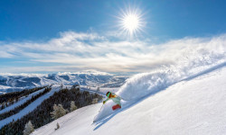
- Downhill Ski
169 trails
- Backcountry Ski
13 trails
- Nordic Ski
72 trails
Region Details
- 24
- 1
- 15
- 50
- 38
- 6
Region Status
Caution as of 21 hoursStats
- Avg Trail Rating
- Trails (view details)
- 379
- Trails Mountain Bike
- 134
- Trails E-Bike
- 45
- Trails Gravel Bike
- 31
- Trails Horse
- 69
- Trails Hike
- 134
- Trails Trail Running
- 133
- Trails Dirtbike/Moto
- 42
- Trails Observed Trials
- 4
- Trails ATV/ORV/OHV
- 14
- Trails Snowmobile
- 1
- Trails Snowshoe
- 8
- Trails Downhill Ski
- 169
- Trails Backcountry Ski
- 13
- Trails Nordic Ski
- 72
- Total Distance
- 591 miles
- Total Descent
- 134,499 ft
- Total Vertical
- 4,907 ft
- Highest Trailhead
- 10,066 ft
- Reports
- 2,376
- Photos
- 946
- Ridden Counter
- 58,202
Articles

Super Duper D Returns to Sun Valley After Two-Year Hiatus
Jul 10, 2025 from pinkbike.com
Sun Valley’s rowdiest descent is back, raising funds for the Wood River Trails Coalition.
Five Reasons Sun Valley Is the Ultimate Ski Resort
Oct 1, 2021 from outsideonline.com
When you combine stellar terrain, world-class amenities, and spectacularly uncrowded slopes, you get a mountain experience like no other
Sub Regions
-
Adam's Gulch
- 1
- 10
- 5
-
Baker
- 3
- 5
-
Bald Mountain - Sun Valley
- 2
- 6
- 2
-
Bigwood Fat Bike Park
- 3
-
Galena Lodge
- 12
- 10
- 7
-
North of Ketchum
- 7
- 1
-
Prairie/Miner
- 4
- 4
-
Sun Valley Nordic Center
- 2
- 1
-
Warmsprings
- 3
- 7
- 1
Popular Ketchum Mountain Biking Trails
• 90 ★ 4.3 • 6 miles • 821 ft • 1,343 •
This trail's upper part above the Wood River is directional for mountain bikers in the north to south direction and is fast flowy single track with some slighty rocky parts. AKA, the west side of the trail is only North to South for...
• 100 ★ 3.4 • 3,517 ft • 33 ft • 1,301 •
Lodge Loop is the shortest trail at Galena at less than .75 miles. It is a great trail to dip your toes into the sport of mountain biking. Kids can even strider the trail! Like all of the singletrack trails at Galena, the Trail is open...
• 100 ★ 4.8 • 2 miles • 51 ft • 1,032 •
This single-track traverse has limited climbing and offers pleasant shade in the mid-summer heat.
• 95 ★ 4.5 • 1 mile • 155 ft • 983 •
Downhill Flow Trail, that starts out from with some steep switchback climb. The main downhill trail is fast and flowing with big berms and high speed. Plenty of little air-out spots along the way down. A classic trail that has been in...
• 95 ★ 4.4 • 2 miles • 257 ft • 884 •
Rip and Tear is an intermediate trail that contains lots of flow. It can be ridden in a variety of ways. You can ride it as a loop (clockwise is best), from the junction down into Gladiator, or from the junction down to Galena View...
• 90 ★ 3.5 • 3 miles • 8 ft • 803 •
This trail connects to Adam's- as well as to Adams Rib Trail.
• 100 ★ 3.5 • 4,642 ft • 284 ft • 774 •
This trail connects Warm Springs and Adams Gulch area. There is no parking on the South side (Warm Springs) so park at Adam's if using this trail.
• 100 ★ 3.0 • 2,438 ft • 30 ft • 662 •
Senate Meadows Connector trail is a short connector trail between and Senate Meadows Loop. Like all of the singletrack trails at Galena, the Senate Meadows Connector Trail is open to two-way traffic and shared use by hikers, horseback...
Ketchum Mountain Bike Routes
★ 3.8 • 257 miles • 38,781 ft • 44 •
The Idaho Gem is a beauty of a bikepacking route traveling through four different mountain ranges in...
★ 5.0 • 37 miles • 7,510 ft • 6 • Loop •
True Enduro style backcountry big ride. Tough climbs, ripping descents. Get it!
7 miles • 665 ft • 3 • Loop •
Senate Meadows to is a popular beginner loop ridden right from Galena Lodge. It can be ridden both...
16 miles • 3,264 ft • 5 • Loop •
This route hits all the staples in Adam's Gulch, from the Adam's Gulch Trailhead. starting out you get a...
6 miles • 1,301 ft • 3 • Loop •
The route combines individual legs in the Adams Gulch area into a loop. Go clockwise if you want to knock...
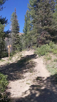
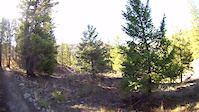
Photos of Ketchum Mountain Bike
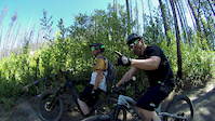
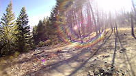
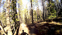
Videos of Ketchum Mountain Bike
trail: Mine Shaft
0:14 |
229 |
Aug 17, 2020

trail: Upper Old Adams Gulch Road
2:57 |
254 |
Sep 24, 2019

trail: Lupine
2:12 |
73 |
Jul 29, 2019

trail: Lupine
2:12 |
104 |
Jul 29, 2019
trail: Eve's Gulch
0:00 |
262 |
Jul 30, 2018
trail: Fox Creek Loop
4:18 |
215 |
Nov 7, 2016
trail: Fox Creek Loop
3:32 |
75 |
Nov 7, 2016
trail: Fox Creek Loop
2:29 |
47 |
Nov 7, 2016
Current Trail Warnings
| status | trail | date | condition | user | info |
|---|---|---|---|---|---|
| Spur Trail | Jun 11, 2026 @ 2:41pm (America/Boise) Jun 11, 2026 | Dry | Alicesch | 1 tree | |
| Cherry Connector | Jun 11, 2026 @ 2:41pm (America/Boise) Jun 11, 2026 | Dry | Alicesch | 2 trees | |
| Castle Rock | Jun 7, 2026 @ 9:28pm (America/Boise) Jun 7, 2026 | Variable | kinsler | Dirtbike/Moto Snow free. Only cut from Placer up. |
Recent Trail Reports
| status | trail | date | condition | info | user |
|---|---|---|---|---|---|
| Old Toll Road Trail | Jun 20, 2026 @ 6:59pm (America/Boise) 21 hours | Dry | gsbeebe | ||
| Fox Creek Loop | Jun 18, 2026 @ 8:36pm (America/Boise) 3 days | Dry | ccmski | ||
| Eve's Gulch | Jun 18, 2026 @ 12:39pm (America/Boise) Jun 18, 2026 | Dry | nickmontee | ||
| Forbidden Fruit | Jun 17, 2026 @ 12:36pm (America/Boise) Jun 17, 2026 | Dry | falltricky | ||
| Norton Cr | Jun 16, 2026 @ 2:49pm (America/Los_Angeles) Jun 16, 2026 | Snow Cover Partial | Bonking | ||
| Apollo Creek | Jun 16, 2026 @ 2:49pm (America/Los_Angeles) Jun 16, 2026 | Snow Cover Partial | Bonking | ||
| Warfield-South Fork | Jun 15, 2026 @ 8:31pm (America/Boise) Jun 15, 2026 | Dry | kinsler | ||
| Oregon-Fox Connector | Jun 13, 2026 @ 7:18pm (America/Boise) Jun 13, 2026 | Dry | ccmski | ||
| Old Adams Gulch Road | Jun 11, 2026 @ 9:45pm (America/Boise) Jun 11, 2026 | Ideal | ccmski | ||
| Oregon Gulch | Jun 11, 2026 @ 9:45pm (America/Boise) Jun 11, 2026 | Ideal | ccmski |
Activity Feed
| username | action | type | title | date |
|---|---|---|---|---|
| gsbeebe | add | report | activity #97446754 | Jun 20, 2026 @ 5:59pm 21 hours |
| enorthey | wishlist | region | activity #97395524 | Jun 20, 2026 @ 7:56am 1 day |
| emeininger | wishlist | route | activity #97392212 | Jun 20, 2026 @ 7:21am 1 day |
| ccmski | add | report | activity #97291943 | Jun 18, 2026 @ 7:36pm 3 days |
| LisajIrHRD | wishlist | route | activity #97289291 and 1 more | Jun 18, 2026 @ 6:42pm 3 days |
Recent Comments
| username | type | title | comment | date |
|---|---|---|---|---|
| trail | Beautiful trail. Early in season so I’m sure... | Jun 12, 2026 @ 5:33am Jun 12, 2026 | ||
| trail | I did not listen to prior reviews hoping to... | Jun 12, 2026 @ 5:30am Jun 12, 2026 | ||
| report | Probably a hundred trees down. Lots of small... | Jun 7, 2026 @ 8:11am Jun 7, 2026 | ||
| trail | Really nice climb up from Warm Springs Road. A... | Jun 7, 2026 @ 7:06am Jun 7, 2026 | ||
| trail | Nice trail up from intersection with Deer... | Jun 4, 2026 @ 4:11pm Jun 4, 2026 |
Local Badges
-

Top 10 Trails0 awarded -

Descent 100k Badge12 awarded -

Big Ride 30k4,498 awarded -

Epic Ride 50k1,448 awarded -

Descent 10k Badge173 awarded -

Completionist0 awarded
Bike & Skill Parks
| name | type | city | rating |
|---|---|---|---|
| Bald Mountain - Sun Valley | bike park | Ketchum | |
| Dollar Mountain - Sun Valley | bike park | Ketchum | |
| Ketchum Bike Park | skill park | Ketchum |
Local Products
Activity Type Stats
| activitytype | trails | distance | descent | descent distance | total vertical | rating | global rank | state rank | photos | reports | routes | ridelogs |
|---|---|---|---|---|---|---|---|---|---|---|---|---|
| Mountain Bike | 134 | 424 miles | 66,608 ft | 174 miles | 4,908 ft | #342 | #126 | 874 | 2,313 | 41 | 31,270 | |
| E-Bike | 45 | 217 miles | 20,335 ft | 69 miles | 4,524 ft | #267 | #675 | 3 | 1,088 | 3 | 834 | |
| Gravel Bike | 31 | 83 miles | 8,533 ft | 44 miles | 3,596 ft | #134 | #833 | 519 | 18 | 128 | ||
| Horse | 69 | 306 miles | 41,001 ft | 107 miles | 4,908 ft | #67 | #348 | 855 | 7 | |||
| Hike | 134 | 436 miles | 62,247 ft | 165 miles | 4,908 ft | #236 | #123 | 27 | 2,060 | 12 | 4,016 | |
| Trail Running | 133 | 426 miles | 59,275 ft | 160 miles | 4,908 ft | #191 | #86 | 40 | 2,058 | 13 | 985 | |
| Dirtbike/Moto | 42 | 192 miles | 19,528 ft | 50 miles | 3,983 ft | #56 | #33 | 2 | 667 | 46 | ||
| Observed Trials | 4 | 22 miles | 2,415 ft | 8 miles | 3,520 ft | #12 | #7 | 72 | 78 | |||
| ATV/ORV/OHV | 14 | 51 miles | 1,283 ft | 9 miles | 3,720 ft | #395 | #120 | 458 | 9 | |||
| Snowmobile | 1 | 9 miles | 23 ft | 771 ft | 1,270 ft | 5 | ||||||
| Snowshoe | 8 | 31 miles | 1,673 ft | 20 miles | 4,567 ft | #223 | #54 | 183 | 147 | |||
| Downhill Ski | 169 | 64 miles | 59,288 ft | 54 miles | 3,665 ft | #64 | #28 | 95 | 5,935 | |||
| Backcountry Ski | 13 | 6 miles | 9,239 ft | 5 miles | 2,461 ft | #160 | #30 | 6 | 1,258 | |||
| Nordic Ski | 72 | 94 miles | 6,181 ft | 45 miles | 2,562 ft | #27 | #10 | 1 | 266 | 6,289 |
Frequently Asked Questions About Ketchum
▼
What are the best places to ride in Ketchum?
Ketchum has 15 areas to explore for mountain biking. The top rated areas are:
▼
What are the highest rated mountain biking trails in Ketchum?
The highest rated mountain biking trails in Ketchum are:
- Alden Gulch (Re-Route) (4.6/5)
- Red Warrior (4.4/5)
- Shady Side Trail (4.4/5)
- Outhouse Loop (4.3/5)
- Senate Meadows Loop (4.3/5)
▼
What is the best time of the year to ride in Ketchum?
Based on ride log data, the most popular months to ride in Ketchum are:
- July (871 activities)
- August (592 activities)
- June (504 activities)
▼
Where can I park to ride in Ketchum?
There are 21 parking locations listed in Ketchum. The most popular parking spots are: View all parking and trailhead locations on the map to plan your visit.
Activities
- Ketchum Mountain Biking Trails
- Ketchum E-Biking Trails
- Ketchum Gravel Biking Trails
- Ketchum Horseback Trails
- Ketchum Hiking Trails
- Ketchum Trail Running Trails
- Ketchum Dirtbiking Trails
- Ketchum ATVing/Offroading Trails
- Ketchum Snowshoeing Trails
- Ketchum Skiing Trails
- Ketchum Backcountry Skiing Trails
- Ketchum Nordic Skiing Trails
Trails
Points of Interest
- Clear Creek Overlook Viewpoint
- Picnic Table Viewpoint
- Roundhouse Gondola (Bottom) Information
- Little America Point Viewpoint
- Galena Lodge Restaurant and Bike/Ski Shop Information
- Boulder City Mine Other
- Water Crossing Information
- Alternative Path Information
- Coyote Yurt Lodge
- River Run Trail Downhill Biking Only During Lift Operations Information
- Galena Peak (11,112 ft)
- Easley Peak (11,073 ft)
- Silver Peak (10,945 ft)
- By ACree
 & contributors
 - Admins: WRTC, BCRD, WRTC
- #6275 - 26,295 views
- ketchum activity log | embed map of Ketchum mountain bike trails | ketchum mountain biking points of interest polygons
Downloading of trail gps tracks in kml & gpx formats is enabled for Ketchum.
You must login to download files.