close
-
Layers w
- Weather Layers
- Pro
- Pro
- Pro
- Pro
- Pro
- Pro
- More Layers
- Pro
- Pro
- Pro
- Pro
-
Upgrade to

3D
Trail Conditions
- Unknown
- Snow Groomed
- Snow Packed
- Snow Covered
- Snow Cover Partial
- Freeze/thaw Cycle
- Icy
- Prevalent Mud
- Wet
- Variable
- Ideal
- Dry
- Very Dry
Trail Flow (Ridden Direction)
Trailforks scans users ridelogs to determine the most popular direction each trail is ridden. A good flowing trail network will have most trails flowing in a single direction according to their intension.
The colour categories are based on what percentage of riders are riding a trail in its intended direction.
The colour categories are based on what percentage of riders are riding a trail in its intended direction.
- > 96%
- > 90%
- > 80%
- > 70%
- > 50%
- < 50%
- bi-directional trail
- no data
Trail Last Ridden
Trailforks scans ridelogs to determine the last time a trail was ridden.
- < 2 days
- < 1 week
- < 2 weeks
- < 1 month
- < 6 months
- > 6 months
Trail Ridden Direction
The intended direction a trail should be ridden.
- Downhill Only
- Downhill Primary
- Both Directions
- Uphill Primary
- Uphill Only
- One Direction
Contribute Details
Colors indicate trail is missing specified detail.
- Description
- Photos
- Description & Photos
- Videos
Trail Popularity ?
Trailforks scans ridelogs to determine which trails are ridden the most in the last 9 months.
Trails are compared with nearby trails in the same city region with a possible 25 colour shades.
Think of this as a heatmap, more rides = more kinetic energy = warmer colors.
- most popular
- popular
- less popular
- not popular
ATV/ORV/OHV Filter
Max Vehicle Width
inches
US Cell Coverage
Legend

Radar Time
Activity Recordings
Trailforks uses anonymized public activity data.
?
Activity Recordings
Trailforks uses anonymized public activity data.
?
Personal Heatmap
▶
Activity Types
all
/
none
▶
Options
2
Date range
month
–
Winter Trails
Warning
A routing network for winter maps does not exist. Selecting trails using the winter trails layer has been disabled.
Missing Trails
Most Popular
Least Popular
Trails are colored based on popularity. The more popular a trail is, the more red. Less popular trails trend towards green.
Jump Magnitude Heatmap
Heatmap of where riders jump on trails. Zoom in to see individual jumps, click circles to view jump details.
BC Backroad Status
![map legend]()
Service Road Atlas is a free to use, community-driven service for viewing and creating reports on the numerous back-country service roads around B.C. and Alberta.

Slope Aspect
Direction the slope faces
Trails Deemphasized
Trails are shown in grey.
Only show trails with no bike usage.
Suggested Layers
Based on selected activity type
Save the current map location and zoom level as your default home location whenever this page is loaded.
Save
No description for Kilburn has been added yet!
Login or register to submit one.
This region uses the Uk/Euro style trail grading system.
Activities Click to view
- Mountain Bike
45 trails
- E-Bike
41 trails
- Gravel Bike
0 trails
- Hike
39 trails
- Trail Running
40 trails
Region Details
- 11
- 3
- 1
- 14
- 8
Region Status
Open as of Dec 15, 2024Stats
- Avg Trail Rating
- Trails (view details)
- 38
- Trails Mountain Bike
- 45
- Trails E-Bike
- 41
- Trails Hike
- 39
- Trails Trail Running
- 40
- Total Distance
- 15 miles
- Total Descent
- 5,172 ft
- Total Vertical
- 594 ft
- Highest Trailhead
- 971 ft
- Reports
- 197
- Photos
- 28
- Ridden Counter
- 5,589
Sub Regions
-
Kilburn Woods
- 3
- 1
- 14
- 8
Popular Kilburn Mountain Biking Trails
• 100 ★ 0.0 • 745 ft • 89 ft • 335 •
Popular red difficulty singletrack. This mountain bike primary trail can be used both directions. On average it takes 2 minutes to complete this trail.
• 85 ★ 0.0 • 925 ft • 82 ft • 324 •
Popular red difficulty singletrack. This mountain bike primary trail. On average it takes 6 minutes to complete this trail.
• 95 ★ 4.0 • 1,040 ft • 0 ft • 323 •
Starts of flowing and gets a bit more steep and technical.
• 95 ★ 3.5 • 948 ft • 0 ft • 283 •
Popular red difficulty singletrack. This mountain bike primary trail can be used downhill primary. It features berm and jump. On average it takes minutes to complete this trail.
• 60 ★ 4.2 • 2,228 ft • 0 ft • 252 •
Steep and loamy with a jump over a log just after you get into the forest.
• 80 ★ 5.0 • 1,206 ft • 0 ft • 241 •
Popular black difficulty singletrack. This mountain bike primary trail can be used downhill primary. On average it takes 1 minutes to complete this trail.
• 75 ★ 4.5 • 1,001 ft • 0 ft • 219 •
Popular black difficulty singletrack. This mountain bike primary trail can be used downhill primary. Trail visibility is always easy to follow. On average it takes 3 minutes to complete this trail.
• 80 ★ 0.0 • 607 ft • 0 ft • 216 •
Popular red difficulty singletrack. This mountain bike primary trail can be used both directions. It features jump. On average it takes 1 minutes to complete this trail.
Kilburn Mountain Bike Routes
1 mile • 136 ft • 0 • Loop •
The newly formed trail centre loop at Sutton Bank that replaces the old National Park Centre loop. That's...
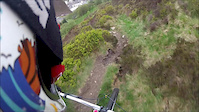
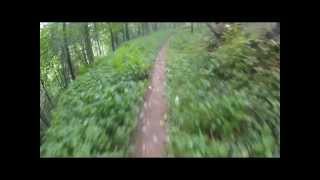
Photos of Kilburn Mountain Bike
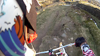
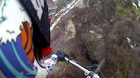
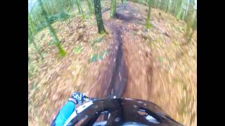
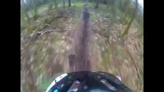
Videos of Kilburn Mountain Bike
trail: Hoodhill Ascent
0:47 |
247 |
Aug 16, 2013
trail: Hoodhill Ascent
0:40 |
170 |
Mar 30, 2013
trail: Hoodhill Ascent
0:32 |
118 |
Mar 30, 2013
trail: Hoodhill Ascent
0:06 |
155 |
Feb 18, 2013
trail: Copper Mine
1687 |
Jun 30, 2015 , Kilburn
trail: Hag Wood Decent
1390 |
Jun 30, 2015 , Kilburn
trail: Hag Wood Decent
826 |
Jun 30, 2015 , Kilburn

trail: Ride The White Horse
1540 |
Jun 30, 2015 , Kilburn
Recent Trail Reports
| status | trail | date | condition | info | user |
|---|---|---|---|---|---|
| Dog Track | Dec 15, 2024 @ 8:12am Dec 15, 2024 | Wet | Qccu2M | ||
| Bushwacker | Dec 15, 2024 @ 8:11am Dec 15, 2024 | Wet | Qccu2M | ||
| Hag Wood Decent | Jul 20, 2024 @ 1:01am Jul 20, 2024 | Variable | JamesxRNbwE | ||
| Hag Wood Decent | Jul 20, 2024 @ 1:01am Jul 20, 2024 | Variable | JamesxRNbwE | ||
| Hood Rats | Jul 20, 2024 @ 1:01am Jul 20, 2024 | Variable | JamesxRNbwE | ||
| The Hag (Top) | Jul 20, 2024 @ 1:01am Jul 20, 2024 | Dry | JamesxRNbwE | ||
| Bridleway | Jul 20, 2024 @ 1:01am Jul 20, 2024 | Variable | JamesxRNbwE | ||
| Pond Life | Dec 3, 2023 @ 1:31am Dec 3, 2023 | Snow Covered | Raymond051280 | ||
| Hood Hill Plantation Decent | Dec 3, 2023 @ 1:31am Dec 3, 2023 | Snow Covered | Raymond051280 | ||
| Hood Hill Plantation | Dec 3, 2023 @ 1:31am Dec 3, 2023 | Snow Covered | Raymond051280 |
Activity Feed
| username | action | type | title | date |
|---|---|---|---|---|
| StevieBump | ridden | trail | activity #95306373 and 3 more | May 23, 2026 @ 5:06am May 23, 2026 |
| GlastoBabe | ridden | trail | activity #93591211 and 6 more | Apr 28, 2026 @ 10:37am Apr 28, 2026 |
| Gregster1975 | ridden | trail | activity #93591169 and 6 more | Apr 28, 2026 @ 10:37am Apr 28, 2026 |
| Gregster1975 | ridden | trail | activity #93578398 and 1 more | Apr 28, 2026 @ 7:10am Apr 28, 2026 |
| bear22 | wishlist | region | activity #91240554 | Mar 24, 2026 @ 6:31pm Mar 24, 2026 |
Recent Comments
| username | type | title | comment | date |
|---|---|---|---|---|
| trail | Open | Aug 23, 2022 @ 2:41am Aug 23, 2022 | ||
| report | All cleared!! | Apr 26, 2022 @ 4:44am Apr 26, 2022 | ||
| trail | Turn your strava off the Forrest commission is... | Aug 8, 2020 @ 1:34am Aug 8, 2020 | ||
| trail | Turn your strava off the Forrest commission is... | Aug 8, 2020 @ 1:34am Aug 8, 2020 | ||
| report | Turn your strava off the Forrest commission is... | Aug 8, 2020 @ 1:33am Aug 8, 2020 |
Local Badges
-

Completionist0 awarded -

Epic Mountain Bike Climb 2k30 awarded -

Climbing 10k Badge13 awarded -

Mountain Biking 100k Badge0 awarded -

Epic Ride Descent 2k30 awarded -

Descent 10k Badge13 awarded
Activity Type Stats
| activitytype | trails | distance | descent | descent distance | total vertical | rating | global rank | state rank | photos | reports | routes | ridelogs |
|---|---|---|---|---|---|---|---|---|---|---|---|---|
| Mountain Bike | 45 | 14 miles | 4,934 ft | 8 miles | 528 ft | #2,992 | #96 | 26 | 197 | 1 | 1,902 | |
| E-Bike | 41 | 13 miles | 4,462 ft | 7 miles | 528 ft | #3,407 | #122 | 181 | 1 | 695 | ||
| Hike | 39 | 15 miles | 4,701 ft | 8 miles | 594 ft | #7,260 | #205 | 2 | 182 | 58 | ||
| Trail Running | 40 | 15 miles | 4,701 ft | 8 miles | 594 ft | #6,849 | #196 | 183 | 82 |
Frequently Asked Questions About Kilburn
▼
What are the best places to ride in Kilburn?
Kilburn has 1 areas to explore for mountain biking. The top rated areas are:
▼
What are the highest rated mountain biking trails in Kilburn?
The highest rated mountain biking trails in Kilburn are:
- Darkest Horse (4.2/5)
- Dark Horse (4.2/5)
- Copper Mine (4.2/5)
- The Hag (Middle) (4.1/5)
- Pond Life (4.1/5)
▼
What is the best time of the year to ride in Kilburn?
Based on ride log data, the most popular months to ride in Kilburn are:
- May (7 activities)
- June (7 activities)
- July (6 activities)
▼
Where can I park to ride in Kilburn?
There are 4 parking locations listed in Kilburn. The most popular parking spots are: View all parking and trailhead locations on the map to plan your visit.
Activities
Trails
Points of Interest
- By gav-s
 & contributors
 - Admins: wisey, MathieuC, cemoorelife, loamcoach
- #38091 - 3,404 views
- kilburn activity log | embed map of Kilburn mountain bike trails | kilburn mountain biking points of interest
Downloading of trail gps tracks in kml & gpx formats is enabled for Kilburn.
You must login to download files.