close
-
Layers w
- Weather Layers
- Pro
- Pro
- Pro
- Pro
- Pro
- Pro
- More Layers
- Pro
- Pro
- Pro
- Pro
-
Upgrade to

3D
Trail Conditions
- Unknown
- Snow Groomed
- Snow Packed
- Snow Covered
- Snow Cover Partial
- Freeze/thaw Cycle
- Icy
- Prevalent Mud
- Wet
- Variable
- Ideal
- Dry
- Very Dry
Trail Flow (Ridden Direction)
Trailforks scans users ridelogs to determine the most popular direction each trail is ridden. A good flowing trail network will have most trails flowing in a single direction according to their intension.
The colour categories are based on what percentage of riders are riding a trail in its intended direction.
The colour categories are based on what percentage of riders are riding a trail in its intended direction.
- > 96%
- > 90%
- > 80%
- > 70%
- > 50%
- < 50%
- bi-directional trail
- no data
Trail Last Ridden
Trailforks scans ridelogs to determine the last time a trail was ridden.
- < 2 days
- < 1 week
- < 2 weeks
- < 1 month
- < 6 months
- > 6 months
Trail Ridden Direction
The intended direction a trail should be ridden.
- Downhill Only
- Downhill Primary
- Both Directions
- Uphill Primary
- Uphill Only
- One Direction
Contribute Details
Colors indicate trail is missing specified detail.
- Description
- Photos
- Description & Photos
- Videos
Trail Popularity ?
Trailforks scans ridelogs to determine which trails are ridden the most in the last 9 months.
Trails are compared with nearby trails in the same city region with a possible 25 colour shades.
Think of this as a heatmap, more rides = more kinetic energy = warmer colors.
- most popular
- popular
- less popular
- not popular
ATV/ORV/OHV Filter
Max Vehicle Width
inches
US Cell Coverage
Legend

Radar Time
Activity Recordings
Trailforks uses anonymized public activity data.
?
Activity Recordings
Trailforks uses anonymized public activity data.
?
Personal Heatmap
▶
Activity Types
all
/
none
▶
Options
2
Date range
month
–
Winter Trails
Warning
A routing network for winter maps does not exist. Selecting trails using the winter trails layer has been disabled.
Missing Trails
Most Popular
Least Popular
Trails are colored based on popularity. The more popular a trail is, the more red. Less popular trails trend towards green.
Jump Magnitude Heatmap
Heatmap of where riders jump on trails. Zoom in to see individual jumps, click circles to view jump details.
BC Backroad Status
![map legend]()
Service Road Atlas is a free to use, community-driven service for viewing and creating reports on the numerous back-country service roads around B.C. and Alberta.

Slope Aspect
Direction the slope faces
Trails Deemphasized
Trails are shown in grey.
Only show trails with no bike usage.
Suggested Layers
Based on selected activity type
Save the current map location and zoom level as your default home location whenever this page is loaded.
Save
No description for Killeen has been added yet!
Login or register to submit one.
Activities Click to view
- Mountain Bike
72 trails
- E-Bike
9 trails
- Gravel Bike
0 trails
- Adaptive Bike
0 trails
- Horse
6 trails
- Hike
71 trails
- Trail Running
71 trails
Region Details
- 3
- 2
- 28
- 27
- 11
Region Status
Open as of Jun 11, 2026Stats
- Avg Trail Rating
- Trails (view details)
- 71
- Trails Mountain Bike
- 72
- Trails E-Bike
- 9
- Trails Horse
- 6
- Trails Hike
- 71
- Trails Trail Running
- 71
- Total Distance
- 39 miles
- Total Descent
- 3,184 ft
- Total Vertical
- 216 ft
- Highest Trailhead
- 839 ft
- Reports
- 352
- Photos
- 83
- Ridden Counter
- 8,499
Sub Regions
-
Belton Lake Outdoor Recreation Area
- 5
- 2
- 1
-
Dana Peak Park
- 2
- 23
- 21
- 10
Popular Killeen Mountain Biking Trails
• 100 ★ 4.5 • 710 ft • 22 ft • 297 •
Popular blue difficulty singletrack. This mountain bike primary trail can be used downhill primary. On average it takes minutes to complete this trail.
• 95 ★ 3.0 • 2 miles • 48 ft • 261 •
Popular green difficulty singletrack. This multi-use trail can be used both directions and has a easy overall physical rating with a 48 ft green climb. On average it takes 10 minutes to complete this trail.
• 95 ★ 1.0 • 551 ft • 0 ft • 257 •
Popular blue difficulty singletrack. This multi-use trail can be used downhill primary. On average it takes minutes to complete this trail.
• 100 ★ 3.5 • 1 mile • 89 ft • 253 •
Popular black diamond difficulty singletrack. This multi-use trail can be used both directions. On average it takes 10 minutes to complete this trail.
• 90 ★ 4.0 • 4,652 ft • 73 ft • 240 •
Popular blue difficulty singletrack. This multi-use trail can be used both directions. On average it takes 7 minutes to complete this trail.
• 100 ★ 1.0 • 984 ft • 11 ft • 221 •
Popular black diamond difficulty singletrack. This multi-use trail can be used downhill primary. On average it takes 1 minutes to complete this trail.
• 80 ★ 4.8 • 1 mile • 72 ft • 213 •
Popular blue difficulty singletrack. This multi-use trail. On average it takes 11 minutes to complete this trail.
• 95 ★ 3.0 • 3,615 ft • 50 ft • 185 •
Popular blue difficulty singletrack. This mountain bike primary trail can be used both directions. On average it takes 4 minutes to complete this trail.
Killeen Mountain Bike Routes
• 7 miles • 598 ft • 2 •
• 5 miles • 366 ft • 2 •
• 13 miles • 815 ft • 11 •
• 9 miles • 650 ft • 4 •
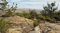
Photos of Killeen Mountain Bike
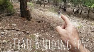
Videos of Killeen Mountain Bike
trail: Above the rim
0:12 |
32 |
Oct 13, 2024

trail: Dead Men Ride No Trails
3:36 |
1350 |
Jun 12, 2020 , Killeen

trail: Dead Men Ride No Trails
8:32 |
367 |
May 25, 2020 , Killeen

trail: Dead Men Ride No Trails
4:56 |
240 |
May 25, 2020 , Killeen

trail: Dead Men Ride No Trails
4:04 |
302 |
May 25, 2020 , Killeen

trail: Dead Men Ride No Trails
2:55 |
251 |
May 25, 2020 , Killeen
trail: Dead Men Ride No Trails
2:52 |
307 |
May 25, 2020 , Killeen

trail: Dead Men Ride No Trails
2:04 |
362 |
May 25, 2020 , Killeen
Recent Trail Reports
| status | trail | date | condition | info | user |
|---|---|---|---|---|---|
| Unknown Name | Jun 11, 2026 @ 8:20am (America/Matamoros) Jun 11, 2026 | Wet | Sufferbike | ||
| Dracula | Apr 29, 2026 @ 1:04pm (America/Chicago) Apr 29, 2026 | Unknown | chasethegnar | ||
| Sidewinder | Feb 13, 2026 @ 10:50am (America/Matamoros) Feb 13, 2026 | Ideal | Copperasrider | ||
| Unknown Name 2 | Feb 13, 2026 @ 10:50am (America/Matamoros) Feb 13, 2026 | Ideal | Copperasrider | ||
| Waters edge | Dec 18, 2025 @ 4:32pm (America/Chicago) Dec 18, 2025 | Dry | texasaggie94 | ||
| Three Amigos | Dec 18, 2025 @ 4:32pm (America/Chicago) Dec 18, 2025 | Dry | texasaggie94 | ||
| Dropout | Dec 18, 2025 @ 4:32pm (America/Chicago) Dec 18, 2025 | Dry | texasaggie94 | ||
| EZ out | Dec 18, 2025 @ 4:32pm (America/Chicago) Dec 18, 2025 | Dry | texasaggie94 | ||
| Twin Peaks Connector | Dec 18, 2025 @ 4:32pm (America/Chicago) Dec 18, 2025 | Ideal | texasaggie94 | ||
| Little Nugget of Joy | Dec 18, 2025 @ 4:32pm (America/Chicago) Dec 18, 2025 | Ideal | texasaggie94 |
Activity Feed
| username | action | type | title | date |
|---|---|---|---|---|
| heatrstock | wishlist | trail | activity #97348462 and 8 more | Jun 19, 2026 @ 3:23pm 2 days |
| Sufferbike | add | report | activity #96742935 | Jun 11, 2026 @ 9:25am Jun 11, 2026 |
| chasethegnar | add | report | activity #93660002 | Apr 29, 2026 @ 11:04am Apr 29, 2026 |
| chasethegnar | ridden | trail | activity #93659904 | Apr 29, 2026 @ 11:03am Apr 29, 2026 |
| ChadI39h4R | wishlist | region | activity #93085996 | Apr 21, 2026 @ 9:24am Apr 21, 2026 |
Recent Comments
| username | type | title | comment | date |
|---|---|---|---|---|
| trail | Visited this trail while traveling on a work... | Dec 6, 2025 @ 1:13pm Dec 6, 2025 | ||
| report | V??? | Sep 23, 2023 @ 5:56am Sep 23, 2023 | ||
| trail | Nothing but smiles! | Feb 20, 2023 @ 11:15am Feb 20, 2023 | ||
| trail | Omg, this was the worst trail I’ve ever... | Apr 10, 2022 @ 1:12pm Apr 10, 2022 | ||
| trail | fun ride i will be back | Nov 26, 2021 @ 7:34pm Nov 26, 2021 |
Local Badges
-

10 Blue Trails106 awarded -

Epic Ride Climb 2k0 awarded -

Climbing 10k Badge20 awarded -

Climbing 100k Badge1 awarded -

Epic Ride Descent 2k0 awarded -

Descent 10k Badge20 awarded
Activity Type Stats
| activitytype | trails | distance | descent | descent distance | total vertical | rating | global rank | state rank | photos | reports | routes | ridelogs |
|---|---|---|---|---|---|---|---|---|---|---|---|---|
| Mountain Bike | 72 | 39 miles | 3,186 ft | 16 miles | 217 ft | #2,715 | #970 | 86 | 349 | 2 | 7,506 | |
| E-Bike | 9 | #9,776 | #3,037 | 6 | 305 | 193 | ||||||
| Horse | 6 | 745 ft | 72 ft | 3 ft | #3,365 | #1,934 | 79 | |||||
| Hike | 71 | 33 miles | 2,815 ft | 14 miles | 203 ft | #5,637 | #1,982 | 345 | 188 | |||
| Trail Running | 71 | 33 miles | 2,815 ft | 14 miles | 203 ft | #4,873 | #1,523 | 348 | 326 |
Frequently Asked Questions About Killeen
▼
What are the best places to ride in Killeen?
Killeen has 2 areas to explore for mountain biking. The top rated areas are:
▼
What are the highest rated mountain biking trails in Killeen?
The highest rated mountain biking trails in Killeen are:
- Leviathan (4.4/5)
- Barbed Wire (4.3/5)
- Secret Squirrel (4.3/5)
- Ring Mountain (4.3/5)
- Through the trees (4.2/5)
▼
What is the best time of the year to ride in Killeen?
Based on ride log data, the most popular months to ride in Killeen are:
- July (103 activities)
- April (88 activities)
- May (69 activities)
▼
Where can I park to ride in Killeen?
There are 4 parking locations listed in Killeen. The most popular parking spots are: View all parking and trailhead locations on the map to plan your visit.
Activities
- By brenthillier
 NSMBA TRAILFORKS & contributors
 - Admins: ARR
- #3696 - 6,020 views
- killeen activity log | embed map of Killeen mountain bike trails | killeen mountain biking points of interest
Downloading of trail gps tracks in kml & gpx formats is enabled for Killeen.
You must login to download files.