close
-
Layers w
- Weather Layers
- Pro
- Pro
- Pro
- Pro
- Pro
- Pro
- More Layers
- Pro
- Pro
- Pro
- Pro
-
Upgrade to

3D
Trail Conditions
- Unknown
- Snow Groomed
- Snow Packed
- Snow Covered
- Snow Cover Partial
- Freeze/thaw Cycle
- Icy
- Prevalent Mud
- Wet
- Variable
- Ideal
- Dry
- Very Dry
Trail Flow (Ridden Direction)
Trailforks scans users ridelogs to determine the most popular direction each trail is ridden. A good flowing trail network will have most trails flowing in a single direction according to their intension.
The colour categories are based on what percentage of riders are riding a trail in its intended direction.
The colour categories are based on what percentage of riders are riding a trail in its intended direction.
- > 96%
- > 90%
- > 80%
- > 70%
- > 50%
- < 50%
- bi-directional trail
- no data
Trail Last Ridden
Trailforks scans ridelogs to determine the last time a trail was ridden.
- < 2 days
- < 1 week
- < 2 weeks
- < 1 month
- < 6 months
- > 6 months
Trail Ridden Direction
The intended direction a trail should be ridden.
- Downhill Only
- Downhill Primary
- Both Directions
- Uphill Primary
- Uphill Only
- One Direction
Contribute Details
Colors indicate trail is missing specified detail.
- Description
- Photos
- Description & Photos
- Videos
Trail Popularity ?
Trailforks scans ridelogs to determine which trails are ridden the most in the last 9 months.
Trails are compared with nearby trails in the same city region with a possible 25 colour shades.
Think of this as a heatmap, more rides = more kinetic energy = warmer colors.
- most popular
- popular
- less popular
- not popular
ATV/ORV/OHV Filter
Max Vehicle Width
inches
US Cell Coverage
Legend

Radar Time
Activity Recordings
Trailforks uses anonymized public activity data.
?
Activity Recordings
Trailforks uses anonymized public activity data.
?
Personal Heatmap
▶
Activity Types
all
/
none
▶
Options
2
Date range
month
–
Winter Trails
Warning
A routing network for winter maps does not exist. Selecting trails using the winter trails layer has been disabled.
Missing Trails
Most Popular
Least Popular
Trails are colored based on popularity. The more popular a trail is, the more red. Less popular trails trend towards green.
Jump Magnitude Heatmap
Heatmap of where riders jump on trails. Zoom in to see individual jumps, click circles to view jump details.
BC Backroad Status
![map legend]()
Service Road Atlas is a free to use, community-driven service for viewing and creating reports on the numerous back-country service roads around B.C. and Alberta.

Slope Aspect
Direction the slope faces
Trails Deemphasized
Trails are shown in grey.
Only show trails with no bike usage.
Suggested Layers
Based on selected activity type
Save the current map location and zoom level as your default home location whenever this page is loaded.
SaveKimi is a coastal town and a former municipality (8,772 inhabitants in 2001) in the island of Euboea, Greece, named after an ancient Greek place of the same name. Since the 2011 local government reform it is part of the municipality Kymi-Aliveri, of which it is a municipal unit.[2] The ancient Euboean Kyme is mentioned as a harbor town related to the more prominent poleis of Chalkis and Eretria in antiquity. Together with these, it is sometimes named as the founding metropolis of the homonymous Kymē (Cumae) in Italy, an important early Euboean colony, which was probably named after it.
source: Wikipedia
Activities Click to view
- Mountain Bike
3 trails
- E-Bike
1 trails
- Hike
0 trails
- Trail Running
0 trails
Region Details
- 3
Region Status
Open as of Nov 4, 2023Stats
- Avg Trail Rating
- Trails (view details)
- 3
- Trails Mountain Bike
- 3
- Trails E-Bike
- 1
- Total Distance
- 1 mile
- Total Descent Distance
- 5,279 ft
- Total Descent
- 1,082 ft
- Total Vertical
- 880 ft
- Highest Trailhead
- 1,676 ft
- Reports
- 66
- Photos
- 60
- Ridden Counter
- 33
Sub Regions
-
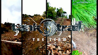
Tank Trails System
- 3
Popular Kimi Mountain Biking Trails
• 100 ★ 4.3 • 3,855 ft • 0 ft • 20 •
is a man made Downhill & Enduro trail, built by a group of friends who share love of hardcore riding & nature.
• 5 ★ 5.0 • 1,286 ft • 5 ft • 6 •
Less popular black diamond difficulty singletrack. This mountain bike primary trail can be used downhill primary and has a hard overall physical rating with a 5 ft black diamond climb. It features berm, jump, gap jump and rock garden. On average it takes 1 minutes to complete this trail.
• 70 ★ 5.0 • 1,030 ft • 0 ft • 5 •
Popular black diamond difficulty machine groomed. This mountain bike primary trail can be used downhill primary and has a moderate overall physical rating with a 0 ft black diamond climb. It features berm, jump and gap jump. Trail visibility is always easy to follow. On average it takes 1 minutes to complete this trail.
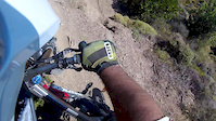
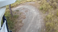
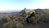
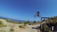
Photos of Kimi Mountain Bike
Videos of Kimi Mountain Bike

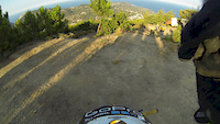
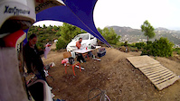
trail: Tank Trail ( Original )
8:03 |
875 |
Apr 24, 2015
trail: Tank Trail ( Original )
0:07 |
319 |
Aug 18, 2014
trail: Tank Trail ( Original )
0:08 |
763 |
Aug 18, 2014
trail: Tank Trail ( Original )
4:47 |
521 |
Dec 24, 2013
trail: Tank Trail ( Original )
4:43 |
351 |
Sep 3, 2013
trail: Tank Trail ( Original )
3:13 |
169 |
Sep 1, 2013
trail: Tank Trail ( Original )
3:22 |
519 |
Nov 14, 2012
trail: Tank Trail ( Original )
2:39 |
250 |
Jan 4, 2012
Recent Trail Reports
| status | trail | date | condition | info | user |
|---|---|---|---|---|---|
| Tank Trail TubeLine | Mar 2, 2023 @ 5:33am Mar 2, 2023 | Variable | george-georg TankTrail | ||
| Tank Trail - TopLine | Mar 2, 2023 @ 5:33am Mar 2, 2023 | Variable | george-georg TankTrail | ||
| Tank Trail ( Original ) | Mar 2, 2023 @ 1:33pm Mar 2, 2023 | Variable | george-georg TankTrail | ||
| Ridgeline | Jun 4, 2017 @ 5:03pm Jun 4, 2017 | Freeze/thaw Cycle | cgrosh |
Activity Feed
| username | action | type | title | date |
|---|---|---|---|---|
| WillieJacobsz | add | region | activity #77662756 | Aug 8, 2025 @ 6:39am Aug 8, 2025 |
| zeluzel | wishlist | region | activity #64265030 | Jan 8, 2025 @ 7:21am Jan 8, 2025 |
| zeluzel | wishlist | trail | activity #64264729 | Jan 8, 2025 @ 7:13am Jan 8, 2025 |
| darkmatterzero01 | ridden | trail | activity #61010658 | Oct 27, 2024 @ 12:53pm Oct 27, 2024 |
| george-georg | update | region | activity #44880018 | Oct 5, 2023 @ 2:20am Oct 5, 2023 |
Activity Type Stats
| activitytype | trails | distance | descent | descent distance | total vertical | rating | global rank | state rank | photos | reports | routes | ridelogs |
|---|---|---|---|---|---|---|---|---|---|---|---|---|
| Mountain Bike | 3 | 1 mile | 1,083 ft | 5,279 ft | 879 ft | #2,076 | #12 | 60 | 66 | 609 | ||
| E-Bike | 1 | 3,855 ft | 745 ft | 3,392 ft | 745 ft | #1,960 | #18 | 51 | 51 |
- By haristheodoropoulos
 HMBA TRAILFORKS & contributors
 - Admins: TankTrail
- #4271 - 5,253 views
- kimi activity log | embed map of Kimi mountain bike trails | kimi mountain biking points of interest
Downloading of trail gps tracks in kml & gpx formats is enabled for Kimi.
You must login to download files.