
close
-
Layers w
- Weather Layers
- Pro
- Pro
- Pro
- Pro
- Pro
- Pro
- More Layers
- Pro
- Pro
- Pro
- Pro
-
Upgrade to

3D
Trail Conditions
- Unknown
- Snow Groomed
- Snow Packed
- Snow Covered
- Snow Cover Partial
- Freeze/thaw Cycle
- Icy
- Prevalent Mud
- Wet
- Variable
- Ideal
- Dry
- Very Dry
Trail Flow (Ridden Direction)
Trailforks scans users ridelogs to determine the most popular direction each trail is ridden. A good flowing trail network will have most trails flowing in a single direction according to their intension.
The colour categories are based on what percentage of riders are riding a trail in its intended direction.
The colour categories are based on what percentage of riders are riding a trail in its intended direction.
- > 96%
- > 90%
- > 80%
- > 70%
- > 50%
- < 50%
- bi-directional trail
- no data
Trail Last Ridden
Trailforks scans ridelogs to determine the last time a trail was ridden.
- < 2 days
- < 1 week
- < 2 weeks
- < 1 month
- < 6 months
- > 6 months
Trail Ridden Direction
The intended direction a trail should be ridden.
- Downhill Only
- Downhill Primary
- Both Directions
- Uphill Primary
- Uphill Only
- One Direction
Contribute Details
Colors indicate trail is missing specified detail.
- Description
- Photos
- Description & Photos
- Videos
Trail Popularity ?
Trailforks scans ridelogs to determine which trails are ridden the most in the last 9 months.
Trails are compared with nearby trails in the same city region with a possible 25 colour shades.
Think of this as a heatmap, more rides = more kinetic energy = warmer colors.
- most popular
- popular
- less popular
- not popular
ATV/ORV/OHV Filter
Max Vehicle Width
inches
US Cell Coverage
Legend

Radar Time
Activity Recordings
Trailforks uses anonymized public activity data.
?
Activity Recordings
Trailforks uses anonymized public activity data.
?
Personal Heatmap
▶
Activity Types
all
/
none
▶
Options
2
Date range
month
–
Winter Trails
Warning
A routing network for winter maps does not exist. Selecting trails using the winter trails layer has been disabled.
Missing Trails
Most Popular
Least Popular
Trails are colored based on popularity. The more popular a trail is, the more red. Less popular trails trend towards green.
Jump Magnitude Heatmap
Heatmap of where riders jump on trails. Zoom in to see individual jumps, click circles to view jump details.
BC Backroad Status
![map legend]()
Service Road Atlas is a free to use, community-driven service for viewing and creating reports on the numerous back-country service roads around B.C. and Alberta.

Slope Aspect
Direction the slope faces
Trails Deemphasized
Trails are shown in grey.
Only show trails with no bike usage.
Suggested Layers
Based on selected activity type
Save the current map location and zoom level as your default home location whenever this page is loaded.
SaveKincumber Mountain is home to a large variety of mountain bike trails, ranging from multiple fire/gravel trails, intermediate level green and blue trails, and advanced black and double black trails.
Rides can begin from either side of the hill. On Kincumber side, you can park at the bottom near the school and climb up the road, or drive right up to the top and begin there. Alternatively, you can start on the Erina side around Bronzewing drive and come up the Creekbed climb and firetrail from there.
The trails on Erina side are a better option during/after wet weather, as they are more sandy and drain faster.
Avoid trails in the kincoaster, booger sugar and high school zones during wet weather.
For beginner/intermediate riders visiting for the first time, The Summit is a good trail to start on.
Once you're ready to progress into some more gravity based trails, a lap of Diggs-RDO, and then Kincoaster to Booger Sugar, are great introductions to enduro style riding at Kincumber.
Rides can begin from either side of the hill. On Kincumber side, you can park at the bottom near the school and climb up the road, or drive right up to the top and begin there. Alternatively, you can start on the Erina side around Bronzewing drive and come up the Creekbed climb and firetrail from there.
The trails on Erina side are a better option during/after wet weather, as they are more sandy and drain faster.
Avoid trails in the kincoaster, booger sugar and high school zones during wet weather.
For beginner/intermediate riders visiting for the first time, The Summit is a good trail to start on.
Once you're ready to progress into some more gravity based trails, a lap of Diggs-RDO, and then Kincoaster to Booger Sugar, are great introductions to enduro style riding at Kincumber.
Primary Trail Type: All-Mountain & Downhill
Shuttleable: YES
Land Status: Managed by Local Riding Association
 google parking directions
 Activities Click to view
- Mountain Bike
59 trails
- E-Bike
37 trails
- Hike
34 trails
- Trail Running
34 trails
Region Details
- 10
- 5
- 18
- 14
- 4
Region Status
Open as of Jul 2, 2026

Stats
- Avg Trail Rating
- Trails (view details)
- 51
- Trails Mountain Bike
- 59
- Trails E-Bike
- 37
- Trails Hike
- 34
- Trails Trail Running
- 34
- Total Distance
- 16 miles
- Total Descent
- 4,466 ft
- Total Vertical
- 551 ft
- Highest Trailhead
- 651 ft
- Reports
- 620
- Photos
- 85
- Ridden Counter
- 9,900
Popular Kincumba Mountain Mountain Biking Trails
• 90 ★ 3.5 • 2,618 ft • 245 ft • 370 •
Climbing trail from Bronzewing Drive which finishes at the 3-way fire trail junciton (close to the entry of Gary's, and trails).
• 95 ★ 4.0 • 971 ft • 9 ft • 369 •
Popular green difficulty singletrack. This mountain bike primary trail can be used both directions. On average it takes 1 minutes to complete this trail.
• 100 ★ 4.6 • 2,697 ft • 5 ft • 363 •
Flowy, twisty single track. Quite narrow through the trees. There are a couple of fencing barriers to ride around.
• 60 ★ 3.9 • 4,760 ft • 114 ft • 362 •
is a great track to learn to mountain bike on and has a great variety of twists & turns plus A & B line options around a couple of rock drop offs. It is also a connector from one fire trail to another and also for access to track.
• 75 ★ 4.0 • 3,927 ft • 63 ft • 298 •
Flowing track, no overly difficult sections, reasonably level ride on side of hill
• 95 ★ 4.2 • 3,143 ft • 84 ft • 295 •
Popular blue difficulty singletrack. This mountain bike primary trail can be used both directions. On average it takes 6 minutes to complete this trail.
• 70 ★ 3.0 • 1,342 ft • 0 ft • 289 •
Over The Rocks can be accessed next to the radio tower (there is a second entry at rider's right of this entry point with a rock roll down a large boulder). Lower down the trail splits off in two, with the left option leading towards 3...
• 80 ★ 3.6 • 535 ft • 0 ft • 273 •
Popular blue difficulty singletrack. This mountain bike primary trail can be used downhill primary. It features berm, drop, jump, gap jump and rock garden. On average it takes minutes to complete this trail.
Kincumba Mountain Mountain Bike Routes
★ 4.0 • 4,859 ft • 368 ft • 0 •
This Climbing Route is up the road used by almost everyone intending to ride Kincumber Mountain Trails....
★ 3.4 • 11 miles • 1,790 ft • 36 • Loop •
This is a guided tour of Kincumba Mountain
Photos of Kincumba Mountain Mountain Bike
Videos of Kincumba Mountain Mountain Bike
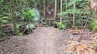
trail: Diggz - RDO
0:18 |
26 |
Apr 9, 2026
trail: Half Turkey
10:27 |
84 |
Oct 27, 2025 , Terrigal
trail: KDP
10:27 |
73 |
Oct 27, 2025 , Terrigal
trail: El Diablo
10:27 |
110 |
Oct 27, 2025 , Terrigal
Recent Trail Reports
Activity Feed
| username | action | type | title | date |
|---|---|---|---|---|
| Zaneoo | comment | trail | activity #99588588 | Jul 19, 2026 @ 10:17pm 2 days |
| ytei | add | report | activity #98315816 and 4 more | Jul 2, 2026 @ 11:20pm Jul 2, 2026 |
| pD5qmq | comment | trail | activity #96942413 | Jun 14, 2026 @ 12:30am Jun 14, 2026 |
| Willharvey04 | ridden | trail | activity #96939975 and 6 more | Jun 13, 2026 @ 10:50pm Jun 13, 2026 |
| JohnMatthews75 | ridden | trail | activity #93925744 | May 3, 2026 @ 2:17am May 3, 2026 |
Recent Comments
| username | type | title | comment | date |
|---|---|---|---|---|
| trail | Or maybe I was on the wrong track | Jul 19, 2026 @ 10:23pm 2 days | ||
| trail | Not a trail but a walking track. You would use... | Jul 19, 2026 @ 10:17pm 2 days | ||
| trail | Very fun but not for the weak | Jun 14, 2026 @ 12:30am Jun 14, 2026 | ||
| trail | Some surprisingly wet patches despite all the sand | Sep 13, 2025 @ 7:41pm Sep 13, 2025 | ||
| trail | Riding well, mostly dry | Sep 13, 2025 @ 7:40pm Sep 13, 2025 |
Nearby Areas
| name | distance | ||||
|---|---|---|---|---|---|
| South Kincumber | 9 | 2 | 2 | 2.4 km | |
| Bouddi National Park | 5 | 17 | 6 | 4.1 km | |
| Brisbane Water National Park | 1 | 7 | 3 | 6.2 km | |
| Nagari Enduro Network | 6.3 km | ||||
| Stickland State Forest | 2 | 1 | 6.3 km |
Local Badges
-

Completionist9 awarded
Bike & Skill Parks
| name | type | city | rating |
|---|---|---|---|
| Terrigal BMX Track | skill park | Terrigal |
Activity Type Stats
| activitytype | trails | distance | descent | descent distance | total vertical | rating | global rank | state rank | photos | reports | routes | ridelogs |
|---|---|---|---|---|---|---|---|---|---|---|---|---|
| Mountain Bike | 59 | 16 miles | 4,465 ft | 9 miles | 551 ft | #1,174 | #64 | 85 | 620 | 2 | 10,736 | |
| E-Bike | 37 | 10 miles | 2,776 ft | 6 miles | 551 ft | #2,225 | #103 | 629 | 2 | 2,680 | ||
| Hike | 34 | 9 miles | 1,709 ft | 4 miles | 551 ft | #5,227 | #141 | 630 | 1 | 388 | ||
| Trail Running | 34 | 9 miles | 1,709 ft | 4 miles | 551 ft | #4,126 | #112 | 629 | 1 | 648 |
Frequently Asked Questions About Kincumba Mountain
▼
What are the highest rated mountain biking trails in Kincumba Mountain?
The highest rated mountain biking trails in Kincumba Mountain are:
- Pegasus (4.5/5)
- Diggz - RDO (4.3/5)
- Russian Track (4.2/5)
- Half Turkey (4.1/5)
- Booger Sugar (4.1/5)
▼
What is the best time of the year to ride in Kincumba Mountain?
Based on ride log data, the most popular months to ride in Kincumba Mountain are:
- July (120 activities)
- April (64 activities)
- August (59 activities)
▼
Where can I park to ride in Kincumba Mountain?
There are 5 parking locations listed in Kincumba Mountain. The most popular parking spots are: View all parking and trailhead locations on the map to plan your visit.
▼
What is the longest trail in Kincumba Mountain?
The longest trail in Kincumba Mountain is Diggz - RDO at 1.5 miles. View all trails sorted by distance.
Activities
Trails
Points of Interest
- By bradscarfe & contributors
- Admins: CCMTB, StifWhip
- #13358 - 39,616 views
- kincumba mountain activity log | embed map of Kincumba Mountain mountain bike trails | kincumba mountain mountain biking points of interest
Downloading of trail gps tracks in kml & gpx formats is enabled for Kincumba Mountain.
You must login to download files.