close
-
Layers w
- Weather Layers
- Pro
- Pro
- Pro
- Pro
- Pro
- Pro
- More Layers
- Pro
- Pro
- Pro
- Pro
-
Upgrade to

3D
Trail Conditions
- Unknown
- Snow Groomed
- Snow Packed
- Snow Covered
- Snow Cover Partial
- Freeze/thaw Cycle
- Icy
- Prevalent Mud
- Wet
- Variable
- Ideal
- Dry
- Very Dry
Trail Flow (Ridden Direction)
Trailforks scans users ridelogs to determine the most popular direction each trail is ridden. A good flowing trail network will have most trails flowing in a single direction according to their intension.
The colour categories are based on what percentage of riders are riding a trail in its intended direction.
The colour categories are based on what percentage of riders are riding a trail in its intended direction.
- > 96%
- > 90%
- > 80%
- > 70%
- > 50%
- < 50%
- bi-directional trail
- no data
Trail Last Ridden
Trailforks scans ridelogs to determine the last time a trail was ridden.
- < 2 days
- < 1 week
- < 2 weeks
- < 1 month
- < 6 months
- > 6 months
Trail Ridden Direction
The intended direction a trail should be ridden.
- Downhill Only
- Downhill Primary
- Both Directions
- Uphill Primary
- Uphill Only
- One Direction
Contribute Details
Colors indicate trail is missing specified detail.
- Description
- Photos
- Description & Photos
- Videos
Trail Popularity ?
Trailforks scans ridelogs to determine which trails are ridden the most in the last 9 months.
Trails are compared with nearby trails in the same city region with a possible 25 colour shades.
Think of this as a heatmap, more rides = more kinetic energy = warmer colors.
- most popular
- popular
- less popular
- not popular
ATV/ORV/OHV Filter
Max Vehicle Width
inches
US Cell Coverage
Legend

Radar Time
Activity Recordings
Trailforks uses anonymized public activity data.
?
Activity Recordings
Trailforks uses anonymized public activity data.
?
Personal Heatmap
▶
Activity Types
all
/
none
▶
Options
2
Date range
month
–
Winter Trails
Warning
A routing network for winter maps does not exist. Selecting trails using the winter trails layer has been disabled.
Missing Trails
Most Popular
Least Popular
Trails are colored based on popularity. The more popular a trail is, the more red. Less popular trails trend towards green.
Jump Magnitude Heatmap
Heatmap of where riders jump on trails. Zoom in to see individual jumps, click circles to view jump details.
BC Backroad Status
![map legend]()
Service Road Atlas is a free to use, community-driven service for viewing and creating reports on the numerous back-country service roads around B.C. and Alberta.

Slope Aspect
Direction the slope faces
Trails Deemphasized
Trails are shown in grey.
Only show trails with no bike usage.
Suggested Layers
Based on selected activity type
Save the current map location and zoom level as your default home location whenever this page is loaded.
SaveTrails are open for the 2026 season
Please purchase your membership prior to accessing the trails: https://www.kingdomtrails.org/membership
Check trail network status at www.kingdomtrails.org/Trail-Conditions or contact the KT Welcome Center at [email protected] or 802-626-0737.
Report trail conditions using the TrailForks app, or contact the Kingdom Trails welcome center at 802-626-0737 or [email protected]. As always, enjoy and Ride with Gratitude!
Most of the trails in the Kingdom are on private property that more than 100 landowners make available to the Kingdom Trail Association (KTA) for our enjoyment. Retaining the goodwill of the landowners is critical for the future of Kingdom Trails, and if you meet one of them on the trails or in town, please express your appreciation.
Kingdom Trails is managed by the Kingdom Trail Association (KTA), a 501(c)3 charitable organization established in 1994 by a group of visionary residents and business leaders in the area. They aim to encourage the recreational use of Vermont's ecologically sensitive Northeast Kingdom and promote the region's natural beauty.
For more information on KTA, the trails, the community, and hospitality options, please visit the Kingdom Trails Website at the link below.
Primary Trail Type: Cross-Country
eBikes Allowed:
Yes
Shuttleable: YES
Land Status: Private Property
Land Manager: Kingdom Trail Association
 google parking directions
 Access Info:
THE KINGDOM TRAILS WELCOME CENTER IS LOCATED AT 478 VT RTE114 IN THE VILLAGE OF EAST BURKE
Parking and restroom facilities are available.
Parking and restroom facilities are available.
Disclaimer:
RIDE WITH GRATITUDE
https://www.kingdomtrails.org/ride-with-gratitude
RESPECT THIS GIFT
Riding trails on public lands is a gift, not a right. That hiker you just passed? She might own the land we're riding on. With Every ride, let's remember to be grateful for the landowners and others who make it possible.
PROTECT NATURE
Enjoy nature, don't ruin it. Keep on the trails. Erosion is our single highest impact when we're out riding. Skidding causes erosion. Cutting corners can cut off access. Riding muddy trails messes it up for everyone. If we see animals, don't bother them, remember them. Pick up trash, pack it out, carpool here and back.
CARE FOR OTHERS
We share the trails with others, and they have the same rights and responsibilities as each of us. If someone needs help, we help. If someone needs encouragement, we share our enthusiasm. And if it's going to make the situation better, we dismount. Be nice, yield to others, and give a smile.
BE THE EXAMPLE
Being aggressive has no place in mountain biking. We know our limits, and we ride within them. Beyond the ride, let's park where we're supposed to, keep the tunes to a dull roar, and leave the IPAs for apres somewhere else. Reckless behaviour? A simple, polite call out will do.
Links
- Purchase a membership
- Sign the one-time on-line Waiver
- Summer Trail Map
- Winter Trail Map & Fat Biking Information
- Kingdom Trails Website
- Kingdom Trails Facebook Page
- Ride with Gratitude
- eMTB Policy
Files
Activities Click to view
- Mountain Bike
221 trails
- E-Bike
230 trails
- Hike
197 trails
- Trail Running
166 trails
- Snowmobile
7 trails
- Snowshoe
84 trails
- Backcountry Ski
17 trails
- Nordic Ski
27 trails
Region Details
- 16
- 37
- 98
- 41
- 2
- 6
Region Status
Open as of 23 hoursStats
- Avg Trail Rating
- Trails (view details)
- 224
- Trails Mountain Bike
- 224
- Trails E-Bike
- 230
- Trails Hike
- 197
- Trails Trail Running
- 166
- Trails Snowmobile
- 7
- Trails Snowshoe
- 84
- Trails Backcountry Ski
- 17
- Trails Nordic Ski
- 27
- Total Distance
- 128 miles
- Total Descent
- 18,083 ft
- Total Vertical
- 1,018 ft
- Highest Trailhead
- 1,729 ft
- Reports
- 11,923
- Photos
- 1,564
- Ridden Counter
- 411,382
Articles

Vermont's 5 Most Popular Trail Networks According to Trailforks Data
Oct 19, 2021 from pinkbike.com
What the Green Mountain State lacks in square mileage, it more than makes up for in its sheer volume of mountain bike trails.
Popular Kingdom Trails Mountain Biking Trails
• 100 ★ 5.0 • 2 miles • 10 ft • 7,358 •
2 miles of downhill exhilaration! Extremely well maintained
• 100 ★ 3.2 • 1,086 ft • 10 ft • 7,227 •
(Downtown) is a fast, flowy trail between the above and b over the Passumsic River down in East Burke . This trail serves to keep riders of which can become quite congested and potentially dangerous with traffic.
• 95 ★ 4.6 • 1,965 ft • 53 ft • 6,485 •
is one of Kingdom Trails’ Top Ten trails in the Trailforks Global Trail Rankings. The ranking is done by an algorithm that takes into account a number of uniform criteria that defines popularity amongst trail users world-wide. is,...
• 95 ★ 4.1 • 2,844 ft • 14 ft • 6,419 •
is one of Kingdom Trails’ Top Ten trails in the Trailforks Global Trail Rankings. The ranking is done by an algorithm that takes into account a number of uniform criteria that defines popularity amongst trail users world-wide. is...
• 90 ★ 4.4 • 2,188 ft • 11 ft • 5,886 •
The Heaven's Bench lookout point is one of the most photographed scenic location in the entire Kingdom. The trail is a relatively easy trail suitable for all levels of riders. It has no significant obstacles and the ride surface is...
• 100 ★ 4.0 • 1,654 ft • 71 ft • 5,465 •
Highly rated popular green difficulty singletrack. This multi-use trail can be used one direction and has a easy overall physical rating with a 71 ft green climb. Trail visibility is always easy to follow. On average it takes 3 minutes to complete this trail.
• 90 ★ 4.3 • 4,938 ft • 231 ft • 5,260 •
is an awesome, moderately technical trail suitable for confident intermediate riders and above, traversing the steep hill side at the southern end of Darling Hill. The trail surface is relatively smooth, packed soil, with intermittent...
• 95 ★ 4.4 • 4,321 ft • 193 ft • 5,182 •
is a moderately technical switchback trail from the bottom end of and , back up to the top at the Market Café / Old Web's area. In addition to the wide switchbacks, the trail traverses the hillside roughly along contours, but with many...
Kingdom Trails Mountain Bike Routes
★ 5.0 • 7 miles • 1,029 ft • 16 • Loop •
Kingdom Trails Intermediate Suggested Route: 8 mile intermediate rider friendly route on green circle,...
★ 5.0 • 7 miles • 744 ft • 8 • Loop •
Fall From Heaven: Moderately Challenging; 7 miles; 900 feet total elevation gain; allow approx. 60-75...
★ 3.4 • 13 miles • 1,739 ft • 8 • Loop •
Kingdom Trails Intermediate Suggested Route: 12 mile with 1800ft of designed for intermediate riders on...
KT Beginner Route: VSS Featured
2 miles • 331 ft • 7 • Loop •
A 2.5 mile with 400ft of . This route is designed for beginner riders and follows green circle and blue...
3 miles • 263 ft • 2 • Loop •
Kingdom Trails Beginner Suggested Route: 3 mile with 250ft of designed for beginner riders. This route...
2 miles • 135 ft • 4 • Loop •
Kingdom Trails Beginner Suggested Route: 2.5 mile beginner rider friendly route on green circle and blue...
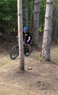
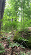
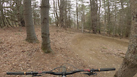
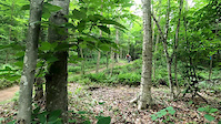
Photos of Kingdom Trails Mountain Bike
Videos of Kingdom Trails Mountain Bike
trail: Drop It!
0:08 |
542 |
Sep 19, 2024
trail: Stormin Norman
0:08 |
331 |
Jul 27, 2022
trail: Sean's Showdown
0:34 |
409 |
May 3, 2022

trail: Pines
0:17 |
|
Feb 27, 2022
trail: Stormin Norman
0:06 |
670 |
Jul 9, 2021

trail: Stormin Norman
6:43 |
207 |
Apr 8, 2020
trail: Stormin Norman
0:16 |
359 |
Aug 31, 2019
trail: Black Bear
9:09 |
375 |
Oct 8, 2018
Recent Trail Reports
Activity Feed
| username | action | type | title | date |
|---|---|---|---|---|
| VTVOL | vote | trail | activity #97219949 and 1 more | Jun 17, 2026 @ 5:25pm 17 hours |
| MatthewOBrien3Qj | add | report | activity #97196366 | Jun 17, 2026 @ 10:58am 23 hours |
| ball4759 | wishlist | route | activity #97181774 and 2 more | Jun 17, 2026 @ 7:23am 1 day |
| Glancingaft | vote | trail | activity #97172778 and 1 more | Jun 17, 2026 @ 4:06am 1 day |
| Ilan-KT | add | trail | activity #97125315 and 1 more | Jun 16, 2026 @ 11:15am 2 days |
Recent Comments
| username | type | title | comment | date |
|---|---|---|---|---|
| report | Ridden on May 25,2026, it appears that the... | May 25, 2026 @ 12:32pm May 25, 2026 | ||
| trail | Definitely my favorite trail here, such a... | Apr 4, 2026 @ 5:46pm Apr 4, 2026 | ||
| report | Trees down | Dec 20, 2025 @ 5:30am Dec 20, 2025 | ||
| report | It is my pleasure Geoff! | Oct 12, 2025 @ 6:32pm Oct 12, 2025 | ||
| report | Thank you Rick for hosting trails and making... | Oct 12, 2025 @ 2:52pm Oct 12, 2025 |
Nearby Areas
| name | distance | ||||
|---|---|---|---|---|---|
| Burke Mountain Resort | 3 | 3 | 12 | 4 | 2.3 km |
| Lyndon Outing Club | 1 | 2 | 4.6 km | ||
| Victory Hill Sector | 1 | 9 | 2 | 4.8 km | |
| NVRH Trails | 2 | 2 | 10.6 km | ||
| Saint Johnsbury Municipal Forest | 3 | 11.8 km |
Local Badges
-

Completionist1 awarded
Bike & Skill Parks
| name | type | city | rating |
|---|---|---|---|
| East Burke Village Pump Track | skill park | East Burke | |
| Skills Park | skill park | East Burke | |
| Balance Bike Skills Park | skill park | East Burke |
Activity Type Stats
| activitytype | trails | distance | descent | descent distance | total vertical | rating | global rank | state rank | photos | reports | routes | ridelogs |
|---|---|---|---|---|---|---|---|---|---|---|---|---|
| Mountain Bike | 221 | 116 miles | 16,289 ft | 51 miles | 1,017 ft | #13 | #5 | 1,519 | 11,678 | 75 | 71,245 | |
| E-Bike | 230 | 127 miles | 18,041 ft | 56 miles | 1,017 ft | #163 | #549 | 13 | 5,011 | 1 | 1,513 | |
| Hike | 197 | 108 miles | 16,135 ft | 48 miles | 1,017 ft | #442 | 17 | 11,576 | 614 | |||
| Trail Running | 166 | 101 miles | 15,007 ft | 45 miles | 1,017 ft | #537 | #215 | 7 | 7,005 | 1 | 512 | |
| Snowmobile | 7 | 4 miles | 338 ft | 1 mile | 299 ft | #16 | #4 | 516 | 9 | |||
| Snowshoe | 84 | 35 miles | 4,541 ft | 16 miles | 761 ft | #59 | #25 | 6,064 | 97 | |||
| Backcountry Ski | 17 | 3 miles | 302 ft | 1 mile | 686 ft | #79 | #20 | 5,001 | 123 | |||
| Nordic Ski | 27 | 5 miles | 295 ft | 2 miles | 686 ft | #279 | #70 | 5,670 | 93 |
Frequently Asked Questions About Kingdom Trails
▼
What are the highest rated mountain biking trails in Kingdom Trails?
The highest rated mountain biking trails in Kingdom Trails are:
- Black Bear (4.9/5)
- Stormin Norman (4.6/5)
- Lou Lou's (4.6/5)
- Moose Alley (4.6/5)
- Pete's Dragon (4.5/5)
▼
What is the best time of the year to ride in Kingdom Trails?
Based on ride log data, the most popular months to ride in Kingdom Trails are:
- September (1,625 activities)
- July (1,615 activities)
- August (1,604 activities)
▼
Where can I park to ride in Kingdom Trails?
There are 13 parking locations listed in Kingdom Trails. The most popular parking spots are:
- Village Sport Shop Trailside Parking
- Mountain View Farm Parking Area
- Kingdom Trails Nordic Center Parking
- New Haven River School Parking
- Main Parking at Mike's Tiki Bar
▼
What is the longest trail in Kingdom Trails?
The longest trail in Kingdom Trails is White School at 2.7 miles. View all trails sorted by distance.
Activities
Trails
- By gwhitch
 & contributors
 - Admins: KTA
- #31162 - 85,073 views
- kingdom trails activity log | embed map of Kingdom Trails mountain bike trails | kingdom trails mountain biking points of interest polygons
Downloading of trail gps tracks in kml & gpx formats is enabled for Kingdom Trails.
You must login to download files.