close
-
Layers w
- Weather Layers
- Pro
- Pro
- Pro
- Pro
- Pro
- Pro
- More Layers
- Pro
- Pro
- Pro
- Pro
-
Upgrade to

3D
Trail Conditions
- Unknown
- Snow Groomed
- Snow Packed
- Snow Covered
- Snow Cover Partial
- Freeze/thaw Cycle
- Icy
- Prevalent Mud
- Wet
- Variable
- Ideal
- Dry
- Very Dry
Trail Flow (Ridden Direction)
Trailforks scans users ridelogs to determine the most popular direction each trail is ridden. A good flowing trail network will have most trails flowing in a single direction according to their intension.
The colour categories are based on what percentage of riders are riding a trail in its intended direction.
The colour categories are based on what percentage of riders are riding a trail in its intended direction.
- > 96%
- > 90%
- > 80%
- > 70%
- > 50%
- < 50%
- bi-directional trail
- no data
Trail Last Ridden
Trailforks scans ridelogs to determine the last time a trail was ridden.
- < 2 days
- < 1 week
- < 2 weeks
- < 1 month
- < 6 months
- > 6 months
Trail Ridden Direction
The intended direction a trail should be ridden.
- Downhill Only
- Downhill Primary
- Both Directions
- Uphill Primary
- Uphill Only
- One Direction
Contribute Details
Colors indicate trail is missing specified detail.
- Description
- Photos
- Description & Photos
- Videos
Trail Popularity ?
Trailforks scans ridelogs to determine which trails are ridden the most in the last 9 months.
Trails are compared with nearby trails in the same city region with a possible 25 colour shades.
Think of this as a heatmap, more rides = more kinetic energy = warmer colors.
- most popular
- popular
- less popular
- not popular
ATV/ORV/OHV Filter
Max Vehicle Width
inches
US Cell Coverage
Legend

Radar Time
Activity Recordings
Trailforks uses anonymized public activity data.
?
Activity Recordings
Trailforks uses anonymized public activity data.
?
Personal Heatmap
▶
Activity Types
all
/
none
▶
Options
2
Date range
month
–
Winter Trails
Warning
A routing network for winter maps does not exist. Selecting trails using the winter trails layer has been disabled.
Missing Trails
Most Popular
Least Popular
Trails are colored based on popularity. The more popular a trail is, the more red. Less popular trails trend towards green.
Jump Magnitude Heatmap
Heatmap of where riders jump on trails. Zoom in to see individual jumps, click circles to view jump details.
BC Backroad Status
![map legend]()
Service Road Atlas is a free to use, community-driven service for viewing and creating reports on the numerous back-country service roads around B.C. and Alberta.

Slope Aspect
Direction the slope faces
Trails Deemphasized
Trails are shown in grey.
Only show trails with no bike usage.
Suggested Layers
Based on selected activity type
Save the current map location and zoom level as your default home location whenever this page is loaded.
Save
No description for Kingsport has been added yet!
Login or register to submit one.
Activities Click to view
- Mountain Bike
43 trails
- Gravel Bike
0 trails
- Adaptive Bike
0 trails
- Hike
46 trails
- Trail Running
41 trails
Region Details
- 11
- 1
- 4
- 15
- 11
Region Status
Open as of Nov 14, 2025Stats
- Avg Trail Rating
- Trails (view details)
- 47
- Trails Mountain Bike
- 43
- Trails E-Bike
- 3
- Trails Hike
- 46
- Trails Trail Running
- 41
- Total Distance
- 63 miles
- Total Descent
- 10,042 ft
- Total Vertical
- 1,218 ft
- Highest Trailhead
- 2,380 ft
- Reports
- 302
- Photos
- 112
- Ridden Counter
- 3,328
Sub Regions
-
Bays Mountain Park
- 2
- 8
- 4
-
Kingsport Greenbelt
-
Warriors Path State Park
- 1
- 1
- 6
- 5
Popular Kingsport Mountain Biking Trails
• 95 ★ 2.8 • 2 miles • 251 ft • 209 •
Popular black diamond difficulty singletrack. This mountain bike primary trail can be used both directions. It features rock garden. On average it takes 13 minutes to complete this trail.
• 80 ★ 4.0 • 2 miles • 259 ft • 198 •
Highly rated popular black diamond difficulty singletrack. This mountain bike primary trail can be used downhill primary. It features rock garden. On average it takes 31 minutes to complete this trail.
• 90 ★ 4.0 • 1,683 ft • 78 ft • 190 •
Popular blue difficulty singletrack. This mountain bike primary trail can be used downhill primary. On average it takes 4 minutes to complete this trail.
• 85 ★ 3.3 • 951 ft • 47 ft • 184 •
Popular black diamond difficulty singletrack. This mountain bike primary trail can be used downhill only. On average it takes 2 minutes to complete this trail.
• 100 ★ 0.0 • 2 miles • 219 ft • 171 •
Popular green difficulty singletrack. This multi-use trail can be used both directions. On average it takes 18 minutes to complete this trail.
• 85 ★ 3.8 • 2 miles • 847 ft • 161 •
Popular blue difficulty singletrack. This mountain bike primary trail can be used both directions. On average it takes 23 minutes to complete this trail.
• 70 ★ 2.7 • 2,348 ft • 266 ft • 155 •
Popular blue difficulty singletrack. This mountain bike primary trail can be used both directions. On average it takes 7 minutes to complete this trail.
• 90 ★ 2.0 • 1,446 ft • 115 ft • 137 •
Popular blue difficulty singletrack. This mountain bike primary trail can be used both directions. On average it takes 2 minutes to complete this trail.
Kingsport Mountain Bike Routes
7 miles • 464 ft • 5 • Loop •
This is a very common sequence of trails at Bay's Mountain. Most mountain bikers park at the "upper"...
Photos of Kingsport Mountain Bike
Videos of Kingsport Mountain Bike
youtuber
![SHREDDING FALL LEAVES! | October MTB POV]()
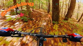
trail: Bays Ridge Trail
15:42 |
61 |
Oct 21, 2025 , Kingsport
Recent Trail Reports
| status | trail | date | condition | info | user |
|---|---|---|---|---|---|
| Rock City | Nov 14, 2025 @ 1:28pm (America/New_York) Nov 14, 2025 | Variable | steuer | ||
| Boneyard | Nov 14, 2025 @ 1:27pm (America/New_York) Nov 14, 2025 | Ideal | steuer | ||
| Zipline | Nov 14, 2025 @ 1:27pm (America/New_York) Nov 14, 2025 | Ideal | steuer | ||
| Darwin's Revenge | Nov 14, 2025 @ 1:27pm (America/New_York) Nov 14, 2025 | Ideal | steuer | ||
| Ridge Top | Nov 14, 2025 @ 1:27pm (America/New_York) Nov 14, 2025 | Ideal | steuer | ||
| Paw Paw | Feb 9, 2025 @ 12:25pm Feb 9, 2025 | Ideal | carraig042 | ||
| White Tail Loop | Feb 9, 2025 @ 12:25pm Feb 9, 2025 | Ideal | carraig042 | ||
| Wahoo | Feb 9, 2025 @ 12:25pm Feb 9, 2025 | Ideal | carraig042 | ||
| Moonshiner's Delight | Oct 19, 2024 @ 12:43pm Oct 19, 2024 | Dry | Jdjohnson82 | ||
| River Mountain Road | Oct 19, 2024 @ 12:43pm Oct 19, 2024 | Dry | Jdjohnson82 |
Activity Feed
| username | action | type | title | date |
|---|---|---|---|---|
| BallsDeep50 | ridden | trail | activity #92141007 and 2 more | Apr 7, 2026 @ 2:17pm Apr 7, 2026 |
| BallsDeep50 | ridden | trail | activity #91936115 and 1 more | Apr 4, 2026 @ 3:13pm Apr 4, 2026 |
| Cingltrak1 | wishlist | region | activity #91879954 | Apr 4, 2026 @ 3:35am Apr 4, 2026 |
| nvmEYM2Z | ridden | trail | activity #91237997 and 2 more | Mar 24, 2026 @ 5:43pm Mar 24, 2026 |
| BallsDeep50 | ridden | trail | activity #91235826 and 4 more | Mar 24, 2026 @ 5:07pm Mar 24, 2026 |
Recent Comments
| username | type | title | comment | date |
|---|---|---|---|---|
| trail | This trail has been renamed. The new name is... | Aug 29, 2025 @ 6:14pm Aug 29, 2025 | ||
| trail | Fun trails for a quick ride if you’re... | Sep 20, 2021 @ 9:28am Sep 20, 2021 | ||
| trail | Fun trails for a quick ride if you’re... | Sep 20, 2021 @ 9:27am Sep 20, 2021 | ||
| trail | Fun trails for a quick ride if you’re... | Sep 20, 2021 @ 9:26am Sep 20, 2021 | ||
| trail | The signs at the park show this is a black... | Apr 25, 2020 @ 2:05pm Apr 25, 2020 |
Local Badges
-

10 Blue Trails47 awarded -

Epic Ride Climb 2k7 awarded -

Climbing 10k Badge18 awarded -

Climbing 100k Badge1 awarded -

Epic Ride Descent 2k7 awarded -

Descent 10k Badge18 awarded
Bike & Skill Parks
| name | type | city | rating |
|---|---|---|---|
| Muddy Creek Raceway | skill park | Kingsport |
Activity Type Stats
| activitytype | trails | distance | descent | descent distance | total vertical | rating | global rank | state rank | photos | reports | routes | ridelogs |
|---|---|---|---|---|---|---|---|---|---|---|---|---|
| Mountain Bike | 43 | 58 miles | 9,383 ft | 25 miles | 1,217 ft | #3,428 | #1,174 | 112 | 301 | 1 | 4,187 | |
| E-Bike | 3 | 2 miles | 243 ft | 659 ft | 246 | 241 | ||||||
| Hike | 46 | 59 miles | 9,393 ft | 24 miles | 1,217 ft | #1,372 | #629 | 299 | 164 | |||
| Trail Running | 41 | 58 miles | 9,242 ft | 24 miles | 1,217 ft | #3,925 | #1,180 | 299 | 87 |
Frequently Asked Questions About Kingsport
▼
What are the best places to ride in Kingsport?
Kingsport has 3 areas to explore for mountain biking. The top rated areas are:
▼
What are the highest rated mountain biking trails in Kingsport?
The highest rated mountain biking trails in Kingsport are:
- Chinquapin (4.2/5)
- Big Oak (4.2/5)
- Moonshiner's Delight (4.2/5)
- Boneyard (4/5)
- Magic Carpet Ride (4/5)
▼
What is the best time of the year to ride in Kingsport?
Based on ride log data, the most popular months to ride in Kingsport are:
- July (80 activities)
- August (74 activities)
- September (62 activities)
▼
Where can I park to ride in Kingsport?
Trails
- By brenthillier
 NSMBA TRAILFORKS & contributors
 - Admins: apply
- #10780 - 3,765 views
- kingsport activity log | embed map of Kingsport mountain bike trails | kingsport mountain biking points of interest
Downloading of trail gps tracks in kml & gpx formats is enabled for Kingsport.
You must login to download files.