close
-
Layers w
- Weather Layers
- Pro
- Pro
- Pro
- Pro
- Pro
- Pro
- More Layers
- Pro
- Pro
- Pro
- Pro
-
Upgrade to

3D
Trail Conditions
- Unknown
- Snow Groomed
- Snow Packed
- Snow Covered
- Snow Cover Partial
- Freeze/thaw Cycle
- Icy
- Prevalent Mud
- Wet
- Variable
- Ideal
- Dry
- Very Dry
Trail Flow (Ridden Direction)
Trailforks scans users ridelogs to determine the most popular direction each trail is ridden. A good flowing trail network will have most trails flowing in a single direction according to their intension.
The colour categories are based on what percentage of riders are riding a trail in its intended direction.
The colour categories are based on what percentage of riders are riding a trail in its intended direction.
- > 96%
- > 90%
- > 80%
- > 70%
- > 50%
- < 50%
- bi-directional trail
- no data
Trail Last Ridden
Trailforks scans ridelogs to determine the last time a trail was ridden.
- < 2 days
- < 1 week
- < 2 weeks
- < 1 month
- < 6 months
- > 6 months
Trail Ridden Direction
The intended direction a trail should be ridden.
- Downhill Only
- Downhill Primary
- Both Directions
- Uphill Primary
- Uphill Only
- One Direction
Contribute Details
Colors indicate trail is missing specified detail.
- Description
- Photos
- Description & Photos
- Videos
Trail Popularity ?
Trailforks scans ridelogs to determine which trails are ridden the most in the last 9 months.
Trails are compared with nearby trails in the same city region with a possible 25 colour shades.
Think of this as a heatmap, more rides = more kinetic energy = warmer colors.
- most popular
- popular
- less popular
- not popular
ATV/ORV/OHV Filter
Max Vehicle Width
inches
US Cell Coverage
Legend

Radar Time
Activity Recordings
Trailforks uses anonymized public activity data.
?
Activity Recordings
Trailforks uses anonymized public activity data.
?
Personal Heatmap
▶
Activity Types
all
/
none
▶
Options
2
Date range
month
–
Winter Trails
Warning
A routing network for winter maps does not exist. Selecting trails using the winter trails layer has been disabled.
Missing Trails
Most Popular
Least Popular
Trails are colored based on popularity. The more popular a trail is, the more red. Less popular trails trend towards green.
Jump Magnitude Heatmap
Heatmap of where riders jump on trails. Zoom in to see individual jumps, click circles to view jump details.
BC Backroad Status
![map legend]()
Service Road Atlas is a free to use, community-driven service for viewing and creating reports on the numerous back-country service roads around B.C. and Alberta.

Slope Aspect
Direction the slope faces
Trails Deemphasized
Trails are shown in grey.
Only show trails with no bike usage.
Suggested Layers
Based on selected activity type
Save the current map location and zoom level as your default home location whenever this page is loaded.
Save
No description for Kinnelon has been added yet!
Login or register to submit one.
Activities Click to view
- Mountain Bike
11 trails
- E-Bike
5 trails
- Gravel Bike
0 trails
- Adaptive Bike
- Winter Fat Bike
0 trails
- Hike
16 trails
- Trail Running
10 trails
- Nordic Ski
5 trails
Region Details
- 7
- 1
- 2
Region Status
Caution as of May 29, 2026Local Trail Association
Stats
- Trails (view details)
- 15
- Trails Mountain Bike
- 11
- Trails E-Bike
- 5
- Trails Hike
- 16
- Trails Trail Running
- 10
- Trails Nordic Ski
- 5
- Total Distance
- 9 miles
- Total Descent Distance
- 5 miles
- Total Descent
- 1,284 ft
- Total Vertical
- 346 ft
- Highest Trailhead
- 1,043 ft
- Reports
- 92
- Photos
- 12
- Ridden Counter
- 728
Sub Regions
-
Farny State Park
-
Rockaway Open Space
- 2
- 1
-
Silas Condit County Park
- 1
- 2
-
Telemark Trails
- 8
- 13
- 4
Popular Kinnelon Mountain Biking Trails
• 85 ★ 5.0 • 1,818 ft • 65 ft • 238 •
Popular black diamond difficulty singletrack. This mountain bike primary trail can be used both directions and has a hard overall physical rating with a 65 ft blue climb. It features a-frame, drop, rock garden and skinny. On average it takes 4 minutes to complete this trail.
• 95 ★ 5.0 • 879 ft • 16 ft • 222 •
Popular blue difficulty singletrack. This mountain bike primary trail can be used both directions. It features rock garden. On average it takes 2 minutes to complete this trail.
• 85 ★ 4.0 • 5,213 ft • 3 ft • 220 •
Popular black diamond difficulty singletrack. This mountain bike primary trail can be used downhill primary and has a hard overall physical rating. It features berm, drop and rock garden. On average it takes 9 minutes to complete this trail.
• 65 ★ 0.0 • 4,760 ft • 170 ft • 154 •
Moderately popular blue difficulty singletrack. This mountain bike primary trail can be used downhill primary and has a moderate overall physical rating. It features berm and rock garden. On average it takes 8 minutes to complete this trail.
• 85 ★ 5.0 • 1,532 ft • 20 ft • 152 •
Popular blue difficulty singletrack. This mountain bike primary trail can be used downhill primary and has a moderate overall physical rating with a 20 ft black diamond climb. It features rock garden. On average it takes 3 minutes to complete this trail.
• 95 ★ 5.0 • 2,946 ft • 42 ft • 149 •
Singletrack climb up to /Shotgun trial. There's a fun rock roller about midway just off the main trail marked by two rock cairns. Some challenging rock ups and tech sections on the switch back section and a spine section over some old...
• 75 ★ 0.0 • 902 ft • 2 ft • 149 •
Popular green difficulty singletrack. This mountain bike primary trail. It features rock garden. On average it takes 1 minutes to complete this trail.
• 90 ★ 5.0 • 2,510 ft • 40 ft • 130 •
Popular blue difficulty singletrack. This multi-use trail can be used both directions with a 40 ft blue climb. It features rock garden. Exposure: Normal Injury Risk. Trail visibility is always easy to follow. On average it takes 3 minutes to complete this trail.
Kinnelon Mountain Bike Routes
★ 5.0 • 7 miles • 1,033 ft • 10 • Loop •
This is the full mildcat loop from the beach parking lot. If you're new to the Wildcat trails and not sure...
★ 5.0 • 15 miles • 2,319 ft • 18 •
A beautifully linked loop of trail around Lake Telemark and Wildcat Ridge. You can rest back at the car LOL.
7 miles • 871 ft • 14 • Loop •
This is a good introduction to mountain biking in Wildcat Ridge. The trails aren't technically in the...
★ 2.0 • 12 miles • 630 ft • 1 • Point to Point •
Open Space and Recreation Plan Update - 2013 for Rockaway Township County of Morris Compiled by The Land...
14 miles • 1,490 ft • 7 • Loop •
This route will kick your butt. Try it and let me know? The route starts in Hibernia at Hudsonia Field...
14 miles • 1,490 ft • 7 • Loop •
This route will kick your butt. Try it and let me know? The route starts in Hibernia at Hudsonia Field...
Photos of Kinnelon Mountain Bike
Videos of Kinnelon Mountain Bike
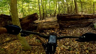
trail: Telemark Brook Trail
0:19 |
|
Nov 29, 2020

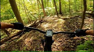
trail: Reaction
0:51 |
823 |
Nov 11, 2013
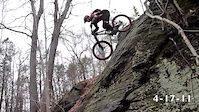
trail: Ridgeline
0:09 |
243 |
Apr 18, 2011
trail: Girlscout Cookies
4:34 |
317 |
Oct 4, 2021 , Kinnelon
trail: Mjölnir (AKA Test Bore)
5:04 |
423 |
Oct 4, 2021 , Kinnelon
Recent Trail Reports
| status | trail | date | condition | info | user |
|---|---|---|---|---|---|
| Orange Trail | May 29, 2026 @ 6:49pm (America/New_York) May 29, 2026 | Dry | trailhead22 JORBA Wildcat | ||
| Telemark Brook Trail | Apr 21, 2026 @ 10:33am (America/New_York) Apr 21, 2026 | Ideal | RobJSinger | ||
| Gus N Bru | Apr 21, 2026 @ 10:33am (America/New_York) Apr 21, 2026 | Ideal | RobJSinger | ||
| Low Line | Apr 21, 2026 @ 10:33am (America/New_York) Apr 21, 2026 | Ideal | RobJSinger | ||
| Girlscout Cookies | Apr 21, 2026 @ 10:33am (America/New_York) Apr 21, 2026 | Ideal | RobJSinger | ||
| Free Solo | Apr 21, 2026 @ 10:33am (America/New_York) Apr 21, 2026 | Ideal | RobJSinger | ||
| Ridgeline | Apr 21, 2026 @ 10:33am (America/New_York) Apr 21, 2026 | Ideal | RobJSinger | ||
| Evergreen | Apr 21, 2026 @ 10:33am (America/New_York) Apr 21, 2026 | Ideal | RobJSinger | ||
| Iron Spirit | Apr 21, 2026 @ 10:33am (America/New_York) Apr 21, 2026 | Ideal | RobJSinger | ||
| Mjölnir (AKA Test Bore) | Apr 21, 2026 @ 10:33am (America/New_York) Apr 21, 2026 | Ideal | RobJSinger |
Activity Feed
| username | action | type | title | date |
|---|---|---|---|---|
| MLAQinParkRidgeaR2YHR | wishlist | route | activity #97133276 | Jun 16, 2026 @ 1:01pm Jun 16, 2026 |
| professorbooty | wishlist | route | activity #96642266 and 1 more | Jun 9, 2026 @ 5:39pm Jun 9, 2026 |
| Philliesnine77 | wishlist | region | activity #96010880 | Jun 1, 2026 @ 5:32am Jun 1, 2026 |
| trailhead22 | add | report | activity #95807249 | May 29, 2026 @ 3:49pm May 29, 2026 |
| RobJSinger | add | report | activity #93097286 and 9 more | Apr 21, 2026 @ 11:53am Apr 21, 2026 |
Recent Comments
| username | type | title | comment | date |
|---|---|---|---|---|
| report | , | Jun 28, 2025 @ 11:38am Jun 28, 2025 | ||
| trail | Good escape route when exhausted. | Sep 22, 2024 @ 4:18pm Sep 22, 2024 | ||
| trail | Gone to seed. | Sep 22, 2024 @ 4:14pm Sep 22, 2024 | ||
| trail | Nice techy rocky trail | Jun 15, 2024 @ 4:13am Jun 15, 2024 | ||
| trail | It's new, ride it in! | Jun 10, 2024 @ 8:25pm Jun 10, 2024 |
Local Badges
-

Epic Ride Descent 2k0 awarded -

Descent 10k Badge2 awarded -

Descent 100k Badge0 awarded -

Epic Mountain Bike Climb 2k0 awarded -

Climbing 10k Badge0 awarded -

Mountain Biking 100k Badge0 awarded
Activity Type Stats
| activitytype | trails | distance | descent | descent distance | total vertical | rating | global rank | state rank | photos | reports | routes | ridelogs |
|---|---|---|---|---|---|---|---|---|---|---|---|---|
| Mountain Bike | 11 | 5 miles | 623 ft | 3 miles | 269 ft | #12,194 | #3,746 | 3 | 89 | 1,110 | ||
| E-Bike | 5 | 1 mile | 171 ft | 3,031 ft | 174 ft | #10,188 | #3,208 | 25 | 21 | |||
| Hike | 16 | 9 miles | 1,283 ft | 5 miles | 348 ft | #9,420 | #3,312 | 9 | 92 | 1 | 208 | |
| Trail Running | 10 | 6 miles | 659 ft | 3 miles | 269 ft | #11,993 | #4,189 | 90 | 1 | 22 | ||
| Nordic Ski | 5 | 4,692 ft | 144 ft | 2,149 ft | 210 ft | #1,942 | #1,052 | 1 | 21 |
Frequently Asked Questions About Kinnelon
▼
What are the best places to ride in Kinnelon?
Kinnelon has 1 areas to explore for mountain biking. The top rated areas are:
▼
What are the highest rated mountain biking trails in Kinnelon?
The highest rated mountain biking trails in Kinnelon are:
- Girlscout Cookies (4.1/5)
- Ridgeline (4.1/5)
- Iron Spirit (4.1/5)
- Free Solo (4.1/5)
- Gus N Bru (4.1/5)
▼
What is the best time of the year to ride in Kinnelon?
Based on ride log data, the most popular months to ride in Kinnelon are:
- April (13 activities)
- June (9 activities)
- September (9 activities)
▼
Where can I park to ride in Kinnelon?
Activities
- By cameronmcslow
 & contributors
 - Admins: NYNJTC, josowski, Tkeyworth, Morris, alutsko
- #41068 - 2,419 views
- kinnelon activity log | embed map of Kinnelon mountain bike trails | kinnelon mountain biking points of interest
Downloading of trail gps tracks in kml & gpx formats is enabled for Kinnelon.
You must login to download files.