close
-
Layers w
- Weather Layers
- Pro
- Pro
- Pro
- Pro
- Pro
- Pro
- More Layers
- Pro
- Pro
- Pro
- Pro
-
Upgrade to

3D
Trail Conditions
- Unknown
- Snow Groomed
- Snow Packed
- Snow Covered
- Snow Cover Partial
- Freeze/thaw Cycle
- Icy
- Prevalent Mud
- Wet
- Variable
- Ideal
- Dry
- Very Dry
Trail Flow (Ridden Direction)
Trailforks scans users ridelogs to determine the most popular direction each trail is ridden. A good flowing trail network will have most trails flowing in a single direction according to their intension.
The colour categories are based on what percentage of riders are riding a trail in its intended direction.
The colour categories are based on what percentage of riders are riding a trail in its intended direction.
- > 96%
- > 90%
- > 80%
- > 70%
- > 50%
- < 50%
- bi-directional trail
- no data
Trail Last Ridden
Trailforks scans ridelogs to determine the last time a trail was ridden.
- < 2 days
- < 1 week
- < 2 weeks
- < 1 month
- < 6 months
- > 6 months
Trail Ridden Direction
The intended direction a trail should be ridden.
- Downhill Only
- Downhill Primary
- Both Directions
- Uphill Primary
- Uphill Only
- One Direction
Contribute Details
Colors indicate trail is missing specified detail.
- Description
- Photos
- Description & Photos
- Videos
Trail Popularity ?
Trailforks scans ridelogs to determine which trails are ridden the most in the last 9 months.
Trails are compared with nearby trails in the same city region with a possible 25 colour shades.
Think of this as a heatmap, more rides = more kinetic energy = warmer colors.
- most popular
- popular
- less popular
- not popular
ATV/ORV/OHV Filter
Max Vehicle Width
inches
US Cell Coverage
Legend

Radar Time
Activity Recordings
Trailforks uses anonymized public activity data.
?
Activity Recordings
Trailforks uses anonymized public activity data.
?
Personal Heatmap
▶
Activity Types
all
/
none
▶
Options
2
Date range
month
–
Winter Trails
Warning
A routing network for winter maps does not exist. Selecting trails using the winter trails layer has been disabled.
Missing Trails
Most Popular
Least Popular
Trails are colored based on popularity. The more popular a trail is, the more red. Less popular trails trend towards green.
Jump Magnitude Heatmap
Heatmap of where riders jump on trails. Zoom in to see individual jumps, click circles to view jump details.
BC Backroad Status
![map legend]()
Service Road Atlas is a free to use, community-driven service for viewing and creating reports on the numerous back-country service roads around B.C. and Alberta.

Slope Aspect
Direction the slope faces
Trails Deemphasized
Trails are shown in grey.
Only show trails with no bike usage.
Suggested Layers
Based on selected activity type
Save the current map location and zoom level as your default home location whenever this page is loaded.
Save
No description for Kirkcudbright has been added yet!
Login or register to submit one.
This region uses the Uk/Euro style trail grading system.
Activities Click to view
- Mountain Bike
8 trails
- E-Bike
4 trails
- Hike
7 trails
- Trail Running
7 trails
Region Details
- 3
- 2
- 1
- 2
Region Status
Caution as of Jun 17, 2026Stats
- Avg Trail Rating
- Trails (view details)
- 8
- Trails Mountain Bike
- 8
- Trails E-Bike
- 4
- Trails Horse
- 3
- Trails Hike
- 7
- Trails Trail Running
- 7
- Total Distance
- 3 miles
- Total Descent
- 467 ft
- Total Vertical
- 603 ft
- Highest Trailhead
- 609 ft
- Reports
- 1,050
- Photos
- 9
- Ridden Counter
- 91
Popular Kirkcudbright Mountain Biking Trails
• 100 ★ 0.0 • 3,123 ft • 15 ft • 17 • • hike
Easy flat path along the side of the River Dee up to the Tarff inlet.
smudgie buggler Permanently Closed
• 40 ★ 5.0 • 1,237 ft • 2 ft • 12 •
Fast hardpack twisty rooty section to start,then onto the jump section which splits 2 ways down muddy loamy end section.
• 75 ★ 0.0 • 758 ft • 0 ft • 10 •
Popular red difficulty singletrack. This mountain bike primary trail can be used downhill only. It features berm, drop and jump. Adaptive MTB rating: amtb blue. Trail visibility is always easy to follow. On average it takes 3 minutes to complete this trail.
• 25 ★ 5.0 • 1,226 ft • 0 ft • 10 •
Some small drops couple the jumps and a really fast root section
• 50 ★ 5.0 • 1,077 ft • 3 ft • 8 •
Start off with the two foot drop and then onto an off camber root section and then into the double drop
• 90 ★ 0.0 • 3,999 ft • 18 ft • 4 • • hike
Popular green difficulty singletrack. This hike primary trail can be used both directions and has a easy overall physical rating with a 18 ft green climb. Trail visibility is always easy to follow. On average it takes 10 minutes to complete this trail.
• 65 ★ 0.0 • 1 mile • 33 ft • 4 • • hike
Moderately popular green difficulty singletrack. This hike primary trail can be used both directions and has a easy overall physical rating with a 33 ft green climb. Trail visibility is always easy to follow. On average it takes 6 minutes to complete this trail.
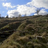
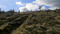
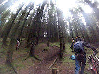
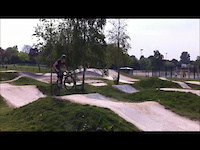
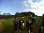
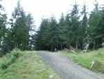
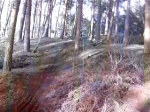
Photos of Kirkcudbright Mountain Bike
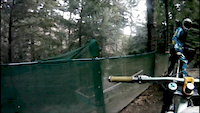
Videos of Kirkcudbright Mountain Bike
trail: Jericho
0:22 |
122 |
May 17, 2020
trail: Jericho
0:16 |
76 |
May 10, 2020
trail: The berm
0:13 |
236 |
Jan 28, 2013
trail: The berm
0:46 |
162 |
Jan 13, 2013
trail: The berm
0:24 |
247 |
Apr 30, 2011
trail: The berm
0:39 |
74 |
Mar 6, 2011
trail: The berm
0:15 |
59 |
Aug 7, 2010
trail: The berm
0:23 |
31 |
Dec 31, 2009
Recent Trail Reports
| status | trail | date | condition | info | user |
|---|---|---|---|---|---|
| The berm | Jul 1, 2023 @ 11:35am Jul 1, 2023 | Dry | dazza2808 |
Activity Feed
| username | action | type | title | date |
|---|---|---|---|---|
| AbernethyBarcaple | update | directory | activity #56479312 | Jul 31, 2024 @ 2:43am Jul 31, 2024 |
| dazza2808 | add | report | activity #41418474 | Jul 1, 2023 @ 11:35am Jul 1, 2023 |
| tomj3 | wishlist | trail | activity #38623443 | Apr 1, 2023 @ 9:21am Apr 1, 2023 |
| Alibobness | add | trail | activity #37505869 and 1 more | Feb 16, 2023 @ 4:28pm Feb 16, 2023 |
| Alibobness | add | trail | activity #37477221 | Feb 15, 2023 @ 12:00pm Feb 15, 2023 |
Recent Comments
| username | type | title | comment | date |
|---|---|---|---|---|
| trail | Myself or Dan? | May 10, 2020 @ 9:30am May 10, 2020 | ||
| trail | check your Trailforks/ Pinkbike inbox... | May 10, 2020 @ 5:07am May 10, 2020 | ||
| trail | check your inbox @DanMan771. It might stop me... | May 10, 2020 @ 5:04am May 10, 2020 | ||
| trail | ????It usually takes me second go to get... | May 10, 2020 @ 4:52am May 10, 2020 | ||
| trail | We've tried a few times but we're going to add... | May 10, 2020 @ 3:25am May 10, 2020 |
Activity Type Stats
| activitytype | trails | distance | descent | descent distance | total vertical | rating | global rank | state rank | photos | reports | routes | ridelogs |
|---|---|---|---|---|---|---|---|---|---|---|---|---|
| Mountain Bike | 8 | 3 miles | 466 ft | 1 mile | 604 ft | #7,055 | #253 | 9 | 1,050 | 1,724 | ||
| E-Bike | 4 | 3 miles | 59 ft | 4,275 ft | 249 ft | #7,254 | #322 | 239 | 48 | |||
| Horse | 3 | 2 miles | 23 ft | 3,517 ft | 36 ft | 119 | ||||||
| Hike | 7 | 3 miles | 433 ft | 1 mile | 604 ft | #10,501 | #348 | 1,003 | 28 | |||
| Trail Running | 7 | 3 miles | 433 ft | 1 mile | 604 ft | #10,373 | #362 | 1,000 | 121 |
Frequently Asked Questions About Kirkcudbright
▼
What are the highest rated mountain biking trails in Kirkcudbright?
The highest rated mountain biking trails in Kirkcudbright are:
- Jericho (4.2/5)
- humpty dumpty (4.1/5)
- The berm (4.1/5)
- Tongland to Low Bridge of Tarff (0/5)
- RUTS AND BRUISES (0/5)
▼
What is the best time of the year to ride in Kirkcudbright?
Based on ride log data, the most popular months to ride in Kirkcudbright are:
- April (6 activities)
- September (3 activities)
- July (3 activities)
▼
Where can I park to ride in Kirkcudbright?
Check the Kirkcudbright trail map for trailhead and parking information. Community members regularly update access and parking details for trails in the area.
▼
What is the longest trail in Kirkcudbright?
The longest trail in Kirkcudbright is Green Bridge to Tongland at 1.0 mile. View all trails sorted by distance.
- By alii
 & contributors
 - Admins: DMBinS, FLS, ATB, GHBC
- #6976 - 4,106 views
- kirkcudbright activity log | embed map of Kirkcudbright mountain bike trails |
Downloading of trail gps tracks in kml & gpx formats is enabled for Kirkcudbright.
You must login to download files.